Garnet Hill Loop
View Photos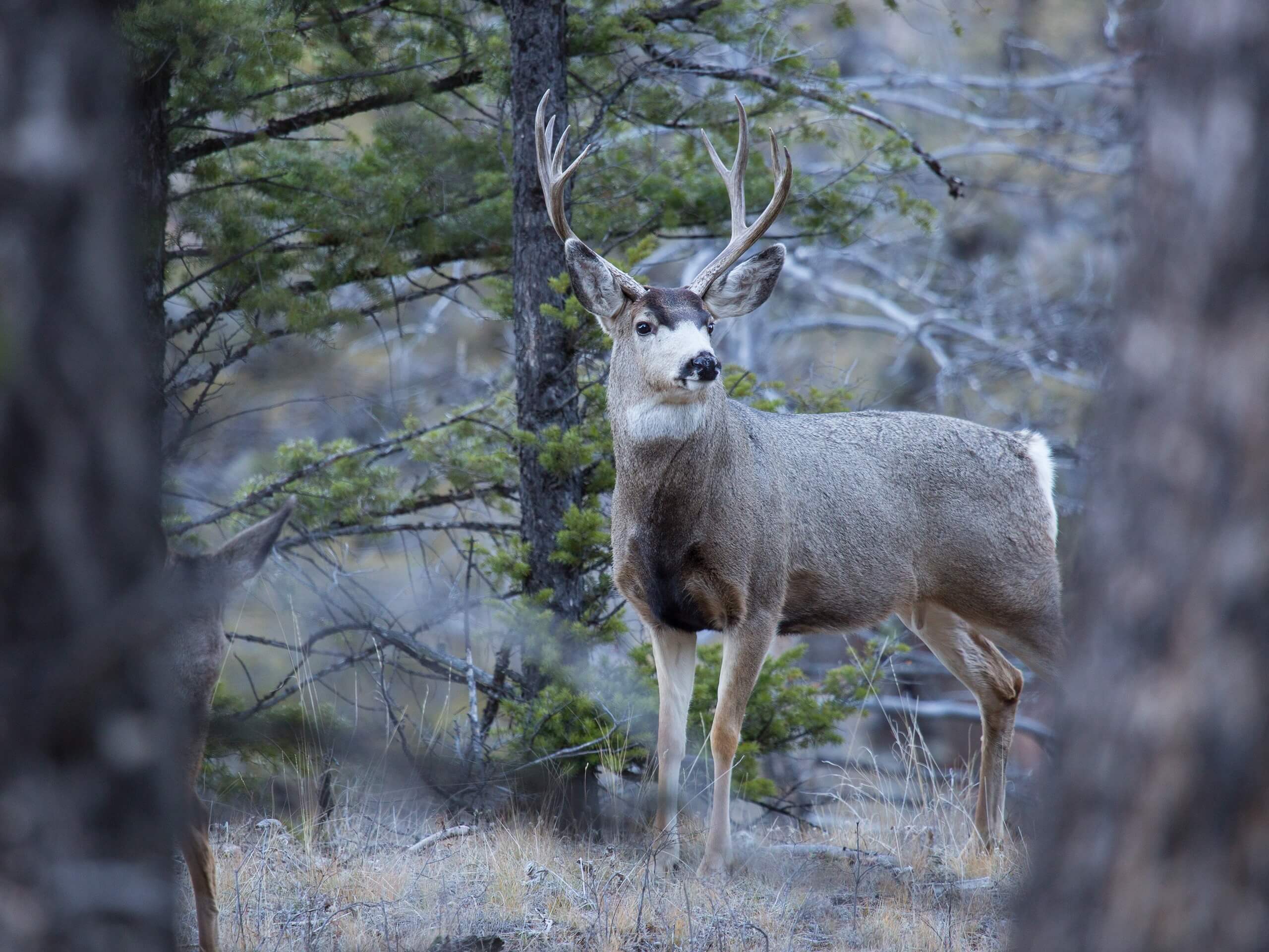
Garnet Hill Loop
Difficulty Rating:
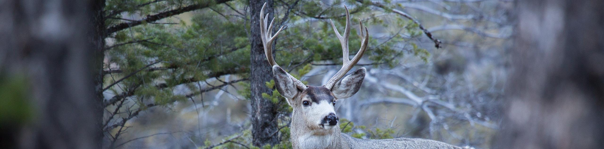
The Garnet Hill Trail is a fantastic route in northern Yellowstone National Park. This trail is a great place to see wildlife including bison, sandhill cranes, and coyotes. Be sure to keep an eye out for bears along this trail and always hike with caution.
Getting there
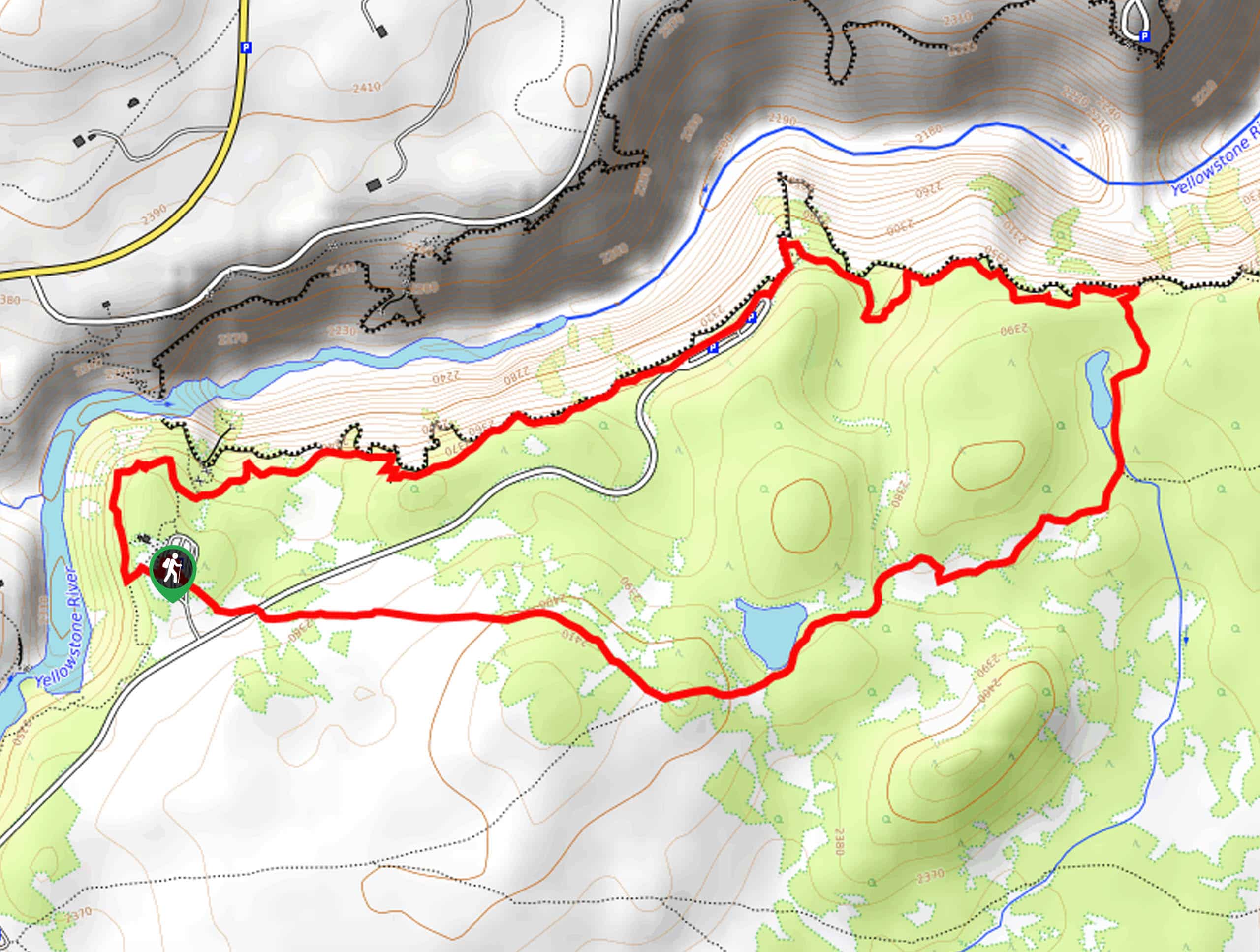
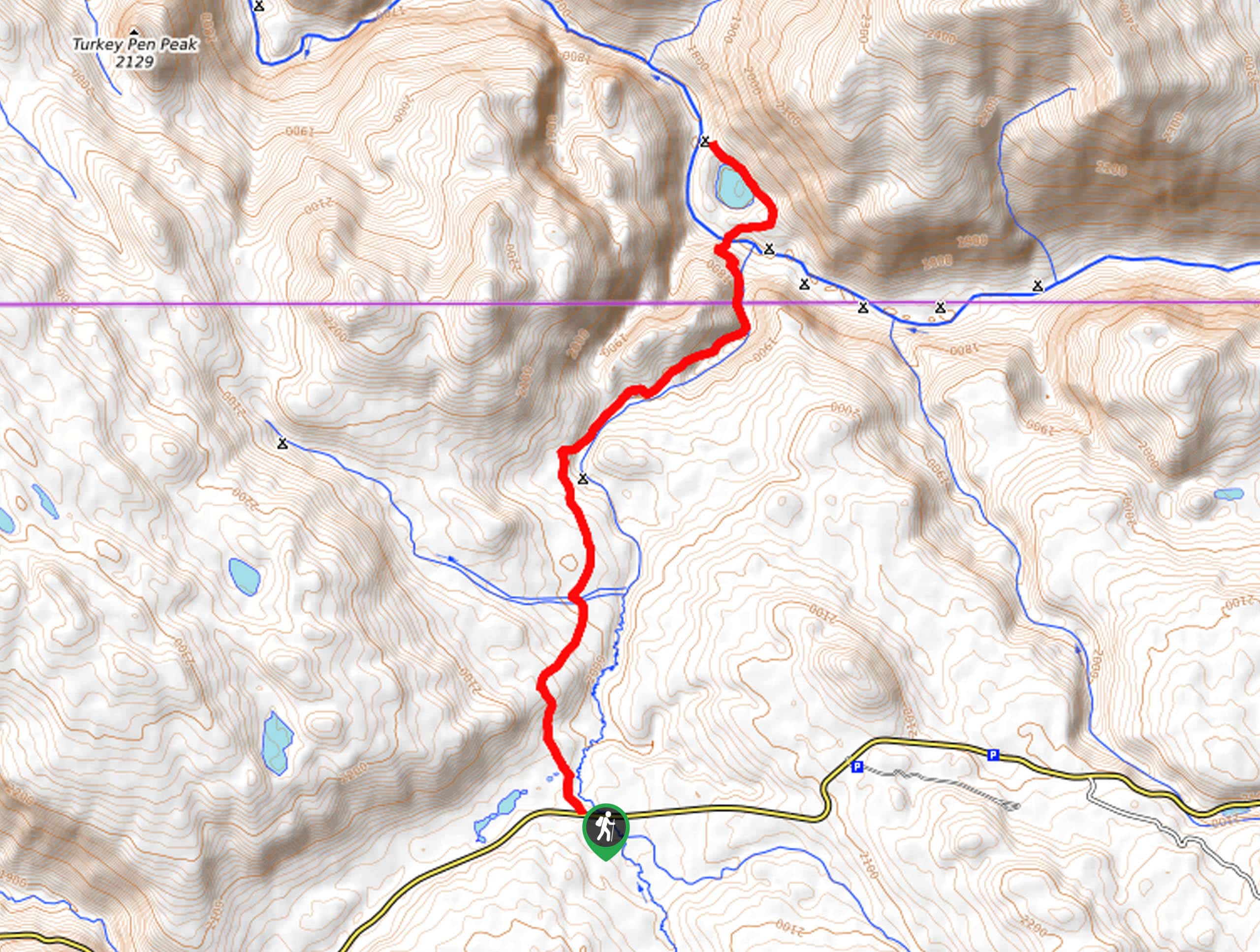
The Garnet Hill Trail begins at Hellroaring Creek Trailhead on the north side of Grand Loop Road approximately 14.5mi east of the Mammoth Hot Springs and Visitors Center.

About
| Backcountry Campground | No |
| When to do | May to October |
| Pets allowed | No |
| Family friendly | Older Children only |
| Route Signage | Average |
| Crowd Levels | Moderate |
| Route Type | Lollipop |
Garnet Hill Loop
Elevation Graph
Weather
Garnet Hill Loop Description
The Garnet Hill Trail is a fantastic loop in Yellowstone National Park. This trail can be quite buggy in the early summer. If you are hiking in June or early July, be sure to pack bug repellent or wear long layers to combat the mosquitoes. Mosquitos aren’t the only wildlife you see on the Garnet Hill Loop. This trail is a popular place to see bison, coyotes, and foxes. Bears are also often seen along this trail. Make sure you educate everyone in your hiking party about bear safety before hitting the trail, always carry bear spray and know how to use it.
With 10.0mi of trail to explore, the Garnet Hill Loop is the perfect place to spend the day in Yellowstone National Park. This trail is bursting with wildflowers and an abundance of flora and fauna in the summer. In the fall, you can avoid the bugs and really take your time to enjoy the panoramic views. This hiking circuit is a must-do no matter what time of year you visit Yellowstone National Park.
To hike the Garnet Hill Trail, begin at the Hellroaring Creek Trailhead and follow the trail up the switchbacks to a divide. At the first divide, take the path on your right to another divide. This second divide marks the beginning and end of the hiking circuit. At the second divide, take the path on your right to hike the loop counterclockwise. Follow the trail south along Elk Creek and stick to the path on your left to make your way to the Tower Junction Station. Tower Junction has restrooms and drinking water, so this is a good place to stop for a rest before following the trail back north. After a rest at Tower Junction, follow the Garnet Hill Loop north over the Northeast Entrance Road. Approximately half a mile past the road, the trail will split; take the path on your right to continue north up to the Yellowstone River. Follow the south bank of the Yellowstone river westward to complete the loop.
Once you find yourself back in familiar territory, simply follow the trail back to the Hellroaring Creek Trailhead, where you began.
Insider Hints
Keep an eye out for wildlife, if you do see animals do not feed them and admire from a safe distance
On this route you will traverse through tall grass, we recommend wearing long pants to avoid scratches and ticks
Similar hikes to the Garnet Hill Loop hike
Clear Lake and Artist’s Point Loop
The Clear Lake and Artist’s Point Loop is an easy, scenic hiking circuit in Yellowstone. This trail features incredible views…
Turbid Lake Trail
The Turbid Lake Trail is an adventurous hike in Yellowstone. This trail is not well maintained and requires navigation and…
The Crevice Lake Trail
The Crevice Lake Trail is a gorgeous hike in Yellowstone. This trail can be done as a day hike or…
Comments