
Thanksgiving Mountain
View Photos
Thanksgiving Mountain
Difficulty Rating:
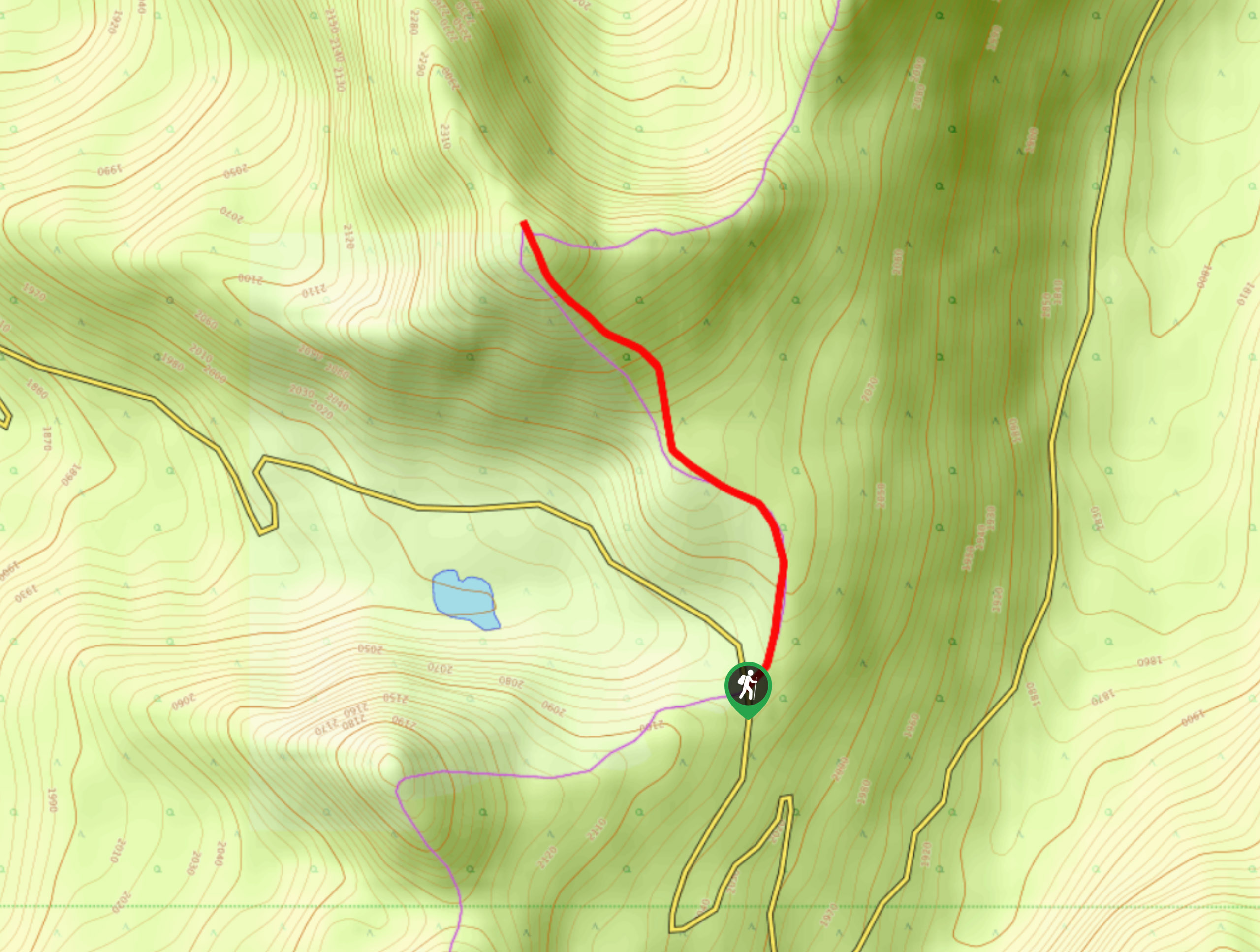
Thanksgiving Mountain is a quick 2.1mi out-and-back hiking route that will take you up to the summit for some amazing mountain views. A popular destination with locals around the Thanksgiving holiday season, this trail is a relatively easy way to bag a peak and cash in on the beautiful scenery that comes with it. This trail will require some basic route finding skills near the top.
Getting there
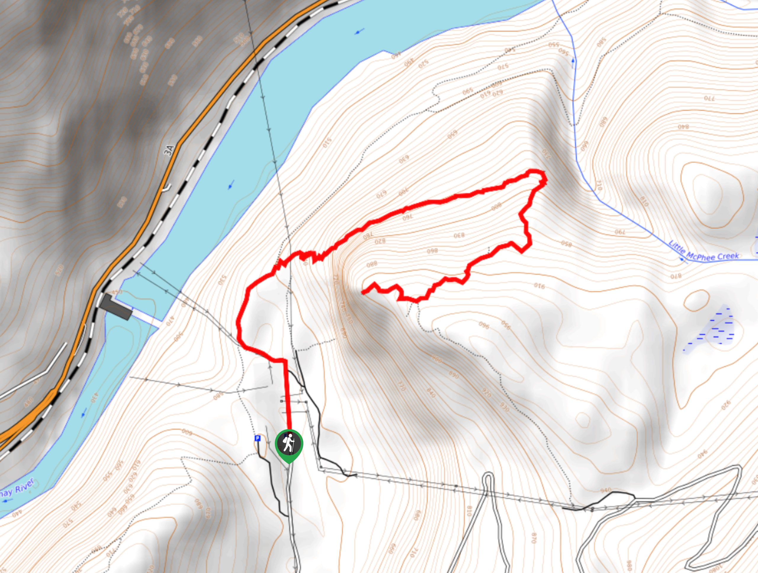
To reach the trailhead for Thanksgiving Mountain from Crawford Bay, drive south on BC-3A for 4.7mi and make a left onto Oliver Road. Reset your odometer, and at 0.8mi turn left at the fork. After 3.7mi, you will begin to drive up a series of switchbacks. Keep on the main road and at the 11.2mi mark, you will arrive at the parking area.

About
| When to do | July-October |
| Backcountry Campsites | No |
| Pets allowed | Yes - On Leash |
| Family friendly | Older Children only |
| Route Signage | Poor |
| Crowd Levels | Low |
| Route Type | Out and back |
Thanksgiving Mountain
Elevation Graph
Weather
Thanksgiving Mountain Trail Description
Hiking up Thanksgiving Mountain is a fun way to get out and reconnect with the outdoors while experiencing some breathtaking views along a fairly easy-to-navigate trail. Thanks to a high elevation starting point, the route to the summit of the mountain only features 994ft of elevation gain along its short length, making for an easy half-day out on the trails.
Setting out from the parking area, cross over the highway and pick up the trail as it heads to the northwest. As you gently climb through the forest, you will pass by countless huckleberry bushes and be surrounded by amazing views of the surrounding mountains. After roughly 1km, the trail will steepen a bit before starting to fade away. Here, you will need to look for orange route flags that will bring you to a rockslide. Head north across the meadow and up the ridge for some amazing views from the summit of Thanksgiving Mountain.
Here, you can spot Sphinx Mountain to the north, Kootenay Lake to the west, and the Purcell Mountains to the southeast. After taking in the amazing views, head back down the same trail to return to your vehicle below.
Similar hikes to the Thanksgiving Mountain hike
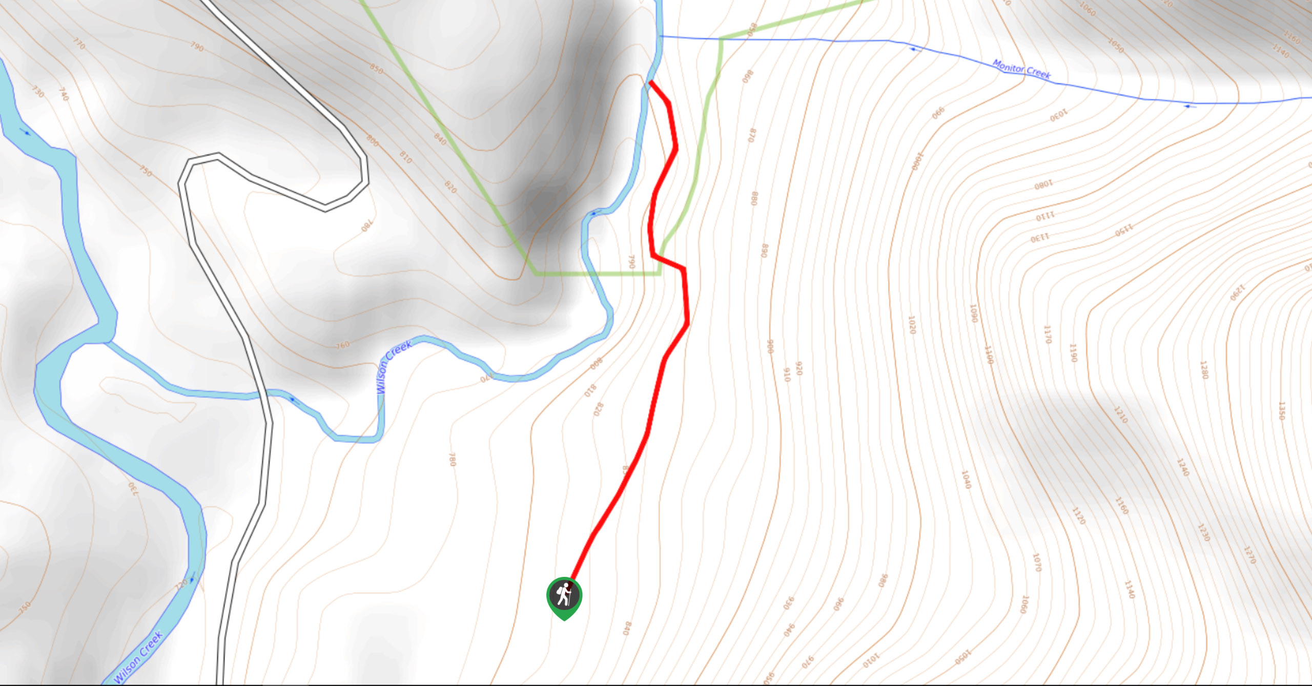
Wilson Creek Falls Trail
The Wilson Creek Falls Trail is a 1.8mi out-and-back route in Goat Range Provincial Park that travels along…
McPhee Waterfalls Hike
The McPhee Waterfalls Hike is a 3.5mi out-and-back hiking route near Castlegar, BC, that will take you along…
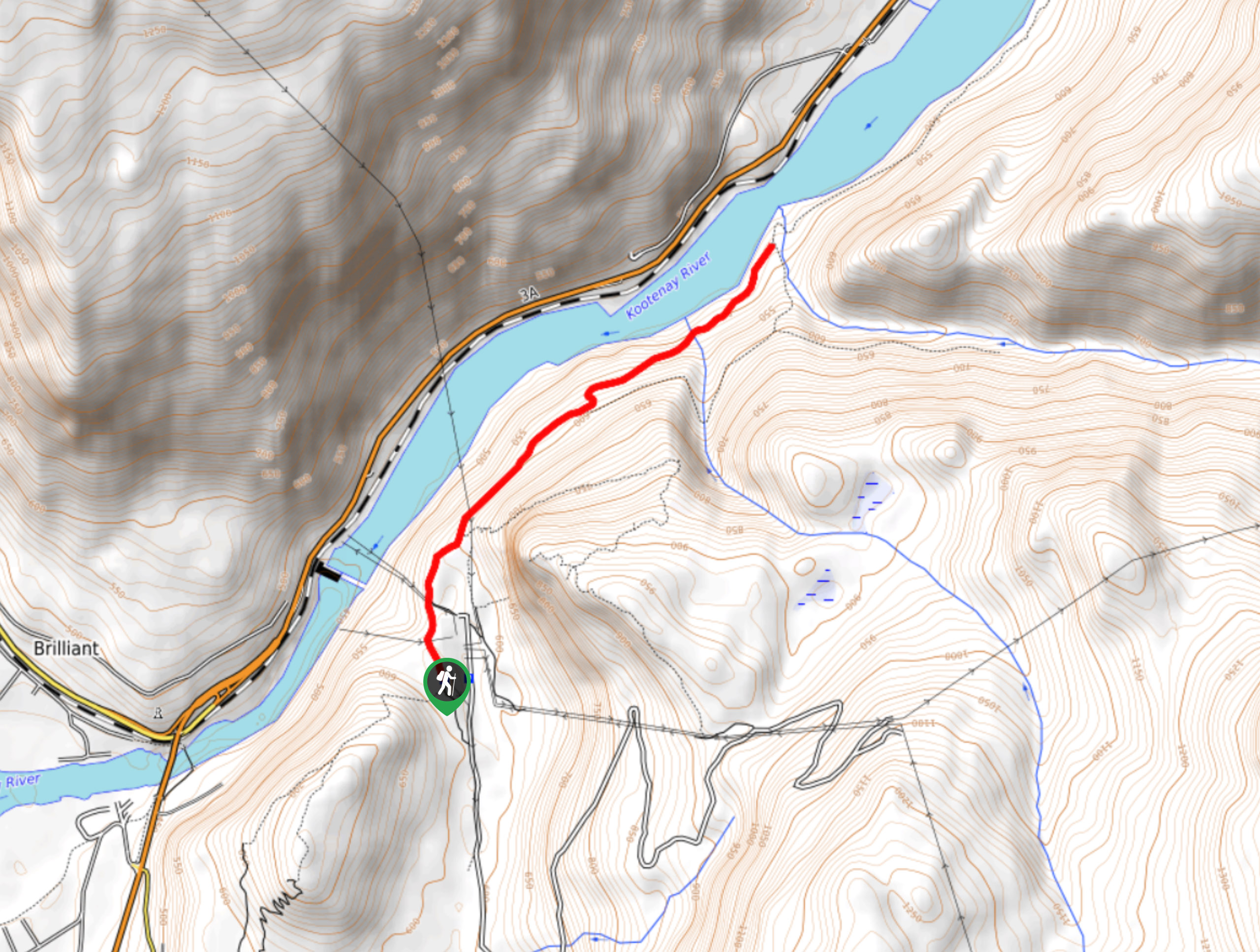
Brilliant Overlook Hike
The hike to Brilliant Overlook is a 3.7mi out-and-back trail in Castlegar, BC, that works through the forest…
Comments