
Arrow Mountain
View Photos
Arrow Mountain
Difficulty Rating:
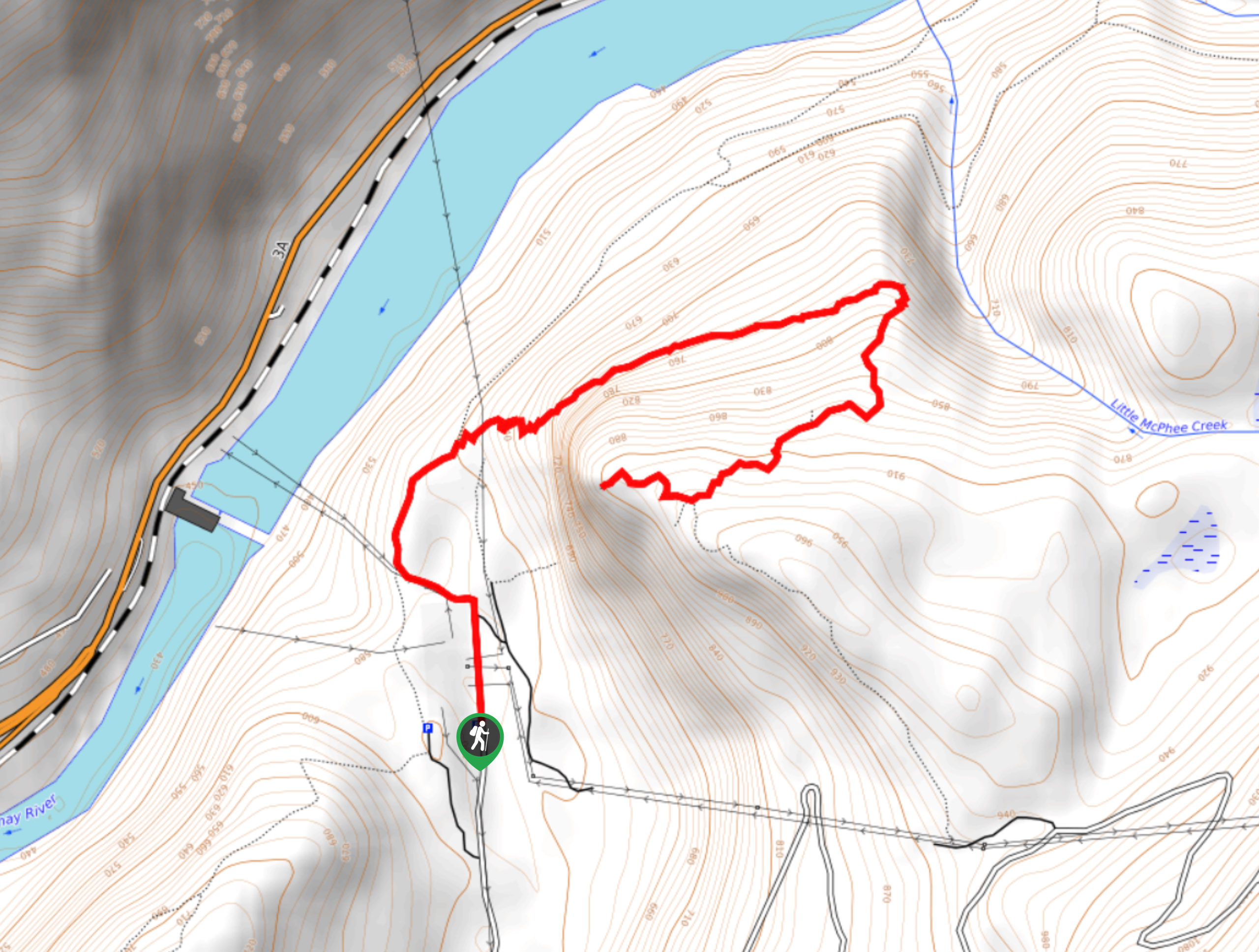
The Arrow Mountain trail is a 8.3mi out-and-back hiking route in Creston, BC, that will take you on a steep route through the forest to the summit of the mountain. Although there aren’t any real views from the summit, hikers will be able to experience some nice views across the valley at different points along the trail. This is a steep hiking route, so remember to bring proper hiking footwear and plenty of water.
Getting there
To get to the Arrow Mountain Trailhead from Creston, head east of BC-3 and turn left onto 20 Avenue N. In 1969ft, you will find the trailhead directly in front of you.

About
| When to do | May-October |
| Backcountry Campsites | No |
| Pets allowed | Yes - On Leash |
| Family friendly | No |
| Route Signage | Average |
| Crowd Levels | Low |
| Route Type | Out and back |
Arrow Mountain
Elevation Graph
Weather
Arrow Mountain Trail Description
Hiking up Arrow Mountain is a challenging but fun adventure that will allow you to take in some scenic views overlooking the valley and surrounding mountain peaks near Creston. Bug and bear spray are recommended for this trail, as hikers have encountered bears and annoying mosquitoes along the route. Additionally, you should make sure to bring plenty of water and snacks to stay fueled for this uphill climb.
Initial stretches of the trail are very steep; however, the slope levels out a bit after the first kilometre to provide a more gradual climb up the mountain. As a largely forested route, hikers will be able to experience the peaceful woodland atmosphere as they climb uphill and take in the intermittent views over the surrounding area. As the trail winds up the mountainside, you will eventually arrive at the summit, which unfortunately doesn’t offer any real views but does provide you with a sense of satisfaction for having completed the ascent along the steep trail.
Similar hikes to the Arrow Mountain hike
Brilliant Overlook Hike
The hike to Brilliant Overlook is a 3.7mi out-and-back trail in Castlegar, BC, that works through the forest…
Merry Loop
The Merry Loop Trail is a 8.7mi circuit hiking route that utilizes a multi-use trail through a beautiful…
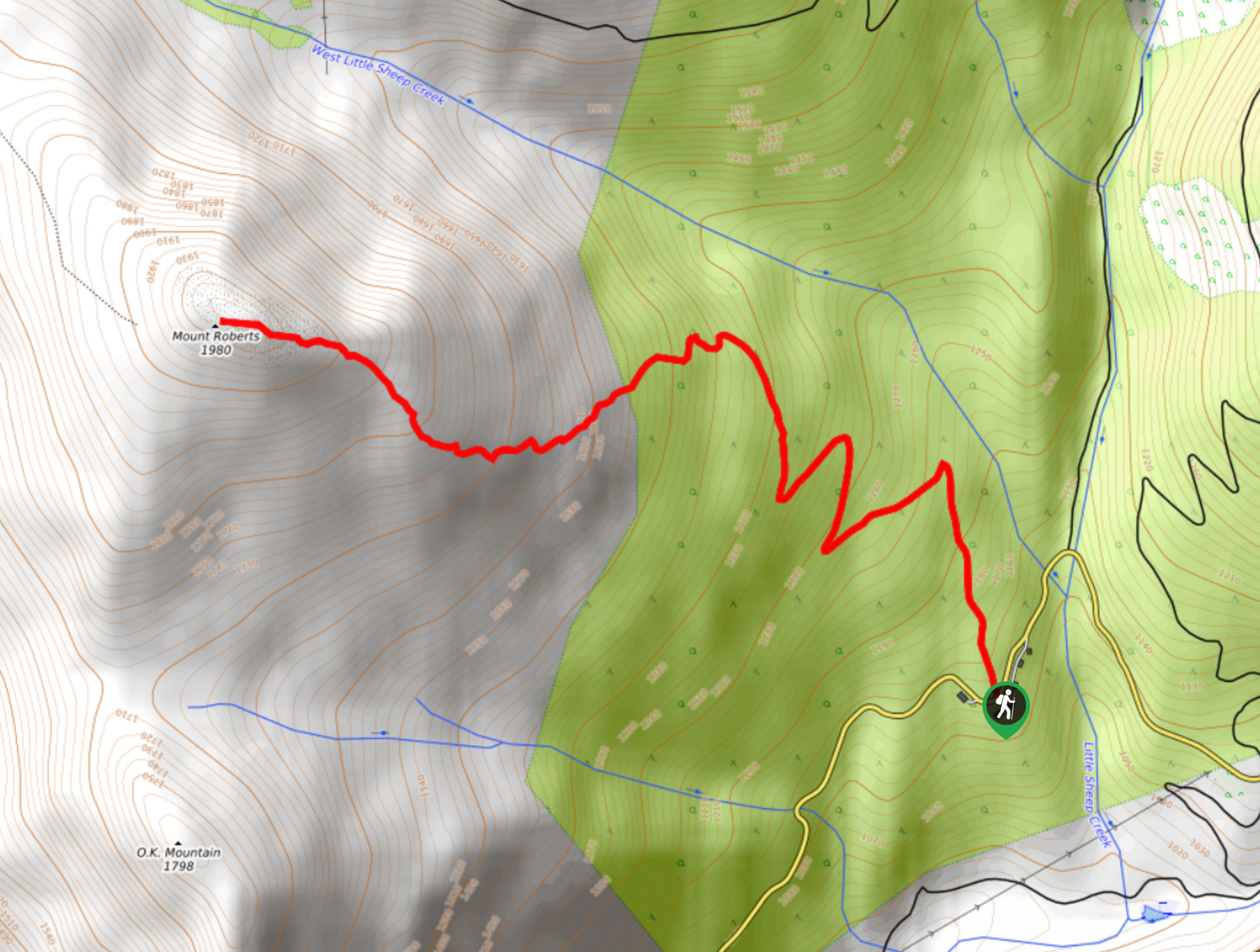
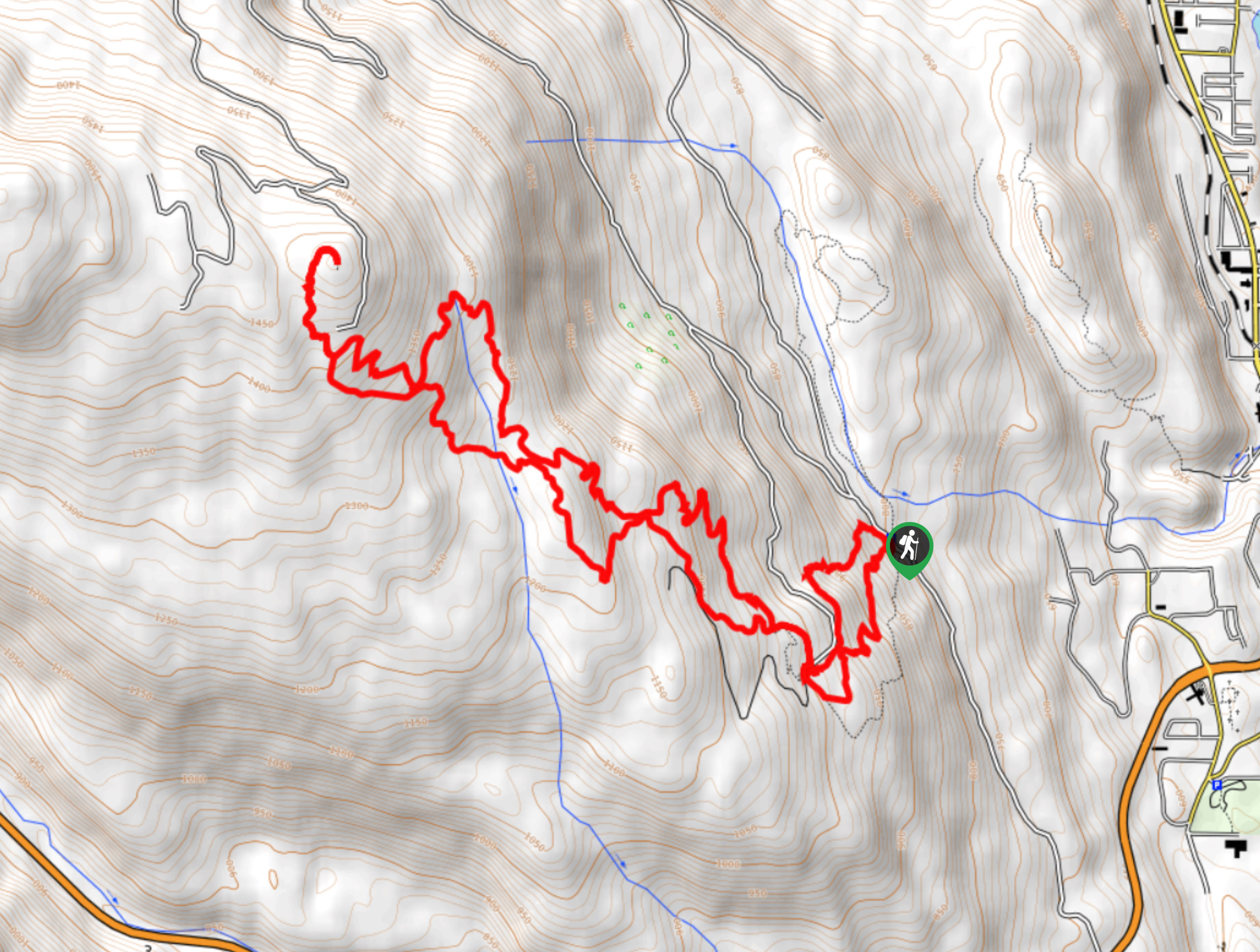
Mount Roberts Trail
The hike up Mount Roberts follows a rugged 4.6mi out-and-back trail that will take you up the mountain…
Comments