Red Rock Canyon Hike and Blakiston Falls
View Photos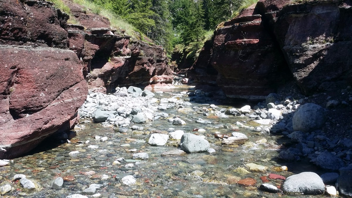
Red Rock Canyon Hike and Blakiston Falls
Difficulty Rating:
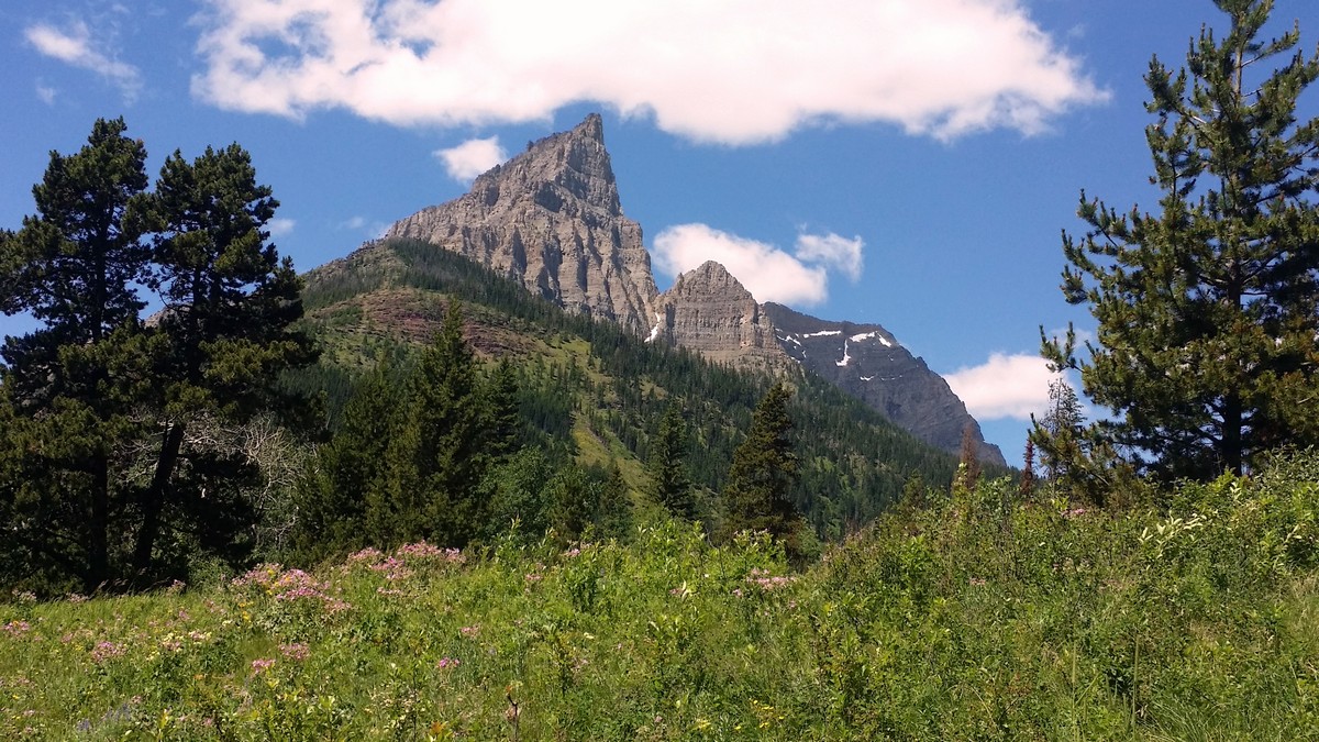
Hiking Red Rock Canyon treats hikers to spectacular layered, red canyon walls, flowing water, and surrounding mountain views. Explore the canyon, dip your feet in the watern and bask in the beauty of the impressive Blakiston Falls hike. This is the best way to introduce you to Waterton Park at a leisurely pace.
Getting there
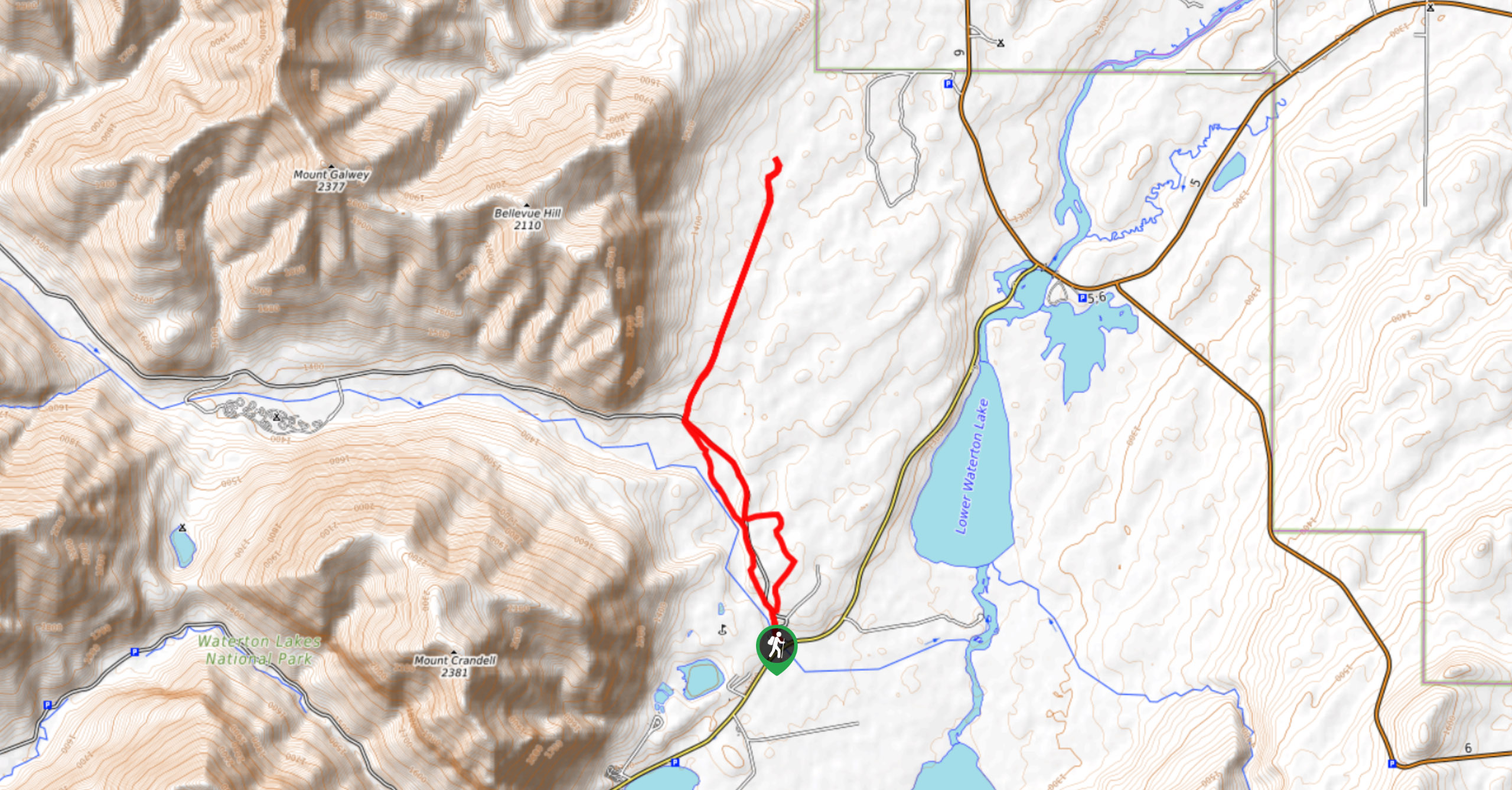
To get to the Red Rock Canyon trailhead, head south from the Waterton Park Entrance on AB-5, turn right onto Red Rock Parkway, just before crossing the bridge over Blakiston Creek. Follow the Parkway 9.3mi to its end in the parking lot.

About
| When to do | May to October |
| Backcountry Campsites | No |
| Toilets | At Red Rock Canyon |
| Family friendly | Yes |
| Route Signage | Average |
| Crowd Levels | High |
| Route Type | Out and back |
Red Rock Canyon Hike and Blakiston Falls
Elevation Graph
Weather
Red Rock Canyon and Blakiston Falls Trail Description
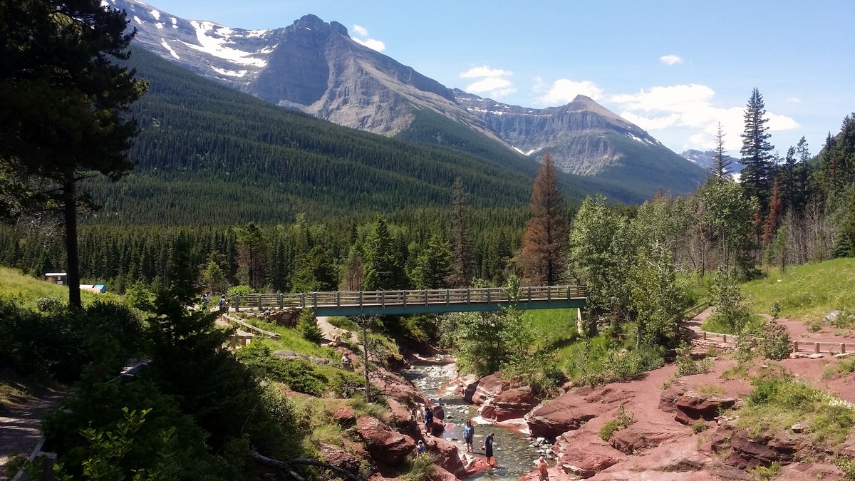
At the main lot, there are several different pathways. Begin your exploration of the area on the short canyon loop from the south end of the parking lot. Facing the stream (West), there is a big bridge directly in front of you, it can’t be missed. This is the start and end of the Red Rock Canyon Loop trail. The loop goes upstream from the bridge on both sides of Red Rock Creek. We chose to cross the bridge first.
Once over the bridge, turn right on the trail to follow the creek bed upstream. The path climbs and quickly rises far above the creek below, gaining a moderate 66ft in elevation over 1148ft before reaching a bridge over the creek. From here it is a long way down to the creek bed, and the canyon walls are steep. Cross the bridge and continue on the path on the other side of the creek, and you are back to your starting point.
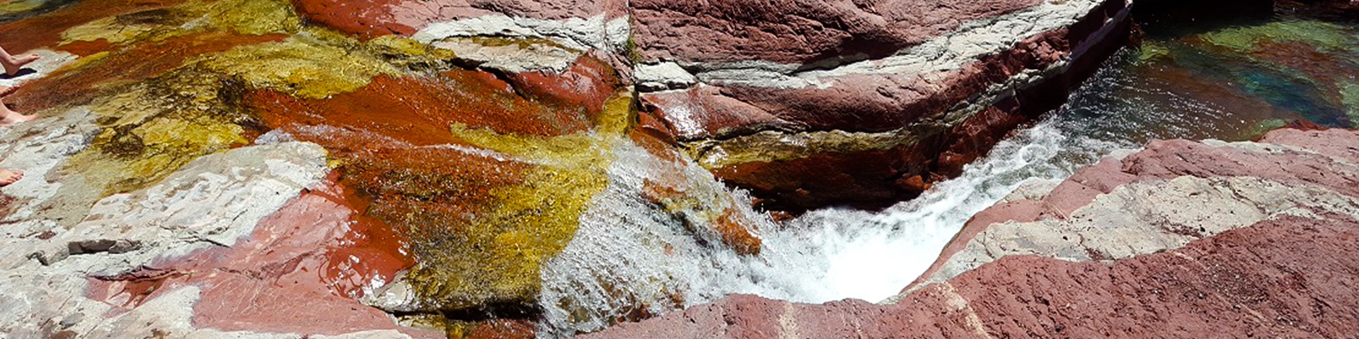
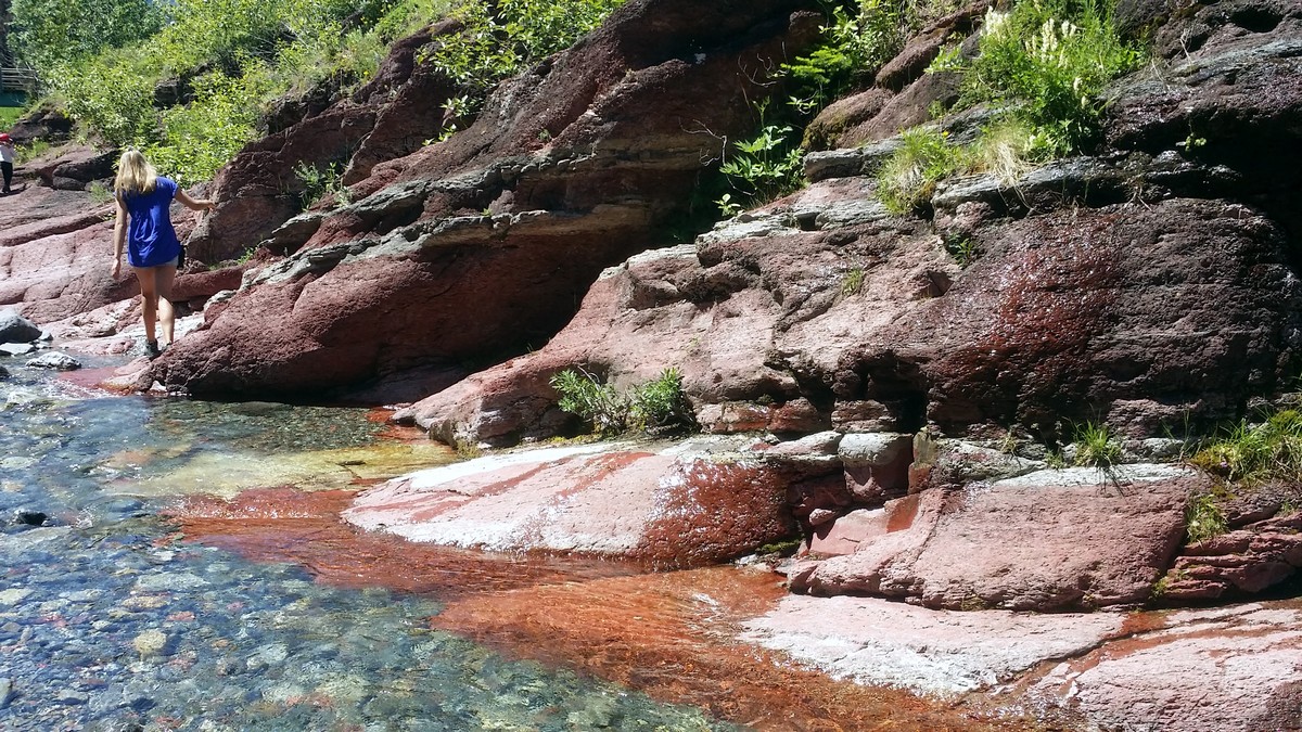
The beginning of the Red Rock Canyon Loop trail also provides a safe entry point down to the creek that sits several feet below, where you can spend some time and look closely at the rocks that gave the area its name. Beautiful layers of reds, creams and gray make an incredible flowing tapestry.
At the creek bed you can explore the canyon bottom in both directions for quite a distance. On a warm day, this is a wonderful place to play, explore, and splash in the water, making it an excellent place to spend time with children!
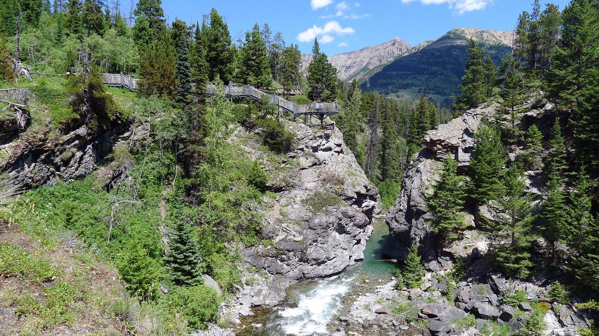
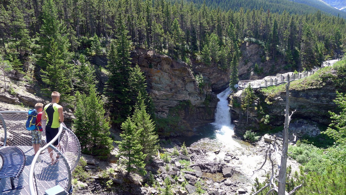
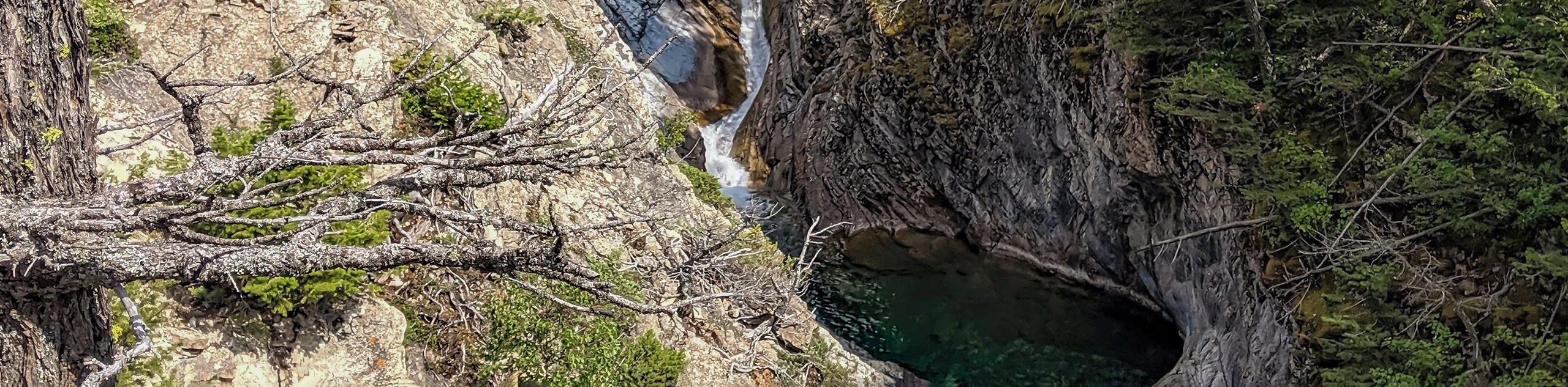
You would be missing out if you passed on the opportunity to hike to Blakiston Falls from Red Rock Canyon. From the bridge at the Red Rock Loop starting point, follow the creek bed on either side downstream to the dual bridges (making an “L” shape) crossing Red Rock and Bauerman Creek. Look for signs for Blakiston Falls and make sure you are on the correct path. The path travels to the right directly after crossing the Bauerman Creek Bridge.
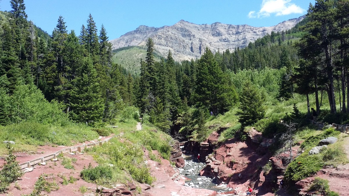
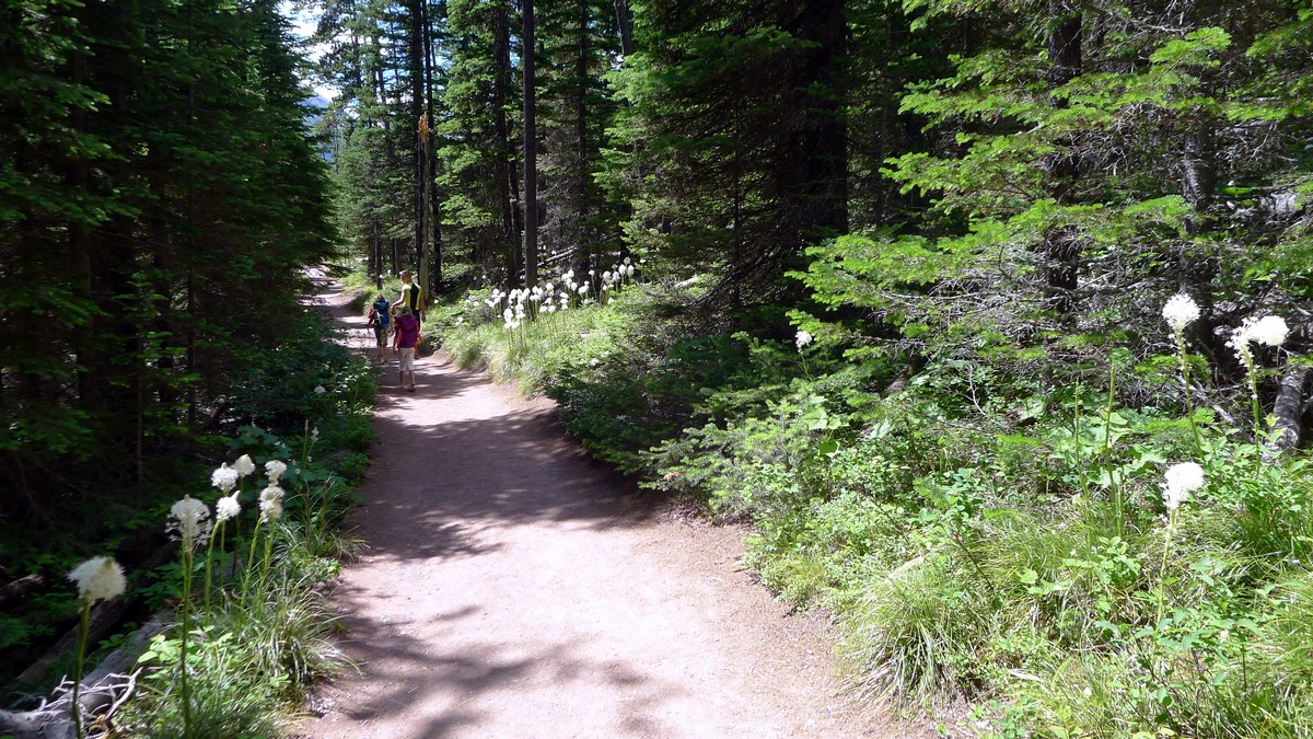
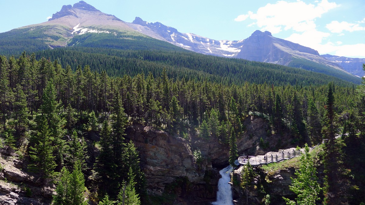
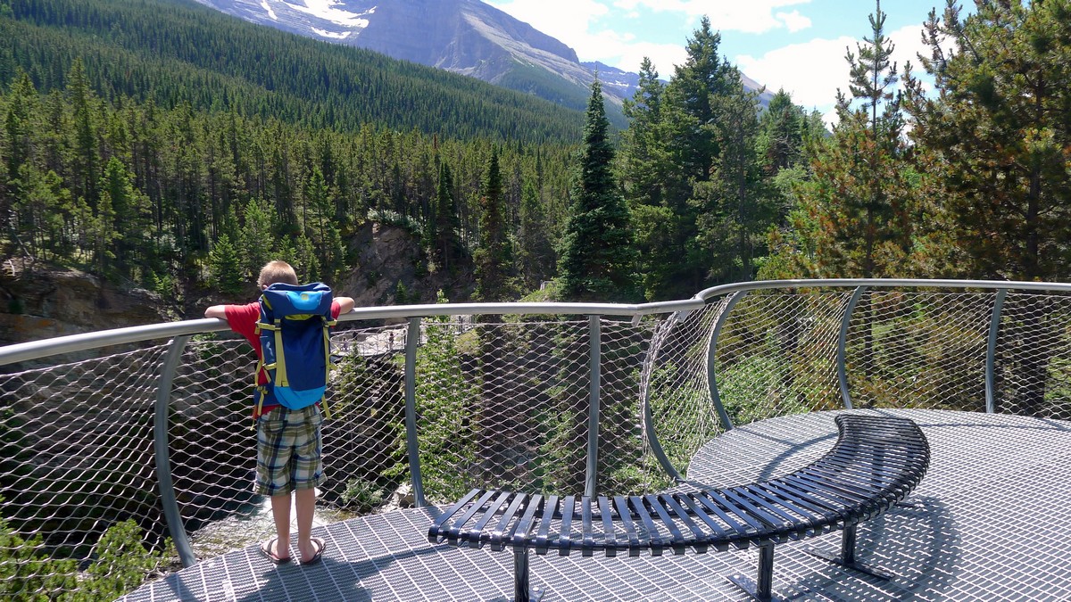
From here, a wide, fairly level and well-maintained trail travels about a kilometre through a beautiful forest before views open up at Blakiston Falls. Here there are two new viewing platforms accessed by wide, metal stairways. Both platforms provide excellent but different views of Blakiston Creek, the falls, and the surroundings, including Mount Blakiston to the south. Take the time to wander to both and enjoy the sound of the pounding water as it rushes down the creek bed. When you’ve had your fill, return the way you came.
Trail highlights
Red Rock Canyon
Red Rock Canyon is a stunning area where a clear, rushing river flows through carved red rock and provides visitors with a great place to enjoy a picnic with family.
Blakiston Falls
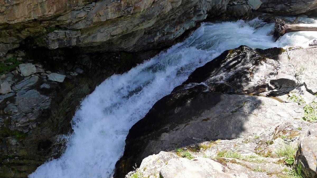
Blakiston Falls is a captivating waterfall set in the Canadian Rockies that is a beautiful spot to enjoy after hiking through the Red Rock Canyon.
Frequently asked questions about the Red Rock Canyon, Waterton Lakes National Park
Is Red Rock Canyon in Waterton open?
Yes Red Rock Canyon in Waterton is open.
How long is the Red Rock Canyon hike?
The Red Rock Canyon Hike is 0.4mi.
Why is Red Rock Canyon Red?
The Red Rock Canyon is red because there is a presence of hematite or iron oxide. When these are exposed to the outdoor elements, they begin to rust.
How far is Waterton from Calgary?
Waterton is 2 hours and 53 minutes drive to Calgary.
Is Red Rock Canyon worth visiting?
Yes, the Red Rock Canyon is worth visiting, especially for its wildflowers in the summer and for the wildlife viewings.
Is Red Rock Canyon Safe?
Red Rock Canyon is safe to hike as long as you follow the marked trails and are always alert.
Find more amazing hikes in Waterton Lakes National Park such as:
• Bertha Lake Hike
• Crypt Lake Hike
• Cameron Lake Hike
Insider Hints
In our opinion, this is the best place to enjoy Waterton with young children. Exploring the canyon bottom can provide hours of fun and splashing in a relatively safe environment. Take water shoes and bathing suits on warm days.
Red Rock Parkway is closed from November 1 to April 30.
If the main parking lot is full, there is a large overflow parking lot just southeast that offers plenty of space.

Similar hikes to the Red Rock Canyon Hike and Blakiston Falls hike
Hell Roaring Falls Hike
The hike to Hell Roaring Falls in Waterton Lakes National Park can be approached by bike, boat, or on foot.…
Bellevue Prairie Trail
The Bellevue Prairie Trail is shaped like a reverse lollipop route that gives hikers the option to take a small…
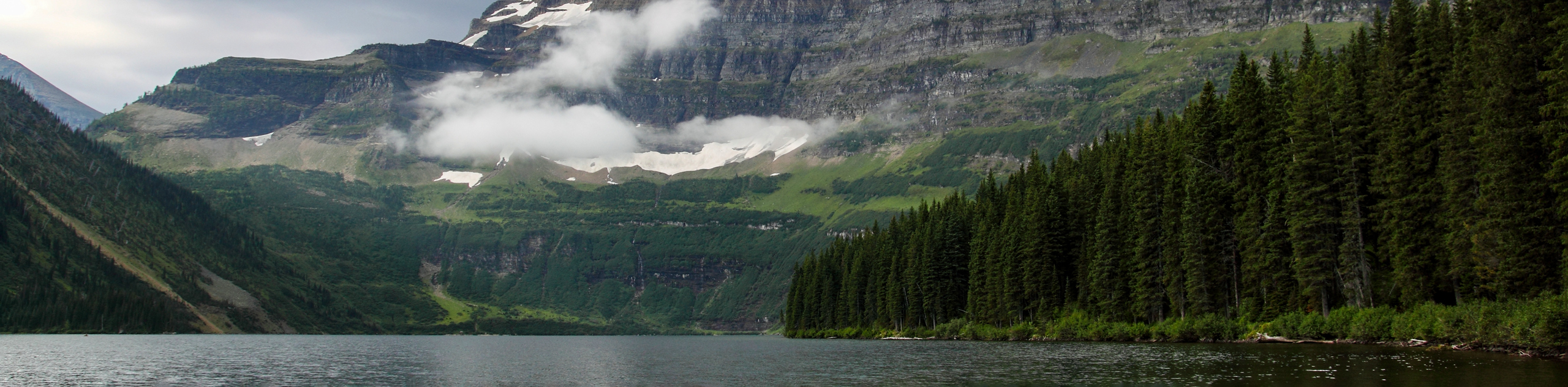
Akamina Lake Hike
The stroll to Akamina Lake is an easy trail that leads hikers 1640ft into the woods before reaching…
CamilaP. 4 years ago
Good short hike, enjoyed exploring the upper falls. A good add-on to the Red Rocks walk. Easy terrain for all ages and stunning overlook platforms above the falls.
Mike Constance 4 years ago
Quick low-intensity hike into the canyon. Lots of gorgeous picture taking opportunities. A short but fun hiking experience.
Parker L. 4 years ago
Easy trail with beautiful spots for photoshoots. Stunning view of the waterfalls. Will definitely visit again if I have spare time.
Kairi Subarashi 4 years ago
Exploring the canyon bottom was so much fun. This is also a family-friendly hike. The best place to enjoy Waterton with young children.
Patrick Dumas 4 years ago
Enjoyed the remarkable view of red canyon walls and surrounding mountains. The falls look incredible. I've taken lots of great photos.
Aaron P. 4 years ago
Not very big and gets busy so It's challenging to take a picture of the canyon without other people. Going early will help to avoid the crowds but the sun isn’t high enough to light both sides of the canyon for your pictures.
mendel 4 years ago
Great venue for concerts! Lovely surroundings too!
LaylaP. 5 years ago
Red Rock Canyon was impressive. This was actually the first time I saw something like it.
Meng Hin Jai 5 years ago
Very nice, and busy. Beautiful Red Rock with lots of different hiking trails depending on your skill. Blakiston Falls is pretty and there were lots of viewpoints once you get there.
Fitzgerald Hikes 5 years ago
About as easy as it gets to access a very special spot. Invite your geologist friend on this one.