Crandell Lake hike
View Photos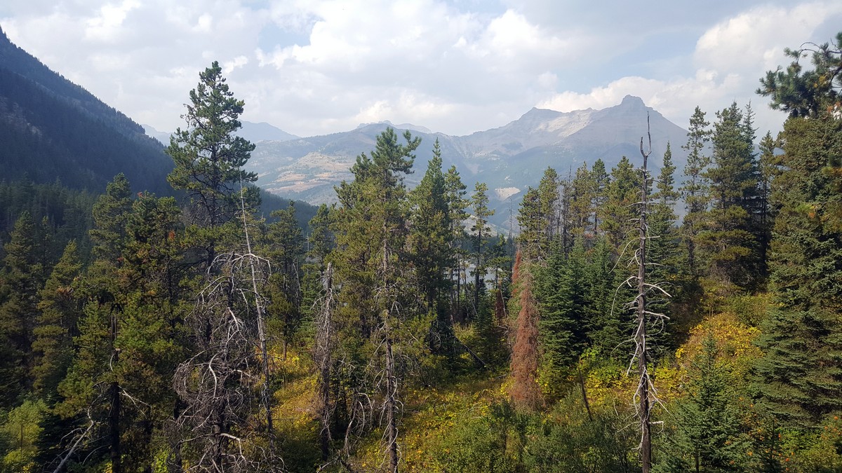
Crandell Lake hike
Difficulty Rating:
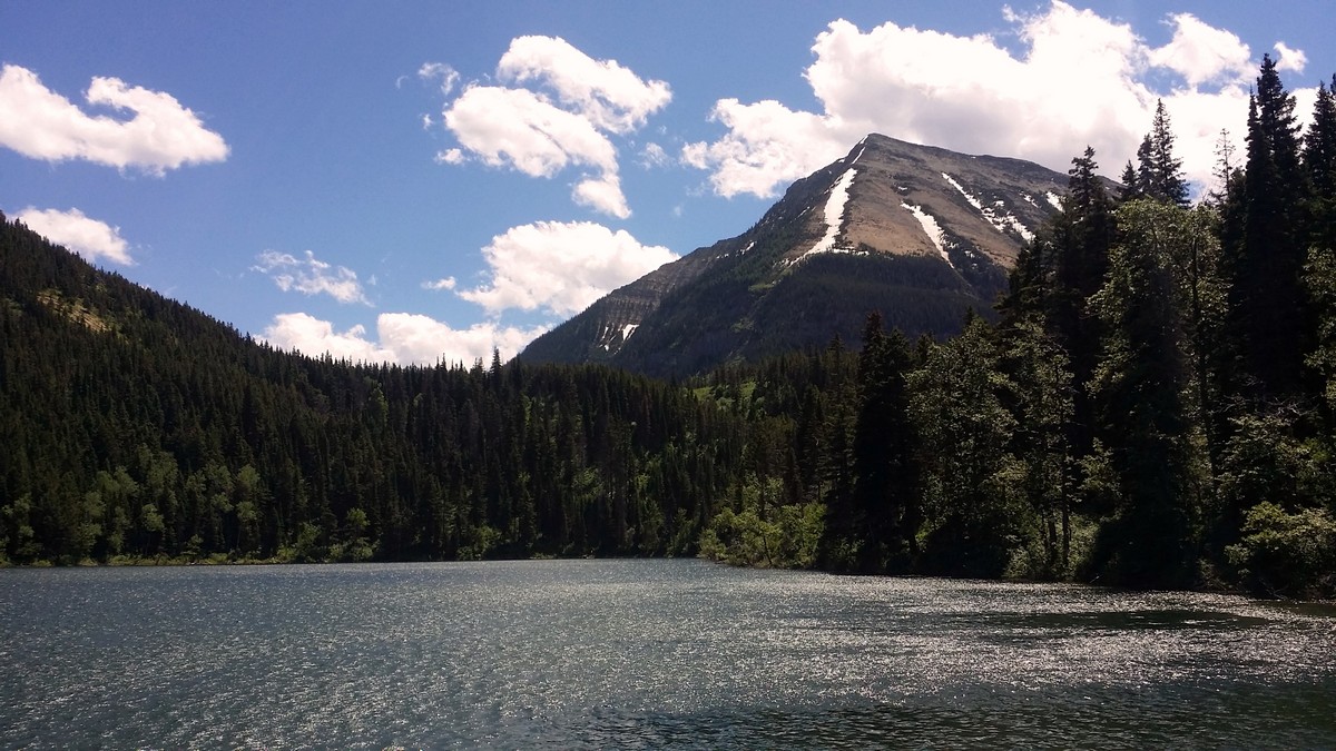
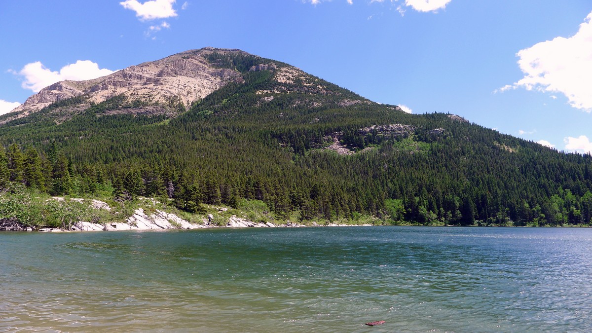
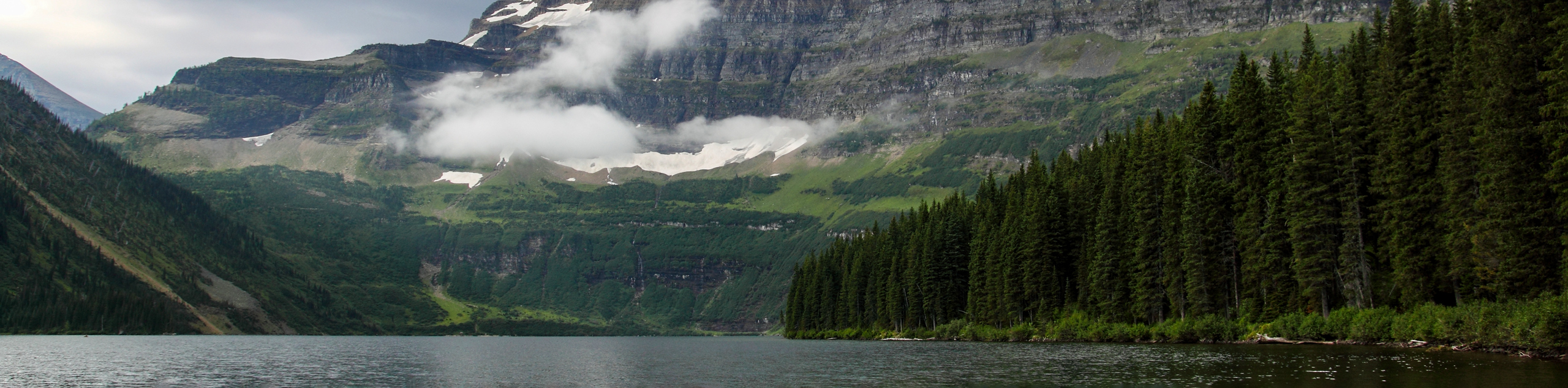
The Crandell Lake hike takes you to a beautiful emerald green lake. It offers an inviting place to climb, play, hike, or picnic. You can loop around the entire lake, spend time climbing the rocky crags, sunbathe on the smooth shoreline boulders, or prepare a picnic under the shelter at the beach. This is a wonderful destination for the family.
Getting there
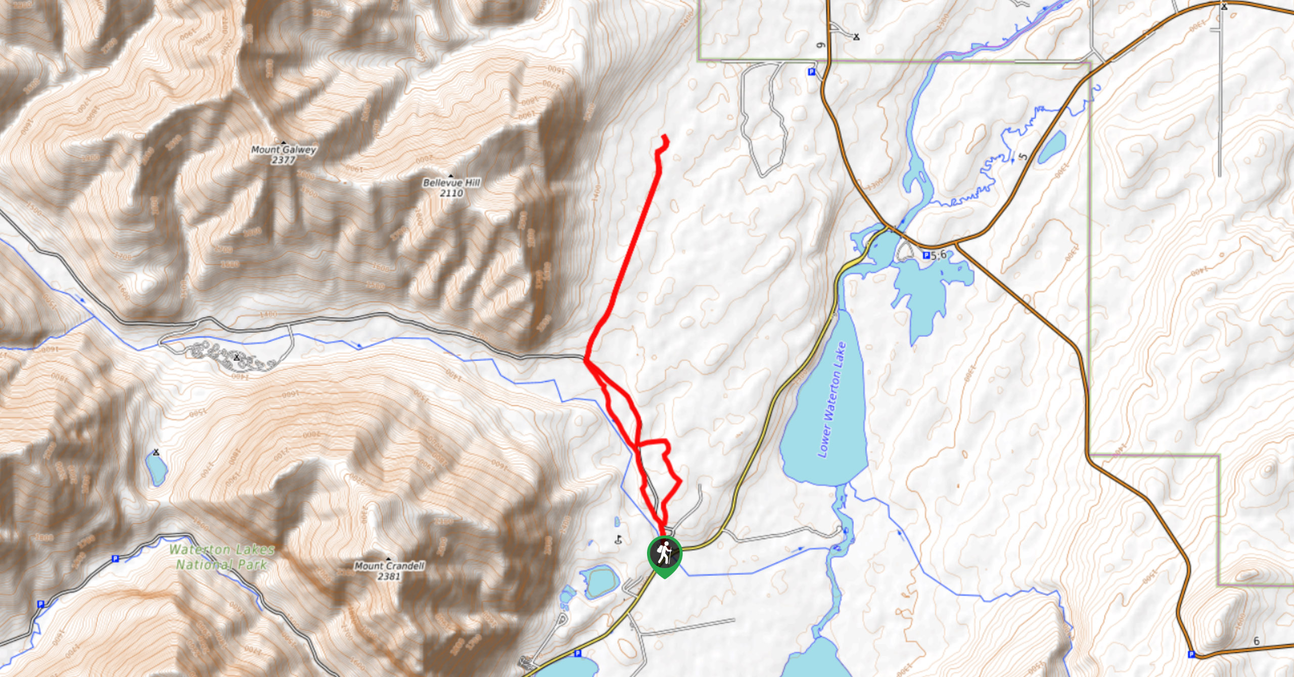
Go south on Akamina Parkway. Travel 3.7mi to the well-signed Crandell pullout on right side of the road.

About
| When to do | May to October |
| Backcountry Campsites | At Crandell Lake |
| Toilets | At Crandell Lake |
| Family friendly | Yes |
| Route Signage | Average |
| Crowd Levels | Low |
| Route Type | Out and back |
Crandell Lake
Elevation Graph
Weather
Route Description for Crandell Lake
Note that much of Waterton National Park was severely impacted by the 2017 Kenow Wildfire. To find out what trails are open, please check the Parks Canada website.
Crandell Lake has two main routes to it. The Red Rock Parkway trail is longer and has a greater elevation gain, although the pitch is fairly gradual. The route from Akamina Parkway is shorter and gains less elevation; however, it is rockier and seems to have a steeper grade. Both are beautiful approaches; this route description is for the approach via Akamina Parkway.
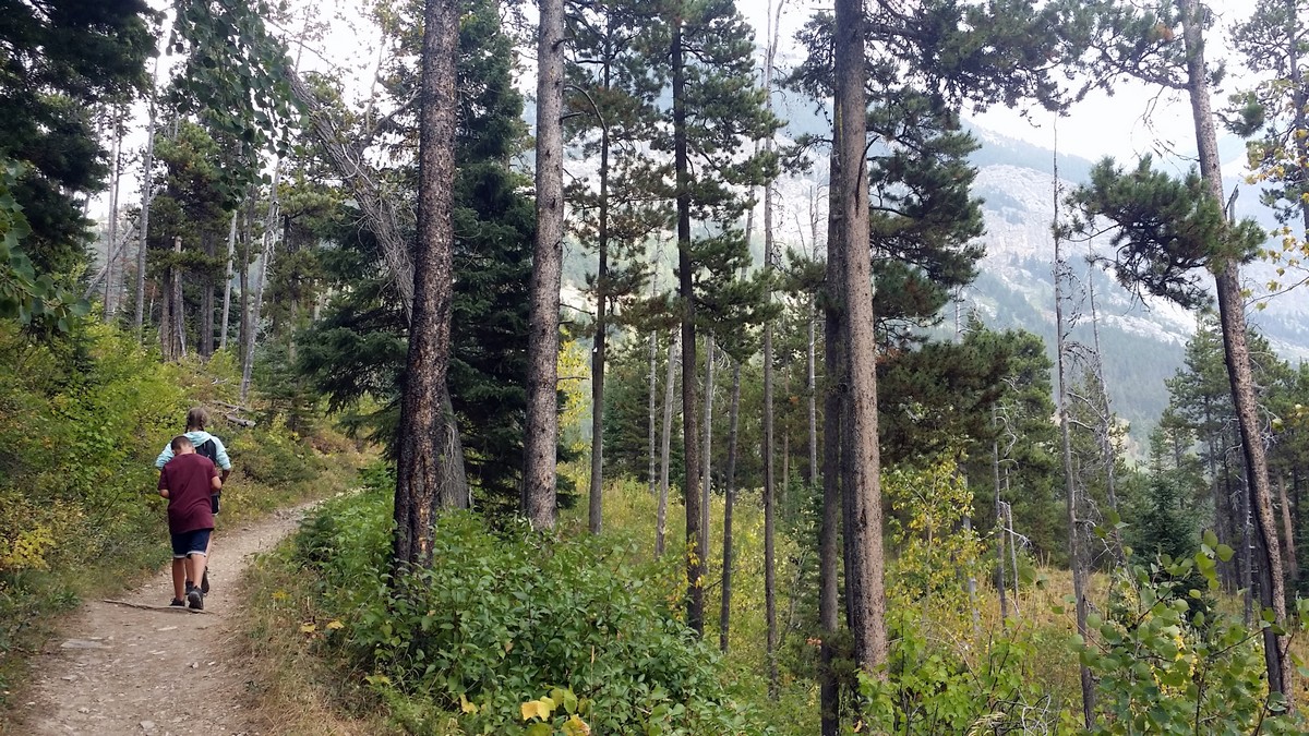
From the Akamina Parkway parking area, the path begins with several stepping stones. The trail travels through stands of aspen and pine, offering glimpses down the valley. The path itself is rather rocky and requires some attention to foot placement. The climbing is steady.
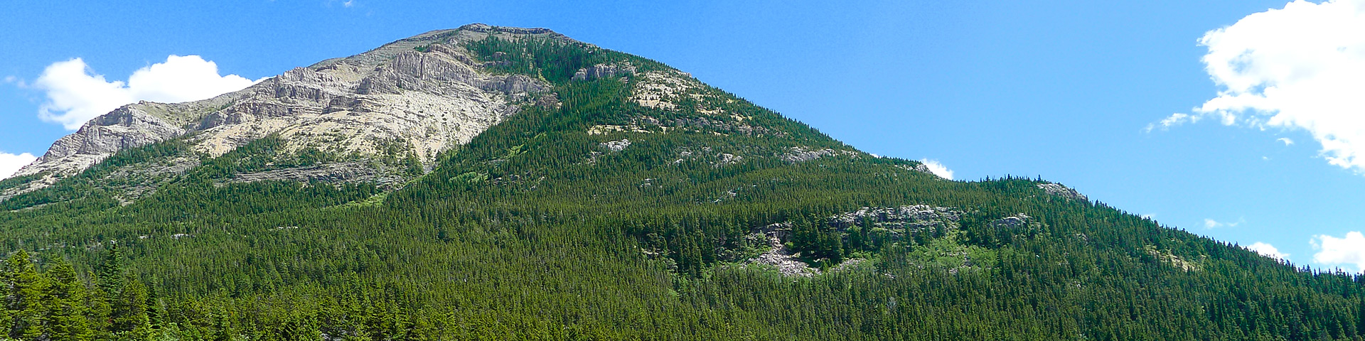
Although steep at times, the beautiful surroundings ease the ascent. The low underbrush is lush and green. The views through the trees to the south east, down Akamina Parkway, are excellent.
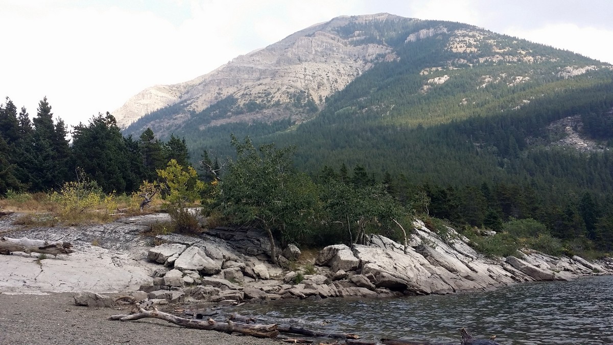
At 0.6mi, you’ll reach a signed junction with another approach trail from the townsite. Stay left for Crandell Lake. At this point, the trail begins to drop towards the lake. Soon, views open up to the north and west, with views of Ruby Ridge. Be careful with your footing as you occasionally rock hop downhill; you may have to navigate around horse droppings as well. At 0.8mi, look for the lake below you.
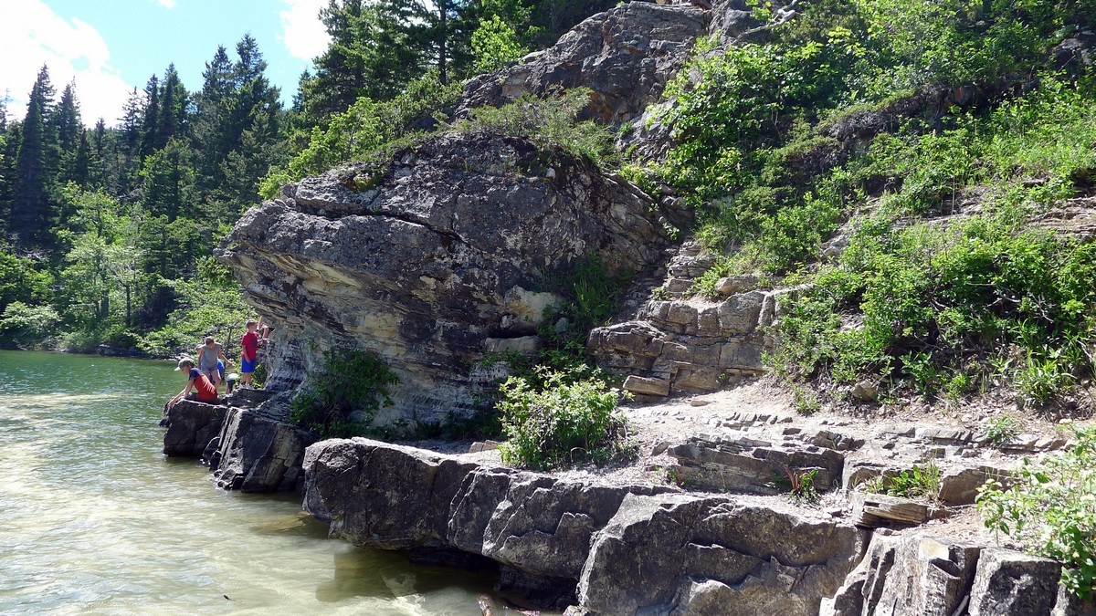
You’ll reach another signed junction at 0.9mi. To go to the south foot of the lake, make a sharp right and go 66ft down a steep, rocky path to the shore (a left at the junction will take you through the trees to the north end of Crandell Lake).
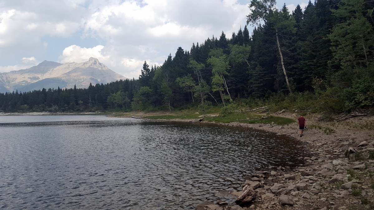
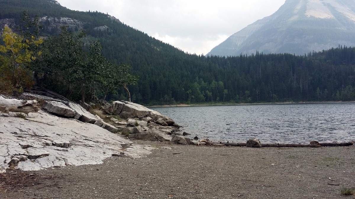
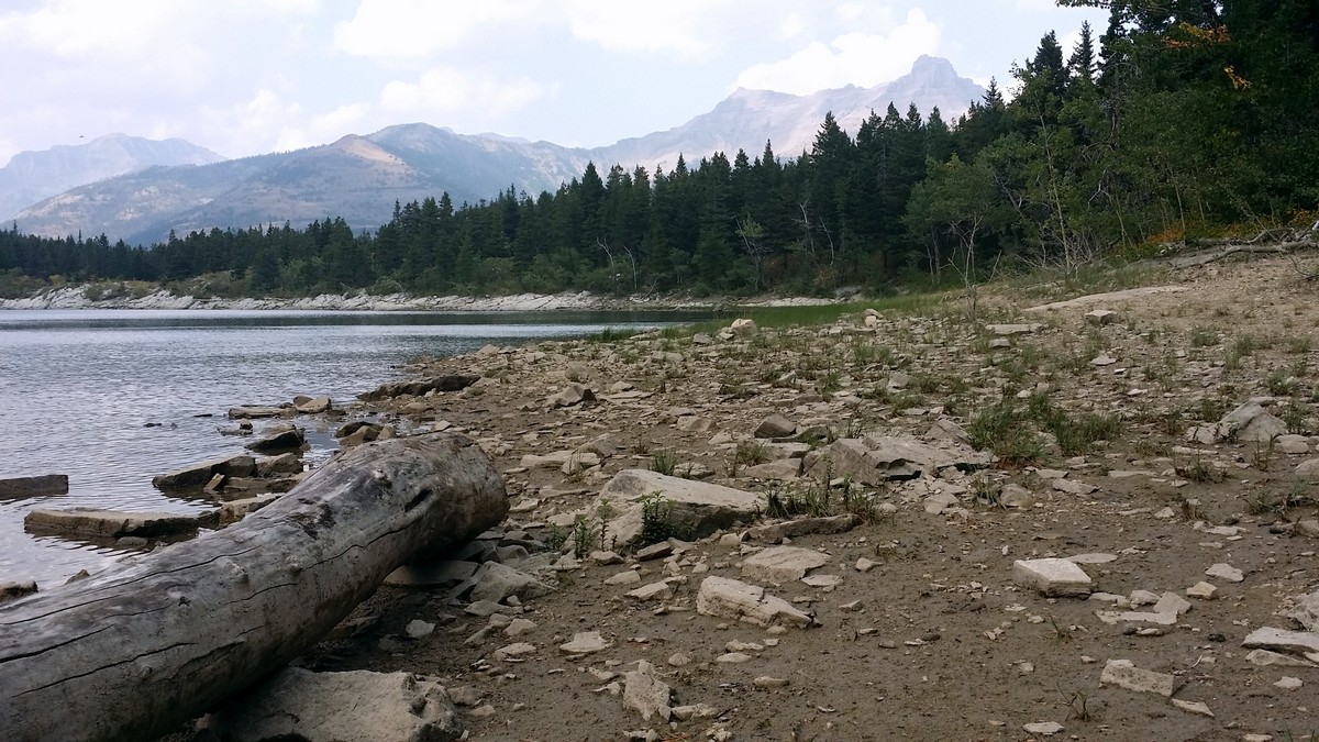
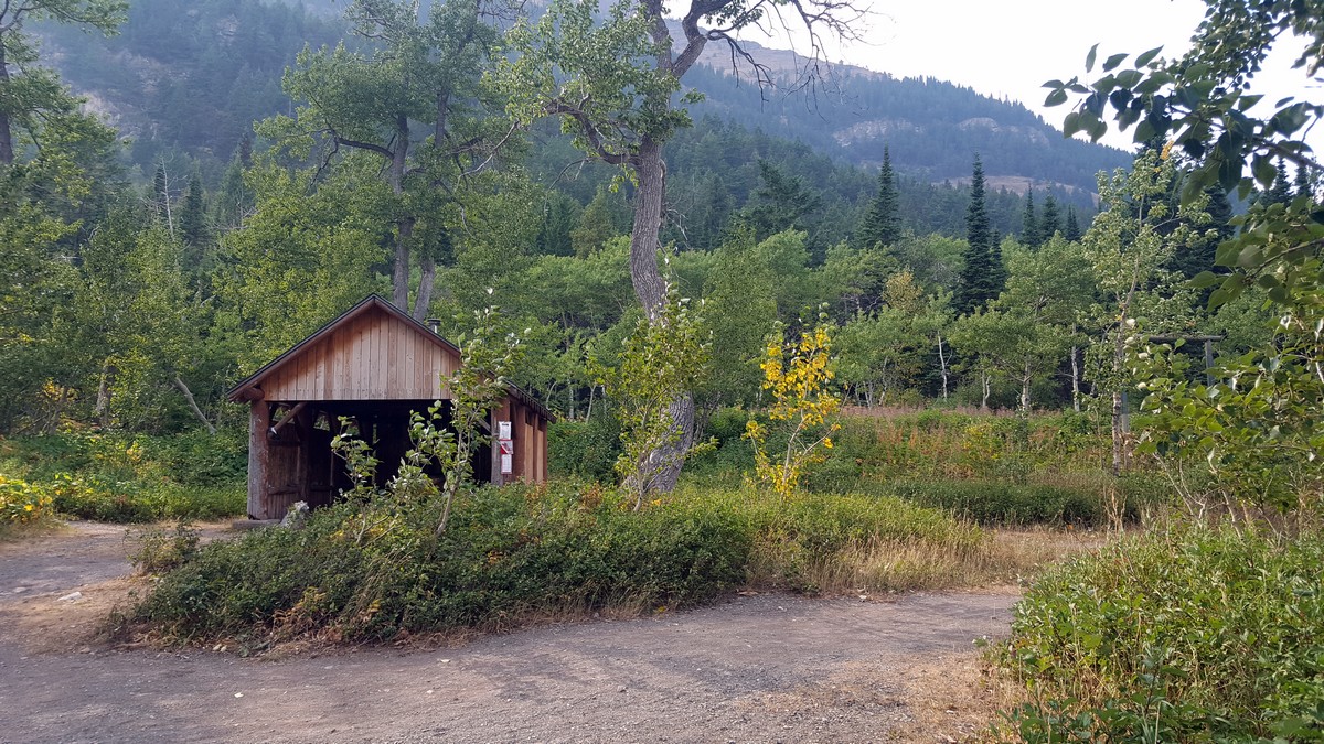
From the south end of the lake, there are views of the west slope of Crandell Mountain. For a wider view, walk along the south shore of the lake (right) for another hundred metres. A rugged path leads around the eastern (right) shore of the lake to the north end, where there is a picnic shelter, pit toilet, and backcountry campground. Along the northeast shore are smooth rocks that invite you to sit and ponder.
From the north end of the lake, take a left at the signed trail junction towards Akamina Parkway to return the way you came. Looping around the eastern shore of the lake to the north end, then travelling south along the west side of the lake back to the junction will add approximately 0.9mi to the total distance.
Insider Hints
This trail is open to bikers as well; so keep an eye open for approaching cyclists and keep your children close by.
For an easier approach, hike to Crandell Lake from Red Rock Parkway on the north end. From Red Rock Parkway, turn left on the Crandell Mountain Campground access road and, continue on to the signed parking lot for the Crandell Lake trailhead.

Similar hikes to the Crandell Lake hike
Hell Roaring Falls Hike
The hike to Hell Roaring Falls in Waterton Lakes National Park can be approached by bike, boat, or on foot.…
Bellevue Prairie Trail
The Bellevue Prairie Trail is shaped like a reverse lollipop route that gives hikers the option to take a small…
Akamina Lake Hike
The stroll to Akamina Lake is an easy trail that leads hikers 1640ft into the woods before reaching…
nikkijay 3 years ago
We tried this hike as a family, and Parks Canada is currently redoing the trail to increase drainage (as rain was wrecking the trail). The elevation climb is substantial - the first half of the trail was uphill. Beautiful walk, and it is good for kids/families, but the elevation climb and length is longer than what is listed here (I looped back at one point to see if I had missed a turn in, and including that, my tracker read closer to 5km than 3, and elevation gain of 150ish meters). I’d do it again, but would bring more snacks and water for the kids! The beach at the end is lovely, and so nice and quiet. Super cold water, but the kids didn’t mind!
Parker L. 4 years ago
We enjoyed sight-seeing while we were having a picnic. Very rewarding hike.
Jackson D. 4 years ago
The rocky path was slightly challenging for me. It's the one thing I do not like about this hike.
Ezekiel H. 4 years ago
I tripped while descending and it really hurts. Luckily, it wasn't so serious.
Agfa P. 4 years ago
This is a must-visit place if you're looking for an easy hike! This trail is open to bikers as well.
Kairi Subarashi 4 years ago
This hike gives you a revitalizing feeling because of the lake. Cool place that offers a lot of activities, like climbing, play, hiking, and even picnic. This is absolutely the best destination for family bonding.
Mildred G. 4 years ago
Great workout! You can loop around the entire lake or spend time climbing the rocky crags. You can also prepare a picnic under the shelter at the beach.
Emma Tree 4 years ago
Fantastic hike. The actual trail close to the lake was wonderful.
LaylaP. 5 years ago
It was an inspiring place! I want to try cycling next time.
Jeremy R. 5 years ago
Beautiful views,wonderful destination for the family Relaxing place to visit.