
Bertha Lake and Bertha Falls Hike
View Photos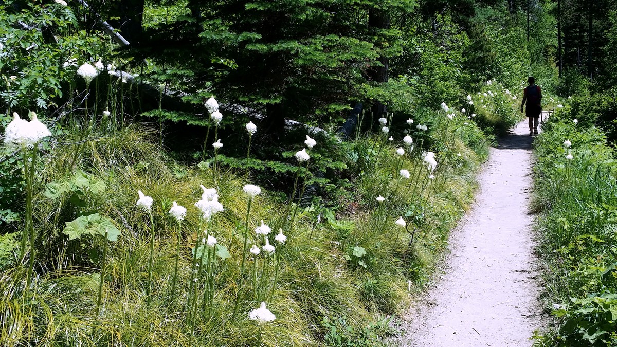
Bertha Lake and Bertha Falls Hike
Difficulty Rating:
This Waterton classic hike boasts waterfalls, sweeping vistas, and an alpine lake, making the trail to Bertha Lake and Bertha Falls a stunning hike. The benches and minimal elevation gain to Lower Bertha Falls make the first half of the hike an excellent family option. However, the second half is where the elevation kicks in.
Getting there
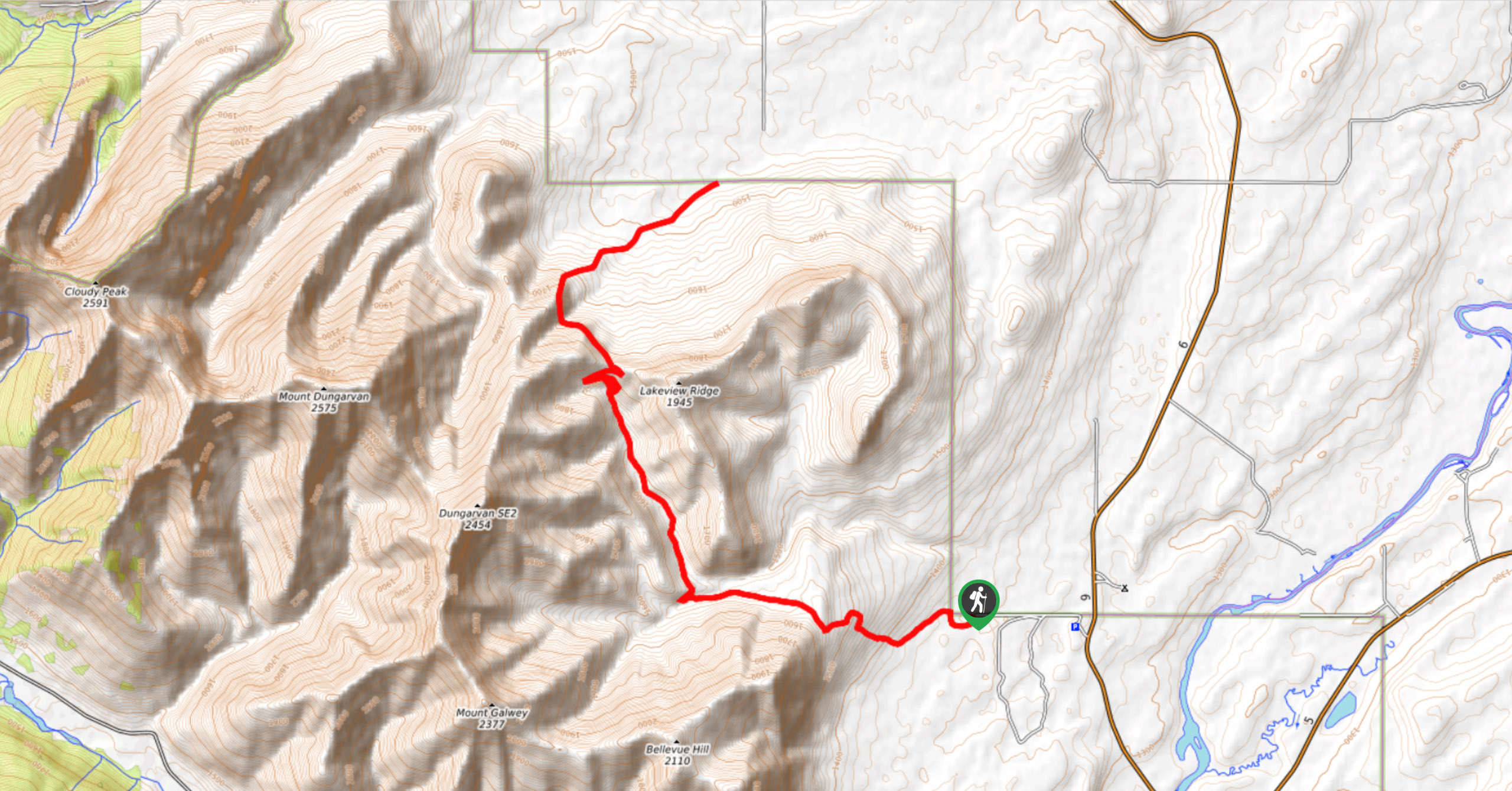
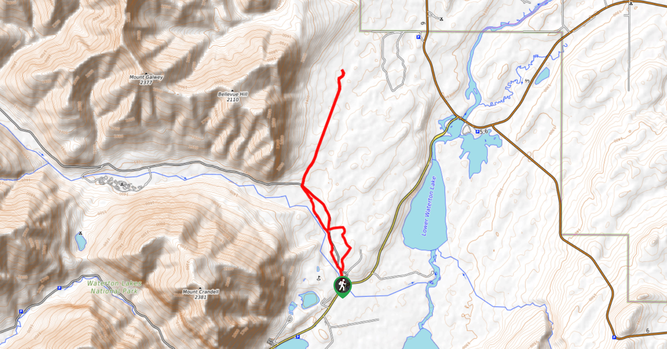
The Bertha Lake Trailhead begins at the Southwest side of Waterton Townsite. Travel south on Evergreen Aveenue, less than 1640ft after Cameron Falls and turn right into the parking lot. A trail map marks the beginning of the hike.

About
| When to do | July to September |
| Backcountry Campsites | At Bertha Lake |
| Toilets | At backcountry campground at lake |
| Family friendly | No |
| Route Signage | Average |
| Crowd Levels | Moderate |
| Route Type | Out and back |
Bertha Lake and Bertha Falls Hike
Elevation Graph
Weather
Bertha Lake and Bertha Falls Trail Report
The Bertha Lake and Bertha Falls Trail begins in the trees and climbs gradually, with occasional glimpses back to Waterton Lake and the townsite. If you’re only going as far as the Lower Bertha Falls, the gentle grade and well-placed benches make it a great hike for people of all ages.
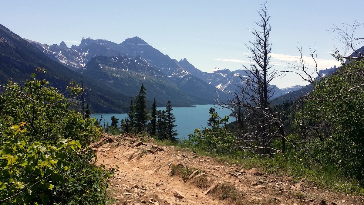
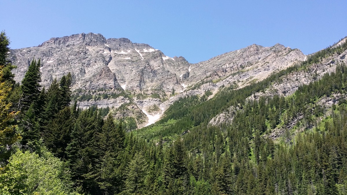
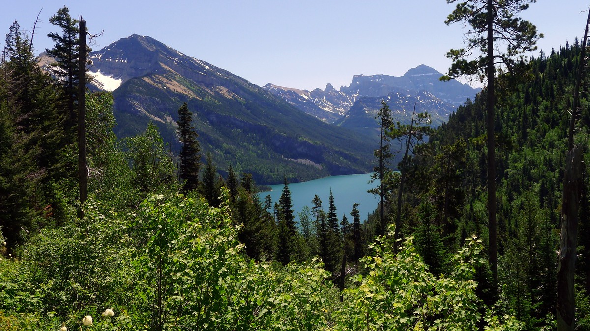
At the fork at 0.9mi, bear left for a viewpoint. The sweeping vista includes Upper Waterton Lake and the surrounding peaks to the East, including Vimy Peak and Mount Boswell. To the South you can see the International Boundary Line with views into Waterton’s American counterpart, Glacier National Park in Montana. Back on the main trail, the path briefly dips and forks again. Stay right for Bertha Falls and Lake.
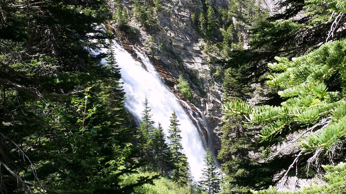
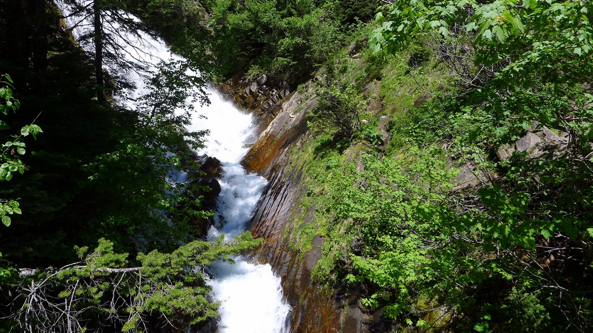
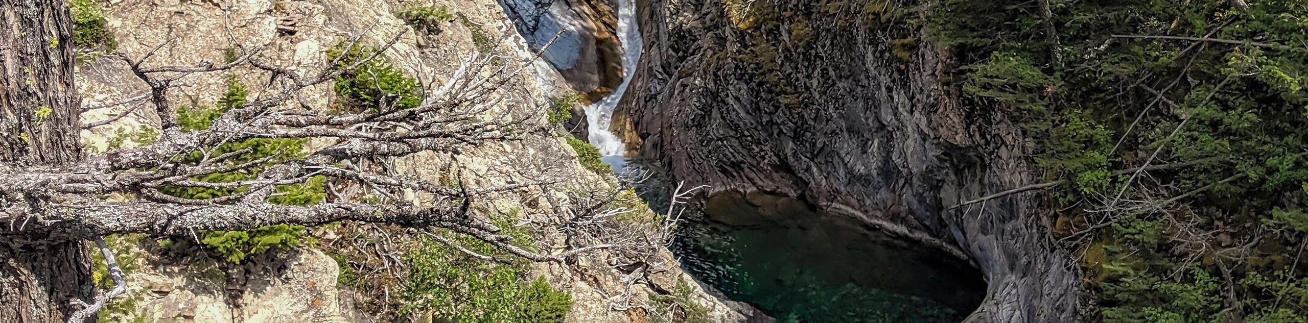
Bear grass is abundant in this area of the trail, but it dwindles once you reach Lower Bertha Falls at 1.7mi. This is a beautiful place to stop for a snack on one of the benches, as you enjoy the tumbling water running over the argillite rock bed.
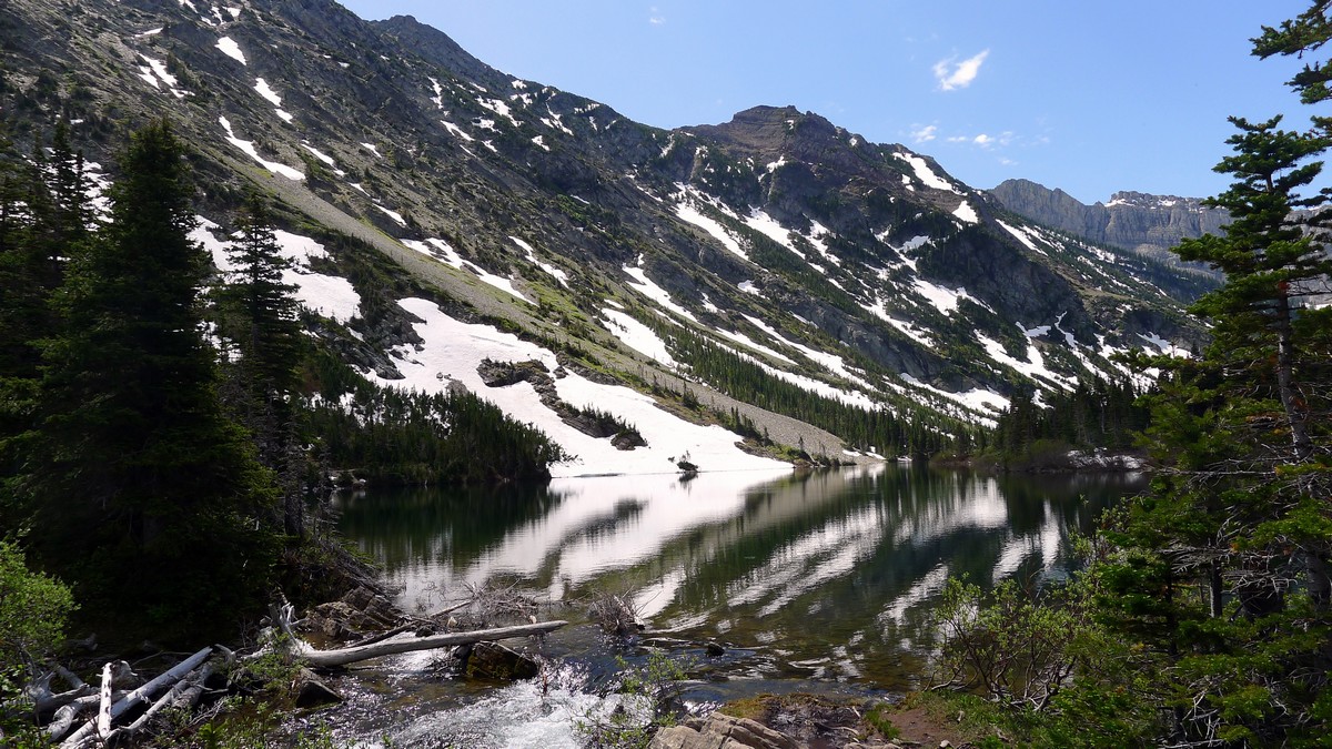
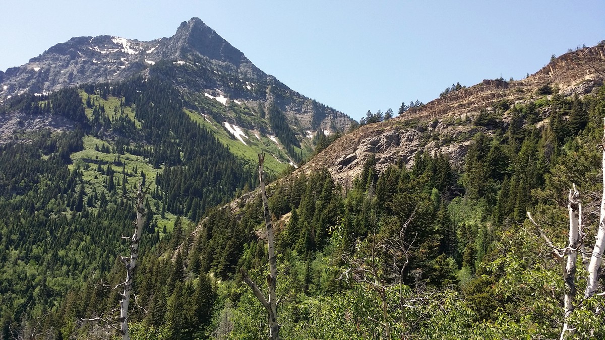
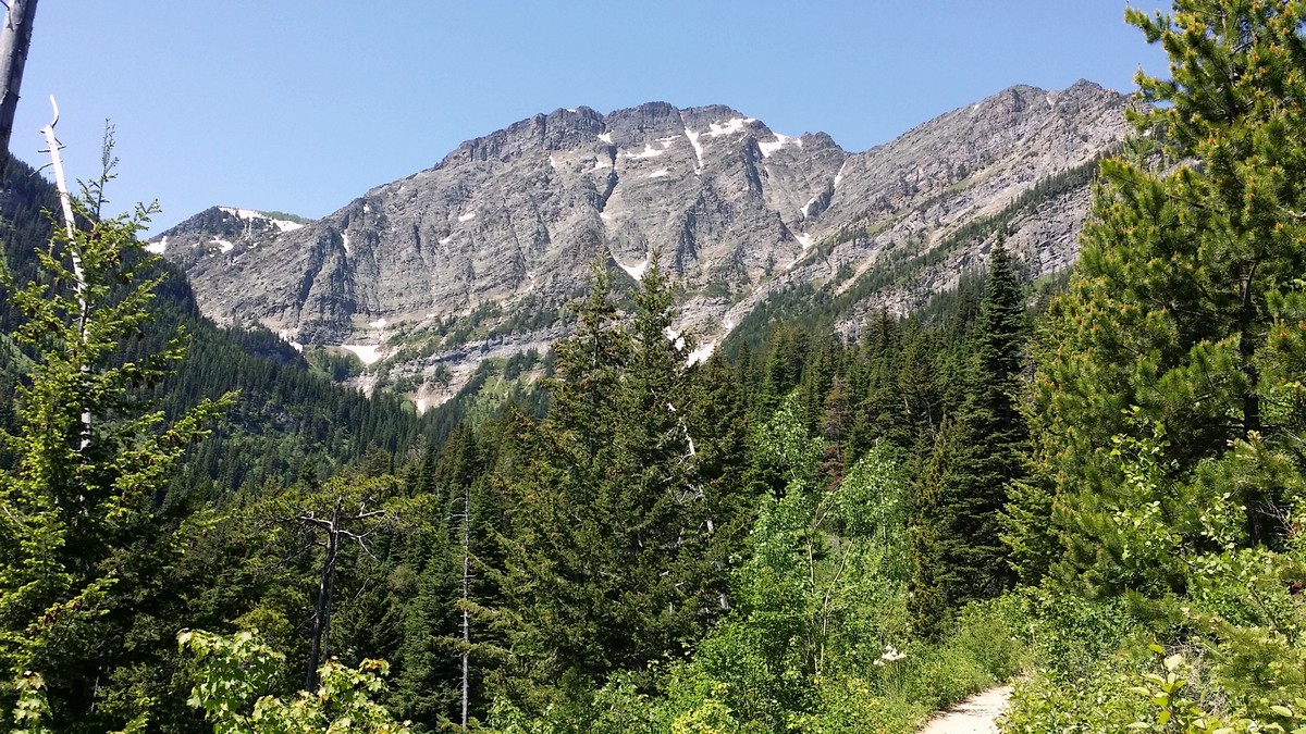
To continue to Bertha Lake, cross the wooden bridge over Bertha Creek. The trail quickly becomes more challenging, and the grade will stay steep for the next 1.4mi. Switchbacks help the ascent, but benches no longer appear, making the section from Lower Bertha Falls to Bertha Lake more challenging than the jaunt to the falls. However, the breaks in the trees with views of the surrounding area continue to tease and propel you forward with promises of what’s to come.
You begin to hear rushing water at 2.7mi, as you get your first glimpse of Upper Bertha Falls. This portion of the falls is especially impressive early in the season when the volume of water is high. Just a few hundred meters further, views of Upper and Middle Waterton Lakes appear. After 984ft, the trail levels as it approaches Bertha Lake.
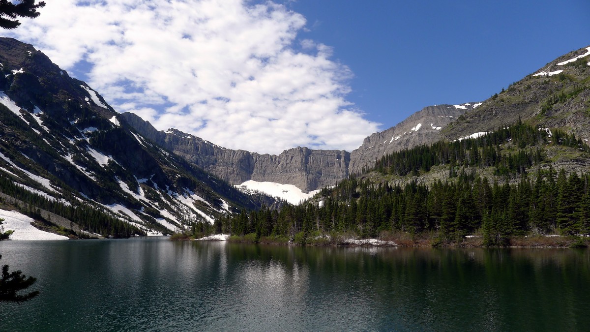
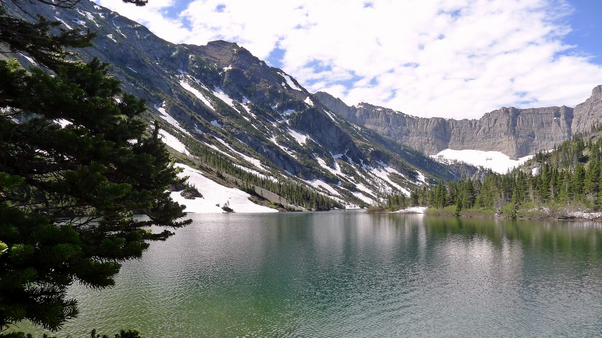
You’ll reach a fork in the trail at 3.4mi; straight ahead will take you to an overlook of Bertha Lake, while the right fork drops down to the lake.
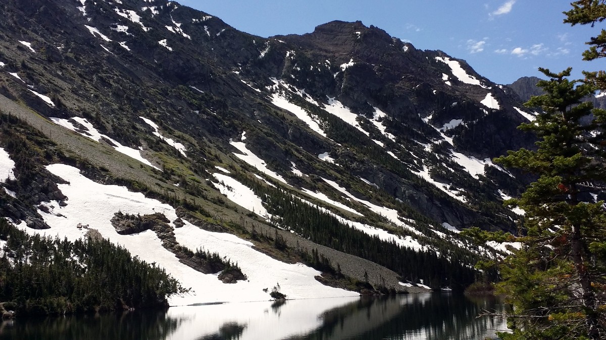
At the lakeshore, you’ll have a beautiful view of the surrounding peaks. Mount Richards sits to the left while Mount Alderson frames the back of the lake and Bertha Peak dominates your view, as you look right.
You can now choose to go left or right. A short distance to the left will take you to a red-gravel beach, an inviting spot to enjoy your lunch. Continue along to do a complete 2.5mi loop of the Lake. Or, go right, stepping over a wood bridge to find a backcountry campground with tent sites and a pit toilet (take your own toilet paper). A little further down the trail you’ll find a picnic and cooking area along the lakeshore. Return to the trailhead the way you came.
Hiking trail highlights
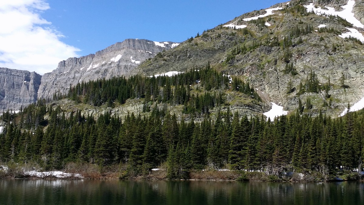
Bertha Lake
Bertha Lake is a stunning, aqua blue lake nestled amongst the mountains and trees that make up the Bertha Lake Trail. It is a wonderful place to stop and enjoy a picnic on the rocks and take in the captivating views that surround you
Lower and Upper Bertha Falls
Lower and Upper Bertha Falls also known as the “Bridal Veil” Falls is one of the most breathtaking falls around that rushes down the side of the rock formations and runs down into a creek. This is a great area to cool off after the hike through Berta Lake Trail.
Find more amazing hikes in Waterton Lakes National Park such as:
• Crypt Lake Hike
• Cameron Lake Hike
• Red Rock Canyon Hike and Blakiston Falls
Insider Hints
Accessibility, good views, and a moderate difficulty means this is a busy trail. To avoid crowds, hike the trail early in the morning or late in the afternoon.
Bertha Falls is one of the earliest snow-free trails in the park, making it a good shoulder season destination.
Horse access is restricted in July and August; in all the other months, be prepared to step around horse droppings on the trail.

Similar hikes to the Bertha Lake and Bertha Falls Hike hike
Horseshoe Basin Hike
The incredible Horseshoe Basin Hike in Waterton Lakes National Park climbs from the Bison Paddock area towards the saddle below…
Hell Roaring Falls Hike
The hike to Hell Roaring Falls in Waterton Lakes National Park can be approached by bike, boat, or on foot.…
Bellevue Prairie Trail
The Bellevue Prairie Trail is shaped like a reverse lollipop route that gives hikers the option to take a small…
ddelaloye 4 years ago
Amazing hike...has it all!
Fitzgerald Hikes 4 years ago
First half would be great for anyone, second half is nice if you want a bit more of an actual hike. Really fantastic views and we got lucky with perfect weather
Allanhoward 4 years ago
The elevation on the second half was easier than I expected. We actually enjoyed it1
Giedre 4 years ago
Did this hike on the long weekend this summer, all the way up to the lake. The route was very busy (as expected on such day), but a bit quieter once you take the turn towards the lake. The first half of the route was crazy hot due to no shade and the bushes holding the heat, but once you get to the second part, the route gets nice and shady, but that's where the elevation gain start. The lake itself is lovely with plenty of nice spots to picnic and enjoy the water.
CamilaP. 4 years ago
The hike is fairly easy, at the beginning and gets progressively steeper after the lower falls. Lake and surrounding mountains are beautiful
Sammy Rickson 4 years ago
Classic hike with gentle trails. It was relatively easy, but it goes with few challenges. The lake and the falls were so beautiful Glad I did this hike.
Agfa P. 4 years ago
Lots of gorgeous spots to stop for a snack. I really enjoyed the tumbling water running over the argillite rock bed. Memorable hiking experience.
Mildred G. 4 years ago
It has nice views, and I would classify it as a moderate trail. The first half of the trail was easy, but the second half was quite challenging. Overall, I enjoyed the hike.
JMC 4 years ago
Not too much of a climb, but very pretty. Just take your time looking at the lake on your left and beautiful wildflowers on the path to the falls.
John Savage 4 years ago
It was a bit challenging but worth the views.