

Sixshooter Canyon Trail
View PhotosSixshooter Canyon Trail
Difficulty Rating:
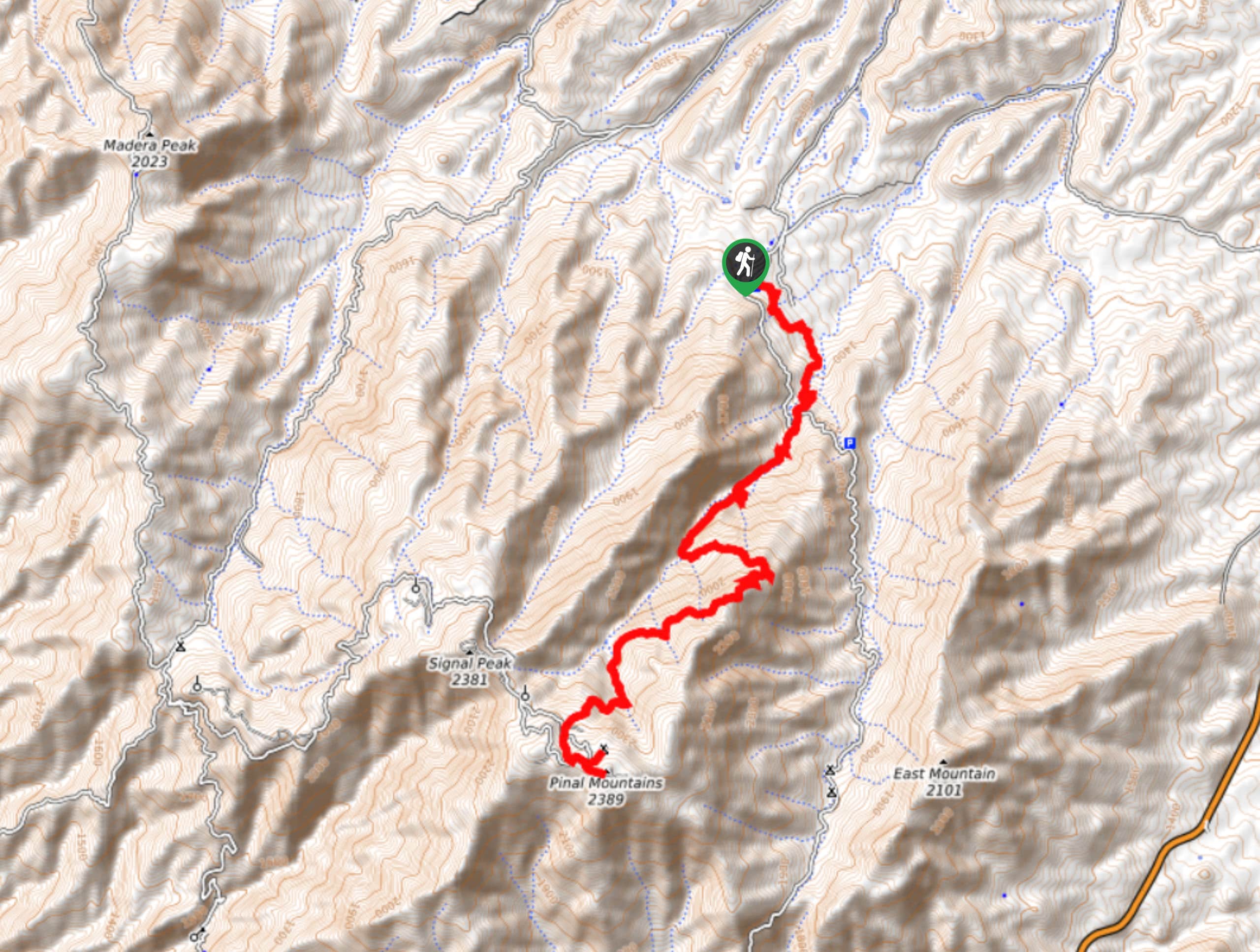
The Sixshooter Canyon Trail is an incredible hike that we’d venture to call an underrated gem. Despite its amazing scenery, this route doesn’t see very much traffic. It begins in the brushy desert and leads you up through a forest with an amazing variety of trees (excellent for birding)into a canyon that stretches up to Pinal Peak. The scenery is unreal, the hike is challenging, and you’ll likely encounter few fellow hikers as you soak up the views.
Getting there
The trailhead for the Sixshooter Canyon Trail is on FR 112.
About
| Backcountry Campground | No |
| When to do | March-November |
| Pets allowed | Yes - On Leash |
| Family friendly | No |
| Route Signage | Average |
| Crowd Levels | Low |
| Route Type | Out and back |
Sixshooter Canyon Trail
Elevation Graph
Weather
Sixshooter Canyon Trail Description
For an impressive hike with ever-changing scenery, the Sixshooter Canyon Trail sees far fewer visitors than it should. That’s the perk, though- after taking on the challenging canyon route to Pinal Peak, you’ll likely have the view to yourself. If you can time your hike for the autumn color change, you’ll be in for an extra treat. This hike is a bit of a leg-burner, so come prepared with lots of water, extra layers for the top, and a map in case you start to lose your way.
Note that the Icehouse Canyon Trail #198 and the Sixshooter Canyon Trail #197 start from the same area but take you to different destinations. Two other trails also ascend this mountain from other starting points, Kellner and Telephone. Ensure you’re on the right track as you head out.
From the trailhead, you’ll amble to your left around the base of the mountain. Hiking through the desert chaparral, the scenery starts brushy and scrubby. As you climb, you’ll pass through a forest with an impressive variety of trees, perfect for the avid birdwatcher. Cross FR 112 where it intersects and begin the real climbing as you ascend the canyon, crossing the creek about halfway up to climb underneath the ridge to Pinal Peak.
From the top, you’ll retrace your steps to the trailhead. It’s also possible to make a loop with the Icehouse Canyon Trail by traversing to Signal Peak and descending the canyon just west of the one you ascended. It’s a longer return trip made easier by the fact that you’ll be heading downhill.
Similar hikes to the Sixshooter Canyon Trail hike
Jacob’s Crosscut Trail
Jacob’s Crosscut Trail is an important route in the network of trails in Lost Dutchman State Park. This route is…
Bronco Trail
The Bronco Trail is a 7.9mi out and back route used for hiking and horseback riding. This trail…
Perlite Road to Arnett Creek Loop
The Perlite Road to Arnett Creek Loop takes you through a section of the Boyce Thompson Arboretum grounds and through…


Comments