

Pine Loop Trail
View PhotosPine Loop Trail
Difficulty Rating:
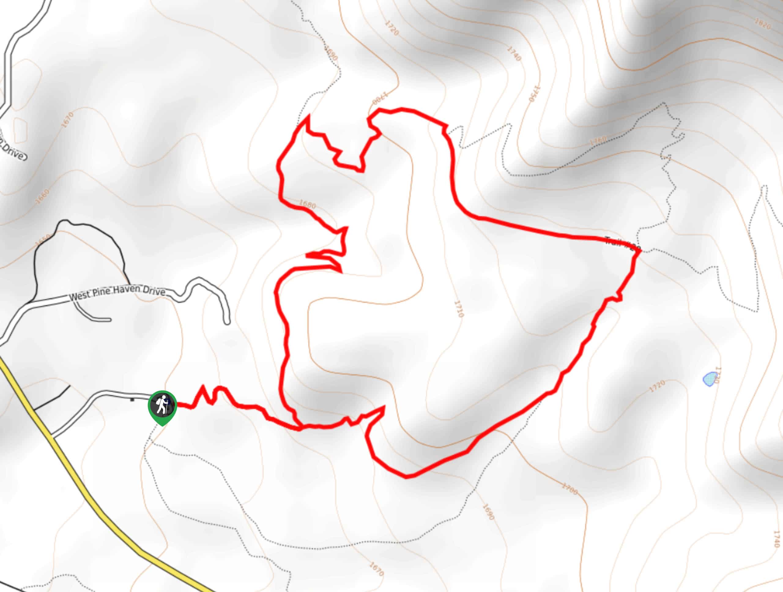
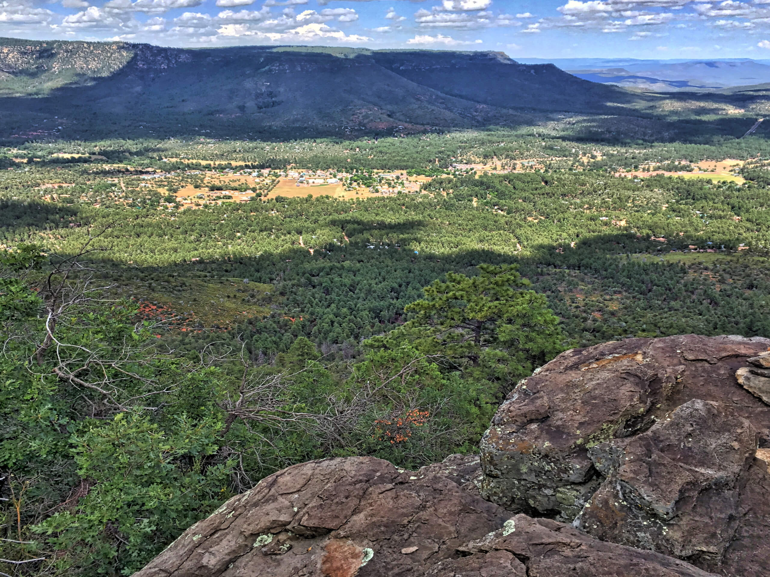
The Pine Loop Trail is a laidback 1.7mi loop hike near Pine, Arizona in the Tonto National Forest. This route follows a section of the Arizona Trail, which extends from the border with Utah to the border with Mexico. This route comes in just under three miles long and the elevation gain is gentle. You’ll explore a red dirt path lined by trees and with a peekaboo mountain view at the end.
With a snow-capped peak visible on the high point of this hike and the forest surrounding you, you might not feel like you’re in typical Arizona, but you’ll love the scenery. Try to visit in the spring when the wildflowers are in full bloom.
Getting there
The trailhead for the Pine Loop Trail is at the end of FR 297.
About
| Backcountry Campground | No |
| When to do | Year-round |
| Pets allowed | Yes - On Leash |
| Family friendly | Yes |
| Route Signage | Average |
| Crowd Levels | High |
| Route Type | Lollipop |
Pine Loop Trail
Elevation Graph
Weather
Pine Loop Trail Description
If you’re on the hunt for a hike with rewarding views that won’t tire you out too much, try the Pine Loop Trail near Pine, Arizona. As the name would suggest, this hike leads you through a sunny pine forest on a red dirt path. At the high point of the trail, you can see snow-capped mountains in the distance.
This hike is suitable for families and beginners thanks to its sub-three mile distance and mild elevation gain. Should you ever find yourself in Pine, it’s worth the stop.
This route follows part of the Arizona Trail, a cross-state hike that begins at the Utah border and travels all the way to the border with Mexico. You just might spot some thru-hikers on your adventure, who are normally happy to chat about their hike.
This trail is especially enjoyable in the spring when the wildflowers are in full bloom.
There are several intersecting trails along this route that can be used to extend your adventure if you want to continue further on. Download a map or GPS route if you’re interested in extending your hike.
From the trailhead, take Pine Canyon Trail on your left. Where the trail splits at the base of the hill, go left. You’ll soon take a couple of easy switchbacks around to another junction, where you’ll stay right.
Keep right again onto Trail 28 and take this to the 4-way junction. Take a sharp right here onto Highline Trail, staying left where it forks.
This relaxed return route will lead you back to the trailhead.
If you want to add a little bit of distance without veering too far off-track, you can stay right onto the upper branch of Trail 28 before the 4-way junction. This will give you a modest climb and a few downhill switchbacks to explore. The other trail that splits off at the 4-way junction requires more aggressive climbing, so we don’t recommend it for beginners or those hiking with kids.
If you want a view of Pine, you can take Trail 26 at the second junction as far as you like as it traverses the hillside above town.
Hiking Route Highlights
Arizona Trail
Following this route will take you along a small section of the 800.0mi Arizona Trail, a hiking route that crosses the entire state from the border with Utah in the north to the border with Mexico in the south. It’s an epic adventure for thru-hikers, although it sees a bit less traffic than more popular thru-hiking trails in the country.
Frequently Asked Questions
Is the Pine Loop Trail good for families?
Yes, this is a nice hike for families and is suitable for all ages.
Is there a fee to hike the Pine Loop Trail?
There is no fee required to hike this route.
Is the Pine Loop Trail open?
The only time this route tends to close is when there is a wildfire in the area.
Insider Hints
Although there’s a bit more shade on this route than many others in the state, we still recommend bringing lots of water on hot days.
THAT Brewery and Pub is just down the street from the trailhead if you want some refreshments after your hike.
Similar hikes to the Pine Loop Trail hike

Jacob’s Crosscut Trail
Jacob’s Crosscut Trail is an important route in the network of trails in Lost Dutchman State Park. This route is…

Bronco Trail
The Bronco Trail is a 7.9mi out and back route used for hiking and horseback riding. This trail…

Pine Canyon Trail Loop
The Pine Canyon Trail Loop in Pine, Arizona is a quick 2.7mi loop that is rated as easy.…


Comments