

Pine Creek and Ballantine Loop
View PhotosPine Creek and Ballantine Loop
Difficulty Rating:
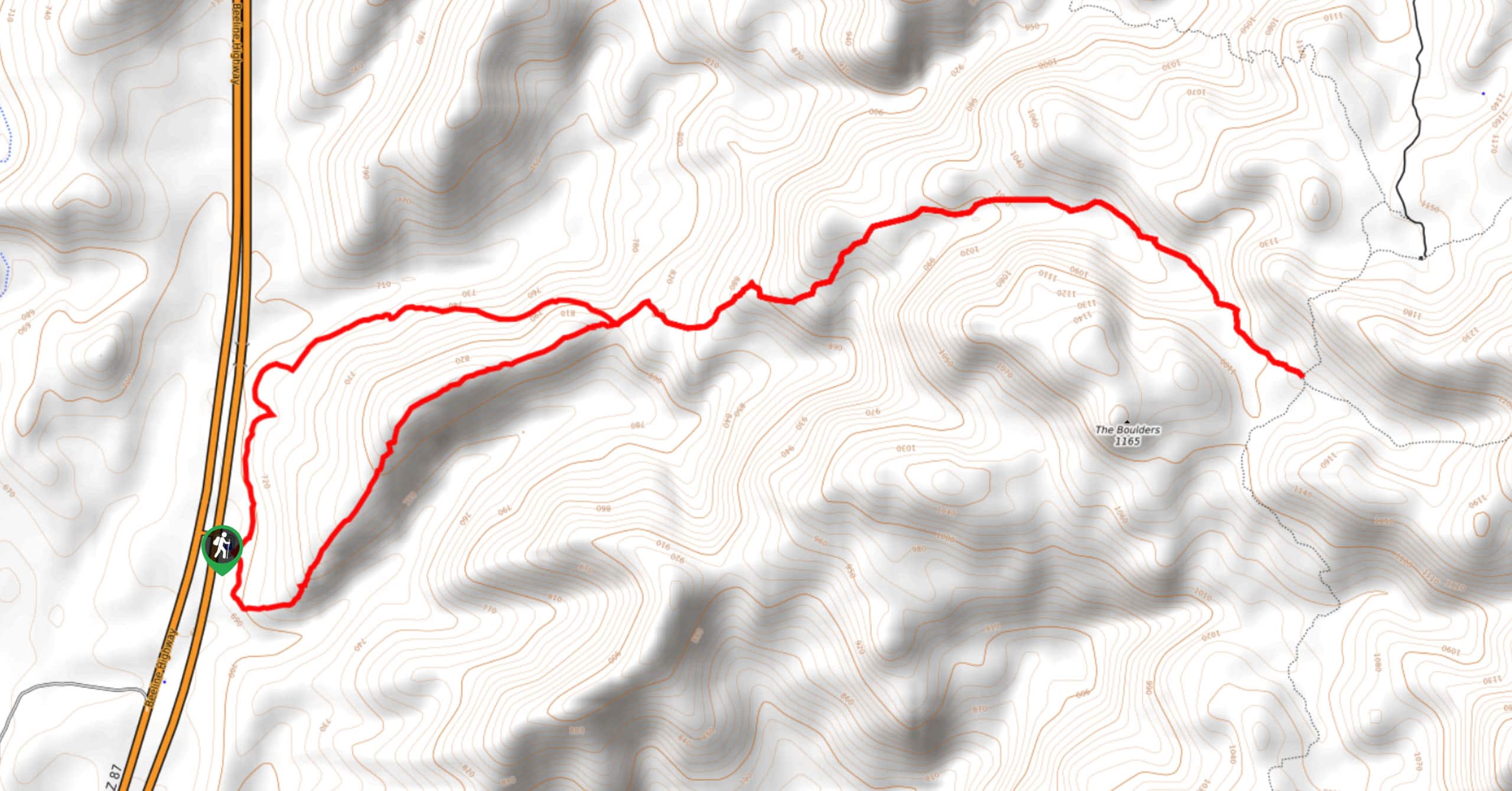
The Pine Creek and Ballantine Loop is a hike north of Mesa in the Tonto National Forest that takes you to appreciate The Boulders, an interesting mountain. This hike is moderately difficult and suitable for strong beginners and better. It can be overgrown, so long pants and a set of clippers are recommended. Bring plenty of water on this hike and avoid visiting in the hot summer months.
Getting there
The trailhead for the Pine Creek and Ballantine Loop is off SR 87.
About
| Backcountry Campground | No |
| When to do | October-May |
| Pets allowed | Yes - On Leash |
| Family friendly | Older Children only |
| Route Signage | Average |
| Crowd Levels | High |
| Route Type | Lollipop |
Pine Creek and Ballantine Loop
Elevation Graph
Weather
Pine Creek and Ballantine Loop Desccription
The Pine Creek and Ballantine Loop is an enjoyable hike in the Tonto National Forest north of Mesa that offers a stellar view of The Boulders. This hike is suitable for strong beginners and better, and the views just get better and better the further you hike.
Bring plenty of water on this hike and wear a hat and sunscreen. We don’t recommend visiting in the summer months as it can get extremely hot in this area. Additionally, you’ll likely want long pants and some clippers to deal with the more overgrown sections of trail.
From the trailhead, you can decide which side of the loop to do first. This hike is shaped like a lollipop, with a short loop leading to a section of out and back trail that comprises the second half of the hike. Pick your side of the loop, hike out to The Boulders, and then follow the other side of the loop on the return trip. The outbound route ends at a 4-way junction.
Similar hikes to the Pine Creek and Ballantine Loop hike
Jacob’s Crosscut Trail
Jacob’s Crosscut Trail is an important route in the network of trails in Lost Dutchman State Park. This route is…
Bronco Trail
The Bronco Trail is a 7.9mi out and back route used for hiking and horseback riding. This trail…
Pine Canyon Trail Loop
The Pine Canyon Trail Loop in Pine, Arizona is a quick 2.7mi loop that is rated as easy.…



Comments