
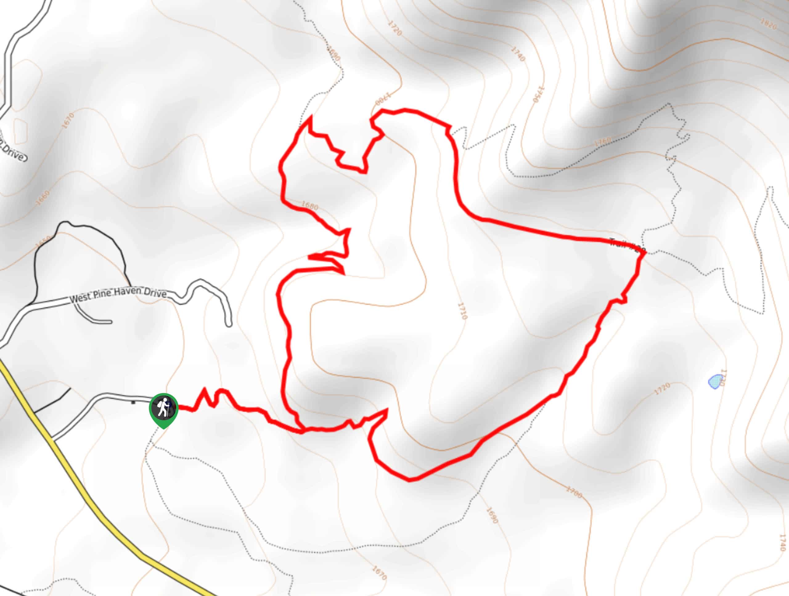
Pine Canyon Trail Loop
View Photos
Pine Canyon Trail Loop
Difficulty Rating:
The Pine Canyon Trail Loop in Pine, Arizona is a quick 2.7mi loop that is rated as easy. This hike combines three trails, but there are others that intersect should you want a bit of a longer adventure. The trails are well-maintained and there’s a bit of shade, which makes this trip more enjoyable. Expect light traffic on this one.
Getting there
The trailhead for the Pine Canyon Trail Loop is at the end of Forest Road 297.

About
| Backcountry Campground | No |
| When to do | September-May |
| Pets allowed | Yes - On Leash |
| Family friendly | Yes |
| Route Signage | Poor |
| Crowd Levels | Low |
| Route Type | Loop |
Pine Canyon Trail Loop
Elevation Graph
Weather
Pine Canyon Trail Loop Description
The Pine Canyon Trail Loop is a fairly quick, fairly easy little hike that’s easy to get to if you’re in Pine. This loop can be done as is or you can take advantage of the other trails that connect to make a longer adventure out of this route. There’s a nice mix of sun and shade, so this one won’t get too unbearable on hotter days.
Despite the bit of shade, we still recommend bringing plenty of water and dressing to protect from the sun if you’re here in the hotter months. The trails are well-maintained, but the signage can be unclear and confusing sometimes. A downloaded GPS route can help clear things up if needed.
From the trailhead, take #26 to where the trail splits. You can go either way but we’ll describe it clockwise. Turn left onto Pine Canyon Trail. Stay right where #26 heads off to the left and again where #28 heads off to the left. At the 4-way junction, take a sharp right to return to the trailhead.
Similar hikes to the Pine Canyon Trail Loop hike
Jacob’s Crosscut Trail
Jacob’s Crosscut Trail is an important route in the network of trails in Lost Dutchman State Park. This route is…
Bronco Trail
The Bronco Trail is a 7.9mi out and back route used for hiking and horseback riding. This trail…
Perlite Road to Arnett Creek Loop
The Perlite Road to Arnett Creek Loop takes you through a section of the Boyce Thompson Arboretum grounds and through…
Comments