Perlite Road to Arnett Creek Loop
View Photos
Perlite Road to Arnett Creek Loop
Difficulty Rating:
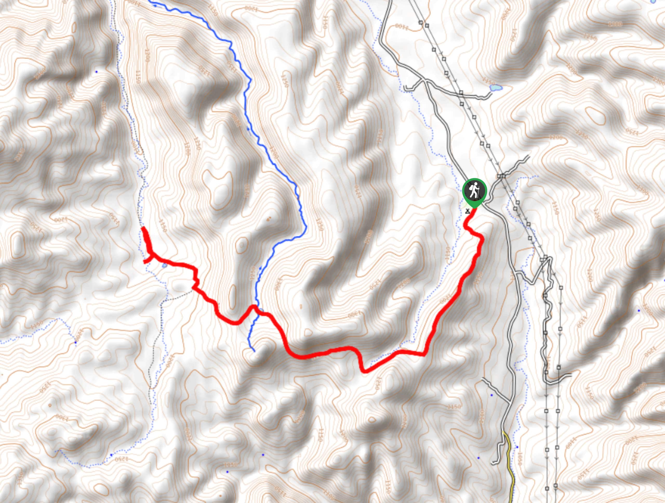
The Perlite Road to Arnett Creek Loop takes you through a section of the Boyce Thompson Arboretum grounds and through the desert underneath Picketpost Mountain. This loop is a fun trip if you’re visiting the arboretum, but it’s not well-defined and can be easy to lose. Make sure you have a map or GPS route handy to help you find your way. Expect light traffic.
Getting there
The trailhead for the Perlite Road to Arnett Creek Loop is on Perlite Road.

About
| Backcountry Campground | No |
| When to do | September-May |
| Pets allowed | Yes - On Leash |
| Family friendly | Yes |
| Route Signage | Average |
| Crowd Levels | Low |
| Route Type | Loop |
Perlite Road to Arnett Creek Loop
Elevation Graph
Weather
Perlite Road to Arnett Creek Loop Description
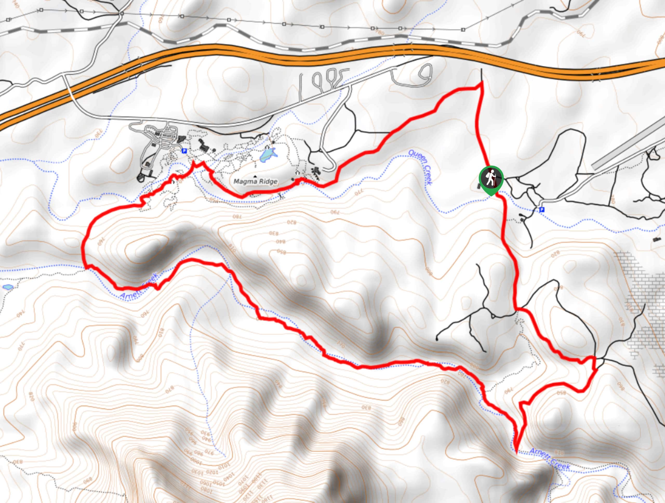
The Perlite Road to Arnett Creek Loop leads you through the grounds of the Boyce Thompson Arboretum and then through a canyon at the base of Picketpost Mountain. If you’re planning a trip to the arboretum but want to spend some time outside and exploring, consider this hike as an addition to your adventures.
This loop is not well defined in all parts and can be hard to follow. We strongly recommend downloading a GPS route to follow. We also recommend hiking this loop counterclockwise so should you lose the trail, you can backtrack through the grounds of the arboretum, which is easier to do than finding your way along the other side of the loop.
From the trailhead, hike up towards the highway and turn left towards the arboretum. Hike alongside the creek and through the grounds past the lookouts. You’ll round the hill between the creeks and turn east to hike through the canyon that Arnett Creek flows through. Look for the trail and heads left out of the canyon and use this to find Perlite Road again.
Similar hikes to the Perlite Road to Arnett Creek Loop hike
Jacob’s Crosscut Trail
Jacob’s Crosscut Trail is an important route in the network of trails in Lost Dutchman State Park. This route is…
Bronco Trail
The Bronco Trail is a 7.9mi out and back route used for hiking and horseback riding. This trail…
Pine Canyon Trail Loop
The Pine Canyon Trail Loop in Pine, Arizona is a quick 2.7mi loop that is rated as easy.…
Comments