

Peach Orchard Trail
View PhotosPeach Orchard Trail
Difficulty Rating:
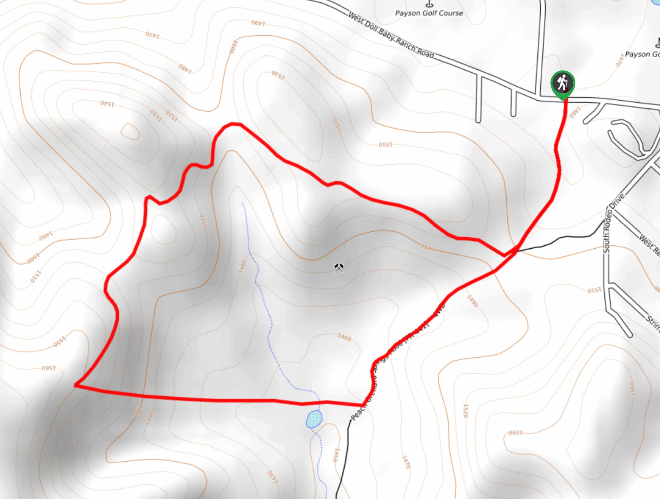
The Peach Orchard Trail is a 2.7mi loop trail in Payson that offers the chance to see wildlife and to enjoy the forest on a well-marked trail. This loop follows an old ATV track so it’s very wide and easy to navigate. You will need to deal with one big, steep, loose section going either uphill or downhill, which isn’t the best choice for very young kids or elderly hikers. Expect moderate traffic on this route.
Getting there
The trailhead for the Peach Orchard Trail is near the Payson Golf Course on W Doll Baby Ranch Road.
About
| Backcountry Campground | No |
| When to do | Year-round |
| Pets allowed | Yes - On Leash |
| Family friendly | Older Children only |
| Route Signage | Good |
| Crowd Levels | Moderate |
| Route Type | Loop |
Peach Orchard Trail
Elevation Graph
Weather
Peach Orchard Trail Description
Peach Orchard Trail is a great little hike through the forests near Payson, with views of the surrounding hills and lots of local wildlife to spot. This hike is a nice quick trip and it’s easily accessible from the golf course.
While this is an easy route overall, there is one section that wouldn’t be suitable for very young kids or hikers with mobility challenges. It’s a steep, rocky hill with loose footing that you’ll either need to ascend or descend. If you want to skip this, do one side of the trail as an out and back instead.
From the trailhead, take Peach Orchard Springs Road to where the trail splits. We recommend going clockwise so you can climb up the steep, rocky section. Going down would be much more challenging. Stay left, taking another left before the Orchard Tank and climbing up the hill. From here, loop back towards the golf course, enjoying the view from atop the hill.
Similar hikes to the Peach Orchard Trail hike

Jacob’s Crosscut Trail
Jacob’s Crosscut Trail is an important route in the network of trails in Lost Dutchman State Park. This route is…

Bronco Trail
The Bronco Trail is a 7.9mi out and back route used for hiking and horseback riding. This trail…

Pine Canyon Trail Loop
The Pine Canyon Trail Loop in Pine, Arizona is a quick 2.7mi loop that is rated as easy.…


Comments