

Parker Creek Trail
View PhotosParker Creek Trail
Difficulty Rating:
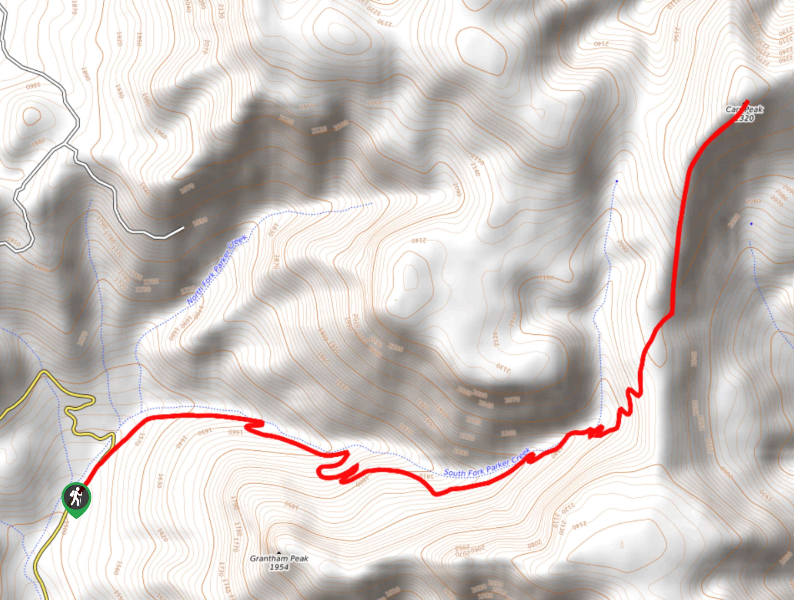
Parker Creek Trail is a 6.4mi hike in the Tonto National Forest that sees little traffic. That’s part of the intrigue and challenge of this route. You’ll very likely have the place to yourself, but you’re going to need to be very bold to make it to the top and back. The views are excellent, but you’ll contend with downed trees, overgrowth, and a lack of signage. If you’re lucky enough to enjoy this trail after it’s been tended to, you’ll be able to cruise through right to the views. Bring pants, poles, good boots, and lots of water on this hike.
Getting there
The trailhead for the Parker Creek Trail is on State Route 288.
About
| Backcountry Campground | No |
| When to do | March-November |
| Pets allowed | Yes - On Leash |
| Family friendly | No |
| Route Signage | Average |
| Crowd Levels | Low |
| Route Type | Out and back |
Parker Creek Trail
Elevation Graph
Weather
Parker Creek Trail Description
Parker Creek Trail is an adventurous trip that takes you between Grantham Peak, Carr Mountain, and partway up Carr Peak. The views are excellent and you likely won’t need to share this trail with anyone. It’s a quiet trip that definitely leaves you feeling like you disconnected from your day to day for a little while.
The flipside of the remoteness of this trail is that it’s not well-maintained. Users report struggling with overgrowth, downed trees, and a lack of signage. Come prepared with long pants, good boots, poles, perhaps some clippers, and a GPS route to help you find your way.
The hike begins from the roadside, wrapping around the base of Grantham Peak as it climbs through a valley. You’ll stay right onto a set of switchbacks and continue to trek along the valley wall. Another set of switchbacks on your right takes you to the saddle with Carr Peak in front of you. The route ends here, where you can stop for a lunch with a view before retracing your steps back down to the trailhead.
Similar hikes to the Parker Creek Trail hike

Jacob’s Crosscut Trail
Jacob’s Crosscut Trail is an important route in the network of trails in Lost Dutchman State Park. This route is…

Bronco Trail
The Bronco Trail is a 7.9mi out and back route used for hiking and horseback riding. This trail…

Perlite Road to Arnett Creek Loop
The Perlite Road to Arnett Creek Loop takes you through a section of the Boyce Thompson Arboretum grounds and through…


Comments