
Little Saddle Mountain Trail
View Photos
Little Saddle Mountain Trail
Difficulty Rating:
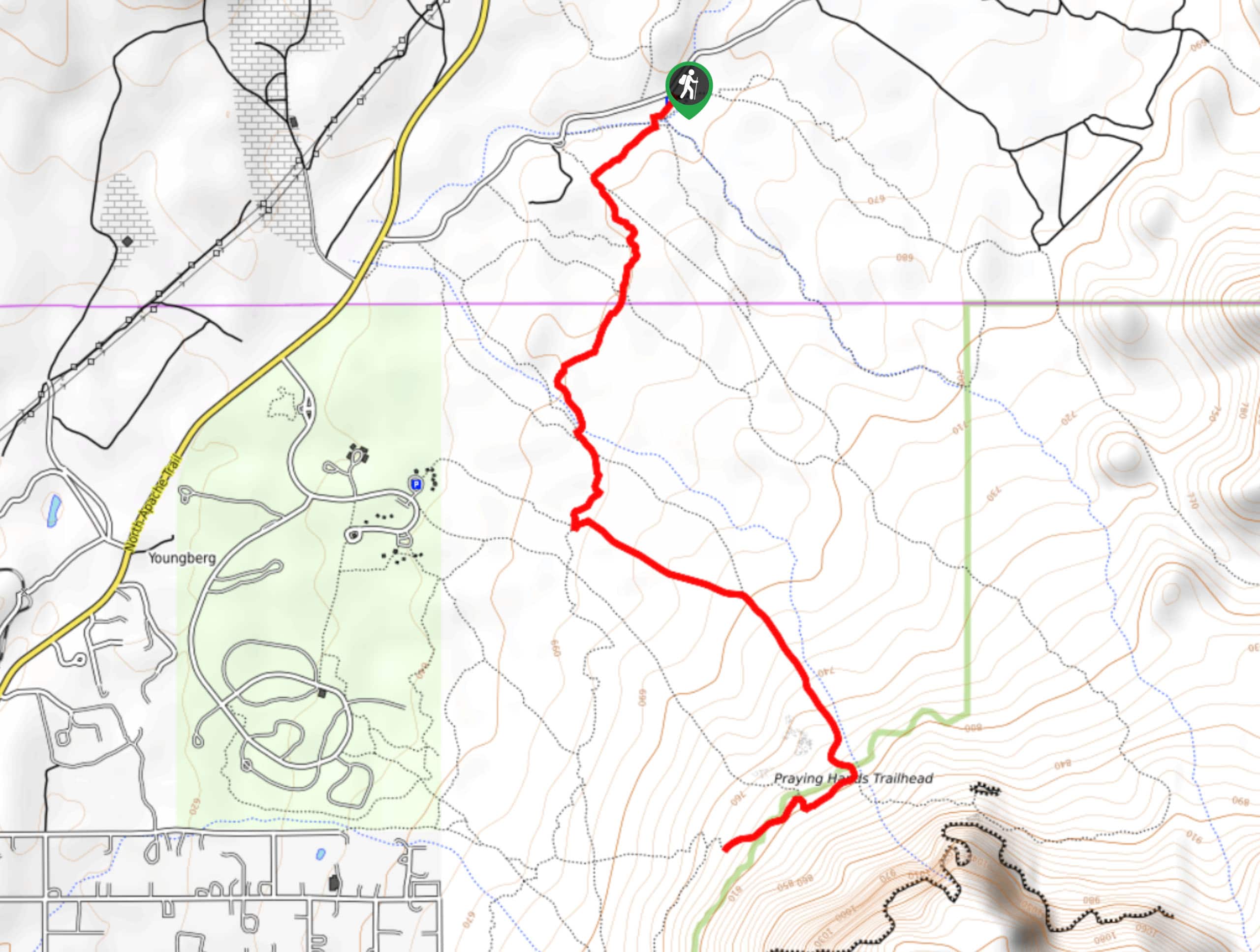
Little Saddle Mountain is an 8.0mi hike in the Tonto National Forest between the Phoenix area and Payson. It delivers some of the same views as Saddle Mountain without being as long or strenuous. This hike is at its best in the spring when everything is blooming! Expect light traffic on this route and come with lots of water.
Getting there
The trailhead for the Little Saddle Mountain Trail is on FR 627.

About
| Backcountry Campground | No |
| When to do | October-May |
| Pets allowed | Yes - On Leash |
| Family friendly | No |
| Route Signage | Average |
| Crowd Levels | Low |
| Route Type | Out and back |
Little Saddle Mountain Trail
Elevation Graph
Weather
Little Saddle Mountain Trail Description
Little Saddle Mountain is a pretty hike with classic desert views for miles. It takes you near Saddle Mountain without the big climb that would be required to reach the top, so it’s a nice in-between hike when a big mountain summit isn’t in the cards. We love this hike in the springtime when the desert is blooming.
Note that this route suffers from overgrowth in the summer and fall after the rainy season. You’ll want long pants and maybe even some clippers to keep the going smooth. Bring plenty of water on this route and avoid hiking it during the heat of the day.
From the trailhead, enjoy a quick warmup before you start climbing, keeping left into the canyon. It’s a consistent but fairly mild uphill trip through the canyon. Keep right where a spur trail heads to the left. The route ends at a T-junction with FR 25. From here, turn around and retrace your steps.
Similar hikes to the Little Saddle Mountain Trail hike
Jacob’s Crosscut Trail
Jacob’s Crosscut Trail is an important route in the network of trails in Lost Dutchman State Park. This route is…
Bronco Trail
The Bronco Trail is a 7.9mi out and back route used for hiking and horseback riding. This trail…
Pine Canyon Trail Loop
The Pine Canyon Trail Loop in Pine, Arizona is a quick 2.7mi loop that is rated as easy.…
Comments