

Horse Tale Trail
View PhotosHorse Tale Trail
Difficulty Rating:
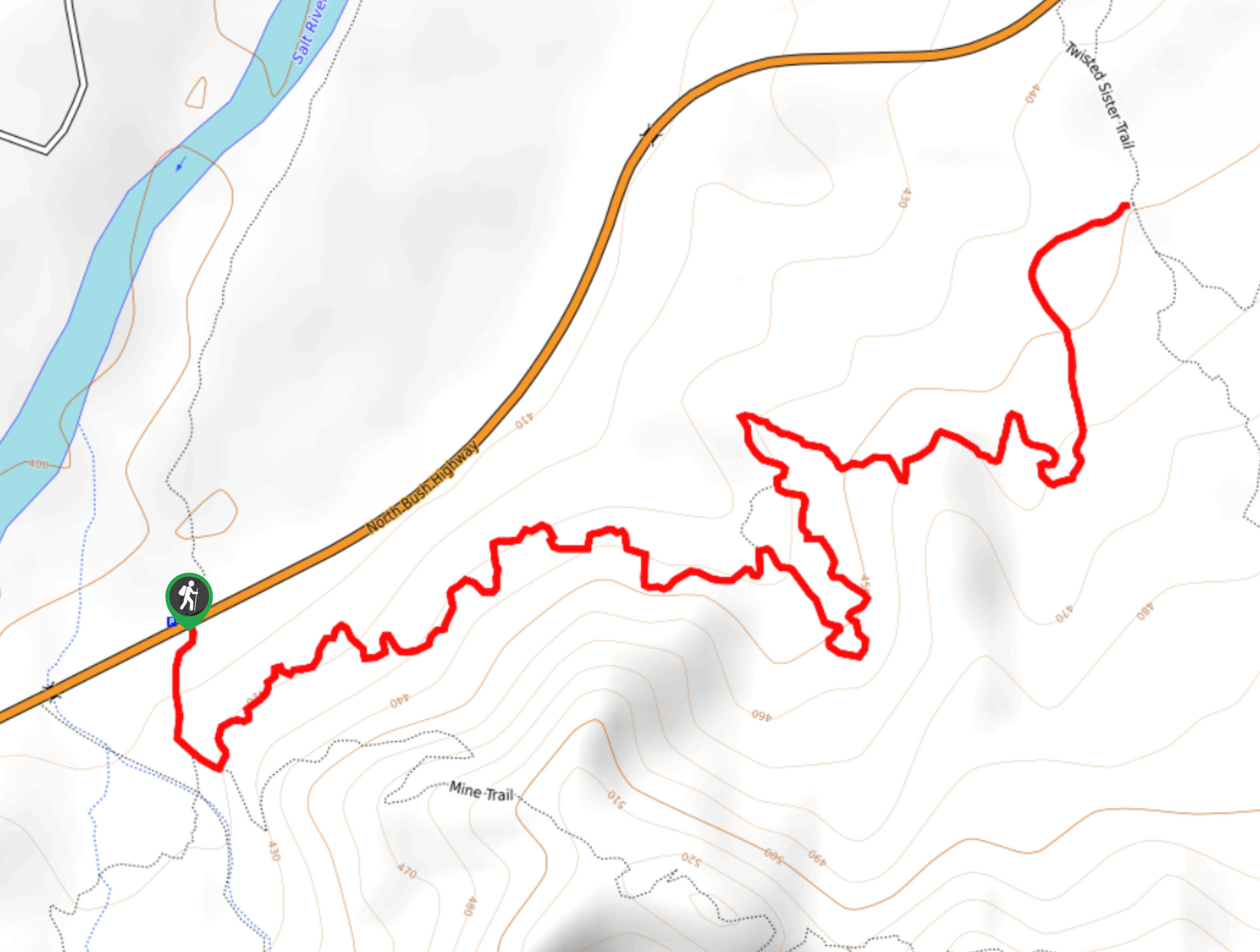
The Hawes Trail System offers trail runners, hikers, and mountain bikers a place to get outside in the Tonto National Forest with a maintained network of trails near the Salt River. The Horse Tale Trail is a 4.3mi route in this network on the north side of this network that, while alright for hikers, is great for trail runners and mountain bikers in particular.
Getting there
The trailhead for the Horse Tale Trail is on North Bush Highway.
About
| Backcountry Campground | No |
| When to do | September-June |
| Pets allowed | Yes - On Leash |
| Family friendly | Yes |
| Route Signage | Poor |
| Crowd Levels | Low |
| Route Type | Out and back |
Horse Tale Trail
Elevation Graph
Weather
Horse Tale Trail Description
The Horse Tale Trail is a route in the Hawes Trail System, a multi-use trail network near the Salt River developed and maintained by an independent group of mountain biking enthusiasts. While the trails are predominantly used by mountain bikers, they’re suitable for trail runners and hikers as well. This route has fairly mild elevation gain required, making it a good beginner trail.
Note that users report liking this route best for trail running and biking. While it doesn’t have the big views many hikers are after, it’s still a nice option if you’re in the area. The trail system isn’t very well signed, so bring a map if you’re unfamiliar with the area.
From the trailhead, cross the road and stay left twice onto Horse Tale Trail. The name of this route might be a nod to the wild horses that live near the Salt River in this part of the forest. The route twists and turns its way to the T-junction with Twisted Sister Trail, where you’ll turn back and retrace your steps.
Similar hikes to the Horse Tale Trail hike
Jacob’s Crosscut Trail
Jacob’s Crosscut Trail is an important route in the network of trails in Lost Dutchman State Park. This route is…
Bronco Trail
The Bronco Trail is a 7.9mi out and back route used for hiking and horseback riding. This trail…
Pine Canyon Trail Loop
The Pine Canyon Trail Loop in Pine, Arizona is a quick 2.7mi loop that is rated as easy.…



Comments