Highline Trail #31
View Photos
Highline Trail #31
Difficulty Rating:
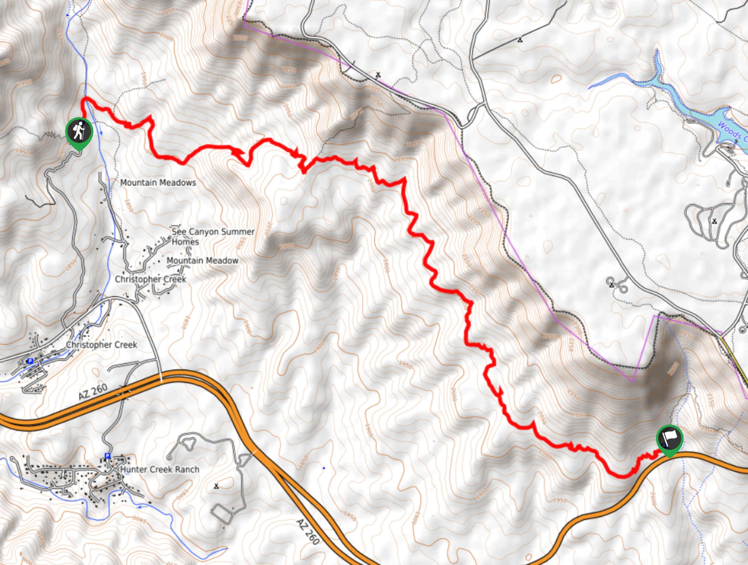
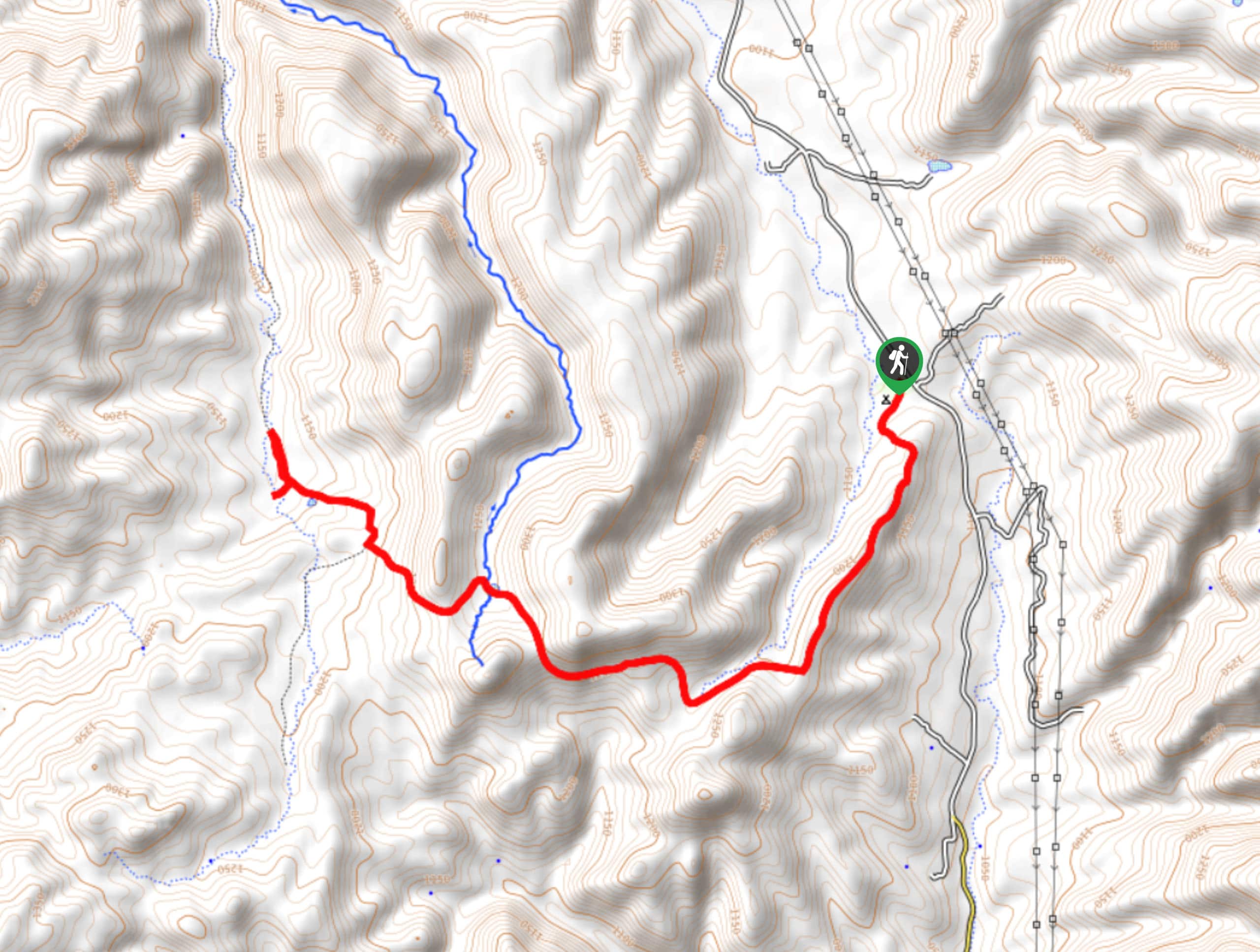
The Highline Trail #31 is a 7.7mipoint-to-point hike in the Tonto National Forest that is rated as moderate. This route can be hiked in part or full as a day hike or you can use it as part of a backpacking trip. The route follows the base of a mesa that has numerous campsites atop it. Expect light traffic on this trail.
Getting there
The east trailhead for the Highline Trail is off SR 260 and the second is at the end of Forest Road 284.

About
| Backcountry Campground | No |
| When to do | Year-round |
| Pets allowed | Yes - On Leash |
| Family friendly | Older Children only |
| Route Signage | Average |
| Crowd Levels | Low |
| Route Type | One Way |
Highline Trail #31
Elevation Graph
Weather
Highline Trail #31 Description
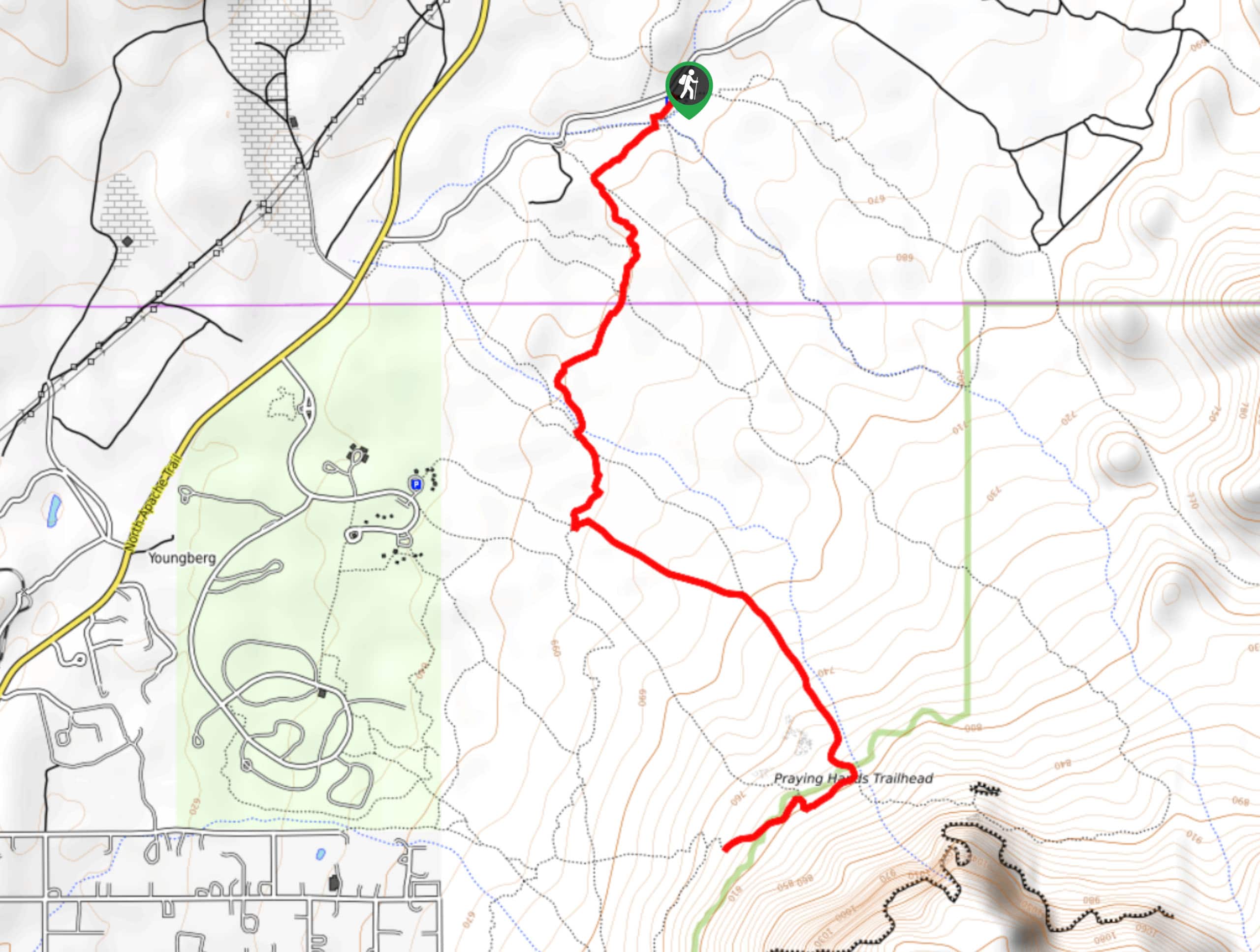
The Highline Trail is an easy hike near Pine that is suitable for all ages and skill levels. Use it to get outside with the kids, with the dogs, or by yourself as a scenic leg-stretcher. You can enjoy part of it, do it as a long out and back, or use the connecting trails to lengthen your adventure into a multi-day trip.
This route is quite flat and straightforward. Bring lots of water if you plan to hike this trail in the heat of the summertime. Christopher Creek can provide a refill point, but you should be prepared with enough to get you through if needed.
You can use either trailhead. The route follows the base of the mesa from west to east. There’s very little elevation change, so this is a nice relaxed trip for the most part. Enjoy the shade there is, the calm of the forest, and the views that peek through. When you’re ready, turn back and return to the trailhead or keep going to wherever you’re off to next.
Similar hikes to the Highline Trail #31 hike
Jacob’s Crosscut Trail
Jacob’s Crosscut Trail is an important route in the network of trails in Lost Dutchman State Park. This route is…
Bronco Trail
The Bronco Trail is a 7.9mi out and back route used for hiking and horseback riding. This trail…
Pine Canyon Trail Loop
The Pine Canyon Trail Loop in Pine, Arizona is a quick 2.7mi loop that is rated as easy.…
Comments