

Granite and Hawes Trail
View PhotosGranite and Hawes Trail
Difficulty Rating:
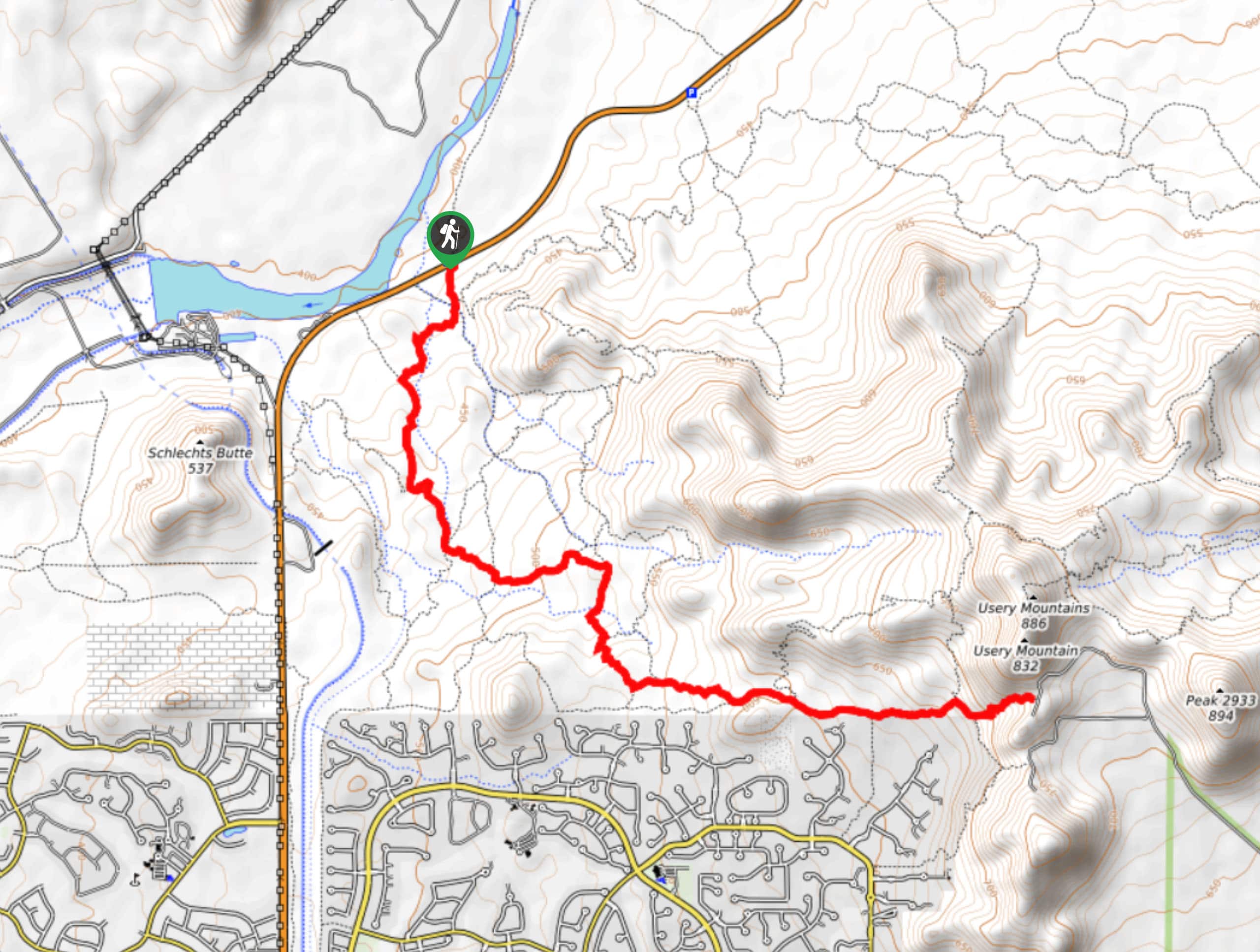
The Hawes Trail System is a well-developed mountain biking and hiking route collection near the Salt River in the Tonto National Forest. The Granite and Hawes Trail route makes use of two trails in the system to put together a hike with awesome desert and river scenery. This trail system is mostly used by mountain bikers, so you’ll need to share the trail. Bring more water than you think you’ll need and avoid this trail in the summertime or heat of the day.
Getting there
The trailhead for the Granite and Hawes Trail is on N Bush Highway.
About
| Backcountry Campground | No |
| When to do | October-May |
| Pets allowed | Yes - On Leash |
| Family friendly | Yes |
| Route Signage | Average |
| Crowd Levels | Moderate |
| Route Type | Out and back |
Granite and Hawes Trail
Elevation Graph
Weather
Granite and Hawes Trail Description
The Hawes Trail System was developed by the Hawes Trail Alliance, a group of mountain bikers and hikers who worked to expand this network of trails. They built over 28.0mi of new trails and worked to improve 34.0mi of existing trails. Now, this network of routes is used by tons of bikers and hikers from Mesa and beyond. This is primarily a mountain bike trail, but most bikers are happy to slow down and announce themselves while passing. Share the trail and watch out for one another.
Bring more water than you think you’ll need on this hike as some users report struggling with heat exhaustion. If you’re not used to the heat, avoid this hike between June and September or hike very early in the morning.
From the trailhead, take Saguaro Trail to the T junction with Granite Trail, where you’ll turn left. At the next trail split, go left again onto Upper Ridge Trail. Go straight through the next two junctions and then keep right twice onto Saddle Trail. Continue to Hawes Trail, which leads you up to the saddle under Usery Mountain. This is your turnaround point.
Similar hikes to the Granite and Hawes Trail hike
Jacob’s Crosscut Trail
Jacob’s Crosscut Trail is an important route in the network of trails in Lost Dutchman State Park. This route is…
Bronco Trail
The Bronco Trail is a 7.9mi out and back route used for hiking and horseback riding. This trail…
Perlite Road to Arnett Creek Loop
The Perlite Road to Arnett Creek Loop takes you through a section of the Boyce Thompson Arboretum grounds and through…



Comments