

Ellison Creek Cascades Hike
View PhotosEllison Creek Cascades Hike
Difficulty Rating:
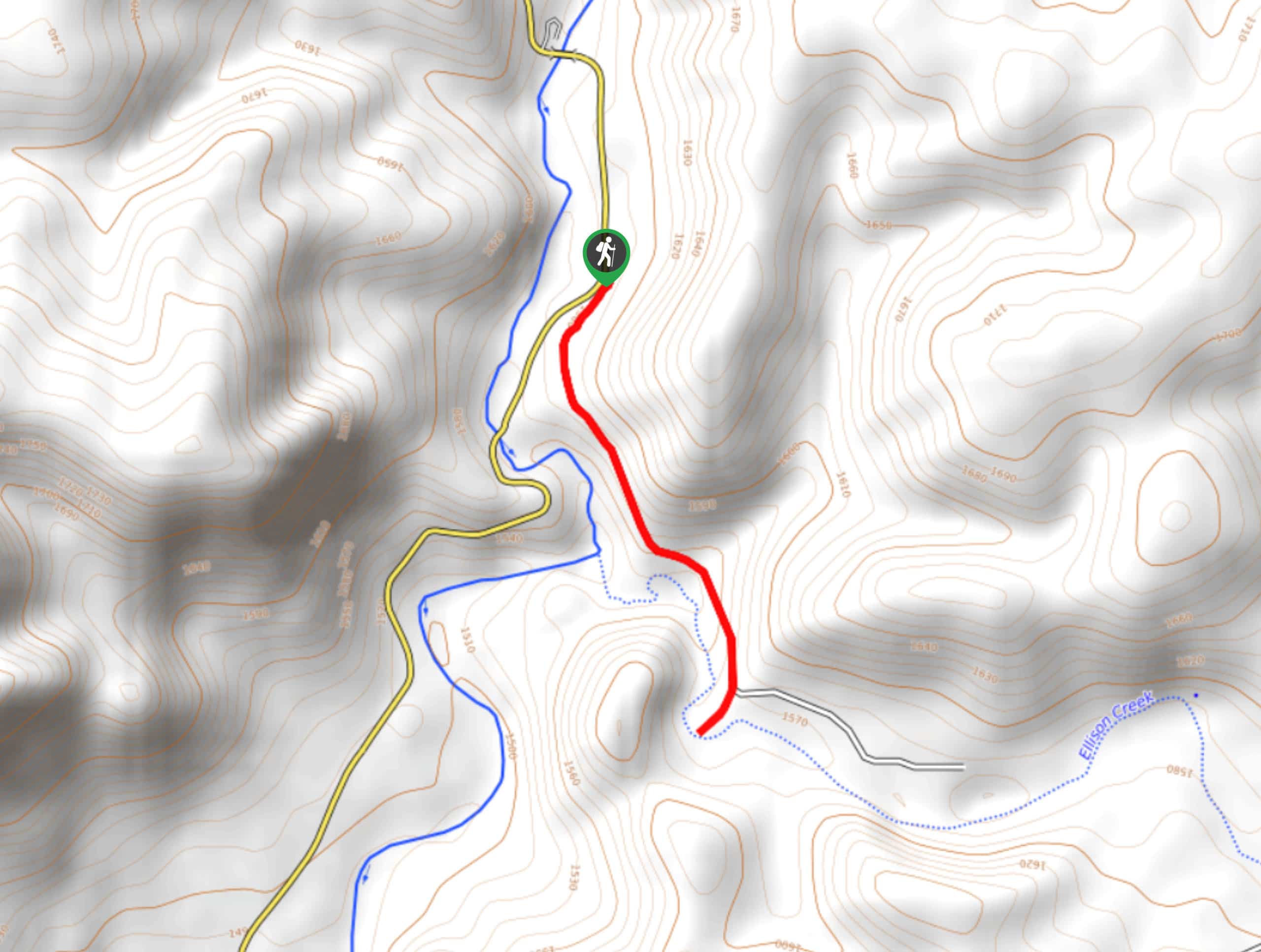
The Ellison Creek Cascades are waterfalls in the Tonto National Forest near Payson that have become increasingly popular because of their great natural swimming opportunities. While the waterfalls are commonly called the Ellison Creek Cascades, you’ll be taking Water Wheel Trail to them. The trail was named for an old water wheel you can see from the trailhead, and the route follows the East Verde River to a gorge used by cliff jumpers and a short waterfall into a swimming hole.
There are lots of points along this route where you can take a swim, but the swimming hole at the confluence of the two creeks is the prime place to get in the water. This easy hike might not be well-marked, but it’s an exceptionally fun adventure for families or for any hiker on a hot Arizona day. Small children might need a hand on some of the rockier parts of the trail.
Getting there
The trailhead for the Ellison Creek Cascades Hike is on Houston Mesa Road.
About
| Backcountry Campground | Water Wheel |
| When to do | April-October |
| Pets allowed | Yes - On Leash |
| Family friendly | Yes |
| Route Signage | Poor |
| Crowd Levels | Extreme |
| Route Type | Out and back |
Ellison Creek Cascades Hike
Elevation Graph
Weather
Ellison Creek Cascades Hike Description
The appeal of a natural swimming hole at the end of a hike is an obvious one. Nothing feels better than a refreshing dip in cool water after trekking through the desert! The Ellison Creek Cascades hike is one of the top swimming hikes in the state, and it’s our top pick on hot days.
This route leads you along the East Verde River to the confluence with Ellison Creek. It’s well-equipped with tons of spots to cool off, cliff jumping areas, and a big natural swimming hole near the waterfall.
This trail isn’t very well marked, but as long as you keep following the water, you shouldn’t have any issues finding your way. You’ll be hiking over rocky terrain and crossing creeks on logs, so wear grippy footwear that you won’t mind getting wet.
When it comes to cliff jumping, you’ll likely see people doing so. While the water in the usual cliff jumping spots tends to be deep enough, we strongly encourage caution. Check out the water beforehand and note any hazards under the surface. The canyon where cliff jumping happens is narrow and you’ll have to climb your way back up on the rocks.
Please note that this hike is in an area that is very prone to flash flooding in the monsoon season. Check the forecast before visiting and do not attempt this hike if there is rain coming. A family was tragically killed here in a flood several years ago. Additionally, keep your shoes on as you hike. Some parts of the trail are prone to having broken glass on them (pack out what you pack in!).
From the trailhead, take a look at the old water wheel before setting off on the dirt path on your left. You’ll begin on a flat, sandy trail with the river to your right. The terrain soon gets rockier, and the marked trail fades away. Keep following the river.
Watch for a small, dramatic gorge in the granite. This is where most of the cliff jumping takes place. Continue along the gorge and over a hill. This is where most of the elevation gain happens, and although it’s mild, small kids might need a breather on the way.
When you reach the confluence of the river and creek, go right along the creek. You’ll cross in a few places, aided by rocks and logs.
You’ll reach the Ellison Creek Cascades and the swimming hole at the end of the hike. This is our favorite spot to swim on the trail, with an emerald green pool waiting underneath imposing walls of red granite. There’s a log with steps carved into it to help you get out of the water.
Splash around, set up your picnic, get some sun, and enjoy this unique spot before packing up and retracing your steps to the trailhead.
Hiking Route Highlights
Ellison Creek Cascades
The Ellison Creek Cascades, also called Water Wheel Falls, flow into a natural swimming hole in a scenic red granite gorge. The falls and the creek are frequented by hikers and swimmers. Tadpoles and crawfish can be found in the creek, which tends to stay quite chilly and refreshing year-round.
Frequently Asked Questions
Are the Ellison Creek Cascades free?
There is a $10 fee to park at the trailhead from March through November. Fees are subject to change.
When is the best time to visit the Ellison Creek Cascades?
Most visitors come between May and October when the weather is at its hottest. Be careful if you choose to hike between June and August when the temperatures can be overwhelmingly high.
Are Water Wheel Falls and the Ellison Creek Cascades the same thing?
Yes, these are two names for the same location.
Insider Hints
Bring blankets and towels to spread out on the rocky banks of the swimming hole if you want to sit and relax.
There is some camping available at Water Wheel if you want to stay for a night or two.
Similar hikes to the Ellison Creek Cascades Hike hike
Jacob’s Crosscut Trail
Jacob’s Crosscut Trail is an important route in the network of trails in Lost Dutchman State Park. This route is…
Bronco Trail
The Bronco Trail is a 7.9mi out and back route used for hiking and horseback riding. This trail…
Pine Canyon Trail Loop
The Pine Canyon Trail Loop in Pine, Arizona is a quick 2.7mi loop that is rated as easy.…


Comments