

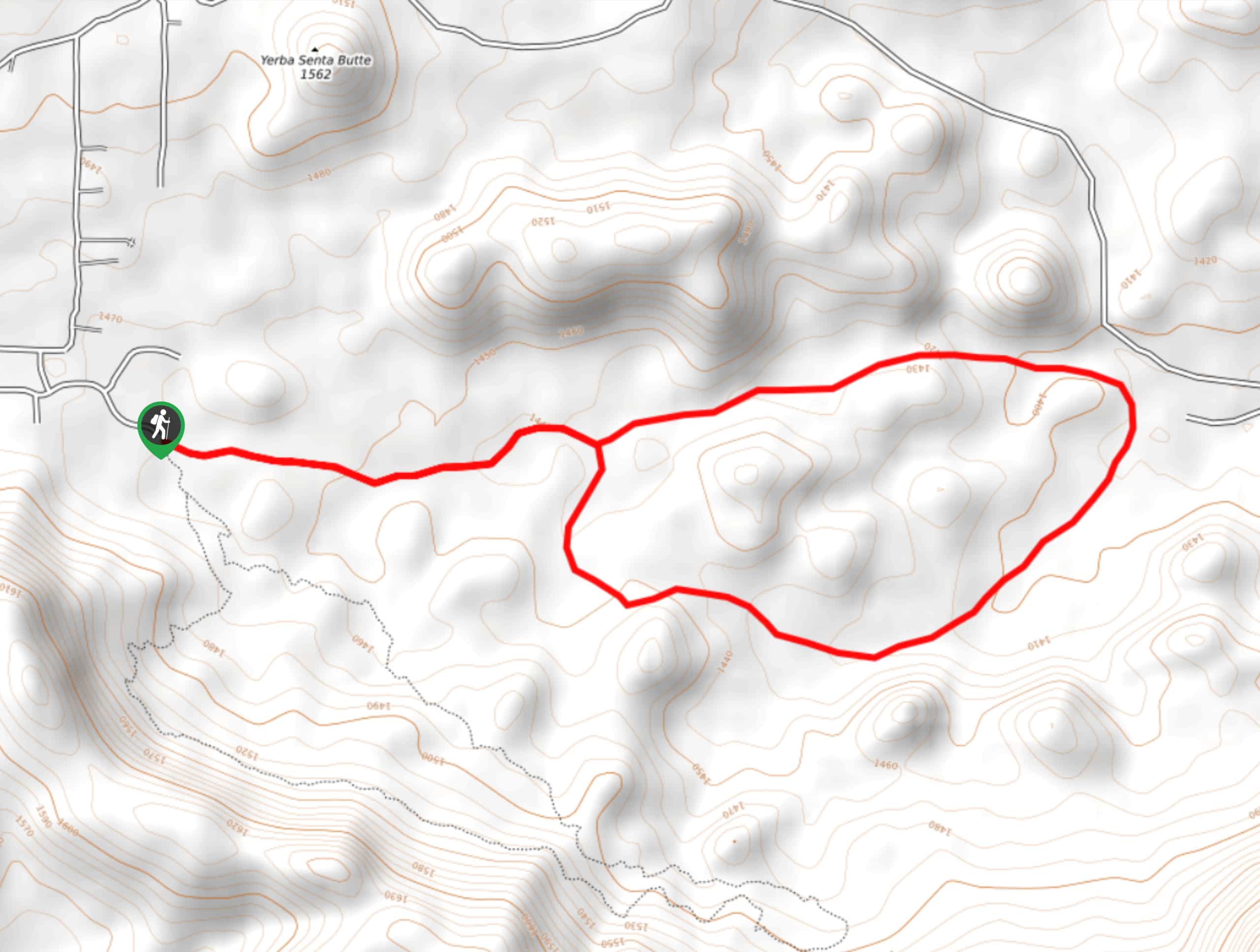
Cypress Trail to Boulders Trail Loop
View PhotosCypress Trail to Boulders Trail Loop
Difficulty Rating:
The network of trails right outside of Payon makes adventure easy for those in town, and the Cypress Trail to Boulder Trail Loop is one of the easiest to access of all of them. Beginning right from the edge of town, this moderate route takes you through varied scenery, including through forests, past interesting boulder formations, and along creeks. This route can be used by hikers and mountain bikers alike.
This hike requires a few creek crossings, but they’re quite narrow and easy to complete. The footing can be loose and sandy in some spots, so good footwear is recommended.
Getting there
The trailhead for the Cypress Trail to Boulders Trail Loop is in the cul-de-sac at the end of E Phoenix Street.
About
| Backcountry Campground | No |
| When to do | Year-round |
| Pets allowed | Yes - On Leash |
| Family friendly | Yes |
| Route Signage | Good |
| Crowd Levels | High |
| Route Type | Loop |
Cypress Trail to Boulders Trail Loop
Elevation Graph
Weather
Cypress Trail to Boulders Trail Loop Description
The Cypress Trail to Boulder Trail Loop shows off the beauty of the PATS (Payson Area Trail System) with incredibly easy access from town. Leaving right from a local street, this hike is a fun choice for almost all skill levels and all ages. The scenery is excellent, with massive Ponderosa pines and huge, house-sized granite boulders lining your trail, which kids will love and adults will marvel at. Stewart Creek runs through the trail network, and bald eagles, elk, and deer inhabit this wilderness. Bring your camera if you like to photograph wildlife!
This loop is well-signed and easy to follow. There are no junctions to consider, so it’s easy to stay on track even if you’re new to the area.
There are several creek crossings on this route, but they tend to be quite simple and you should be able to keep your feet dry. Because of all the shade, this hike is doable in the summertime as long as you avoid the heat of the day and bring plenty of water.
Look out for mountain bikers on this route and remember to share the trail.
You’ll park on the residential street (take care not to block any driveways) and find the trailhead to the left of the cement wall.
From the trailhead, keep left. There are other routes that depart to the right, but they lead to a different loop. You’ll hike down Cypress to Boulders North.
Stroll beside the massive boulders, which seem like they’ve been dropped from space by the size of them. Listen for deer, elk, or birds of prey as you hike. You’ll cross over Stewart Creek a few times, enjoying the gentle sounds of the creek.
The loop will take you back to Cypress, which you’ll follow back to the trailhead the same way you came out.
Hiking Route Highlights
Granite Dells
The boulders of the Granite Dells are fascinating to look at. These massive rock formations, sometimes house-sized or bigger, line the aptly-named Boulders Trail Loop. Remnants of the area’s geological past, today they add intriguing scenery to this delightful hike.
Frequently Asked Questions
Is the Cypress Trail to Boulder Trail Loop dog-friendly?
Yes, but make sure you keep dogs leashed at all times, especially because this trail is shared by mountain bike traffic.
Is there a fee to hike the Cypress Trail to Boulder Trail Loop?
There is no fee required to hike this route.
Is the Boulders Trail open?
The only time this route tends to close is when there is a wildfire in the area.
Similar hikes to the Cypress Trail to Boulders Trail Loop hike
Jacob’s Crosscut Trail
Jacob’s Crosscut Trail is an important route in the network of trails in Lost Dutchman State Park. This route is…
Bronco Trail
The Bronco Trail is a 7.9mi out and back route used for hiking and horseback riding. This trail…
Pine Canyon Trail Loop
The Pine Canyon Trail Loop in Pine, Arizona is a quick 2.7mi loop that is rated as easy.…



Comments