

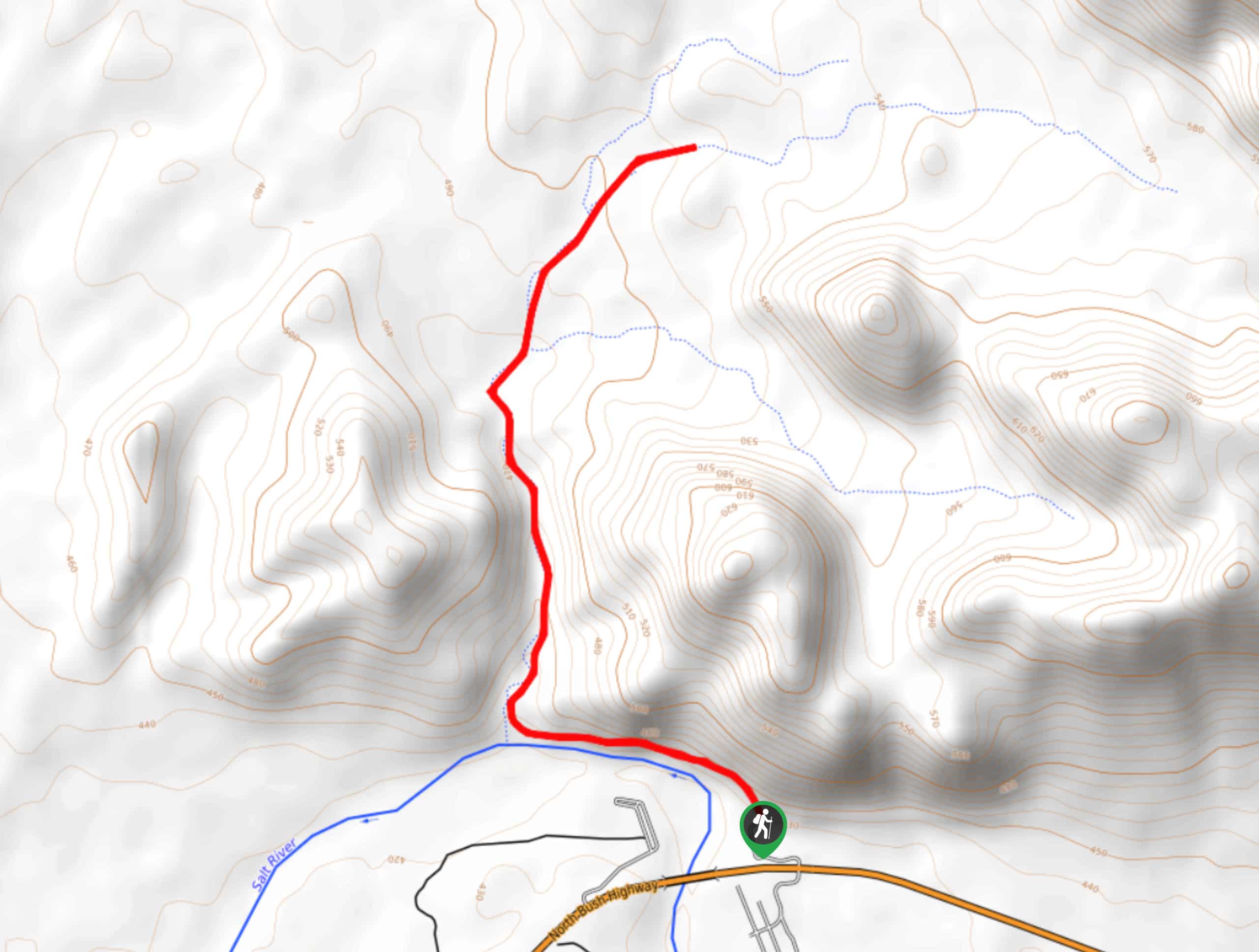
Blue Point to the Oven Hike
View PhotosBlue Point to the Oven Hike
Difficulty Rating:
The Blue Point to the Oven hike is a 4.0mi trek in the Tonto National Forest that leads you along the Salt River to an old limestone oven built into the hillside. Between the river scenery and the massive oven, it’s a unique hike with lots of spots to dip your feet and cool down on hot days. Expect moderate traffic on this route.
Getting there
The trailhead for the Blue Point to the Oven hike is off N Bush Highway.
About
| Backcountry Campground | No |
| When to do | October-May |
| Pets allowed | Yes - On Leash |
| Family friendly | Yes |
| Route Signage | Average |
| Crowd Levels | Moderate |
| Route Type | Out and back |
Blue Point to the Oven Hike
Elevation Graph
Weather
Blue Point to the Oven Hike Description
Not many hikes boast a massive oven built into the hillside as their main attraction, but this one does. The hike from Blue Point to the Oven is a delightful journey with the Salt River trailing through, offering a nice way to cool down if you explore on hot days. Expect moderate traffic on this hike.
We recommend doing this hike outside of the hot summer months. Bring plenty of water and wear a hat and sunscreen to protect yourself from the blazing sun if you’re here in the heat. Additionally, remember to have your Tonto pass to park. You can grab one at any nearby Circle K.
From the trailhead, hike between the river and the cliffside before turning right to hike through the canyon. The oven is found 1.3mi into the hike. It’s huge, and you can either climb inside from the bottom to look up or climb onto the hill on top to peer down from the inside. Of course, please treat it with respect in order to preserve it for future generations. You can keep hiking past this point to enjoy the river to the trail’s end, where you’ll turn back and retrace your steps.
Similar hikes to the Blue Point to the Oven Hike hike
Jacob’s Crosscut Trail
Jacob’s Crosscut Trail is an important route in the network of trails in Lost Dutchman State Park. This route is…
Bronco Trail
The Bronco Trail is a 7.9mi out and back route used for hiking and horseback riding. This trail…
Pine Canyon Trail Loop
The Pine Canyon Trail Loop in Pine, Arizona is a quick 2.7mi loop that is rated as easy.…


Comments