

Arnett Canyon Trail Segment
View PhotosArnett Canyon Trail Segment
Difficulty Rating:
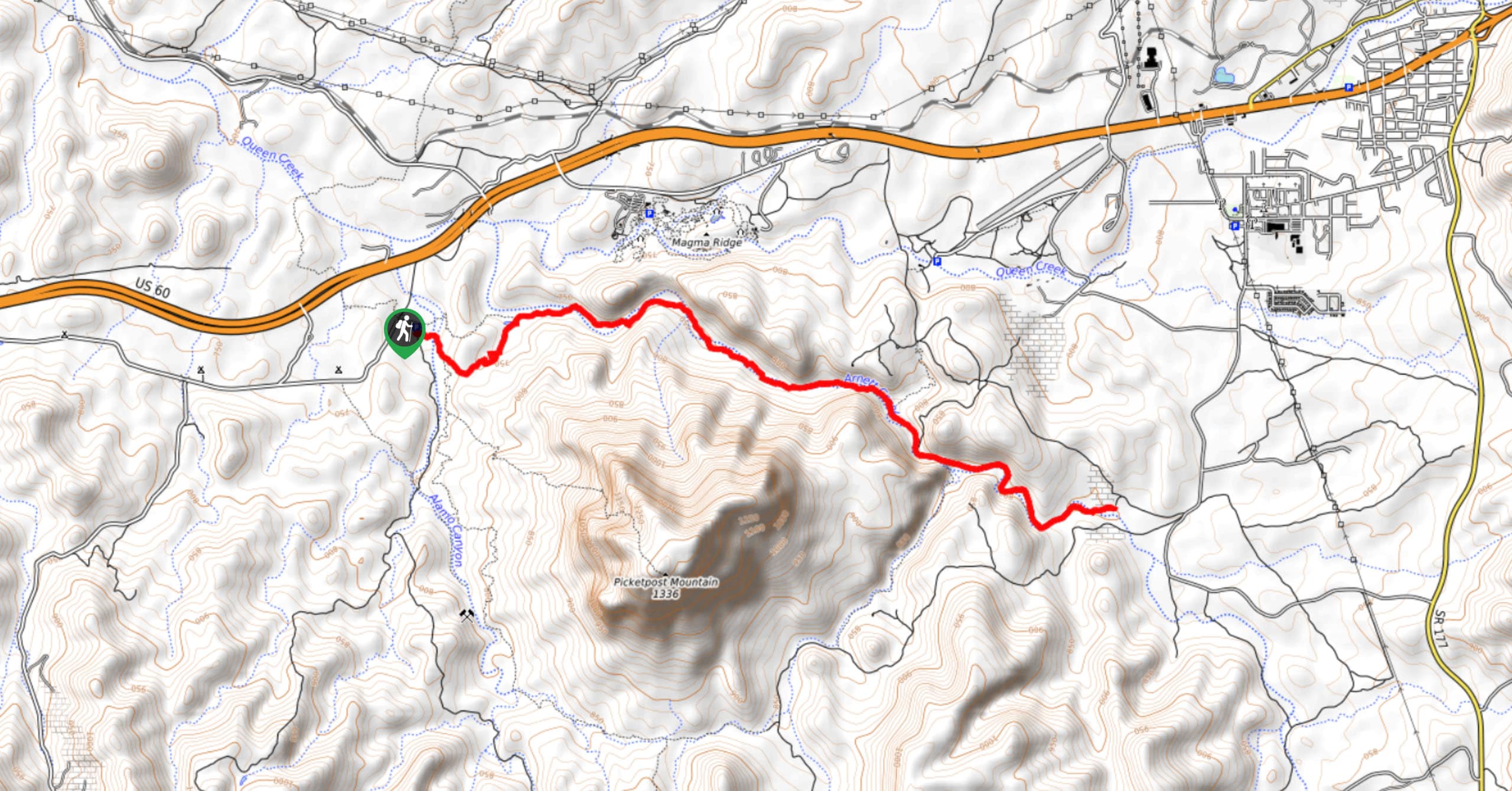
The Arnett Canyon Trail is a beautiful spot to hike, horseback ride, or bike in the Tonto National Forest. This route is 8.3mi long and moderately difficult with fairly minimal elevation gain. With changing scenery from desert to woods and lots of wildlife to observe, it’s a rewarding hike that’s suitable for most skill levels. Expect light to moderate traffic on this route.
Getting there
The trailhead for the Arnett Canyon Trail Segment is at the end of FR 310.
About
| Backcountry Campground | No |
| When to do | Year-round |
| Pets allowed | Yes - On Leash |
| Family friendly | Yes |
| Route Signage | Average |
| Crowd Levels | Low |
| Route Type | Out and back |
Arnett Canyon Trail Segment
Elevation Graph
Weather
Arnett Canyon Trail Segment Description
From cows to lizards and deserts to woodlands, the Arnett Canyon Trail Segment is a delightful adventure that gives you plenty of space to stretch your legs without requiring that much elevation gain. It’s a great trail for hikers, horseback riders, and mountain bikers, so remember to share the trail with those around you. That being said, it’s usually not too busy out here.
There’s a bit of shade on this trail, but you’ll still want to bring lots of water and wear sunscreen and a hat if it’s warm out. Finally, expect to see cows on this route. Give them plenty of space and they tend to be friendly as you pass. Watch out for the cow pies, though!
From the trailhead, take the Arizona trail across the creek and keep left where it splits. You’ll continue onto L.O.S.T. Trail #221 alongside Arnett Creek. Watch for a cave on your left where the creek splits and continue hiking through the canyon. The route ends at the end of the canyon, where you can turn back and retrace your steps to the trailhead.
Similar hikes to the Arnett Canyon Trail Segment hike
Jacob’s Crosscut Trail
Jacob’s Crosscut Trail is an important route in the network of trails in Lost Dutchman State Park. This route is…
Bronco Trail
The Bronco Trail is a 7.9mi out and back route used for hiking and horseback riding. This trail…
Pine Canyon Trail Loop
The Pine Canyon Trail Loop in Pine, Arizona is a quick 2.7mi loop that is rated as easy.…



Comments