
200 Trail
View Photos
200 Trail
Difficulty Rating:
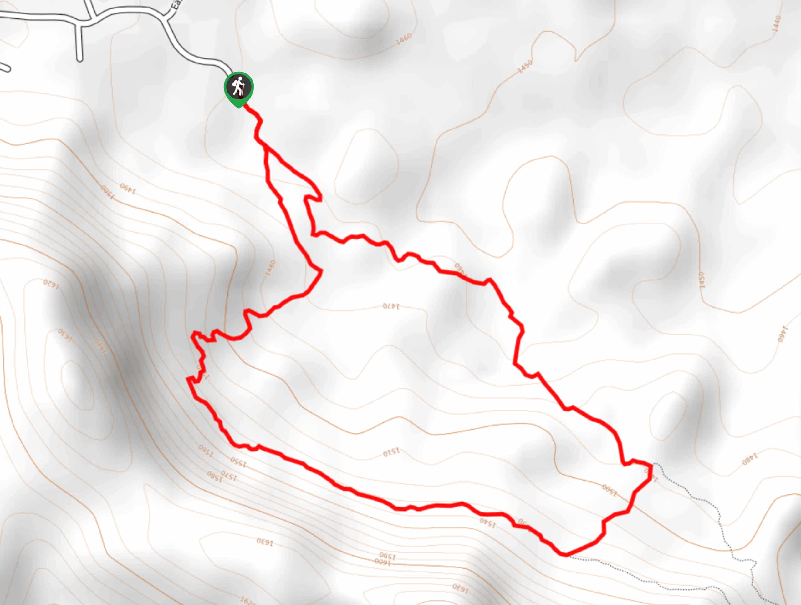
200 Trail is a 2.6mi hike near Payson that is rated as easy, but it does still require a bit of an intrepid spirit. This hike has great views of Payson and the surrounding area, but the route is extremely hard to follow and there are tons of spur trails to lead you astray. It’s alright, though, since exploration is part of what makes this area so rewarding. Bring a GPS track and be willing to adventure a bit on this one.
Getting there
The trailhead for the 200 Trail is at the end of E Phoenix Street.

About
| Backcountry Campground | No |
| When to do | September-May |
| Pets allowed | Yes - On Leash |
| Family friendly | Yes |
| Route Signage | Poor |
| Crowd Levels | Moderate |
| Route Type | Loop |
200 Trail
Elevation Graph
Weather
200 Trail Description
200 Trail is an interesting route best suited to the hiker who doesn’t mind a bit of extra exploration. It’s very hard to follow and there are a lot of spur trails, but some of them offer incredible views. If you’re happy to roam around and see where the trail takes you, you might find some great vistas!
Bring a GPS track for this hike and pay close attention to it. Some of this route gets very close to private property, so make sure you keep dogs leashed, respect signage, and take your trash with you.
From the trailhead, you’ll hike out to where the trail splits. We like to hike the flatter portion on the left first, looping around where you’ll encounter a junction. Keep right at both junctions, climbing modestly up the ridge where the view opens up a bit. You’ll traverse along the ridge, descend through a couple of switchbacks, and return to the trailhead.
Similar hikes to the 200 Trail hike
Jacob’s Crosscut Trail
Jacob’s Crosscut Trail is an important route in the network of trails in Lost Dutchman State Park. This route is…
Bronco Trail
The Bronco Trail is a 7.9mi out and back route used for hiking and horseback riding. This trail…
Pine Canyon Trail Loop
The Pine Canyon Trail Loop in Pine, Arizona is a quick 2.7mi loop that is rated as easy.…
Comments