
San Antonio Creek Falls Trail
View Photos
San Antonio Creek Falls Trail
Difficulty Rating:
There is nothing better than a hike that culminates at a waterfall, and the San Antonio Creek Falls Trail delivers. Explore the enchanting mixed conifer woodlands adorned with granite outcrops before exposing the 89ft cascades.
Getting there
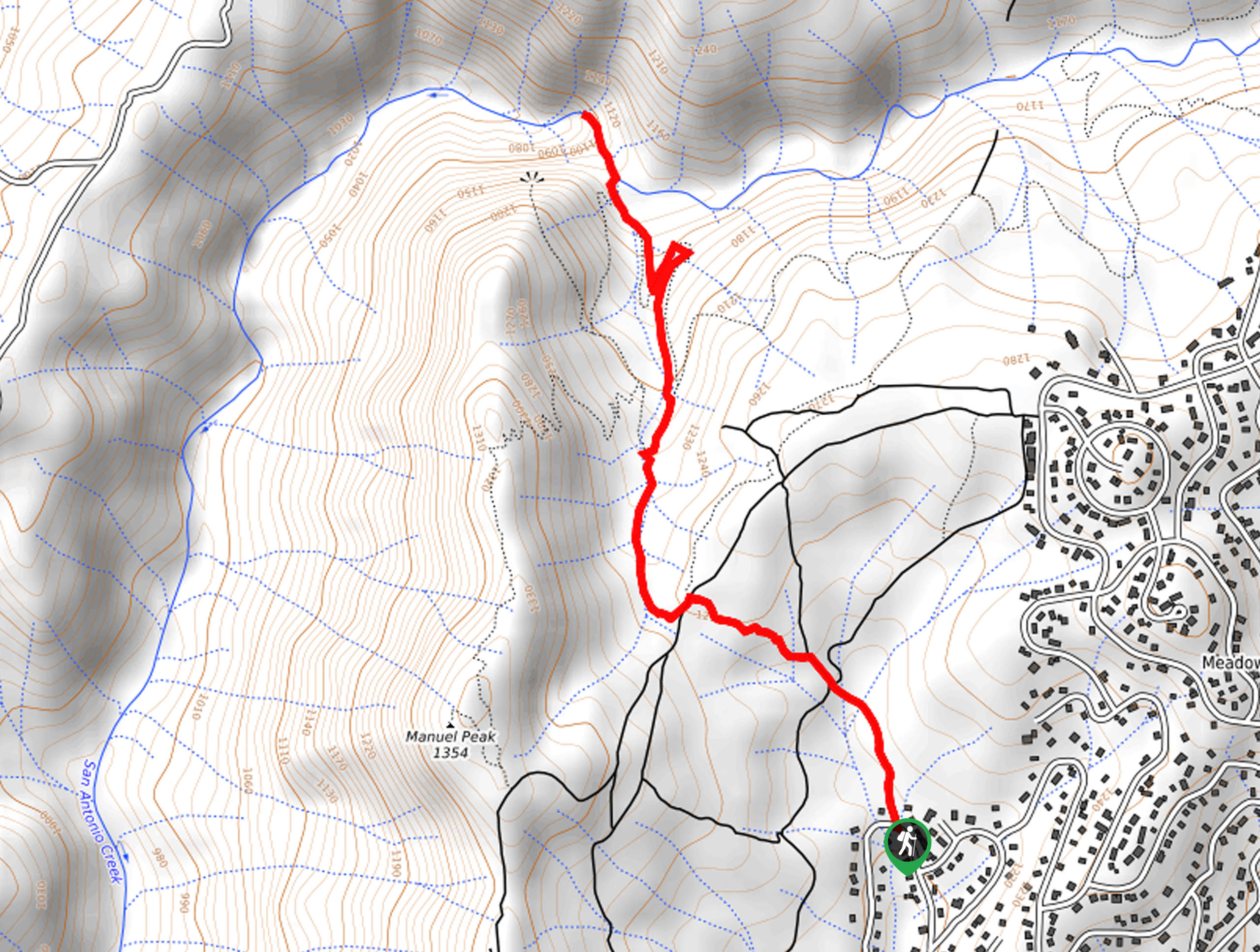
Access this hike from the trailhead off Lakemont Drive.

About
| Backcountry Campground | No |
| When to do | April-October |
| Pets allowed | Yes - On Leash |
| Family friendly | Yes |
| Route Signage | Average |
| Crowd Levels | Moderate |
| Route Type | Out and back |
San Antonio Creek Falls Trail
Elevation Graph
Weather
San Antonio Creek Falls Trail Description
Hiking this trail makes for an incredible day hike. Explore the scenic terrain and get your heart rate up as you adventure the trail. Located within an extensive network of routes, following this hike can be confusing at times, so the trail GPS may prove useful. Note sections of terrain become incredibly slippery when wet, so it may not be ideal for children and pups. Though the views of the cascades are not awe-inspiring due to trees standing in the way, if you seek better vistas, then head up to the overlook.
Setting out from the trailhead, the San Antonio Creek Falls Trail follows the Lakemont Drive Trail before merging onto the Penny Pines Trail. Briefly wander northwest along this route before hiking the connector trail up to the Arnold Rim and San Antonio Falls Overlook Connector. This path will guide you through the forestlands, over the granite slabs and outcrops down to the San Antonio Creek.
From here, you will be granted a view of the cascades pouring over the granite cliffside. Let the mist cool you off, and let the sounds of the surging waters lull you into a state of relaxation. When you are through admiring the scenery, retrace your footing along the path back to the trailhead.
Similar hikes to the San Antonio Creek Falls Trail hike

Folger Peak Hike
The Folger Peak Hike is an awesome adventure that boasts 360-degree, panoramic vistas of the high country. This wonderful adventure…

Long Gulch Ridge Loop
Adventure the Long Gulch Ridge Loop for an exciting, scenic experience in the Stanislaus National Forest. This shared route travels…

Eagle Meadow Hike
Hiking the Eagle Meadow Trail makes for a unique experience. Hike amongst equestrians through the expansive meadowlands along Eagle Creek…
Comments