Kennedy Meadows to Relief Reservoir Trail
View Photos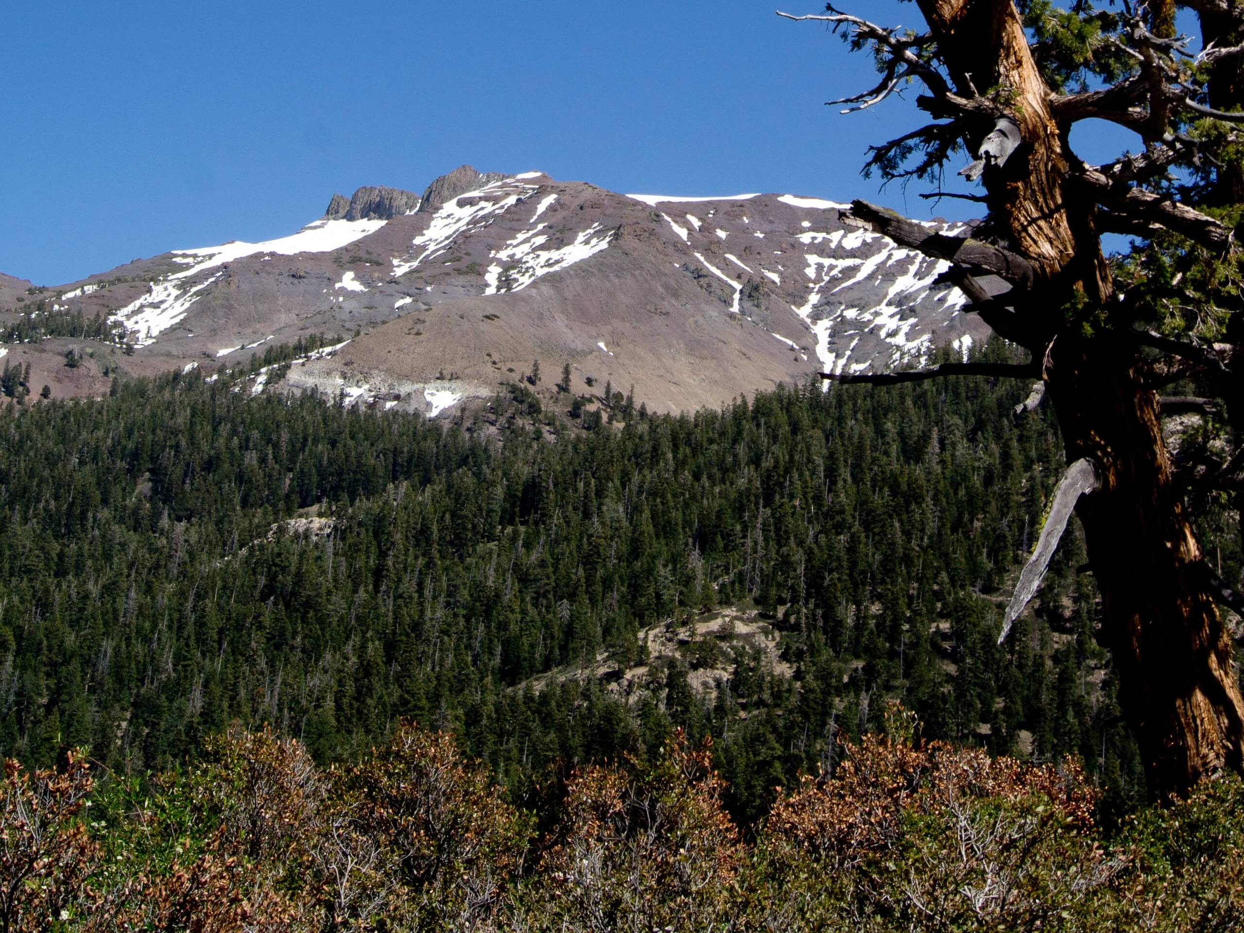
Kennedy Meadows to Relief Reservoir Trail
Difficulty Rating:
The Kennedy Meadows to Relief Reservoir Trail is arguably one of the most scenic adventures in the Stanislaus National Forest. Wander past several waterfalls, natural pools, and granite rock formations to the reservoir and dam. Though we will do our best to depict the beauty of this route, we can’t do it justice, as hard as we try!
Getting there
The Kennedy Meadows to Relief Reservoir departs from the Kennedy Meadows Trailhead in the Kennedy Meadows Resort off Sonora Pass Highway.

About
| Backcountry Campground | Backcountry Camping, wilderness permit required. |
| When to do | Year-round |
| Pets allowed | Yes |
| Family friendly | Yes |
| Route Signage | Good |
| Crowd Levels | Moderate |
| Route Type | Out and back |
Kennedy Meadows to Relief Reservoir Trail
Elevation Graph
Weather
Kennedy Meadows to Relief Reservoir Trail Description
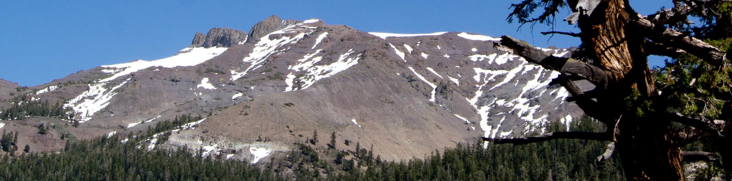
Indulge in the best scenes that the Stanislaus National Park has to offer along the Kennedy Meadows to Relied Reservoir Trail. This picturesque adventure is unparalleled in its beauty, boasting inspiring views of the High Sierra. Offering great views, this trek is no walk in the park as this trek ascends the granite terrain to the Relief Reservoir Dam. Almost entirely unshaded, we suggest heading out in the early morning to beat the heat… and the crowds! Additionally, as the terrain is uneven and rocky, a supportive pair of footwear will make a difference.
Located off the Kennedy Meadows Resort, the Kennedy Meadows to Relief Reservoir Trail is an easily accessible route. Not only is it conveniently located, but this route also offers amazing panoramas, and the crowds that flock to the trail are a testament to its beauty. Travel past a series of surging cascades and natural pools bounded by impressive granite rock bluffs. Usually, the trail’s end is the piece de resistance, but in this case, the footpath is scenic every step of the way—from the meadows to the reservoir. This adventure is a must-add to your Stanislaus itinerary for those seeking a heart-pumping, breathtaking, awe-inspiring experience.
Your journey along the Kennedy Meadows to Relief Reservoir Trail begins from the Kennedy Meadows Trailhead. Setting out from here, the Relief Reservoir Trail will guide you south through a corridor hemmed by rocky bluffs before opening to Kennedy Meadows. Admire the scene of the luxuriant meadow and the bounding cliffs. Continue hiking through the meadowlands, and the path will begin. You gradually increase in intensity, climbing out of the grasslands and into the granite bounded valley. Soon the path will cross over a footbridge above the Middle Fork Stanislaus River and the surging cascades. As you climb the mesmerizing views of the granite terrain, vibrant evergreens and natural pools will overwhelm you.
Progressing further along the path, you will pass a stronger, more picturesque waterfall cascading from Kennedy Creek through the valley. Soon you will cross yet another, longer bridge over the canyon. At this point, you will merge onto the Huckleberry Trail, heading south. Mind your footing on the rocky terrain as you ascend the path to the Relief Reservoir and dam. Walk along the dam, and you will be granted 360-degree, panoramic views of the granite canyon and the shimmering reservoir. Marvel in the perfect postcard scene of the blue-hued reservoir and bounding mountains before beginning your return. Retrace your footing along the path back to the trailhead.
Trail Highlights
Relief Reservoir
Relief Reservoir is a reservoir formed by the rockfill dam on Summit Creek— a tributary of the Middle Fork Stanislaus River. Constructed in 1910, the reservoir sits at an elevation of 145ft above the riverbed and has a water capacity of 15,122 acre-feet. Bounded by the granite bluffs, this alpine pool is picture perfect! Note the reservoir is often drained in the late summer, so head out in the spring to see it at its fullest!
Frequently Asked Questions
How long is the Kennedy Meadows to Relief Reservoir Trail?
The Kennedy Meadows to Relief Reservoir Trail is a 6.1mi out-and-back hike.
Are dogs permitted on the Kennedy Meadows to Relief Reservoir Trail?
Yes, dogs are welcome on the Kennedy Meadows to Relief Reservoir Trail.
Insider Hints
Charge your camera, the scenery is picture-perfect.
The granite is slippery when wet!
Dress in layers as insurance against changing conditions.
Wear ankle-bracing footwear— you’ll thank us later.
Wear sun protection in the summer months!
Similar hikes to the Kennedy Meadows to Relief Reservoir Trail hike

Folger Peak Hike
The Folger Peak Hike is an awesome adventure that boasts 360-degree, panoramic vistas of the high country. This wonderful adventure…
Long Gulch Ridge Loop
Adventure the Long Gulch Ridge Loop for an exciting, scenic experience in the Stanislaus National Forest. This shared route travels…

Eagle Meadow Hike
Hiking the Eagle Meadow Trail makes for a unique experience. Hike amongst equestrians through the expansive meadowlands along Eagle Creek…
Comments