Moel Siabod - A Stunning Walk in Snowdonia National Park
View Photos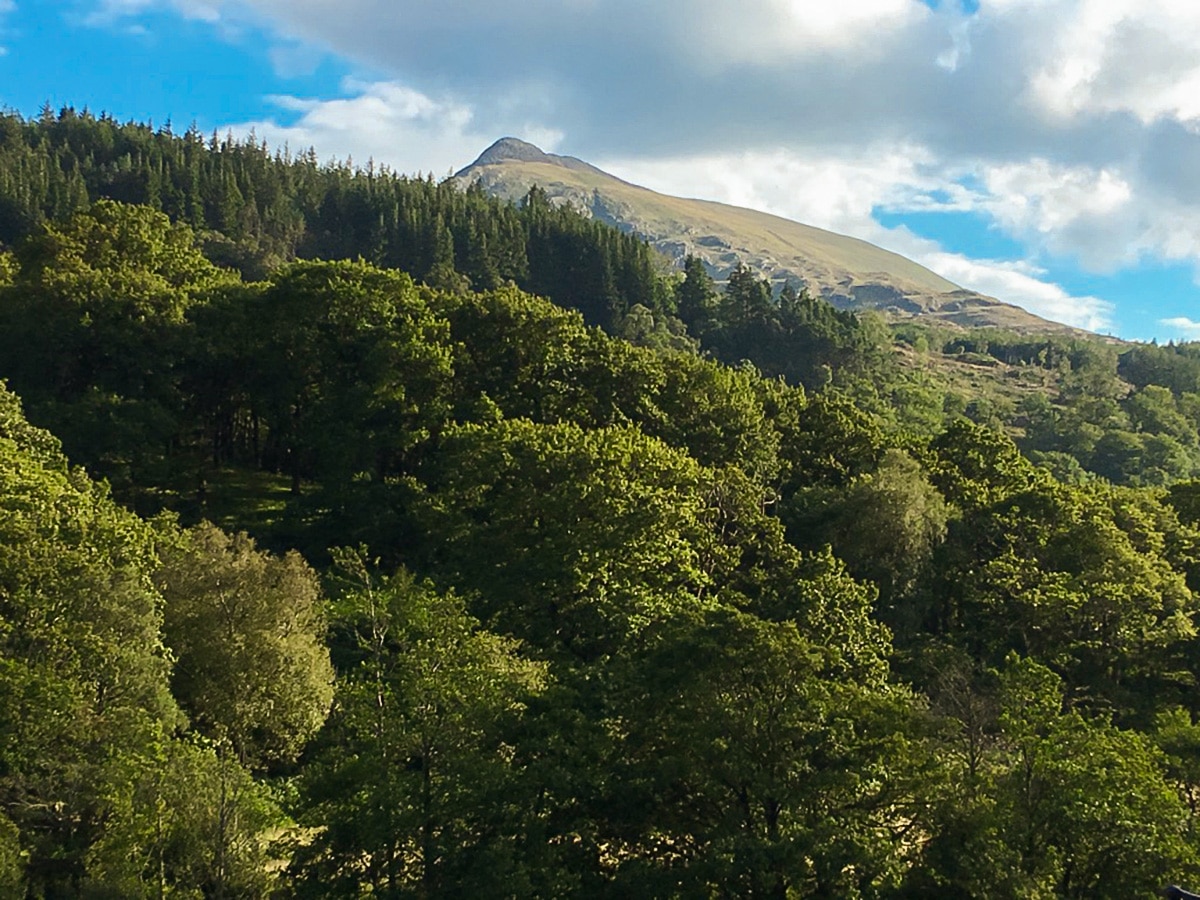
Moel Siabod - A Stunning Walk in Snowdonia National Park
Difficulty Rating:
Moel Siabod is a superb Welsh mountain hike with excellent views across Snowdonia, and a wonderful climb to the summit. This walk is a definite must for lovers of the great outdoors. The trail starts out as a relatively easy few miles before reaching a short, sharp, final ascent to the summit.
Getting there
To get to the Moel Siabod trailhead, follow the A5 from Betws-y-Coed towards Capel Curig. After 4.5mi layby parking is available on the left-hand side of the road. This parking spot is just a few hundred meters further along from the Bryn Glo B&B which you will see on the right-hand side of the road.

About
| When to do | April - October |
| Backcountry Campsites | Yes |
| Toilets | No |
| Family friendly | No |
| Route Signage | Poor |
| Crowd Levels | Low |
| Route Type | Loop |
Moel Siabod - A Stunning Walk in Snowdonia National Park
Elevation Graph
Weather
Moel Siabod Walk Description
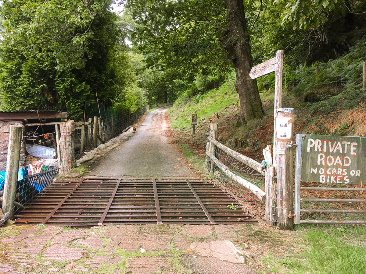
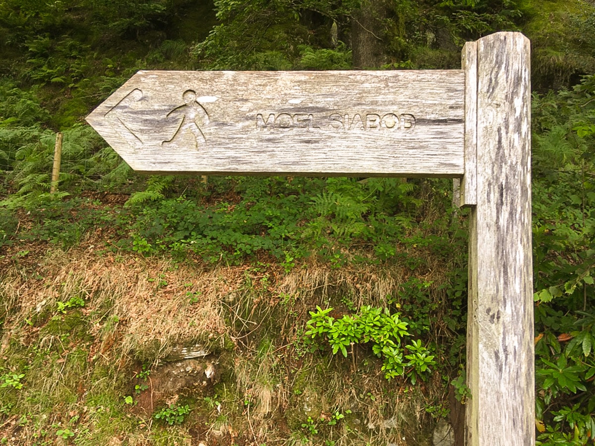
To start the climb up to Moel Siabod, walk along the pavement from the layby with the river to your left-hand side. Approximately 328ft further along, turn left onto a minor road towards the small hamlet of Pont Cyfyng. The road crosses the river. Continue ahead and after 328ft turn right up a private drive, over a cattle grid, following a signpost for Moel Siabod.
The path climbs steeply. As it veers sharply to the right, follow the small waymarked footpath that continues uphill. Follow the path to meet a wider farm track and turn left here. From here, assuming you have picked a clear day, the summit of Moel Siabod can be seen straight ahead.
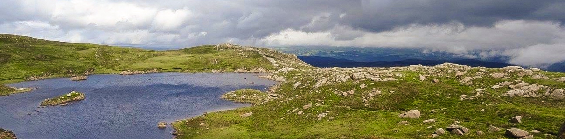
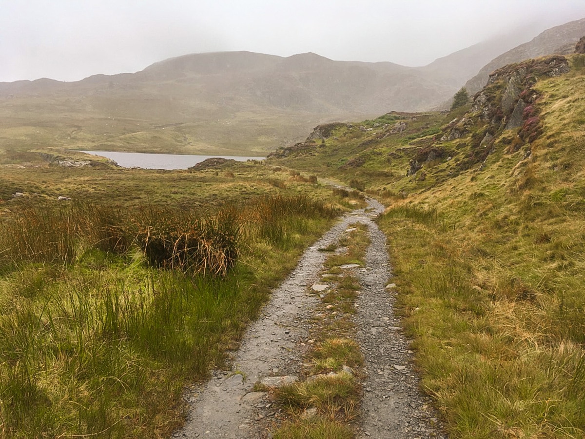
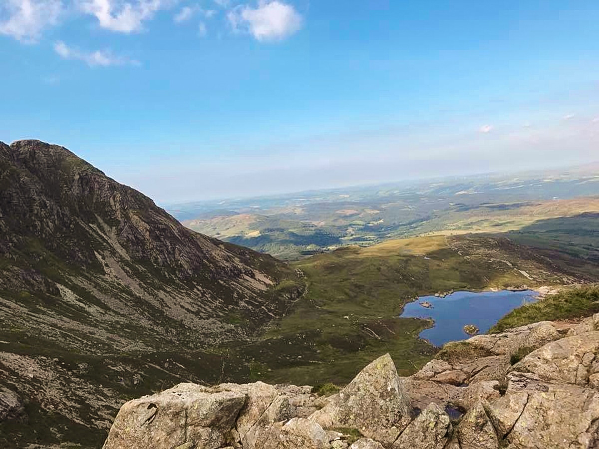
Passing the Siabod cottages, continue ahead and cross over a stile. Here the road becomes more of a track. Follow the track as it leads you up onto the exposed higher ground. Follow this track, ignoring any paths leading off, for just over 0.6mi when you will reach the shores of a small unnamed lake. The Moel Siabod path follows the north shore and then swings to the left towards the old quarry spoil.
Continuing ahead, you will soon reach a second water feature, a small water-filled quarry complete with a waterfall, an ideal spot for a break!
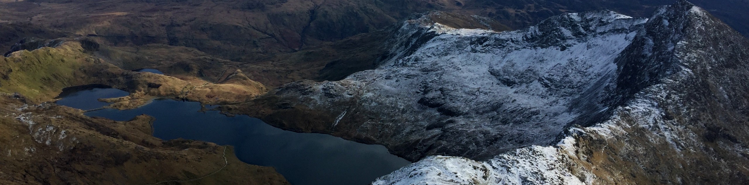
Back on the track, the path continues in a westerly and then south-westerly direction, and after 0.5mi reaches Llyn y Foel, another lake. Here the ground is quite boggy. The track follows the shoreline, before taking you onto the Daear Ddu ridge line.
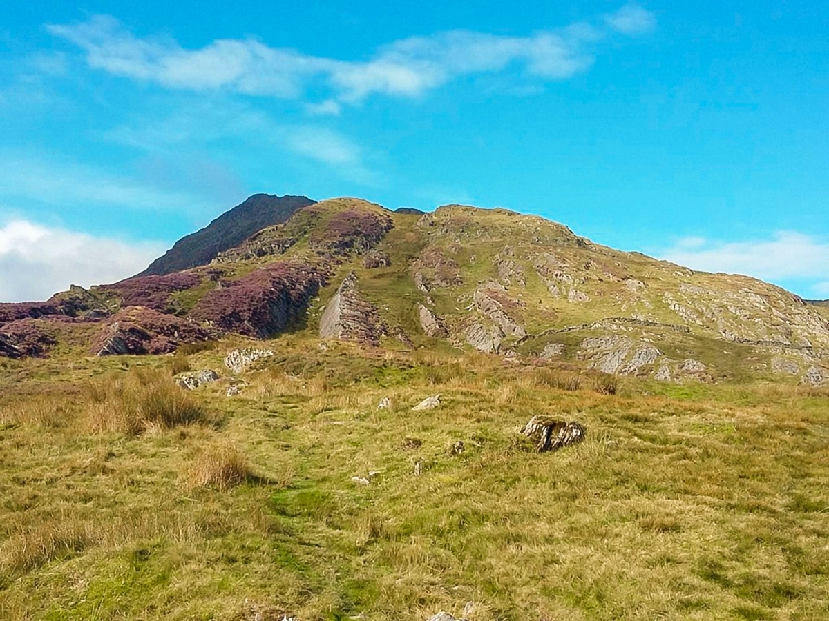
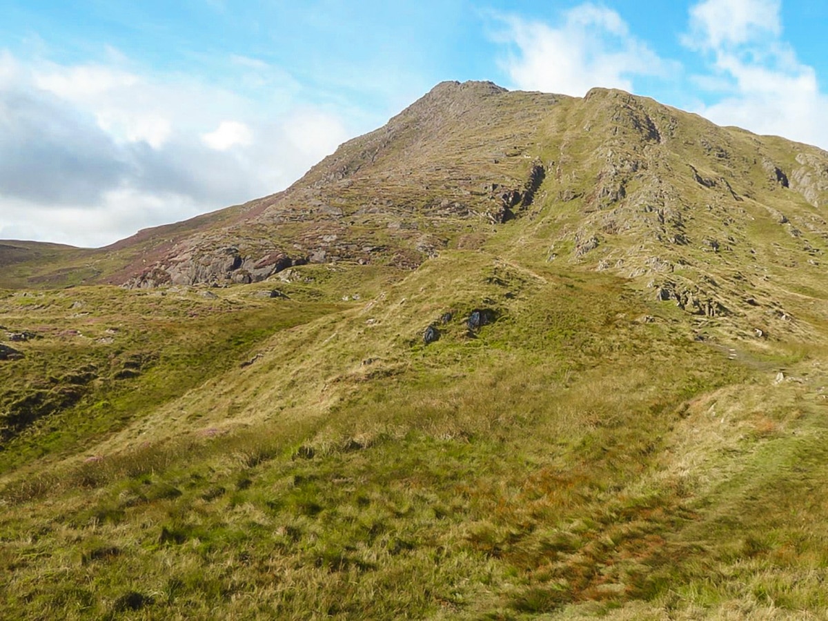
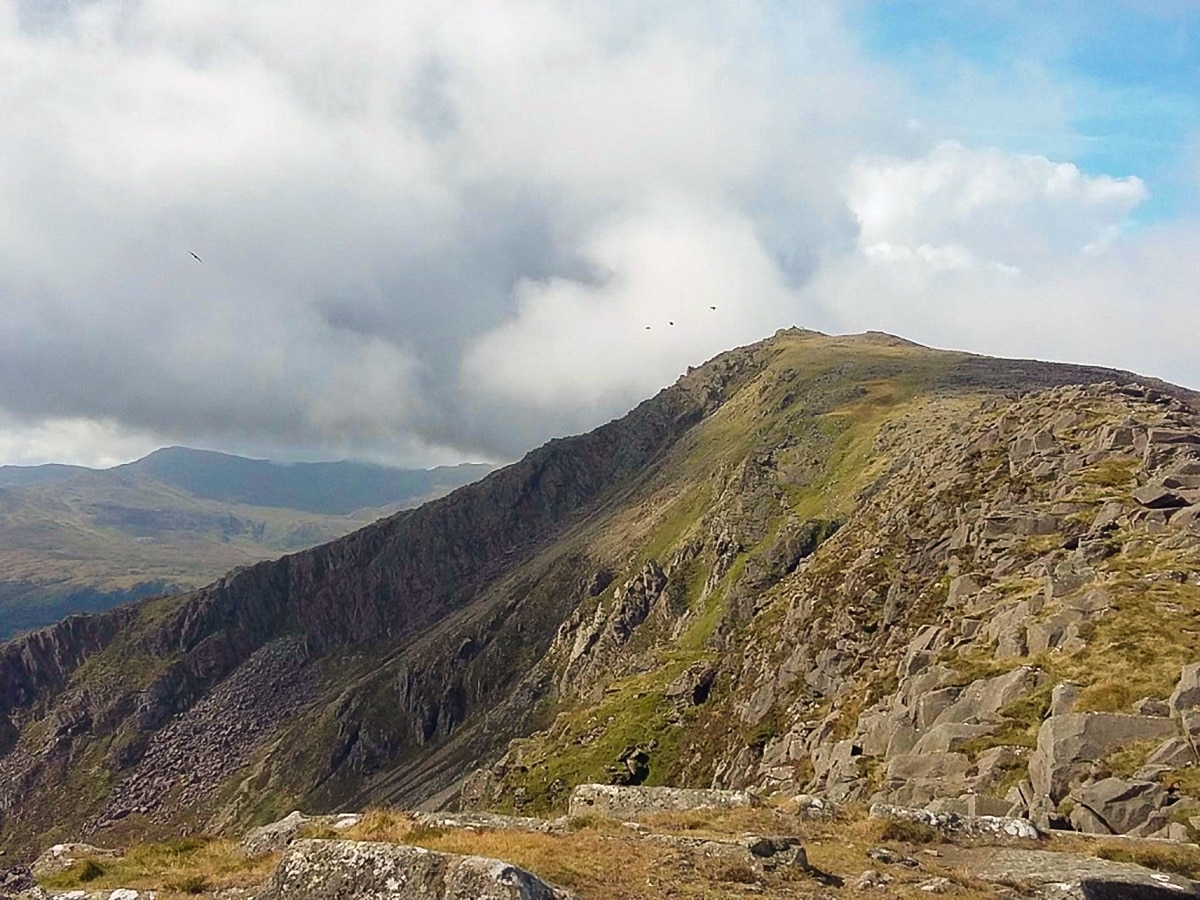
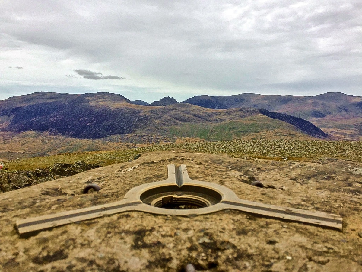
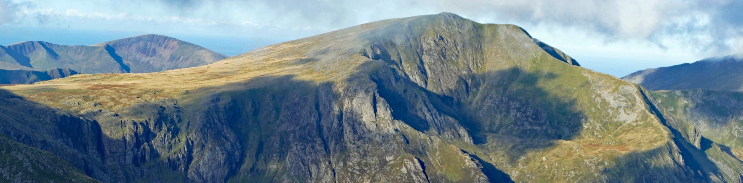
From here, the path to Moel Siabod is less clear, however, the ridgeline is obvious and there is more than one route up. It is a scramble but not particularly difficult. Following a line slightly left of the crest is an easier option. After 0.4mi on the ridge, you will top out just a few meters short of the trig point. From the summit looking northwest, the impressive mountains of Snowdon, Glyderrau and Carneddau (left to right) can all be seen.
The descent route can be tricky to find, particularly in poor visibility. It is possible to return via the ascent and this may be advisable if you are not a confident navigator. Leaving the trig point in a northeasterly direction, with boulder field and large wind shelter to your left, the path (visible in places) descends gently over small boulders to find a well-trodden path that traverses the hillside.
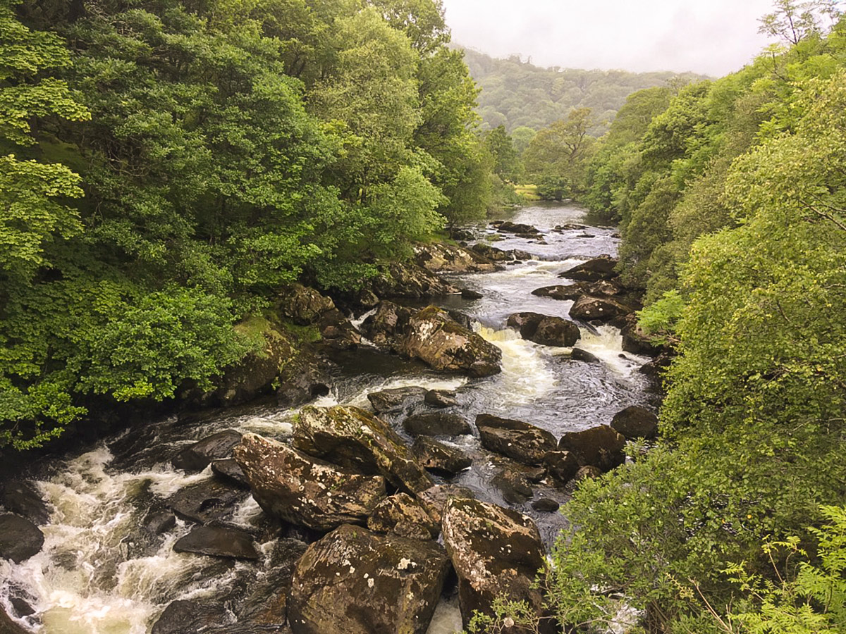
From here, the path is easy to follow, although boggy in places. After about 0.7mi cross a small stream and continue ahead towards the village of Capel Curig, seen below. Eventually, the path crosses a stile and enters a plantation continuing towards the river. Just before reaching the river (Afon Llugwy), turn right onto the forest road and continue past some cottages to your left.
Follow the forest road through the woodland, ignoring the road coming in from the right and just a short distance later take the right-hand fork. Soon the road ends. Follow the narrower footpath that continues ahead following the river. Continuing close to the river, follow a sharp right onto trickier ground, (ignoring the footbridge). Cross a small grassy pasture and a small footbridge to a broader track beyond. Turn left here before emerging on to the minor road where the hike began.
Walking Route Highlights
Moel Siabod
Moel Siabod (pronounced ‘moyl shab-od’) is not known as one of the prettier peaks in North Wales. Indeed, in a landscape dominated by the dramatic, striking mountains of Snowdonia, this unassuming mountain might go unnoticed, were it not for one important characteristic. Moel Siabod offers perhaps the best view of Mount Snowdon that you’ll find anywhere in Wales!
Attracting half a million hikers every year, Snowdon is one of the UK’s most crowded peaks, and up close, it’s sometimes hard to appreciate its rugged beauty. On the other hand, from Moel Siabod, you’ll have a completely unspoiled view over Snowdon’s magnificent geology, and the nearby Glyderau range.
Rising 2861ft above sea level, Moel Siabod stands alone in the Welsh countryside, and is a relatively exposed, windy peak. On a clear day, however, the hike up here is very pleasant and not too taxing, involving some fun scrambling and multiple options for the ascent.
Frequently Asked Questions about Moel Siabod
How long does it take to climb Moel Siabod?
If you’re a regular hillwalker, the ascent of Moel Siabod is not too taxing, and you are likely to complete the ascent and descent in around four hours, depending on how long you linger at the peak.
What does Moel Siabod mean?
Moel Siabod is typically translated as ‘shapely hill’. The word ‘moel’ is used to refer to a bare (treeless) peak, and ‘siabod’ is thought to mean ‘shapely’, although an alternative translation suggests that it means ‘snow-covered’.
Want to find more amazing walks in Snowdonia? Check out the Pyg Track to Snowdon, Llyn Ogwen or the Barmouth Panorama walks.
Insider Hints
Maps and compass are essential for locating the descent route, particularly when visibility is poor.
Snowdon Bar at Plas y Brenin is a great stop off before a gentle amble along the river to return to your starting point.
The Moel Siabod café in Capel Curig is great for breakfast and further information about this hike.

Similar hikes to the Moel Siabod - A Stunning Walk in Snowdonia National Park hike

Foel Goch via Bwlch Tryfan Walk
A walk up Foel Goch via Bwlch Tryfan is an excellent way to take in the iconic beauty of Tryfan…
Snowdon via Crib Goch and Miner’s Track
Of all the many routes up Snowdon, this approach via Crib Goch may be the most demanding! The walk starts…
Y Garn and the Glyderau
The Glyderau may be the most celebrated mountain range within Snowdonia National Park, and this full-day adventure visits the highlights!…
Alex Stark 4 years ago
lovely trail. the surroundings were remarkable. it was a magnificent hike.
Byron Hermes 4 years ago
Beautiful views. The rugged trail was somehow challenging, but it's not impossible.
Kantinka B. 5 years ago
Absolutely gorgeous trail.The trail gets more challenging as you make your way to the summit.
rosaline.oh 5 years ago
Did this in ridiculous rain and fog (not recommended for safety or views) in July, still walked away with awe in my heart. Took the scramble route down from the peak despite the terrible weather because I'm stubborn, and almost plunged to my death a couple of times. Hardest scramble I've done in my life, and I can do Crib Goch with relative grace and ease. Hence why it took so long. If done in another condition and following a visible scramble trail instead of holding onto rocks for my dear life in zero visibility, I'm sure the this is stunning and not too difficult. Still loved it though, and the quarry & waterfall in the last quarter of the trail really took my breath away.
Isaac Hermit 5 years ago
One of the best must visit hike in Snowdonia! Moel Siabod is extremely underrated!
Jorge Mulls 5 years ago
Great hike! Every step was worthwhile. The journey and the destination were fun and unforgettable.
Gabriela Villar 5 years ago
It's easy in the beginning, but It gets more challenging towards the end. This not a chill hike at all, but I enjoyed it a lot!
ClaraBrown 5 years ago
Moel Siabod hike is really strenuous. The elevation gain really feels on your legs but the views are really nice.