Llyn Dinas
View Photos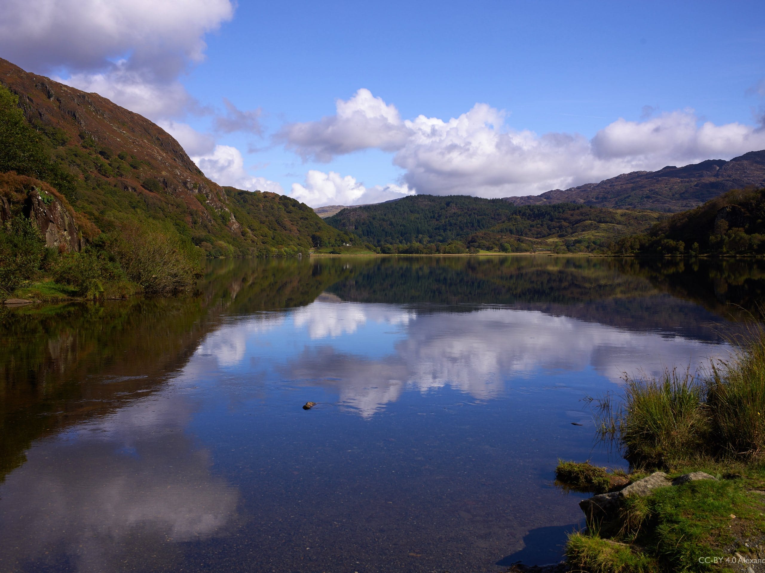
Llyn Dinas
Difficulty Rating:
The walk along Llyn Dinas is a beautiful, family-friendly adventure that can be customized to your energy and ability level. With plenty of shops and cafes in the area, it’s a great adventure to add to a family day out without any major challenges. Enjoy the water, plentiful birds and wildlife, and serene countryside.
Getting there
The Llyn Dinas trailhead is right at the southeast corner of the lake where the river opens up to the wider body of water. From Nant Gwynant, follow the A498 south along the northern side of the lake. Coming out of Beddgelert, you’ll want to pull into the car park on the left.

About
| When to do | February-November |
| Backcountry Campsites | No |
| Pets allowed | Yes - On Leash |
| Family friendly | Yes |
| Route Signage | Good |
| Crowd Levels | Moderate |
| Route Type | Out and back |
Llyn Dinas
Elevation Graph
Weather
Llyn Dinas Walk Description
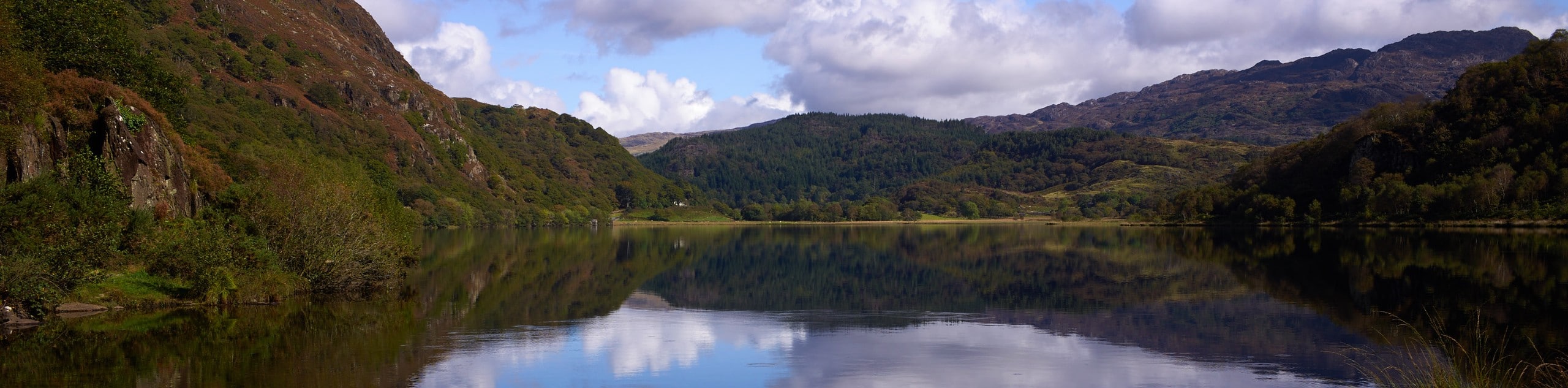
Llyn Dinas is one of the prettiest lakes of Eryri, and it’s a perfect trail for those wanting great views and flexibility with the distance and time required. Some hikers complete this as a loop by returning through the hills over the northern shore of the lake, but this approach is not nearly as well-marked and not family-friendly. The track around the southern shore is very well-maintained.
The Llyn Dinas walk begins from the car park located on the left on your way out of Beddgelert. You’ll cross the road and pass through a gate. Feel free to drop some change into the collection box for the National Trust, which maintains this trail. Purple wildflowers flank the trail here in the spring and summer.
Continue along the obvious trail as it wraps around the lake. Cross the bridge over Glaslyn, then stay left. The path is in great condition and very easy to follow from here, with a new bridge over the stream crossing. Walk over a couple of stiles before arriving at the Llyndy Isaf farmhouse.
The track departs from the farm, passing a barn and a field on your left. You’ll come up to a smaller road, where you should turn left and cross the bridge. Go left again onto the main road.
It’s worth crossing the road and heading right to the Gwynant Cafe before turning back, a favourite halfway stop for many walkers. When you’re ready, simply retrace your steps back to the starting point.
It’s not recommended to follow the road back, even though it’s shorter; the trail is not well-maintained and often strewn with trash because of the roadway.
Insider Hints
There are plenty of shops and cafes in Beddgelert if you’d like to add to your day
This trail is being developed as part of the larger Snowdon Circular Walk
Parking can be somewhat limited at the car park, but there is another further south on the A498
Similar hikes to the Llyn Dinas hike

Foel Goch via Bwlch Tryfan Walk
A walk up Foel Goch via Bwlch Tryfan is an excellent way to take in the iconic beauty of Tryfan…
Moel Wnion from Rachub
Walking up Moel Wnion from Rachub is a superb exploration of the Carneddau’s lower reaches. A gate at the end…
Alltwen to Mynydd y Dref Walk
Alltwen to Mynydd y Dref is a wonderful walk when you’re a bit short on time for Snowdonia’s larger mountains,…
Comments