Llanberis Path to Snowdon
View Photos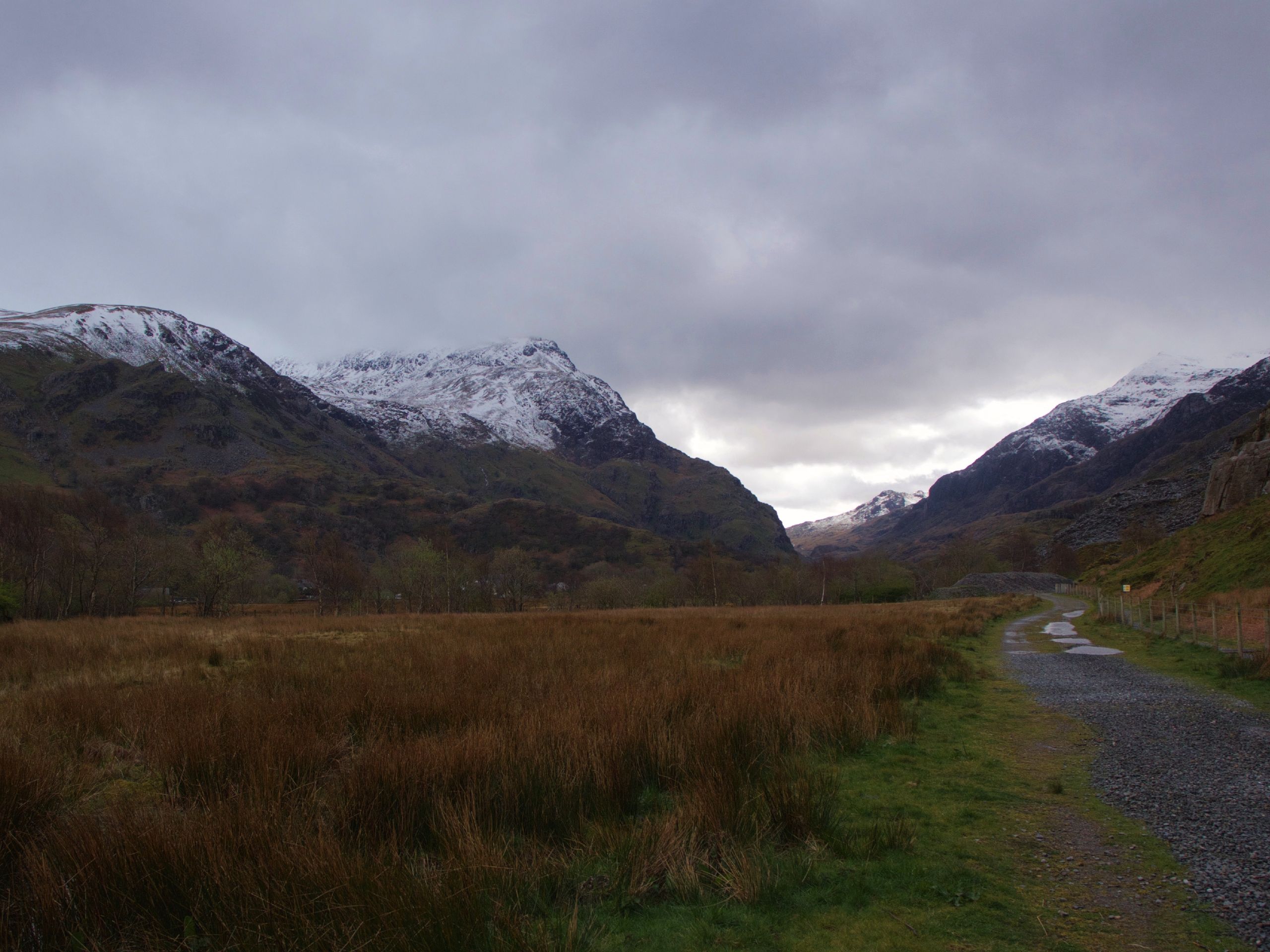
Llanberis Path to Snowdon
Difficulty Rating:
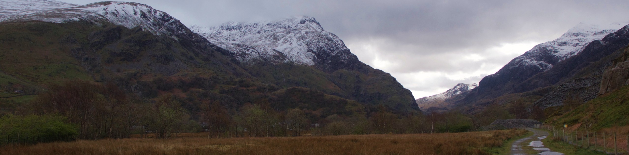
There are plenty of ways to climb Snowdon, but the Llanberis Path up Wales’ highest peak could be the perfect option for you! This trail is scenic, but you can breathe easy knowing no demanding technical sections await. As you power your way up, you’ll be treated to expansive views over the surrounding deep blue lakes, imposing peaks, and lush groves of trees. With several sections guaranteed to get the heart pumping, you’ll feel fantastic as you stand atop this legendary mountain!
Getting there
The Llanberis Path begins in Llanberis and there are several starting points to choose from. The Mountain Railway Station near the Royal Victoria Hotel is a great option. From town, head towards Snowdon on A4086. Immediately after crossing the creek, there are several parking options, including the designated Llanberis car park on your right up Victoria Terrace.

About
| When to do | March-October |
| Backcountry Campsites | No |
| Pets allowed | Yes - On Leash |
| Family friendly | Older Children only |
| Route Signage | Good |
| Crowd Levels | High |
| Route Type | Out and back |
Llanberis Path to Snowdon
Elevation Graph
Weather
Llanberis Path to Snowdon Description
Summiting Snowdon is a pride point for any hiker in the area, and Llanberis Path offers a straightforward (if not steep at times!) approach to this fantastic objective. Note that you should not attempt this path in the winter without careful consideration. The section of trail between Allt Moses and the Pyg/Ranger is known as the Killer Convex in the winter because the path disappears and presents a dangerous scramble across a steep, unstable snow slope. No, thank you!
From the parking lot, pass the terrace of houses and continue up the small road that crosses a cattle grid. Expect your heart to start pumping right away, as this section is immediately steep. Continue along this road through a gate and watch for the trail marker on your left that reads “Snowdon Summit.”
You’ll press on along a wide, easy to follow dirt track on an open grass slope. Enjoy a flatter section along moorland for about a kilometre, pass under the railway, and soon pass the Halfway House. Yes, this does indeed mark your approximate halfway mark. Feel free to grab a tea here!
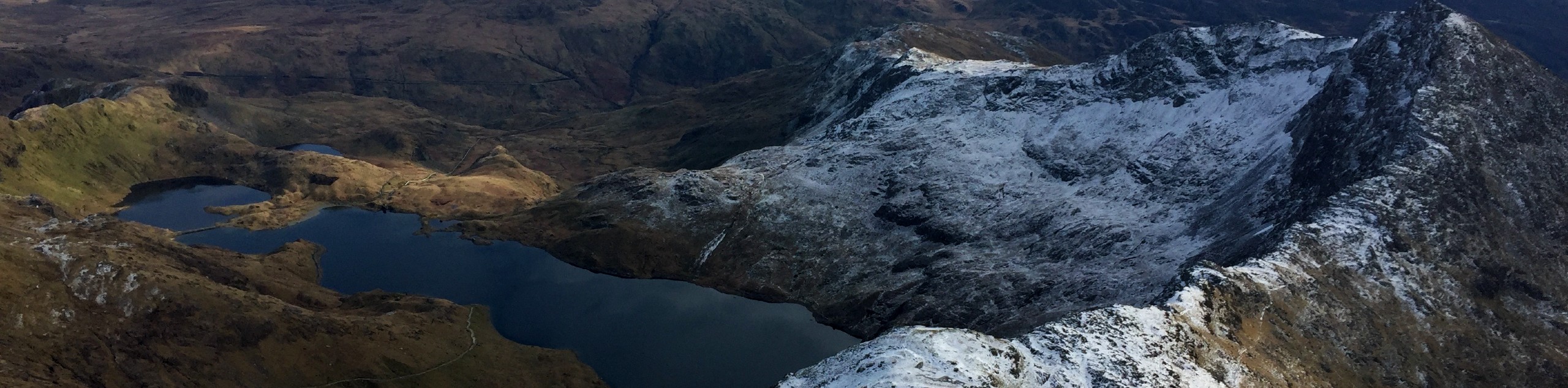
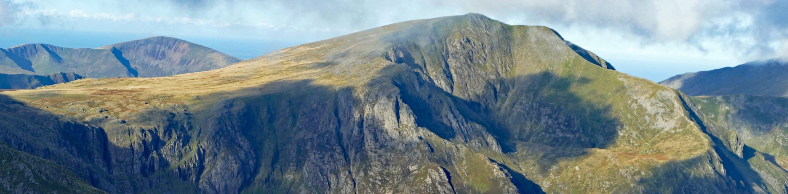
Continue along the trail, where after another kilometre you should begin to be able to see the views of Clogwyn Du’r Arddu. Soon you’ll start Allt Moses, a section of the trail that traverses large stone steps and is considerably steeper. Take a breather to appreciate the view of Glyder Fawr if you need!
The next section is what’s known as the Killer Convex in winter. If you happen to be here in the snow, take extreme caution traversing this section where the trail is buried. You’ll be traversing a steep snow slope. In the summer, enjoy a breezy passage through.
328ft from the summit, you’ll pass the Bwlch Glas Standing Stone, which points you in the direction of the top. Keep pushing along the rocky path until the summit building, Hafod Eryri, is in view. Push on up the smooth, wide stone steps that lead to the summit cairn. You made it!
Savour the best views of Snowdonia you can get before continuing down the same way you came. Note that where the path branches off, not far below the summit, you’ll want to head straight ahead here. The steep section through Allt Moses might require some patience, but otherwise, it should be an easy enough decent.
Trail Highlights
Snowdon
Snowdon is the obvious highlight of Snowdonia National Park, towering 3560ft above Wales. This mountain is designated as a national nature reserve and attracts up to 600,000 walkers every single year. There are several different trails to choose from when climbing Snowdon, some of them even used by Edmund Hillary to train for his Everest ascent in 1953.
Frequently Asked Questions
How long does it take to walk the Llanberis Path?
Most walkers can complete their trek on the Llanberis Path in 3-4 hours in good conditions.
Is Llanberis Path dangerous?
Llanberis Path is not particularly dangerous until it becomes covered in snow. In winter conditions, there is a section of the path called the Killer Convex that presents a considerable threat when traversed. In the summer, the path is considered safe.
How fit do you need to be to walk up Snowdon?
Most reasonably fit walkers should be able to climb Snowdon. The Llanberis Path is considered the easiest way to complete the ascent, and walkers only need to be capable of hiking about 4.3mi of uphill terrain with no technical sections to make it.
Insider Hints
If you fancy a cup of tea, a stop at the Half Way House is a great way to rest before taking on the summit push
Want to shave off some distance? You can get a train (locally known as the Sherpa Train) to Clogwyn Station 3.1mi up the mountain and begin from here
This is considered by many to be the easiest path up Snowdon, so we recommend it for first-timers
Similar hikes to the Llanberis Path to Snowdon hike

Foel Goch via Bwlch Tryfan Walk
A walk up Foel Goch via Bwlch Tryfan is an excellent way to take in the iconic beauty of Tryfan…
Snowdon via Crib Goch and Miner’s Track
Of all the many routes up Snowdon, this approach via Crib Goch may be the most demanding! The walk starts…
Y Garn and the Glyderau
The Glyderau may be the most celebrated mountain range within Snowdonia National Park, and this full-day adventure visits the highlights!…
Comments