Gwydir Forest Park Walk
View Photos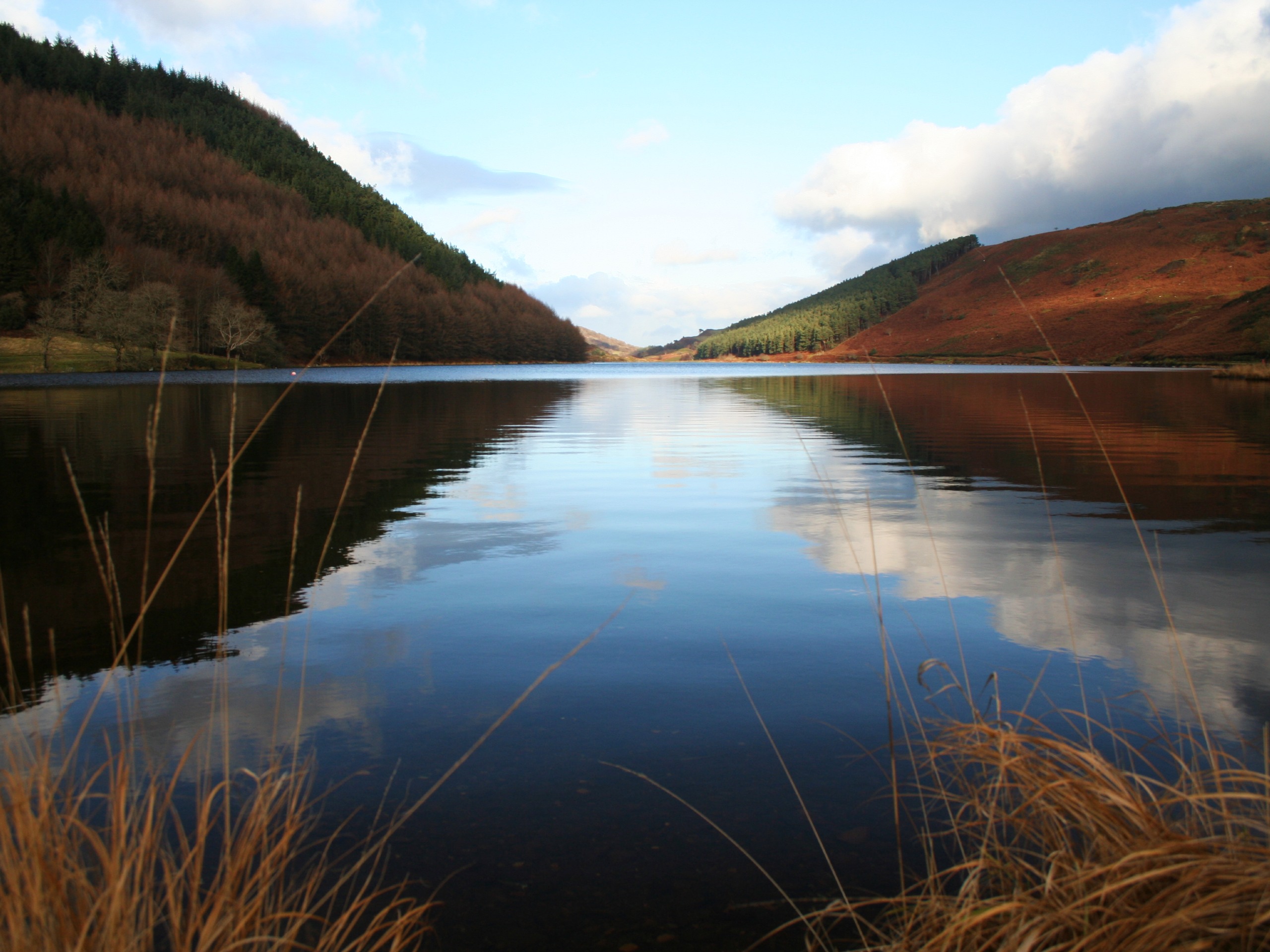
Gwydir Forest Park Walk
Difficulty Rating:
A walk through the Gwydir Forest Park is an exceptional way to spend a day in Snowdonia without clambering up the mountains. Betws-y-Coed provides a convenient access point, and the waymarked paths are easy to navigate for any adventurer. The trail starts along the flowing Afon Llugwy, passing by the majestic Swallow Falls before turning north along fields and lakeshores. Llyn Geirionydd is a lovely midpoint, where the legendary poet Taliesin lived (and is allegedly buried). A path then cuts back through the heart of the forest, looping back along the edge of Llyn Parc before returning to your starting point. A gorgeous day in the woods!
Getting there
To get to the Gwydir Forest Park Walk, head for the village of Betws-y-Coed. The settlement sits just north of the confluence of the A5 and A470 roads. There are plenty of places to park; the best car park for this walk is just north of the Pont-y-Pair bridge that connects the B5106 to the A5. If driving from the A5, cross the bridge then take your first left. The car park is on your right.

About
| When to do | February-November |
| Backcountry Campsites | No |
| Pets allowed | Yes - On Leash |
| Family friendly | Older Children only |
| Route Signage | Average |
| Crowd Levels | High |
| Route Type | Circuit |
Gwydir Forest Park Walk
Elevation Graph
Weather
Gwydir Forest Park Walk Description
This stretch of the Gwydir Forest is a beautiful region for walking, with well laid-out paths and plenty of lovely spots to stop and admire the scenery along the way. This is a particularly solid option in wet weather, as the forest will provide plenty of cover – much more than the nearby mountains!
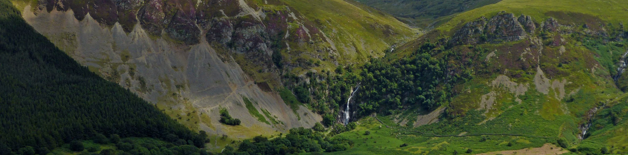
From the car park on the north side of the Pont-y-Pair bridge, cross Forest Road and head west on a clearly marked trail that runs along the Afon Llugwy. This trail bends north at the old Miner’s Bridge (which was washed away by flood in 2020) and meets up with a road. Follow this road west as it curves west, mirroring the river. Where the road splits to the right, keep left to stay along the river, and follow the path all the way to Swallow Falls. These spectacular waterfalls are a postcard-perfect scene, especially after a heavy rain! While you won’t be able to get right up close, a viewpoint makes for a fantastic photo.
From Swallow Falls, the trail continues for about 1969ft before banking around to the right and taking a northeast bearing. If you reach a wider forest track before turning right, you’ve gone a bit too far – but not to worry, simply turn right and follow this northeast, since both paths will link up anyway. You’ll pass a picnic bench and a car park, ignoring the right-hand turn that comes shortly after. At the next major juncture, turn left and take the path running alongside Llyn Ty’n-y-Mynydd, the little lake on your left-hand side. This path continues through the woods, bearing slightly left before another junction just south of Llyn Geirionydd. Follow the main path on the right to approach the lake.
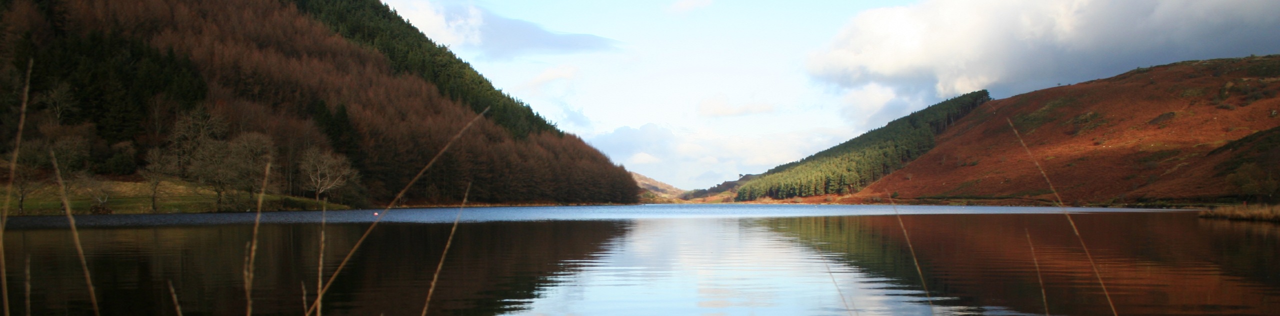
Enjoy views over the serene Llyn Geirionydd as you walk north along its eastern shore. This is currently the only lake in Snowdonia permitting motorized boats on its surface, a testament to its summer popularity. About two-thirds of your way down the lake, you’ll spot a path on your left that cuts back towards the south, rising above the lakeshore. Turn around and hop on this trail, ascending to the highest point on the route as you move away from the lake. After about 1km, reach a trail junction and bear left, heading east as you pass by Llyn Glangors on your left. You should be walking ESE along the path, which sees a very short portion of pronounced descent before leveling out.
About 700m from a car park, the path turns right and bears directly south towards Llyn Parc. The placid lake waters will be on your right as you continue your stroll. Once you pass the southern end of the lake, the final stretch of the walk follows a steeper descent as it rounds back in a southwest direction. The path will lead right back to Forest Road – take a left and then another to find yourself back at the initial car park.
Insider Hints
If you’re in the area and want to stop at Swallow Falls without the walk, you can visit from the south (along the A5). Do note that this entrance requires payment: £2 for adults, and £1 for kids 14 and under.
If the first path along the river from the car park is muddy or damaged, you can always take the side road that runs parallel to the path, just to the north. This passes by the Tan Dinas Country House before meeting up with the first path as it follows the Afon Llugwy north.
Llyn Geirionydd is the perfect halfway point for a picnic lunch!
Similar hikes to the Gwydir Forest Park Walk hike

Foel Goch via Bwlch Tryfan Walk
A walk up Foel Goch via Bwlch Tryfan is an excellent way to take in the iconic beauty of Tryfan…
Moel Wnion from Rachub
Walking up Moel Wnion from Rachub is a superb exploration of the Carneddau’s lower reaches. A gate at the end…
Alltwen to Mynydd y Dref Walk
Alltwen to Mynydd y Dref is a wonderful walk when you’re a bit short on time for Snowdonia’s larger mountains,…
Comments