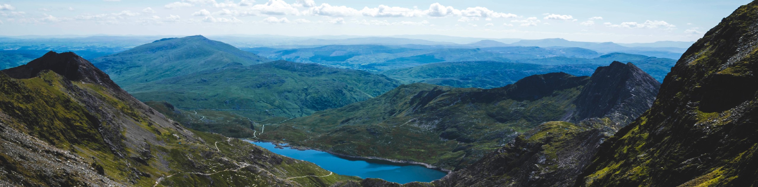
Cnicht from Croesor
View Photos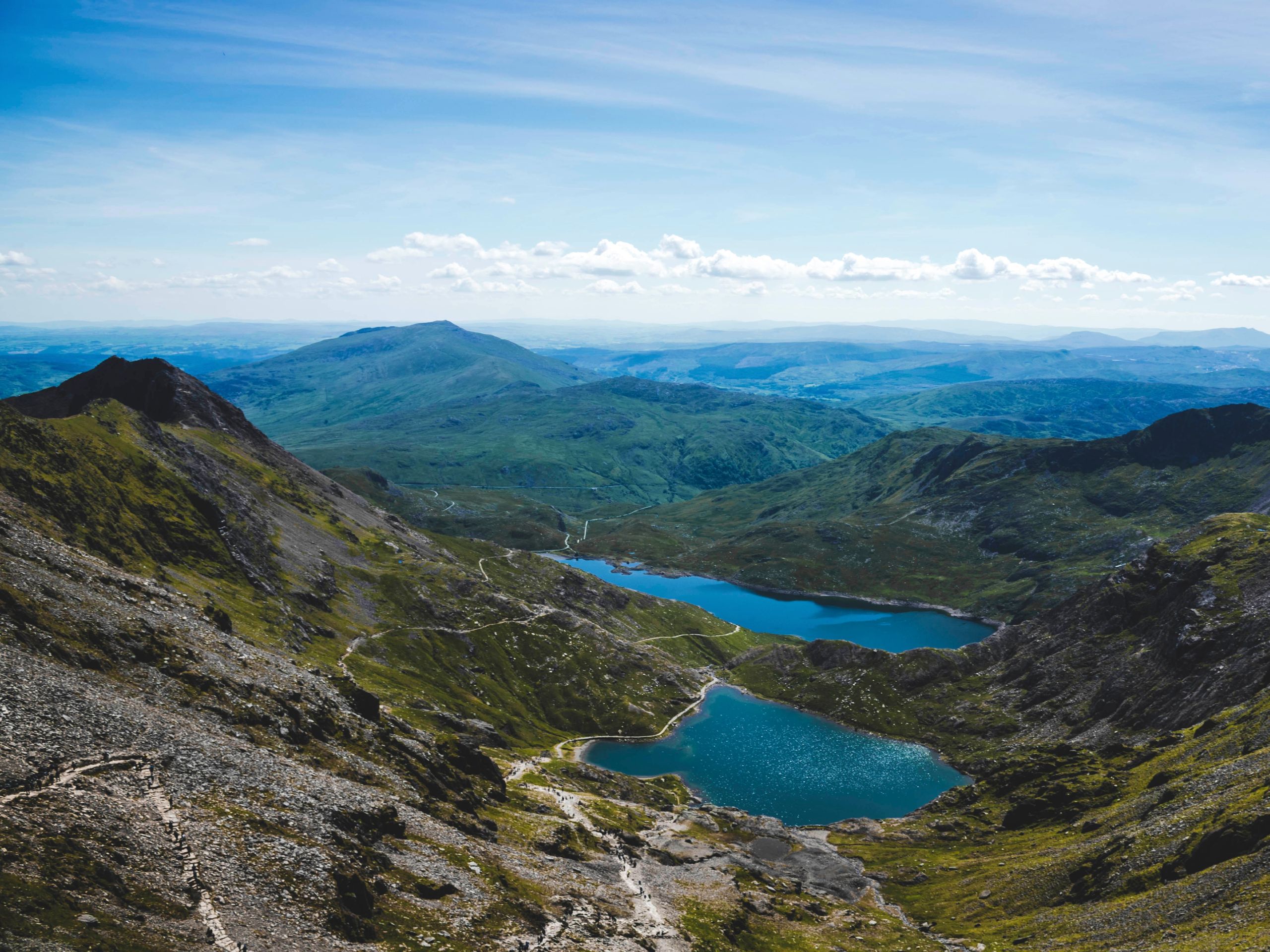
Cnicht from Croesor
Difficulty Rating:
Cnicht is a 2260ft peak in the Moelwynion range known as the “Matterhorn of Wales”. The Croesor ascent is an exhilarating way to conquer this impressive mountain, beginning in the quaint village of Croesor and traversing over a wooded path before ending with a Class 1 scramble to the summit. Here, expansive views of Snowdonia National Park await. While it’s a bit of a leg-burner, the hike up Cnicht from Croesor is a rewarding trek perfect for hikers wanting to test out their scrambling skills.
Getting there
The trailhead for Cnicht is in the village of Croesor. At the intersection of the village’s main roads, there is a path that heads generally northwest. Where this path crosses Afon Croesor, continue heading northwest to pick up the trail. Walk along this road past the intersection with Chapel Street. Where the road dead-ends and a smaller road branches to the right, continue straight onto the footpath from the dead-end.

About
| When to do | March-November |
| Backcountry Campsites | No |
| Pets allowed | Yes - On Leash |
| Family friendly | No |
| Route Signage | Poor |
| Crowd Levels | Moderate |
| Route Type | Circuit |
Cnicht from Croesor
Elevation Graph
Weather
Cnicht from Croesor Description
The Cnicht from Croesor trail conveniently picks up from a dead-end street in Croesor, but beware: route-finding can be difficult in spots, so downloading the GPS route is recommended. It’s also recommended that you attempt this hike in good weather, and the scrambling portion near the end is more challenging when wet.
Embarking up to the summit of Cnicht (derived from the old English word for “knight”), the trail is initially clear and easy to follow. You’ll curve gently right and cross a small stream twice. When the Hut circle is on your right, make sure you keep right at the junction.
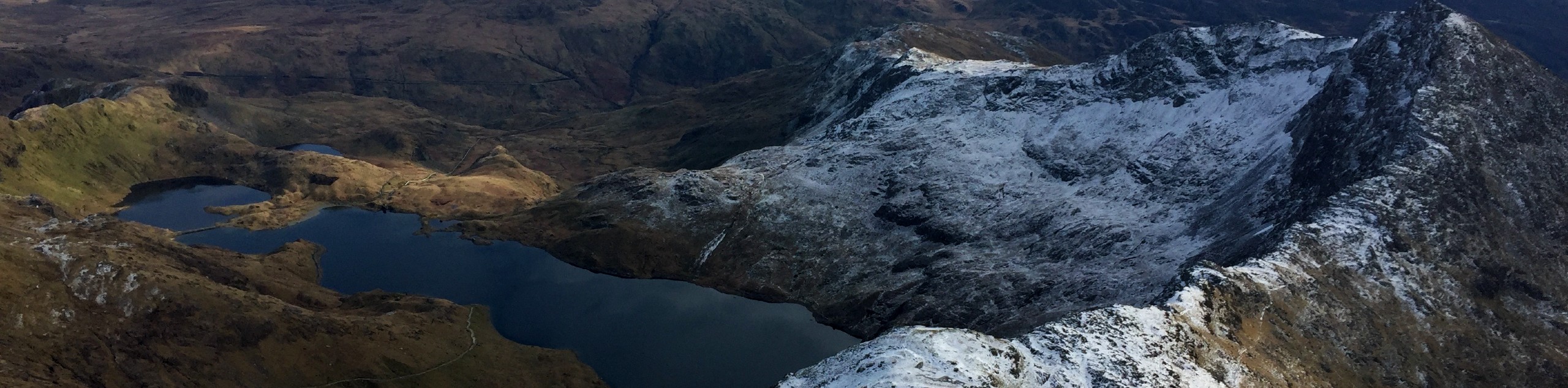
Keep on ascending steadily on the obvious path. Just shy of the summit, there is a Class 1 scramble section. The handholds and footholds are plentiful, but take care if you’re a newer climber. Less experienced hikers may find this section taxing, but comfortable hikers often find it to be fairly easy. Once atop the summit, enjoy views of Moelwyn Mawr to the southeast and Yr Allt Fawr to the northeast. Impressive Snowdon is visible not far in front of you.
The pathway down from the summit nearly disappears once the old slate mine is in sight. As you descend through a boggy area, keep an eye on the GPS to keep the trail underfoot. You’ll pass Llyn Cwm-corsiog on your right and then the Rhosydd Quarry Village further on. Make sure you stick hard right here, so you don’t overshoot the trail.
If you want to avoid this section entirely, you can do this hike as an out-and-back and simply return on the trail you ascended on.
Trail Highlights
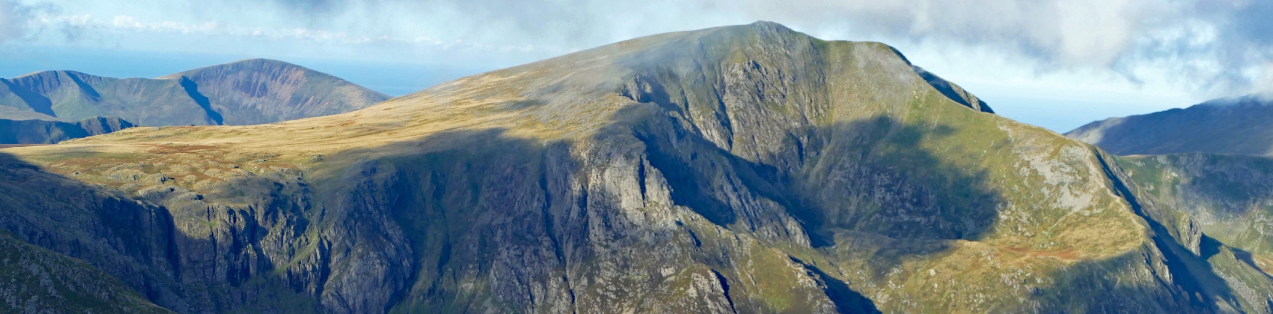
Snowdon
The view of Wales’ highest mountain never disappoints, and on a clear day it is one of the gems of the Cnicht panorama. This peak towers 3560ft high and is a designated national nature reserve. It was even used by Edmund Hillary to train for his 1953 ascent of Mount Everest.
Insider Hints
If you’re unable to download the map and not confident in your route-finding, you can turn around at the summit and descend the same way you came up
Oriel Caffi Croesor is directly along your route right near the end of the hike, making it a perfect stop to celebrate your trek with a cup of tea or coffee
Similar hikes to the Cnicht from Croesor hike

Foel Goch via Bwlch Tryfan Walk
A walk up Foel Goch via Bwlch Tryfan is an excellent way to take in the iconic beauty of Tryfan…
Snowdon via Crib Goch and Miner’s Track
Of all the many routes up Snowdon, this approach via Crib Goch may be the most demanding! The walk starts…
Y Garn and the Glyderau
The Glyderau may be the most celebrated mountain range within Snowdonia National Park, and this full-day adventure visits the highlights!…
Comments