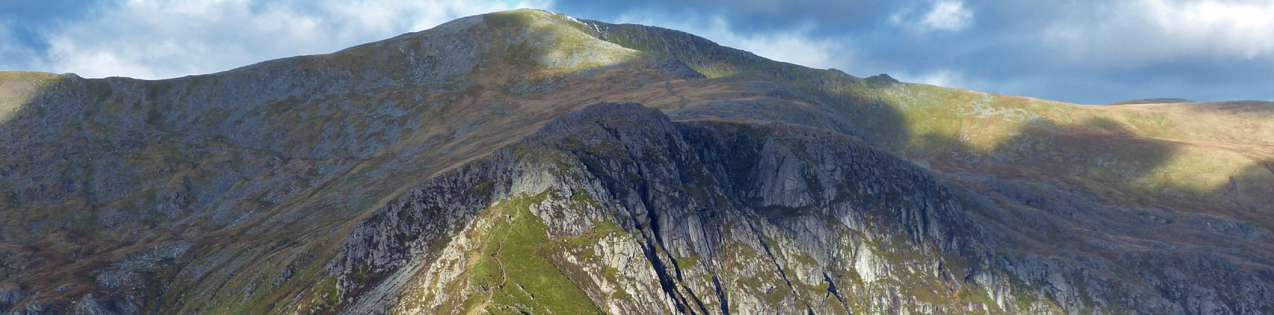
Carnedd Dafydd and Llewelyn
View Photos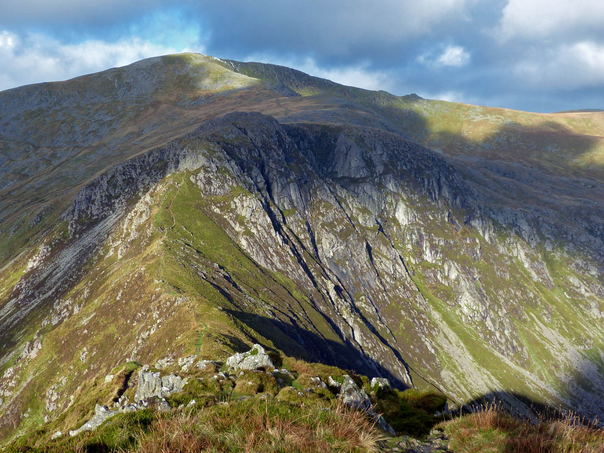
Carnedd Dafydd and Llewelyn
Difficulty Rating:
Carnedd Dafydd and Llewelyn are the crown jewels of the Carneddau, the largest contiguous area of elevation across Wales and England alike. This circular walk tackles both summits on an epic adventure for seasoned hikers. Easy access from the A5 marks the start of a journey, where you’ll cross streams, scramble up steep rocks, stroll along breathtaking ridges, and gaze across all of Snowdonia. The descent is no peach, but views of the lakes and valleys make it all worthwhile. A true journey for a memorable day in the hills!
Getting there
This walk up Carnedd Dafydd and Llewelyn starts from the A5. Drive just past the east end of Llyn Ogwen, where there should be space to pull over near Glen Dana. Driving west along the A5, it should be just after the Gwern Gof Uchaf campsite, before you reach the lake.

About
| When to do | March-October |
| Backcountry Campsites | No |
| Pets allowed | Yes - On Leash |
| Family friendly | No |
| Route Signage | Poor |
| Crowd Levels | Moderate |
| Route Type | Circuit |
Carnedd Dafydd and Llewelyn
Elevation Graph
Weather
Carnedd Dafydd and Llewelyn Trail Description
This is the classic route up Carnedd Dafydd and Llewelyn, with plenty of challenges to navigate. There are several scrambles on this walk. None are overly technical, but you should be comfortable with steep ascents and unstable terrain. Experience with route-finding is also recommended, as some of the paths can be tricky to track, especially in poor conditions.
From your parking spot, start walking north, passing a hut and heading to the right of the Tal y Lyn Ogwen farm. You’ll spot some National Trust waymarks – follow the red arrows for this route. Continue uphill, crossing the Afon Lloer from the right to left bank. You’ll pass a wall before the path veers off to the left, away from the river and towards the mountains.
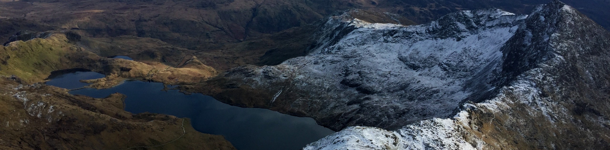
Continue west towards Pen yr Ole Wen, as the ascent begins to steepen. Here’s where you’ll encounter your first few scrambles. In good weather, the views over Cwm Lloer and the shimmering waters of Ffynnon Lloer below are an excellent companion to your climb.
From this summit, the path turns back towards the north. There’s little elevation change from here to the peak of Carnedd Dafydd, but the path can be tricky to follow in foggy conditions. Stay along the ridge line, and you’ll be fine! The summit shelter at Carnedd Dafydd is a big one – perfect for a sheltered break from the alpine winds.
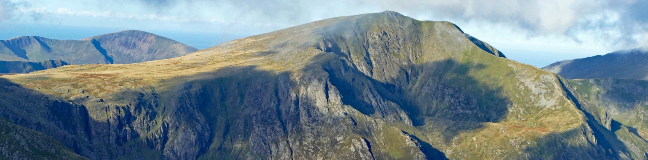
Continue along the ridge towards Carnedd Llewelyn, which starts east then turns to the north. In clear weather, the views on both sides are simply incredible. The path is faint in places, so keep a keen eye for its progress. From Bwlch Cyfryw-drum, it’s a clear shot just over 100m to the summit of Carnedd Llewelyn. Panoramic views in all directions await in good weather – only natural for one of the highest points in Wales!
The descent should be aimed at Bwlch Eryl Farchog, southwest of the summit. Finding the correct path from the peak can be tricky. Once you locate it, the way down is largely straightforward, until the path vanishes into some crags above the col. Take plenty of care scrambling down this section. At the Bwlch, the path angles to the right and drops quite steeply down the slope. Fortunately, keeping your bearings is easy, as you aim for the shores of Ffynnon Llugwy below.
The path stops just before the reservoir road, so continue on your bearing to join a track that leads down to the A5. After about 656ft, you can turn left off the A5 into Gwern Gof Isaf, then right onto a track that runs parallel to the main road. This track meets back up with the A5 right around where your car should be parked.
Frequently Asked Questions
Where are the Carneddau mountains?
The Carneddau mountains are a group of mountains in northern Snowdonia National Park. They make up nearly half of the tallest fifteen peaks in all of Wales!
How tall is Carnedd Llewelyn?
Carnedd Llewelyn is 1,064m tall. This makes it the second-highest distinct peak in all of Wales!
Insider Hints
The Gwern Gof Uchaf campsite provides a scenic and ultra-convenient place to stay if you’re spending a few nights in the area, or even just a fun overnight adventure. Tents are welcomed on the property, and a bunkhouse is also available. Showers are present, but please make sure to bring all other supplies you might need. The price of £7 per person includes parking costs.
Similar hikes to the Carnedd Dafydd and Llewelyn hike

Foel Goch via Bwlch Tryfan Walk
A walk up Foel Goch via Bwlch Tryfan is an excellent way to take in the iconic beauty of Tryfan…
Snowdon via Crib Goch and Miner’s Track
Of all the many routes up Snowdon, this approach via Crib Goch may be the most demanding! The walk starts…
Y Garn and the Glyderau
The Glyderau may be the most celebrated mountain range within Snowdonia National Park, and this full-day adventure visits the highlights!…
Comments