Cader Idris via Minffordd Path
View Photos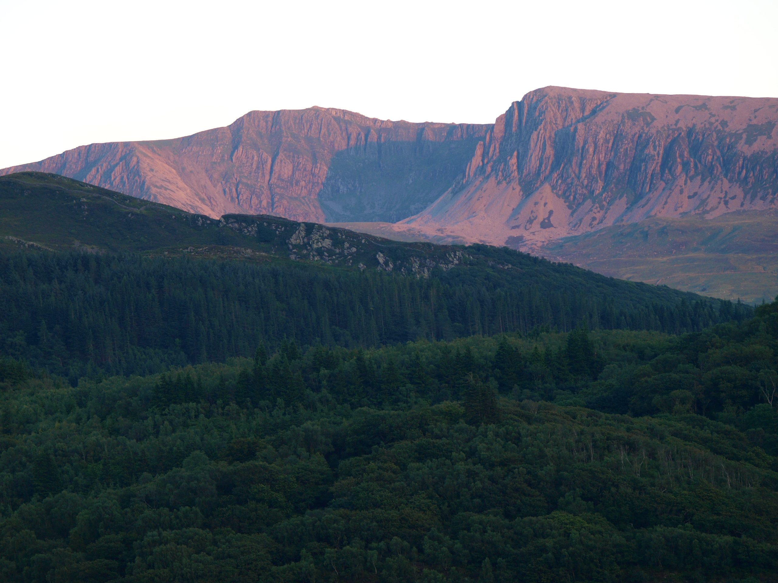
Cader Idris via Minffordd Path
Difficulty Rating:
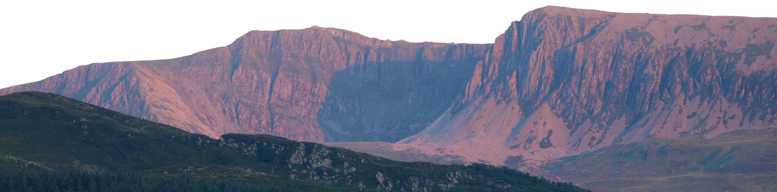
While there are several ways to climb this beloved mountain, walking Cader Idris via the Minffordd Path is perhaps the most scenic of them all. This route starts along rivers and waterfalls, ascends above the placid waters of Llyn Du, and brings out your adventurous spirit while clambering through rocky paths to the panoramic summit of Cader Iris. A second summit of Mynydd Moel is an extra treat to discover before descending through open moorlands with sweeping views of your Snowdonia surroundings.
Getting there
To get to the start of the Cader Idris walk, head for the Dôl Idris car park. It’s located just off the A487, a little under 9.0mi north of the village of Machynlleth.

About
| When to do | March–November |
| Backcountry Campsites | No |
| Pets allowed | Yes - On Leash |
| Family friendly | Older Children only |
| Route Signage | Poor |
| Crowd Levels | Moderate |
| Route Type | Lollipop |
Cader Idris via Minffordd Path
Elevation Graph
Weather
Cader Idris via Minffordd Path Description
Start through a gate at the far left corner of the car park, and follow a broad gravel path to a second gate. Turn left and pass by the Cadair Tea Room (a lovely place to stop for refreshments on your way back). A footpath sign leads you right through another gate—follow the arrows for Cader Idris. You’ll begin to ascend quite quickly through the woods, passing the Nant Cadair Falls. At the fringe of the woods, one more gate opens onto a rocky path with a fork, where you should head left and continue your ascent.
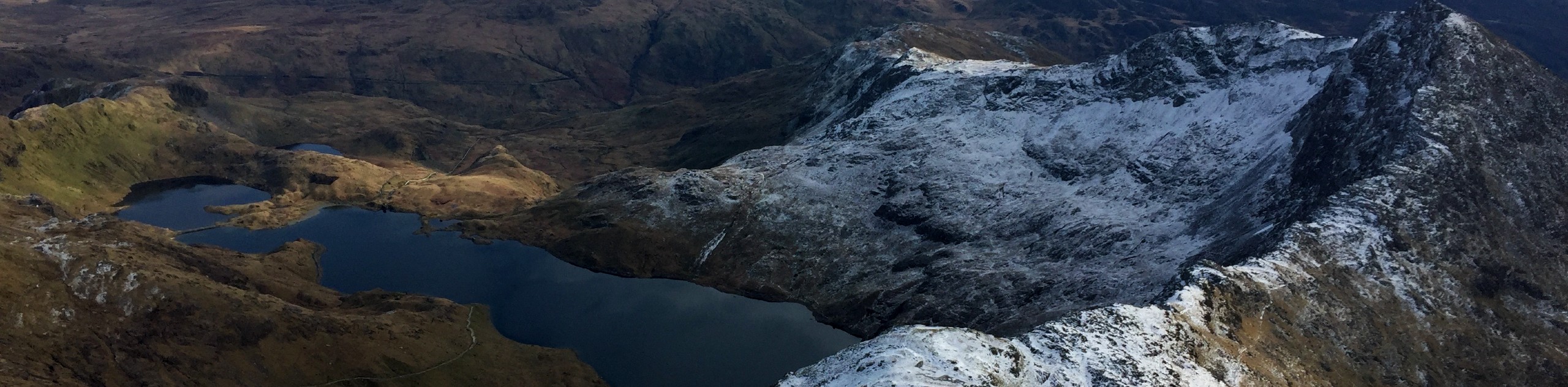
Stay left at the next junction as well, as you rise above the serene waters of Llyn Cau. Upon reaching an unmissable cairn, head right and walk along the ridge path, keeping the lake on your right. Sections of this trail are rough and quite exposed, but it’s easy enough to follow. Clamber over a rocky section and reach a stile—hop over that, and you’ve reached the peak of Craig Cau. A quick left along the fence followed by an almost immediate right after a few metres brings you to a narrow path that grows clearer as it follows the edge of the cliffs.
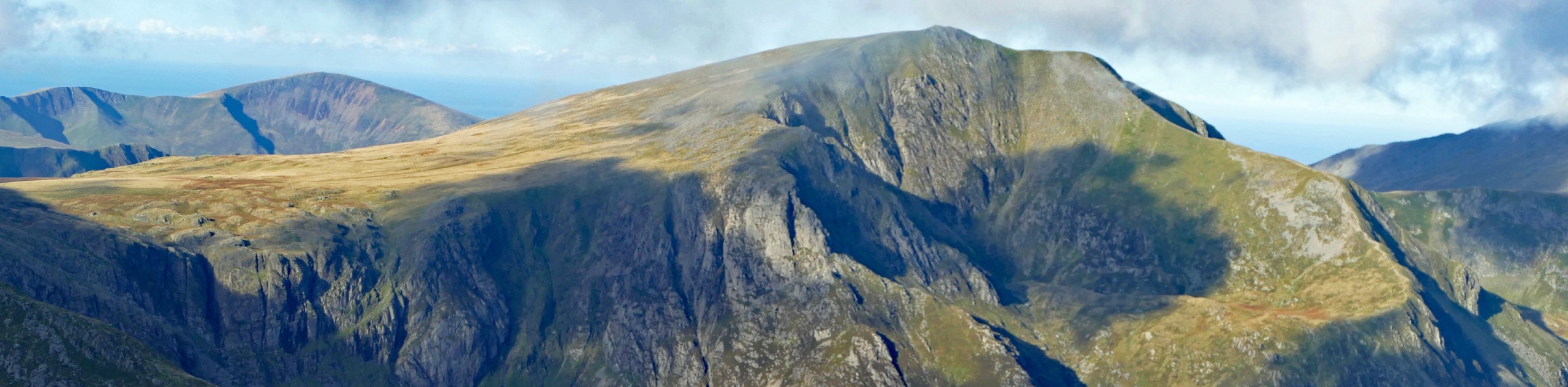
A final push through a steep rocky section brings you to the Cader Idris summit. In good weather, you can gaze towards the western sea. From here, head down towards a stone shelter, then follow a grass path to the right. Depending on the conditions, you might see the next summit of Mynydd Moel directly in front of you. A cairn on the left marks Fox’s Path. Continue straight past this to a junction, then turn left and head up to the peak of Mynydd Moel, clambering over a stile to reach the shelter. You’ll be treated to more outstanding views of the surrounding mountains and faraway coastline.
To descend, pivot back to the fence and turn left, keeping the fence on your right-hand side as you walk down over the grass. Much of this path is muddy and loose, so take plenty of care while you make your way downwards. Stone steps lead to a stile overlooking a lake—hop over the stile and continue along the path until you reach the banks of the Nant Cadair river. Cross the bridge and turn left to re-join the pathway into the woods. From here, it’s a simple matter of walking back the way you came—maybe stopping for a spot of tea and cake before you reach the car park.

Similar hikes to the Cader Idris via Minffordd Path hike

Foel Goch via Bwlch Tryfan Walk
A walk up Foel Goch via Bwlch Tryfan is an excellent way to take in the iconic beauty of Tryfan…
Snowdon via Crib Goch and Miner’s Track
Of all the many routes up Snowdon, this approach via Crib Goch may be the most demanding! The walk starts…
Y Garn and the Glyderau
The Glyderau may be the most celebrated mountain range within Snowdonia National Park, and this full-day adventure visits the highlights!…
dbrookes 3 years ago
Fantastic hike! Highly recommend. We were lucky with the weather and the the views were stunning down to the sea and across to the mountains to the north. Although the path is in good condition it can get steep in places.