Cader Idris via Llanfihangel y Pennant
View Photos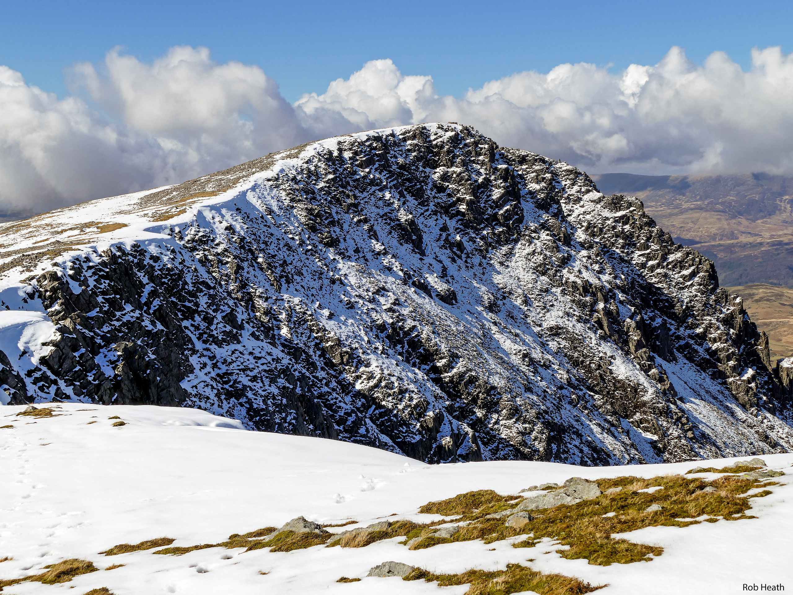
Cader Idris via Llanfihangel y Pennant
Difficulty Rating:
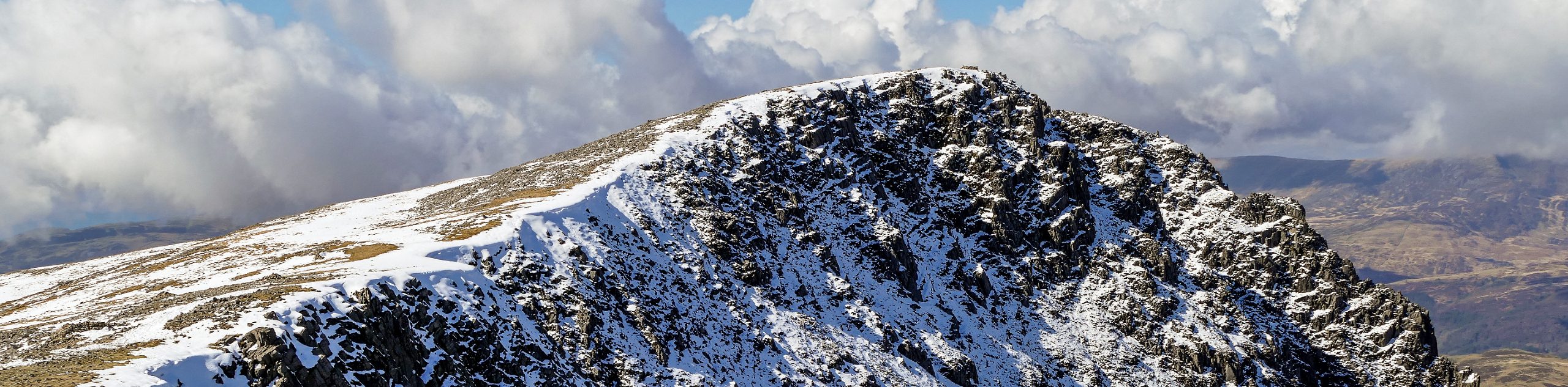
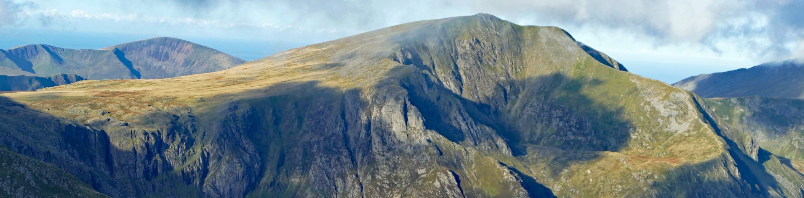
Cader Idris (also known as Cadair Idris) is one of the most popular mountains in Snowdonia. This walk from Llanfihangel y Pennant provides a reprieve from the crowds that make use of the Pony and Minffordd Paths - although you do join the Pony Path for the final push to the summit. The walk up from the village follows clear trails along the Afon Cader, then a grassy path which winds along the lower slopes of Tyrrau Mawr before linking up with the Pony Path for the final portion of your ascent.
Getting there
For this walk up Cader Idris, head for the village of Llanfihangel y Pennant. From Bryncrug, take the 82 road leading northeast and follow this until you arrive in the village. You’ll spot a church on the left - the National Park car park is just nearby

About
| When to do | March-November |
| Backcountry Campsites | No |
| Pets allowed | Yes - On Leash |
| Family friendly | No |
| Route Signage | Poor |
| Crowd Levels | Moderate |
| Route Type | Out and back |
Cader Idris via Llanfihangel y Pennant
Elevation Graph
Weather
Cader Idris via Llanfihangel y Pennant Description
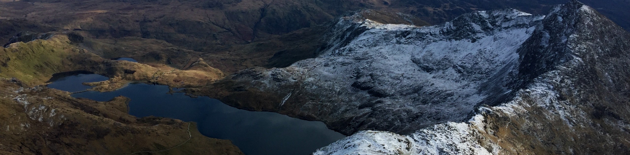
From the car park, set off along the country lane in a northern direction. The track bears right to follow the Afon Cader uphill. You’ll come to a fork – the “official” path is on the right, but the broad path to your left provides easier terrain. Regardless of your choice, the paths merge again after roughly 1.2mi and continue north. At Gwastadfryn, cross the river and follow a grassy path on the right. Keep the summit of Tyrrau Mawr on your left as you work around its lower slopes, the path bearing slightly left as you approach then swerving to the right to bypass the mountain. Once past Tyrrau Mawr, continue on a northeast bearing as you ascend to the bwlch, with views over the Mawddach Estuary to the north.
Here you’ll join the well-worn Pony Path for the final push to the summit of Cader Idris. This is an extremely clear path with little in the way of surprises! Turn right to join the path and walk to the peak of Cader Idris. Interestingly enough, the summit itself is known as Penygader (“top of the chair”). A shelter just below the top provides a reprieve in bad weather. Otherwise, take in the spectacular views over the surrounding lakes and mountains. Return along the Pony Path the way you came, turning left this time to rejoin your original route. Follow this all the way back down to the car park to complete the adventure.
Similar hikes to the Cader Idris via Llanfihangel y Pennant hike

Foel Goch via Bwlch Tryfan Walk
A walk up Foel Goch via Bwlch Tryfan is an excellent way to take in the iconic beauty of Tryfan…
Snowdon via Crib Goch and Miner’s Track
Of all the many routes up Snowdon, this approach via Crib Goch may be the most demanding! The walk starts…
Y Garn and the Glyderau
The Glyderau may be the most celebrated mountain range within Snowdonia National Park, and this full-day adventure visits the highlights!…
Comments