Alta Peak Trail
View Photos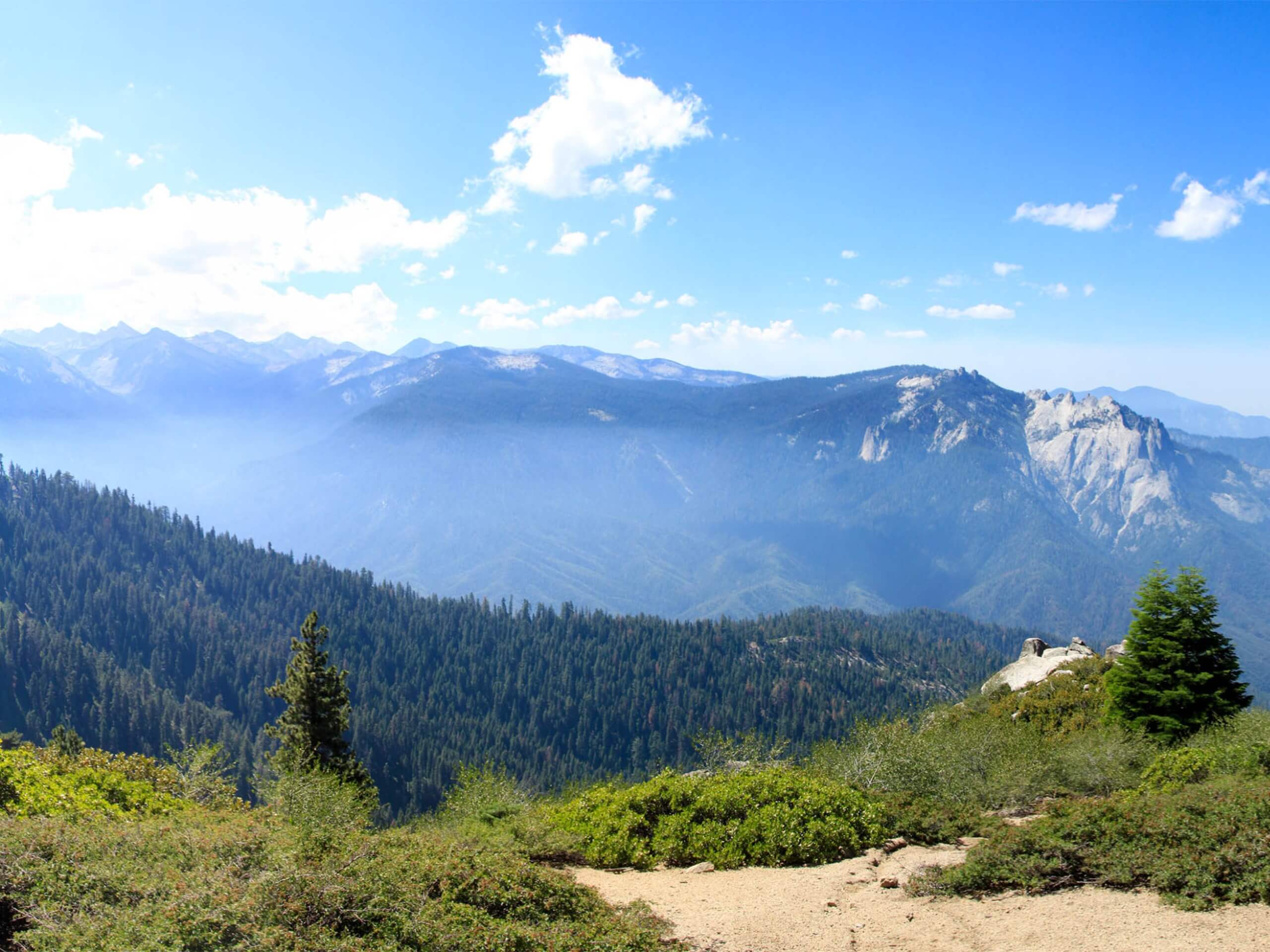
Alta Peak Trail
Difficulty Rating:
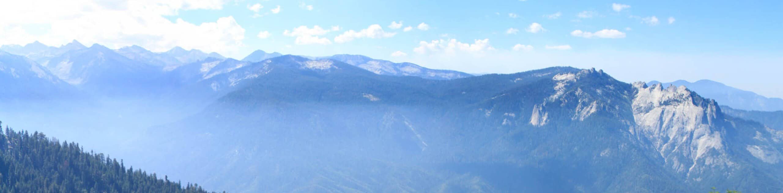
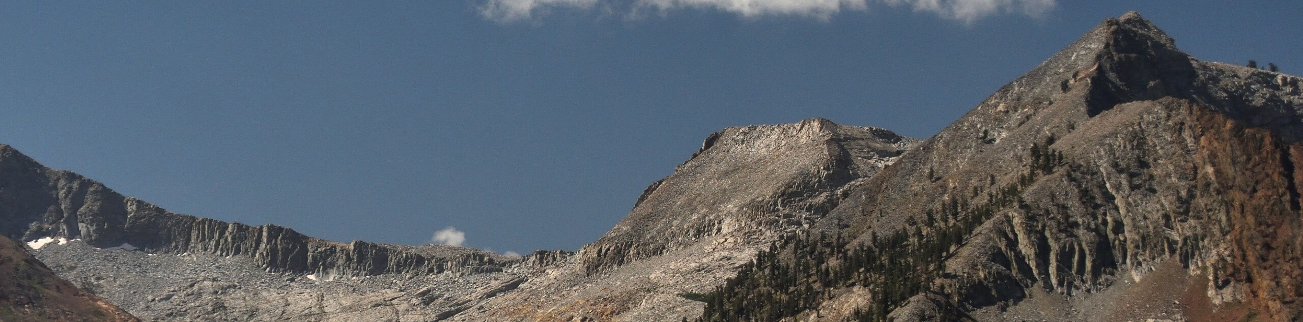
The Alta Peak Trail is an amazing adventure in the Sequoia National Park that showcases the striking beauty of the Sierra Nevada Mountains bound by the lush forestlands. Those seeking a challenging day hike or epic overnight expedition will enjoy this high-country route.
Getting there
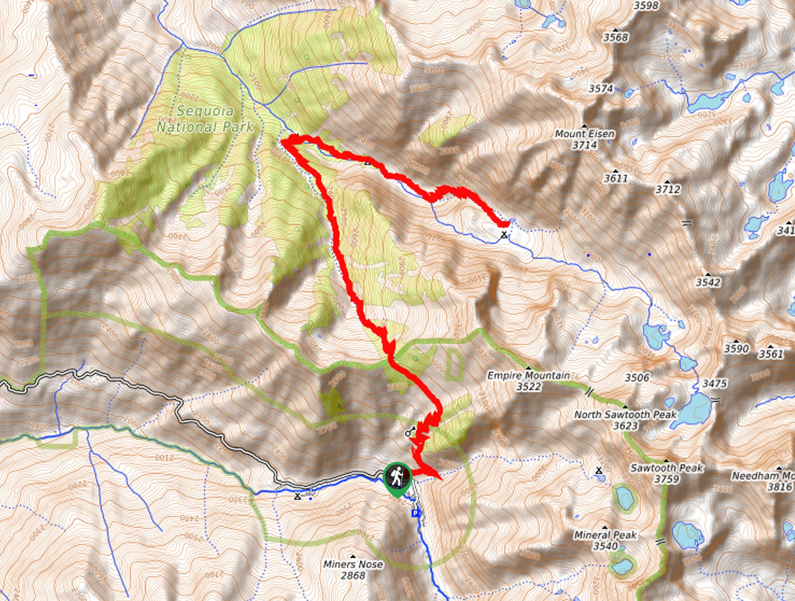
Access this hike via the Lakes Trailhead off Wolverton Road.

About
| Backcountry Campground | Backcountry Camping, wilderness permits required. |
| When to do | Year-round |
| Pets allowed | No |
| Family friendly | No |
| Route Signage | Average |
| Crowd Levels | Low |
| Route Type | Out and back |
Alta Peak Trail
Elevation Graph
Weather
Alta Peak Trail Description
Challenge yourself along the Alta Peak Trail. Though this route can be completed as a long day hike, this trek makes for an incredible backpacking trip! After securing a wilderness permit, you can camp at the Panther Gap or continue on and summit the peak, hurrying back before nightfall. Traveling at high elevations, it is important to be mindful of varying weather conditions and thunderstorms. When trekking in the winter months, crampons and trekking poles are necessary. Don’t forget to charge your camera—the scenery is unrivaled. Note the park charges an entrance fee of $35USD per vehicle or $20USD per person for pedestrians or cyclists.
Embark on your trek along the Alta Peak Hike from the Lakes Trailhead. Setting out from here, you will be guided east along Wolverton Creek. Not long after your departure will you reach an intersection, here veer right onto the Panther Gap Trail. This path will intently climb through the lush montane meadow bound by the craggy ridges. When you reach Panther Gap, turn left onto the Alta Trail over Mehrten Creek and through the alpine meadow.
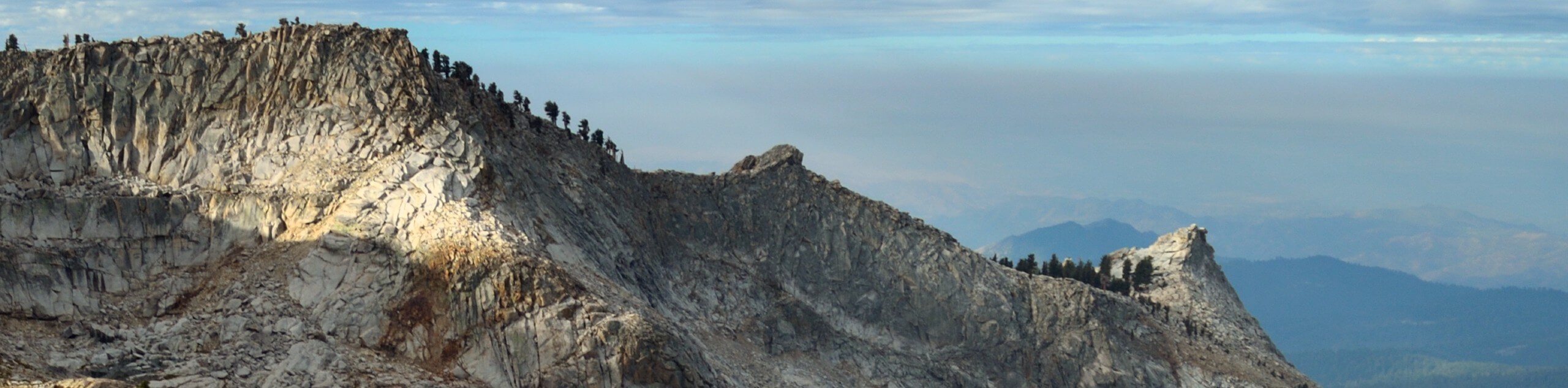
Beyond this point, the terrain will become increasingly rocky and steep, demanding careful footing and stamina. After passing Tharp’s Rock you will summit Alta Peak via a set of switchbacks. From here, you will enjoy panoramic views of the High Sierra. Revel in the striking vistas, then head back the way you came!
Similar hikes to the Alta Peak Trail hike
Mount Silliman Hike
The Mount Silliman Hike boasts the perfect opportunity to summit a Sierra Nevada Mountain. Explore the high country and revel…
Pinto Lake Trail
Beckoning the exploration of intrepid spirits and experienced hikers, the Pinto Lake Trail is a no walk in the park.…
White Chief Canyon Trail
The White Chief Canyon Trail is a beautiful adventure in the High Sierra that rewards its tired conquerors with incredible…
Comments