Loy Canyon Trail
View Photos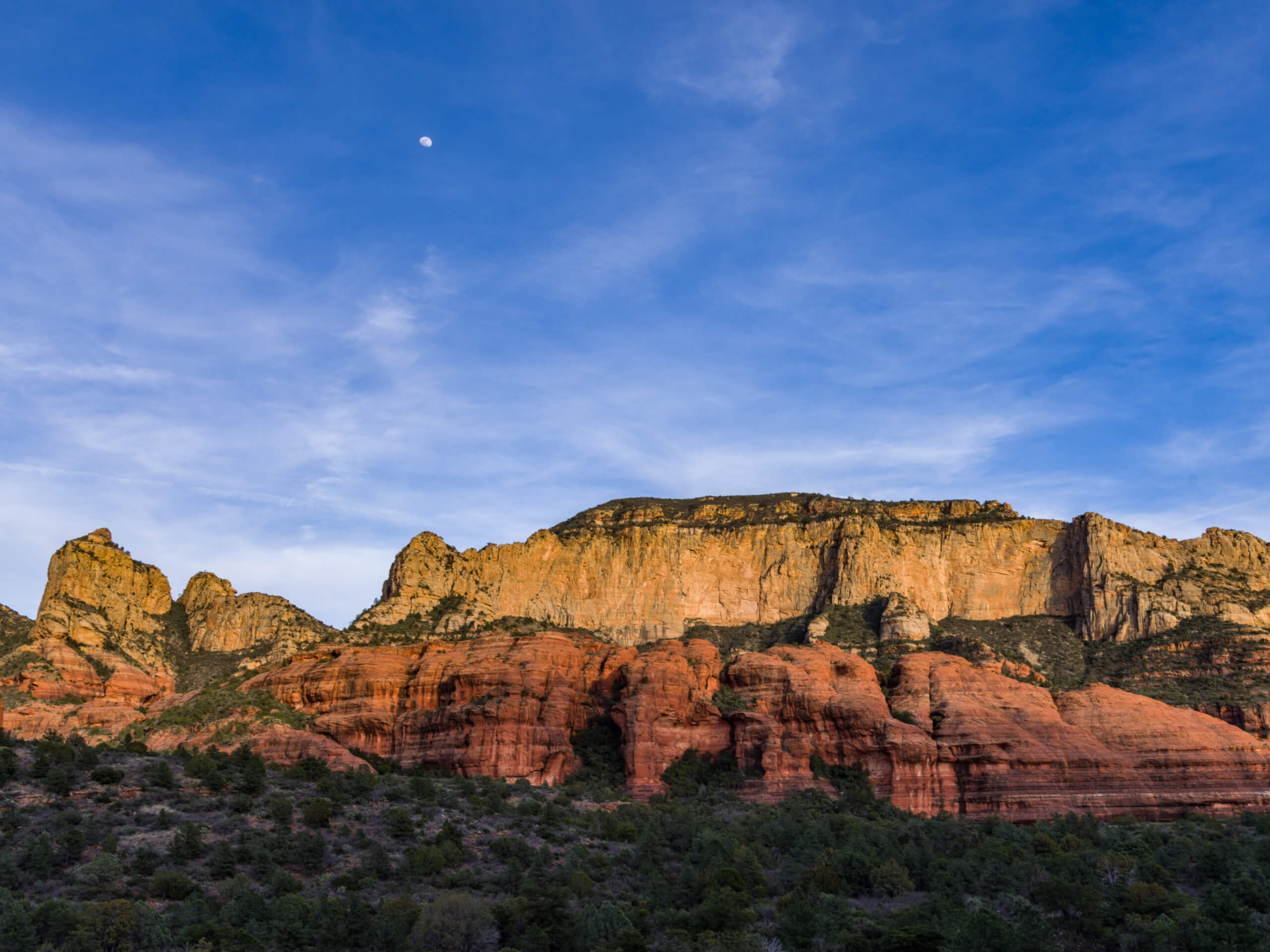
Loy Canyon Trail
Difficulty Rating:
Loy Canyon Trail is a 9.8mi hike near Sedona that sees light-moderate traffic. The hike is an adventurous one, with some routefinding, sand hiking, and a bit of bushwhacking involved. While it’s not easy going, it’s a nice break from the crowds that descend on Sedona’s other trails. Bring a downloaded GPS track and lots of water for this hard hike.
Getting there
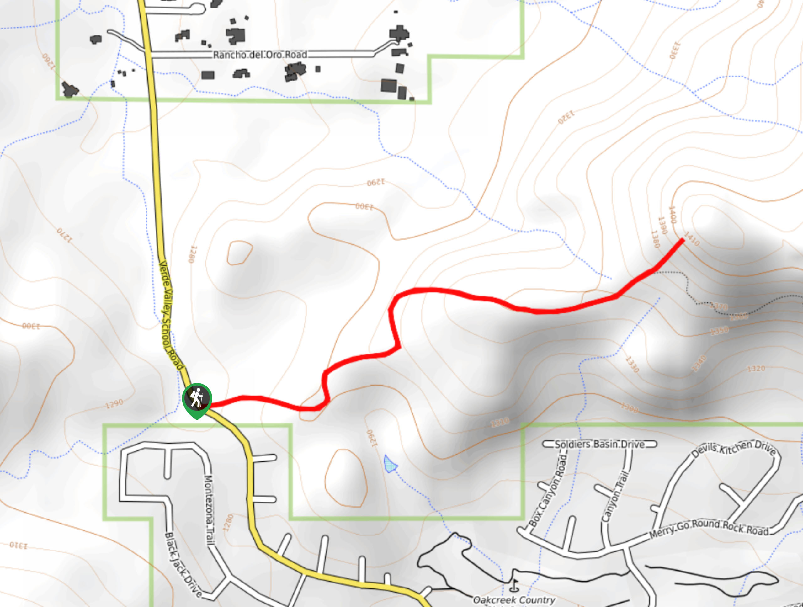
The trailhead for the Loy Canyon Trail is on N Loy Butte Road.

About
| Backcountry Campground | No |
| When to do | March-October |
| Pets allowed | Yes - On Leash |
| Family friendly | No |
| Route Signage | Poor |
| Crowd Levels | Moderate |
| Route Type | Out and back |
Loy Canyon Trail
Elevation Graph
Weather
Loy Canyon Trail Description
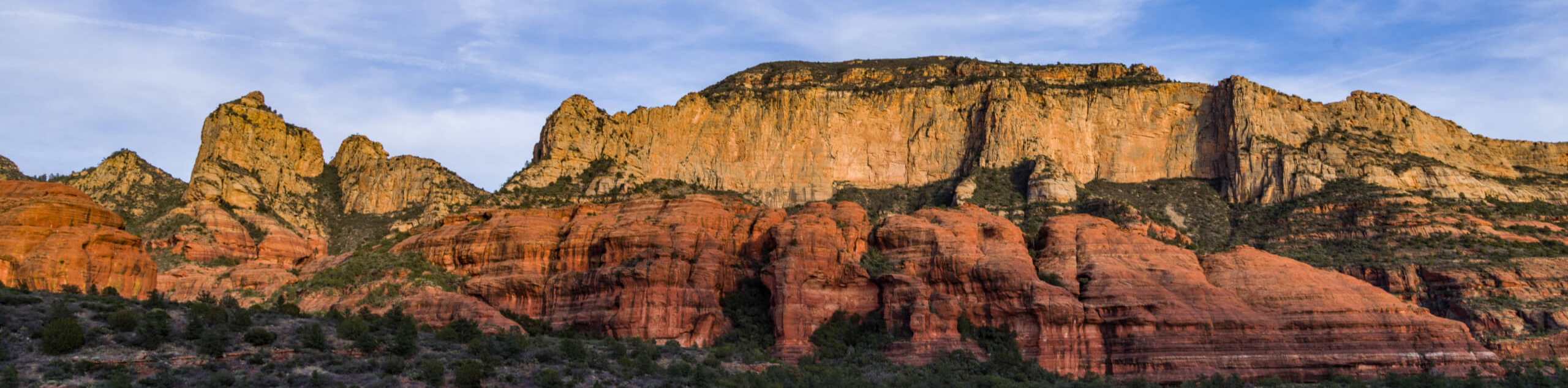
Loy Canyon is an interesting hike. It starts out in the trees without much to see and progresses through sand to a viewpoint atop the canyon. Along the way, you’ll be climbing in and out of washes and making your way through overgrown underbrush. Some hikers enjoy it a lot and some report not wanting to return. One thing’s certain though, if you want to get off the beaten path, this is a good pick.
This trail can be hard to follow at points, so a downloaded GPS map is highly recommended. Additionally, there is no water on the trail most of the year, so bring more than you think you’ll need, especially on hot days.
The trail begins from beside the road. The first 3.0mi–4.0mi miles are fairly flat and treed in. After you hit the sand and start to climb, things get more interesting. Most of the elevation gain happens in the last third of the hike as you climb up through the canyon, which can be quite rocky. Head up the left side canyon wall to cut across to Secret Mountain. The trail terminates up here, so find a viewpoint to rest up at before taking the same route back down.
Similar hikes to the Loy Canyon Trail hike

Baby Bell, Llama, and Bail Loop
The Baby Bell, Llama, and Bail Loop is a 3.6mi hike in Sedona near Bell Rock and Courthouse…

Herkenham Trail
Herkenham Trail is a 2.0mi out and back trail in the Coconino National Forest near Sedona. This route…
Transept Trail
The Transept Trail is a route less travelled in Sedona, Arizona. This hike is pretty quick and suitable for most.…
Comments