Turquoise Lake Trail
View Photos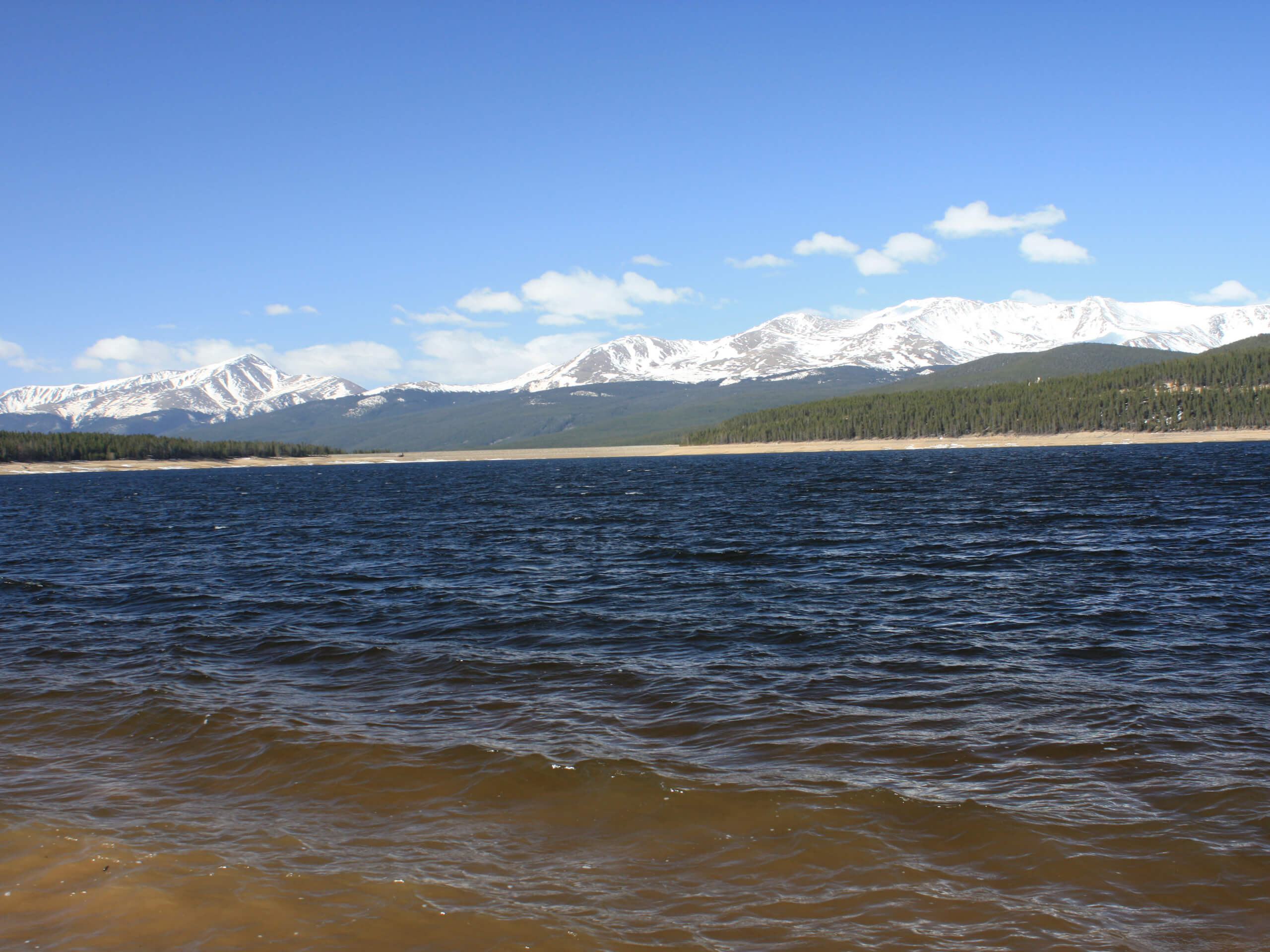
Turquoise Lake Trail
Difficulty Rating:
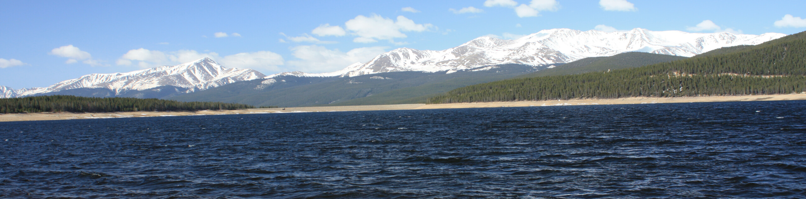
Immerse yourself in nature and enjoy sights of the snow-capped Sawatch Mountain Range peaks as you venture the Turquoise Lake Trail. This impressively scenic adventure through the high country exhibits the diversity of the Colorado wilderness. Trek along the shores of the alpine lake encircled by lodgepole pines and revel in the views of the craggy summits in the background. This unique experience is a must-add to your Leadville itinerary.
Getting there
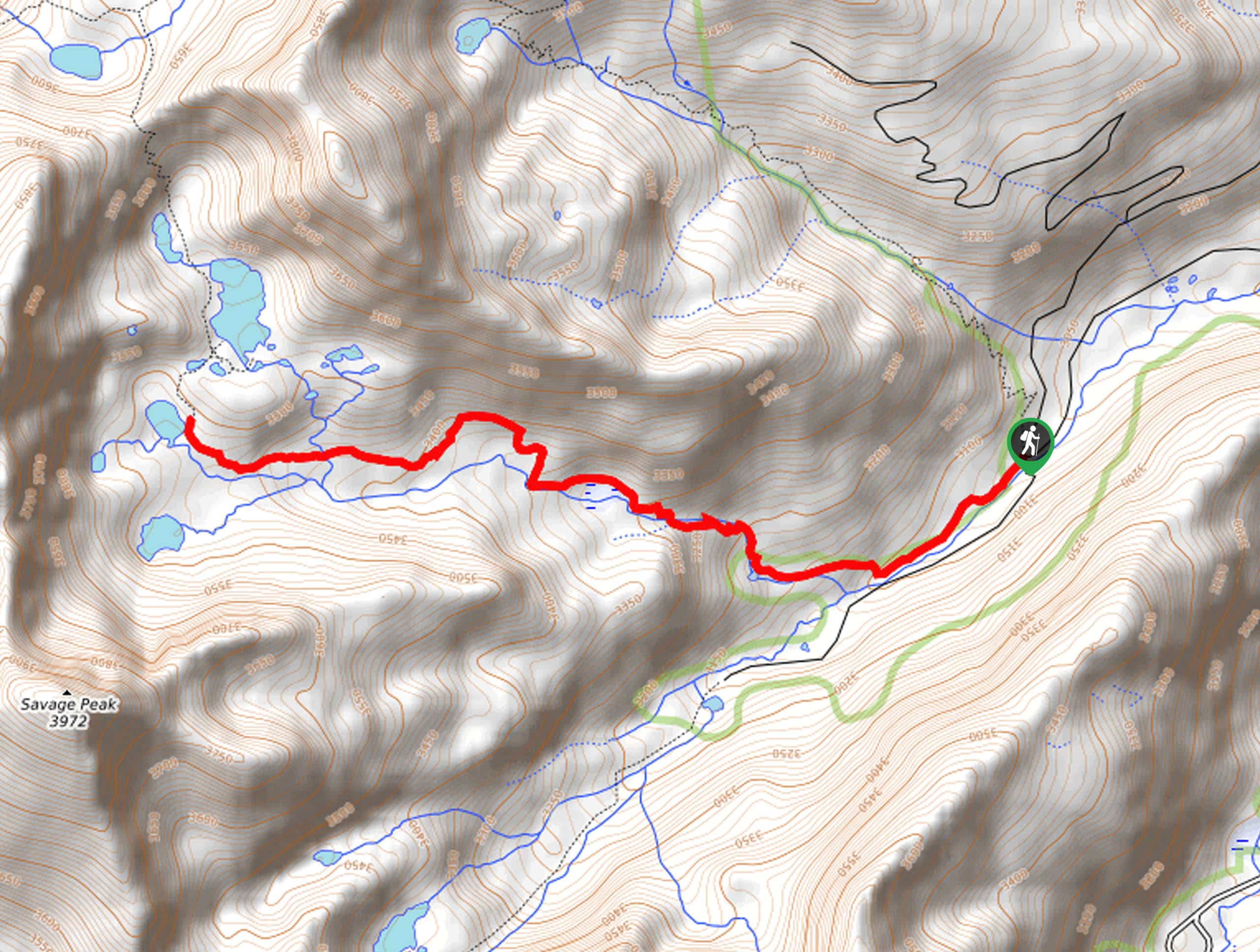
The Turquoise Lake Trail departs from the trailhead off County Road 4/Turquoise Lake Road.

About
| Backcountry Campground | Several campgrounds near the trailhead and dispersed |
| When to do | April-September |
| Pets allowed | Yes - On Leash |
| Family friendly | Yes |
| Route Signage | Good |
| Crowd Levels | High |
| Route Type | Out and back |
Turquoise Lake Trail
Elevation Graph
Weather
Turquoise Lake Trail Description
The Turquoise Lake Trail is an epic, family-friendly adventure in Colorado’s high country. Sitting at about 9843ft in elevation, this excursion presents the ideal opportunity to get acclimated to the area’s altitude prior to attempting a demanding summit hike. This revered trail is a crowd favorite, so you will undoubtedly be sharing the path with like-minded outdoor enthusiasts. If you are seeking a walk-in solitude, we suggest departing before dawn or heading to the lake in the off-season. As this path travels through the wilderness and forestlands it is important to be vigilant of wildlife—including black bears. Though the mildly undulating path is long, it can easily be customized to the hikers’ abilities by simply turning around prior to the trail’s proper end.
If you are anything like us, then you also enjoy a lakeside stroll—especially when there are mountain views involved. The Turquoise Lake Hike is an incredible adventure that will satisfy novice and experienced hikers alike. Trekking around one of the largest bodies of water in the state, the vistas, and lush wilderness are unparalleled. Enjoy the verdant lodgepole pines and fauna along the path, whilst noticing sailboats, canoes, and kayaks dotting the glittering lake. Our favorite aspect of the hike is undoubtedly the views of the snow-dusted craggy peaks that line the horizon. Shared with bikers, you will be in the company of many outdoor lovers as you trek the Turquoise Lake Trail.
Embark on your adventure along the Turquoise Lake Trail from the trailhead off the parking lot and boat launch. From here, track northeast along the Turquoise Lake Trail. The initial segment of the hike will guide adventurers past the numerous campsites along the shimmering lake’s eastern shore. As you wander, you will likely see visitors enjoying the waters by paddleboards, sailboats, canoes, and more. Follow along the water’s edge and the route will eventually divert west.
As you trek west, enjoy sights of the snow-dusted peaks towering above the tree line in the south. Now weaving between the shade of lodgepole pines, the sounds of the singing birds will lull you into a state of relaxation. Intersecting with several alpine streams along the way, this stunning adventure warrants endless photo opportunities. You will meet the trail’s end when the route meets the western trailhead. From here, revel in the sights of the Mount Massive Wilderness summits, and when you are ready to head back, simply retrace your footing along the path to the trailhead. If you are seeking a change of scenery, you can loop back along the shoulder of the Turquoise Lake Road back to your starting point.
Trail Highlights
Turquoise Lake
Turquoise Lake is an extremely popular high country recreation area near Leadville, Colorado. The human-made reservoir sits at about 10000ft of elevation in the San Isabel National Forest. Ranked 13th on the list of Colorado’s biggest lakes, this body of water is pretty impressive. With over 300 campsites along the lake, this area is a frequent weekend escape in the summer months.
Though many attribute the name to the lake’s blue-hue, it was actually named for the area’s turquoise mines. Though the lake is believed to have been naturally occurring, in the 19th century it was dammed to provide water to the mining operations. Today the lake remains managed by the Sugar Loaf Dam, which was completed in 1968. If you have time, Turquoise Lake is a must-visit when in the Leadville area.
Frequently Asked Questions
Can you swim in Turquoise Lake, Colorado?
Yes, swimming is permitted in Turquoise Lake, but the alpine water is extremely chilly!
Can you drive around Turquoise Lake?
Yes, the Turquoise Lake Road is a lovely drive through forests and along the shoreline that reveals stunning mountain views.
Are dogs allowed at Turquoise Lake?
Yes, dogs are permitted at Turquoise Lake and along the trails if they remain on-leash.
How long is the Turquoise Lake Trail?
The Turquoise Lake Trail travels over 10.6mi along the northeastern side of the lake, but the hike can be customized to the hiker’s needs and abilities.
Insider Hints
On a warm day, a dip in the chilly alpine waters can be refreshing
Consider camping at one of the many campgrounds along the lake and be the first one on the trail in the morning
Grab a kayak or canoe and enjoy the shimmering lake from a different perspective
When the snow flies, trade your hiking boots for snowshoes or cross-country skis to enjoy this scenic adventure year-round
Grab a coffee and a sweet treat at City on a Hill Coffee in Leadville after your walk
Similar hikes to the Turquoise Lake Trail hike
Village Creek Trail
Explore the Beaver Creek Ski Resort and revel in the vibrance of the encompassing woodlands as you venture the Village…
Sopris Lake via Brady Lake Trail
Immerse yourself in the jaw-dropping scenery that the Swatch Mountain Range has to offer, as you venture to Sopris Lake…
First Missouri Lake Trail
The First Missouri Lake Trail is a stunning day hike into Colorado’s high country. Explore the alpine terrain and revel…
Comments