Mount Princeton Chalet to Summit Hike
View Photos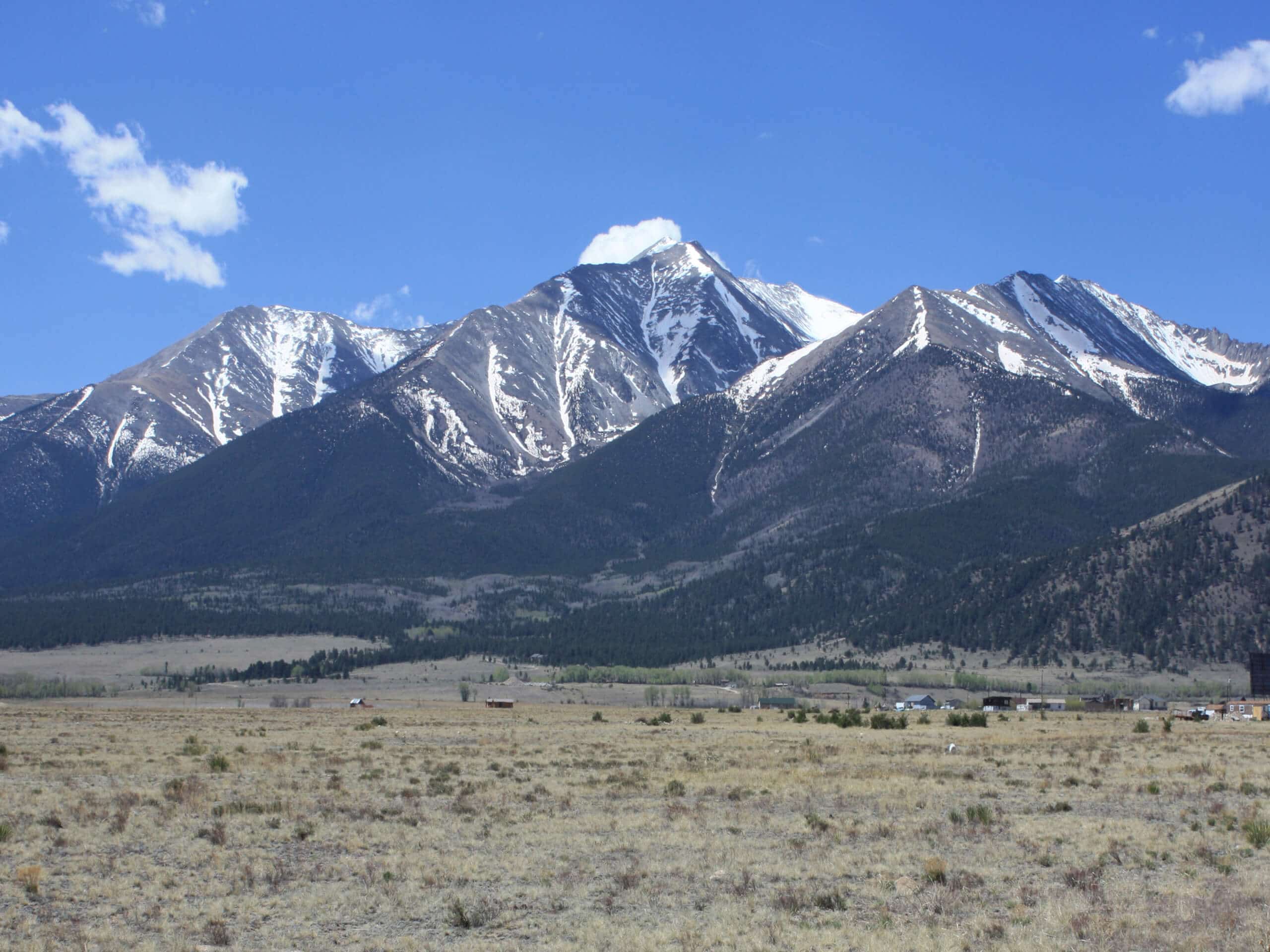
Mount Princeton Chalet to Summit Hike
Difficulty Rating:
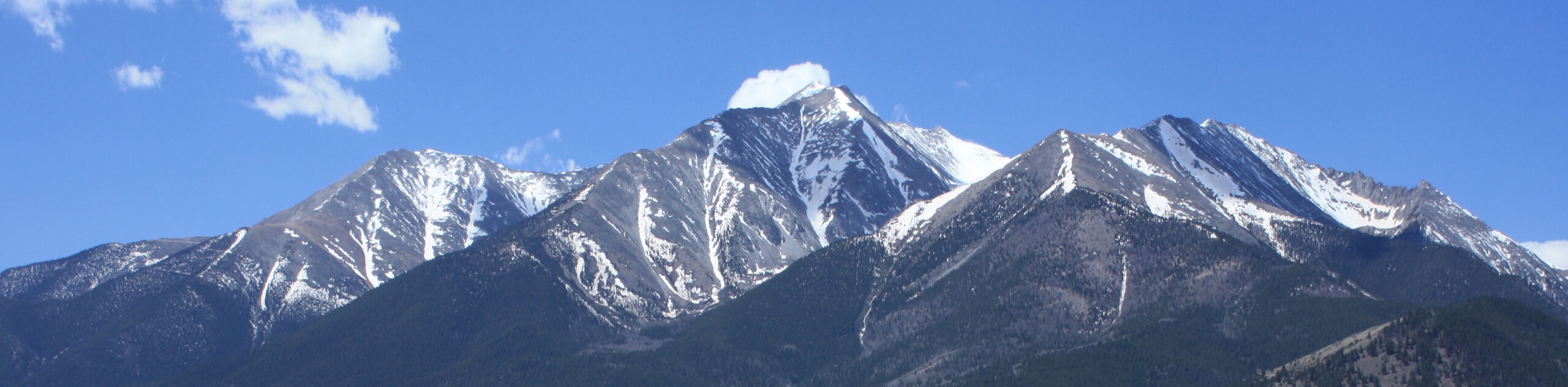
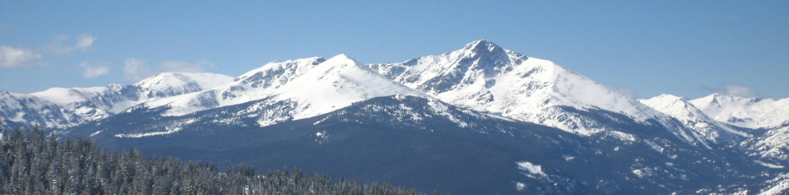
Put your endurance to the test as you climb up to one of Colorado’s highest peaks. The Mount Princeton Chalet to Summit Hike is an exciting excursion that exhibits panoramic vistas of the Sawatch Mountain Range’s snow-capped peaks. This hike is a must-add to your adventure list.
Getting there
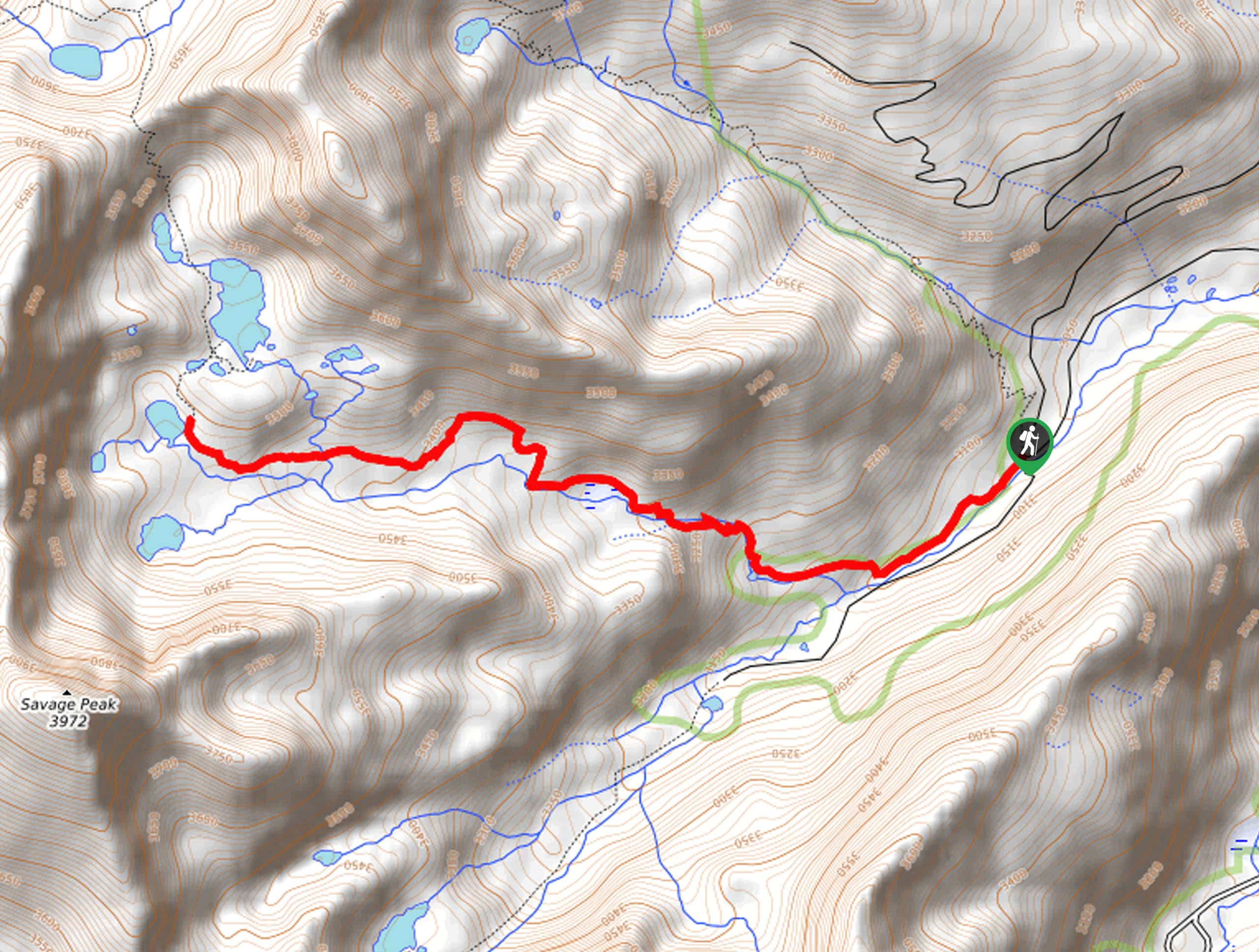
The Mount Princeton Chalet to Summit Hike departs from the Chalet and Lucky Mine off the Lucky Mine Road.

About
| Backcountry Campground | No |
| When to do | June-October |
| Pets allowed | Yes - On Leash |
| Family friendly | No |
| Route Signage | Average |
| Crowd Levels | High |
| Route Type | Out and back |
Mount Princeton Chalet to Summit Hike
Elevation Graph
Weather
Mount Princeton Chalet to Summit Hike Description
Explore Colorado’s high country as you trek the Mount Princeton Chalet to Summit Hike up to a famous Collegiate Peak. Traveling through the vibrant alpine, the exposed terrain reveals 360-degree vistas, but can also bring extreme weather. Be sure to check the forecast prior to your climb and summit before noon to mitigate the chances of getting caught in an afternoon storm. Additionally, be sure to strap on some microspikes and consider trekking poles to navigate the vertiginous terrain more easily when hiking in the autumn and winter months.
Embark on your adventure along the Mount Princeton Chalet to Summit Trail from the Mount Princeton Trailhead off Lucky Mine Road. From here, the Mount Princeton Trail travels west through the meadowlands and along the rocky terrain. As you trek this demanding route you will be distracted by the breathtaking alpine views. Carefully navigate the steep terrain and you will eventually summit the impressive peak.
From the summit of the Colorado 14er, you will be granted sweeping views of the neighboring snow-dusted summits that flank the verdant woodlands below. Revel in the views and take plenty of photos before beginning your descent. When you are ready, retrace your steps along the route back to the trailhead to mark the end of your adventure.
Similar hikes to the Mount Princeton Chalet to Summit Hike hike
Mount of the Holy Cross Loop Trail
Hike up to one of the most famous Colorado 14ers along the Mount of the Holy Cross Loop Trail. This…
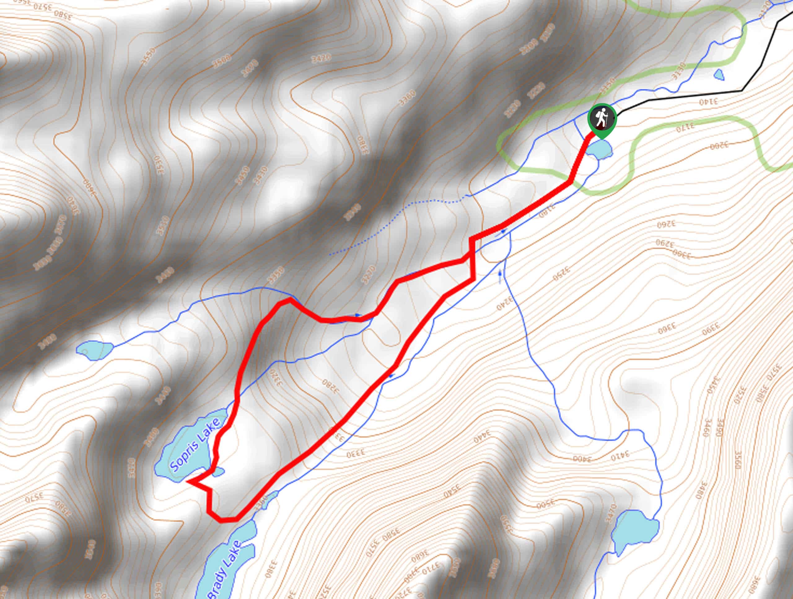
Sopris Lake via Brady Lake Trail
Immerse yourself in the jaw-dropping scenery that the Swatch Mountain Range has to offer, as you venture to Sopris Lake…
First Missouri Lake Trail
The First Missouri Lake Trail is a stunning day hike into Colorado’s high country. Explore the alpine terrain and revel…
Comments