
Lamphier Lake Trail
View Photos
Lamphier Lake Trail
Difficulty Rating:
The Lamphier Lake Trail is an amazing adventure through Colorado’s high country that you are not going to want to miss out on. Indulge yourself in the beauty of the alpine scenery as you get your heart rate up trekking to the shimmering lakes. We love this route, and we know you will too!
Getting there
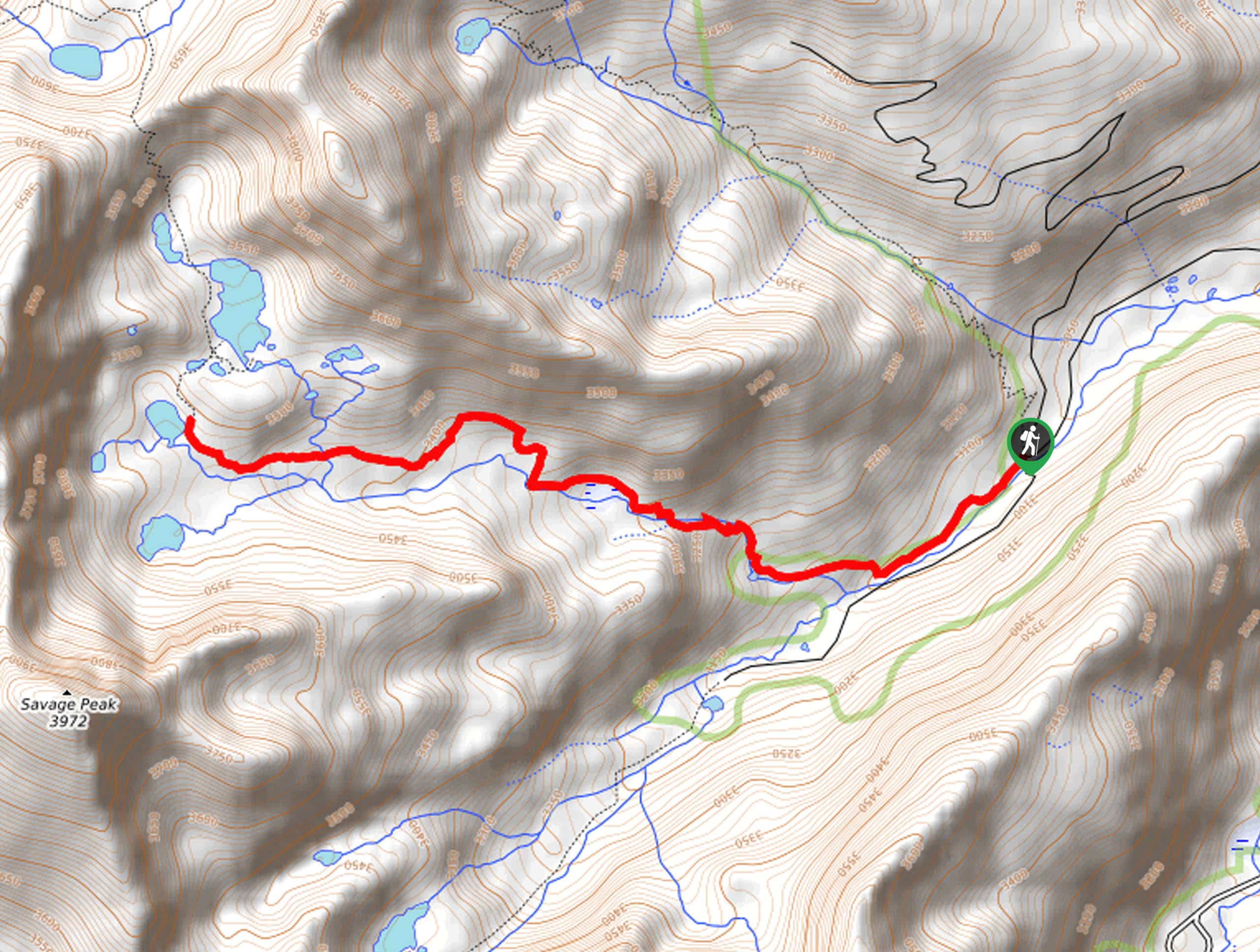
The Lamphier Lake Trail is accessed via the South Lottis Trailhead off Gold Creek Road.

About
| Backcountry Campground | Dispersed Backcountry Camping |
| When to do | April-October |
| Pets allowed | Yes - On Leash |
| Family friendly | Yes |
| Route Signage | Average |
| Crowd Levels | Moderate |
| Route Type | Out and back |
Lamphier Lake Trail
Elevation Graph
Weather
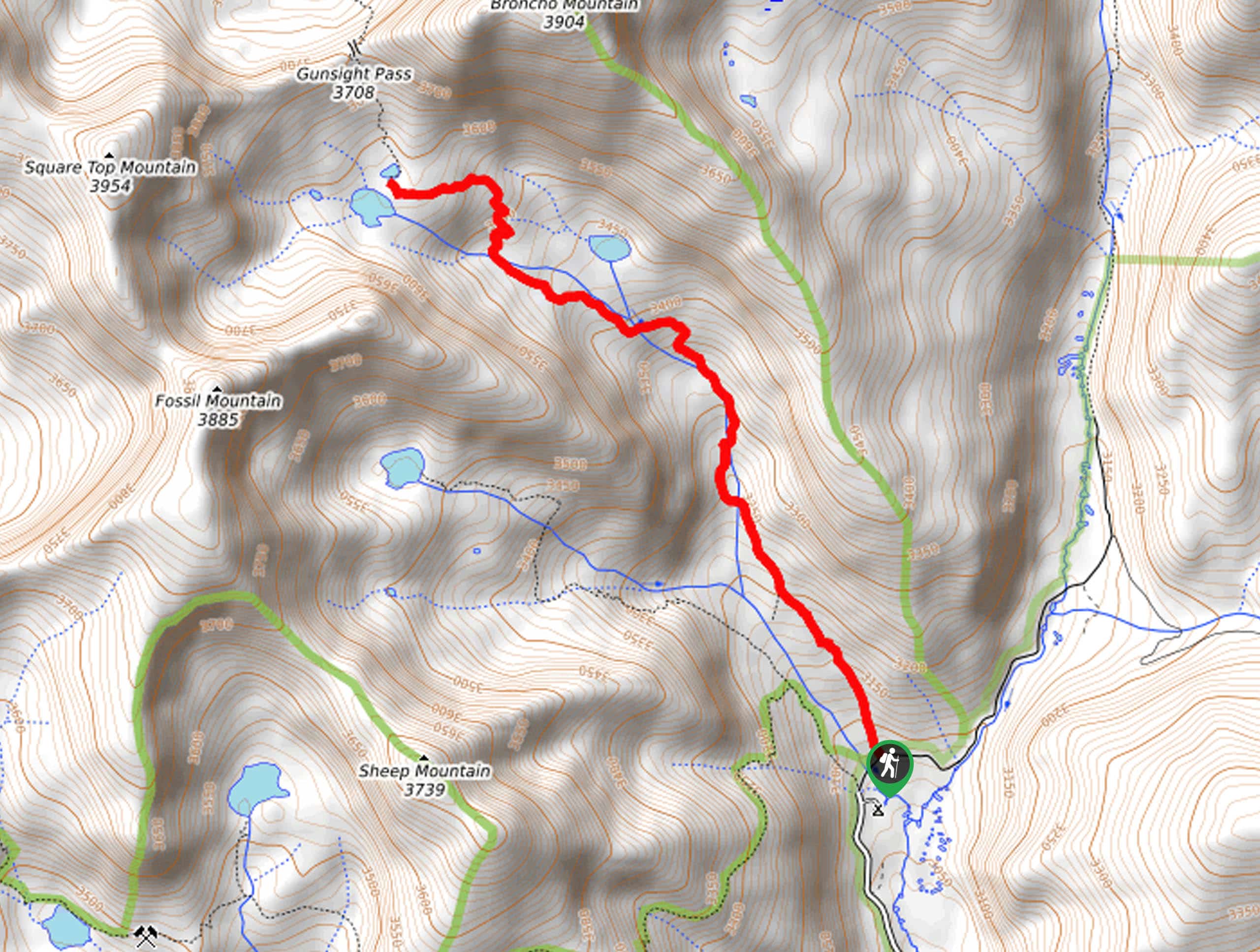
Lamphier Lake Trail Description
The Lamphier Lake Hike is a must-add to your Colorado hiking itinerary. Immerse yourself in the dense pine woodlands as you venture up into the alpine tundra, where you will find a stunning lake in a mountain basin. With unforgettable scenery, low levels of foot traffic, and mountain views, this adventure couldn’t get much better! Note: there are steep sections of the path, but they are manageable, especially if you have sturdy hiking footwear and trekking poles.
Begin your journey along the Lamphier Lake Trail from the South Lottis Trailhead. From here, you will want to take the South Lottis Trail in a northwestern direction beneath the timberline. Enjoy the tree shade as you climb along the curves of Lampier Creek. Let the meditative sounds of the gurgling waters lull you into a state of relaxation as you climb through the woodlands. Soon, you will pass Lower Lamphier Lake before ascending several switchbacks up to Lamphier Lake.
Revel in the sight of the waters mirroring the Square Top Mountain above. Take your time to appreciate and admire the views of the alpine lake that is bounded by towering cliffs, before beginning your return. To get back to the trailhead, simply backtrack along the path.
Similar hikes to the Lamphier Lake Trail hike
Village Creek Trail
Explore the Beaver Creek Ski Resort and revel in the vibrance of the encompassing woodlands as you venture the Village…
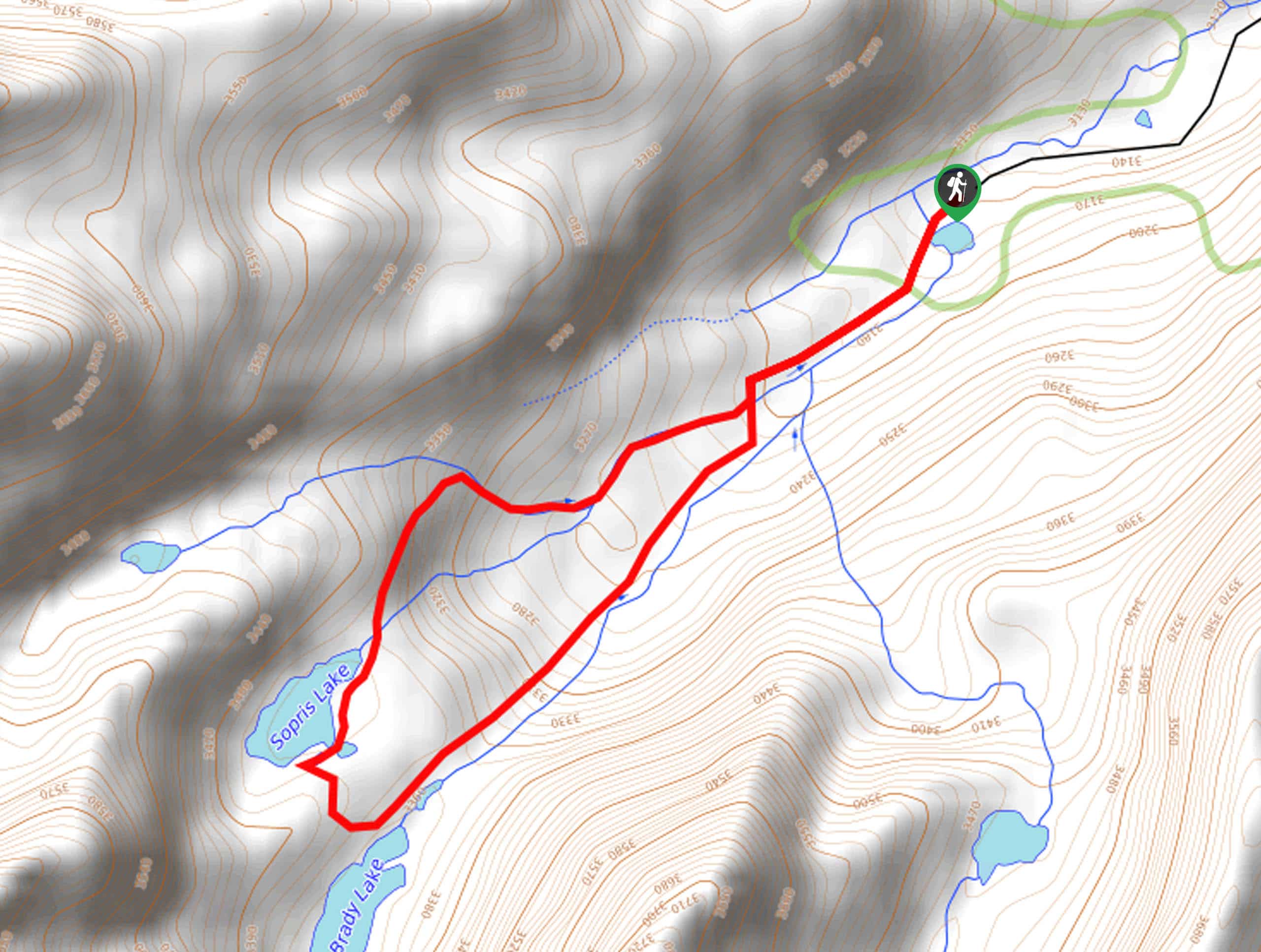
Sopris Lake via Brady Lake Trail
Immerse yourself in the jaw-dropping scenery that the Swatch Mountain Range has to offer, as you venture to Sopris Lake…
First Missouri Lake Trail
The First Missouri Lake Trail is a stunning day hike into Colorado’s high country. Explore the alpine terrain and revel…
Comments