Huron Peak North Trail
View Photos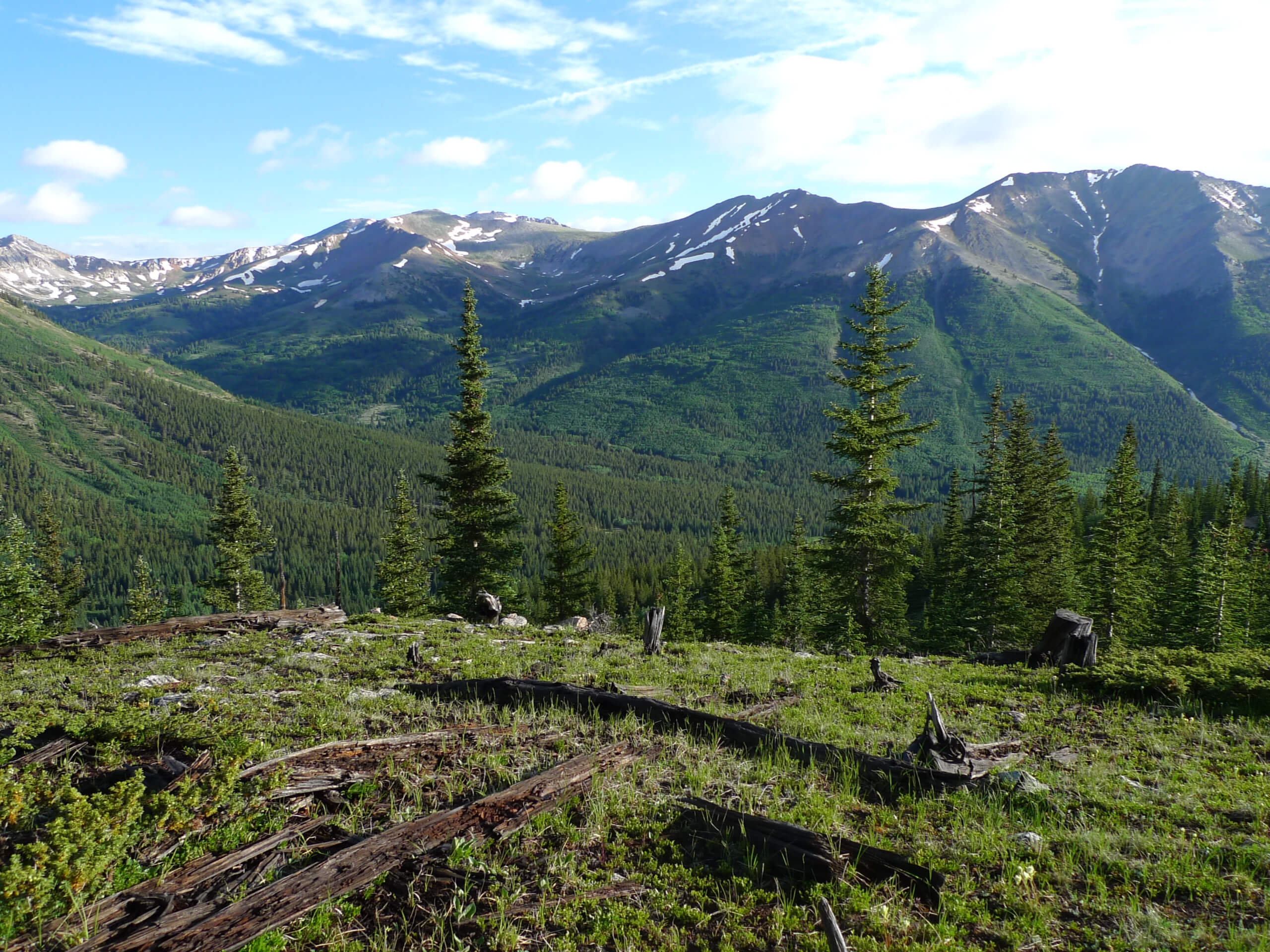
Huron Peak North Trail
Difficulty Rating:
The Huron Peak North Trail is an epic adventure up to the summit of a Colorado fourteener (14er) in the Sawatch Mountain Range. Immerse yourself in the mountainous landscape and revel in the vistas of the neighboring snow-capped peaks. Perfect for an introductory hike to 14er ascents, the Huron Peak North Trail is easy to navigate and only requires a Class 2 scramble up to the summit.
Getting there
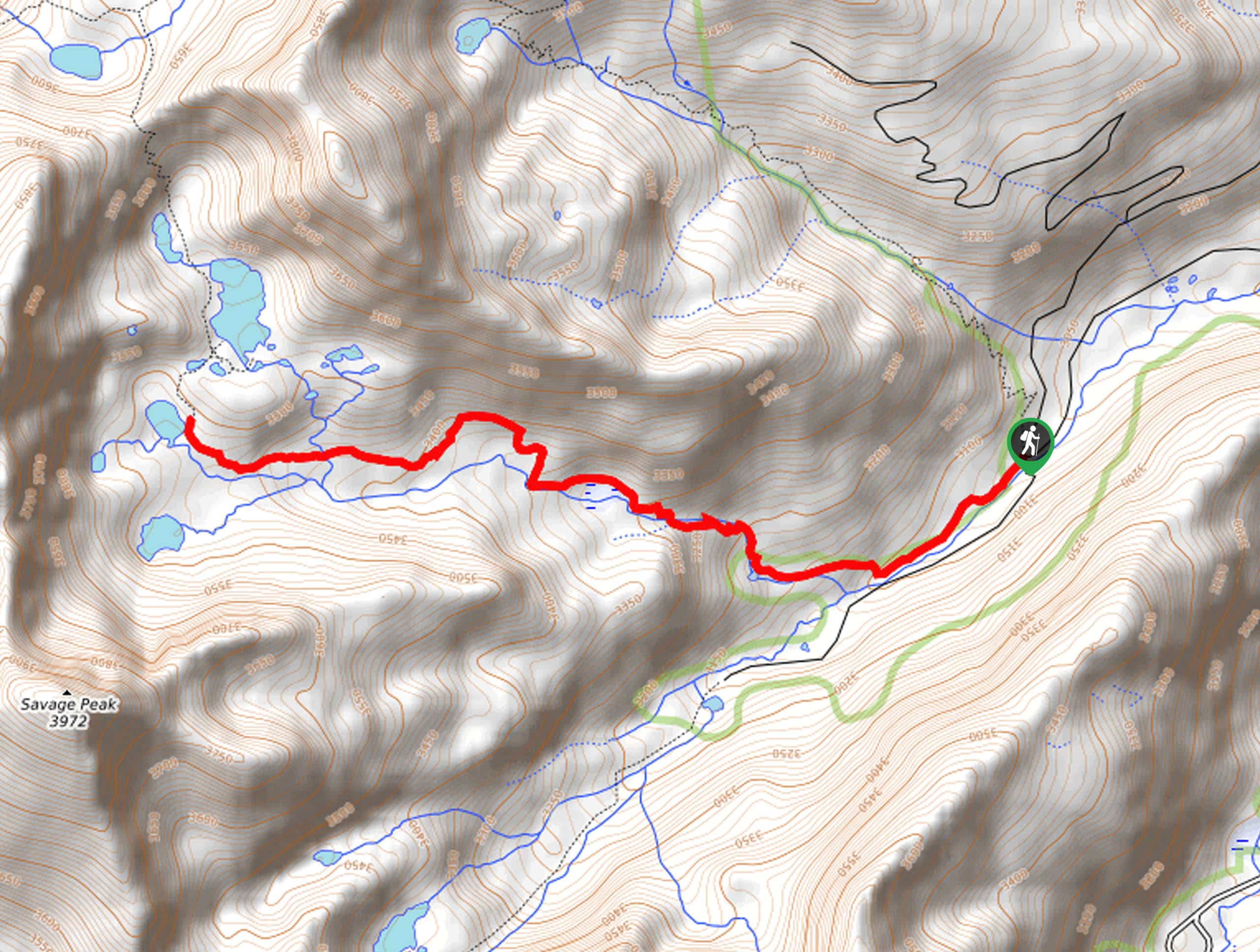
The Huron Peak North Trail departs from the trailhead off Clear Creek Road.

About
| Backcountry Campground | Dispersed backcountry camping |
| When to do | May-September |
| Pets allowed | Yes - On Leash |
| Family friendly | No |
| Route Signage | Average |
| Crowd Levels | High |
| Route Type | Out and back |
Huron Peak North Trail
Elevation Graph
Weather
Huron Peak North Trail Description
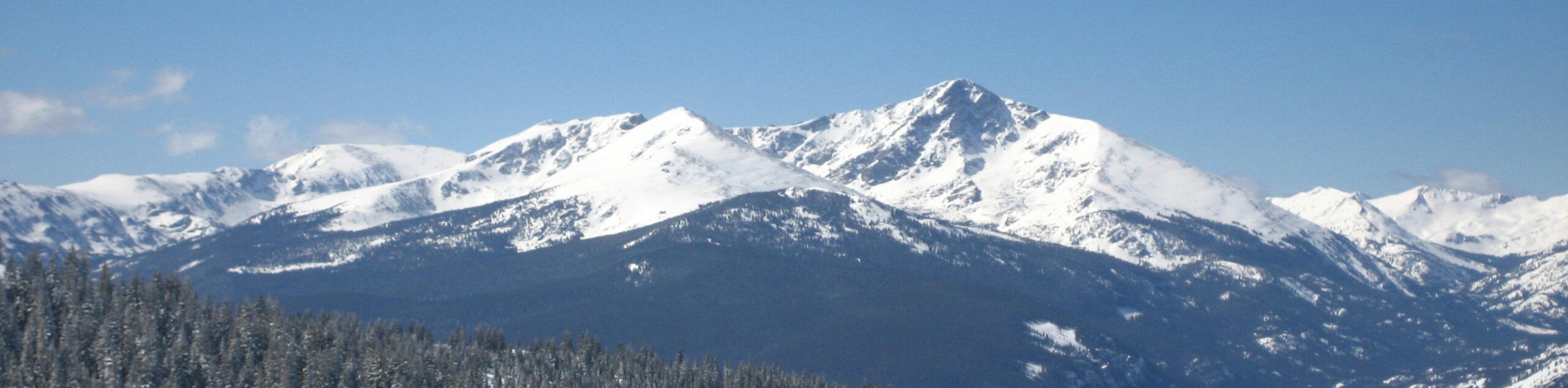
The Huron Peak North Trail is a wonderful adventure in the San Isabel National Forest. Though not as challenging as other Colorado 14ers, this hike does require some endurance. Traveling to such high altitudes exposes astounding vistas, but it can also be hard on the body if you are not acclimated, so make sure you spend some time in the area before attempting a vertiginous ascent. Additionally, it is important to head out at dawn to summit the barren peak before noon, mitigating the chances of getting caught in an afternoon storm. Keep an eye on the skies as you walk and if you see some scary clouds, then head back below the timberline. When hiking in the winter months, be sure to wear crampons and consider trekking poles to help you safely navigate the likely icy and snow-packed terrain. Note the road to the trailhead requires a 4×4 vehicle with high ground clearance.
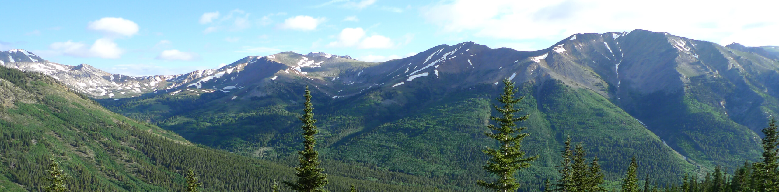
Though demanding, the Mount Huron North Trail is worth the effort. Exhibiting the diversity and beauty of the Colorado wilderness, this stunning route passes through dense evergreen forests, along snowmelt streams, and through vibrant alpine tundras all before arriving at the summit. This incredible hike packs a punch and you undoubtedly will be overwhelmed by a sense of personal achievement once you ascend the peak. Get out of your comfort zone as you trek through Colorado’s high country, which reveals awe-inspiring vistas of the surrounding mountainous topography.
Embark on your expedition along the Mount Huron North Trail from the trailhead on Clear Creek Road. Departing from the trailhead, follow the North Huron Trail southeast, almost immediately intersecting with an alpine creek. Cross the gurgling waters and continue your hike through the evergreen forest. Enjoy the tree shade while you can as the route diverts east up several switchbacks through a valley. Navigate the seemingly endless winding path above the timberline.
Once you graduate the treeline the path will open into an expansive alpine meadow dotted with wildflowers in the summer months. Now wandering through a basin, you will have a quick break from the climb as you travel through the tundra that reveals commanding views of Browns Peak in the northeast and sights of Mount Huron towering above. This is a great place to rest and rehydrate before commencing your final push. Assess the skies, and if they are all clear, continue along the North Mount Huron Trail through the vibrant alpine tundra.
The terrain will become increasingly vertiginous and rocky as you near the summit. Navigate another set of tightly wound switchbacks up to the top of Huron Peak. From atop the Colorado 14er, revel in the views of the Three Apostles in the south: Ice Mountain, North Apostle, and South Apostle, and sights of the dozen other snow-capped Sawatch Mountain Range summits. Across the saddle in the north, you will be rewarded up close and personal vistas of Browns Peak, Middle Mountain, and Cross Mountain. Appreciate the grandeur of Colorado’s mountainous wilderness, and when you are ready, retrace your footing along the path back to the trailhead.
Trail Highlights
Mount Huron
Mount Huron is a Colorado 14er in the Sawatch Mountain Range that just barely made the benchmark. Sitting at an elevation of 14003ft, this impressive peak ranks 51st on the list of the highest mountains in the Rockies. Located in the Collegiate Peaks Wilderness of the San Isabel Forest, it is said that the summit of Mount Huron presents one of the most scenic overlooks of Colorado’s mountainous wilderness. This stunning mountain also has a sad history. In 1994, a helicopter went down on the side of the mountain while trying to rescue a hiker with a broken ankle, killing the pilot and on-flight nurse.
Frequently Asked Questions
How long does it take to hike the Huron Peak North Trail?
The answer varies greatly, but generally, the hike up to Huron Peak takes between 4.5-6.5hrs.
Is the Huron Peak North Trail hard?
Yes, the Huron Peak North Trail is rated as a difficult hike.
Is Huron Peak a Colorado 14er?
Yes, Huron Peak is a Colorado 14er that sits at 14003ft of elevation.
Are dogs allowed on Mount Huron?
Yes, dogs on-leash are permitted on Mount Huron.
Insider Hints
Make sure you are acclimated to the area’s high altitude prior to your trek or bring along oxygen
Microspikes are necessary for the fall and winter months
Charge up your camera before your hike, because you are going to want pictures of the stunning panoramas
Consider trekking poles to help navigate the steep terrain
Try to summit the peak before noon and wear layers
Pack plenty of water—this hike will tire you
Similar hikes to the Huron Peak North Trail hike
Mount of the Holy Cross Loop Trail
Hike up to one of the most famous Colorado 14ers along the Mount of the Holy Cross Loop Trail. This…
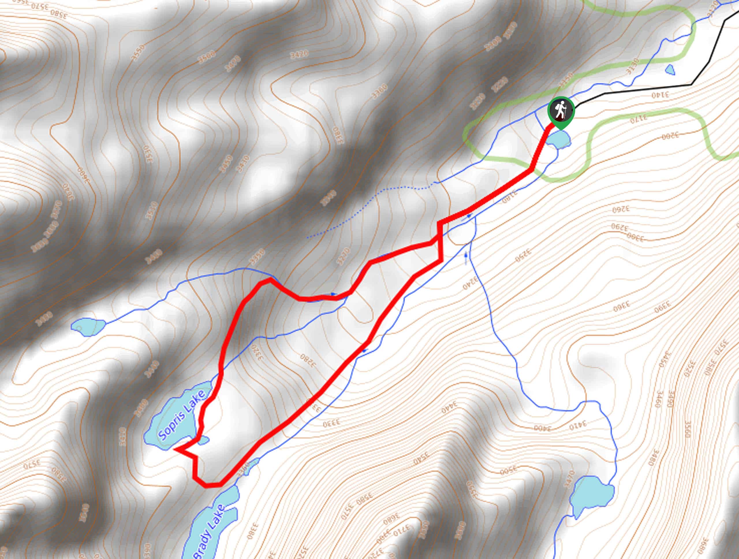
Sopris Lake via Brady Lake Trail
Immerse yourself in the jaw-dropping scenery that the Swatch Mountain Range has to offer, as you venture to Sopris Lake…
First Missouri Lake Trail
The First Missouri Lake Trail is a stunning day hike into Colorado’s high country. Explore the alpine terrain and revel…
Comments