Storm Pass Trail
View Photos
Storm Pass Trail
Difficulty Rating:
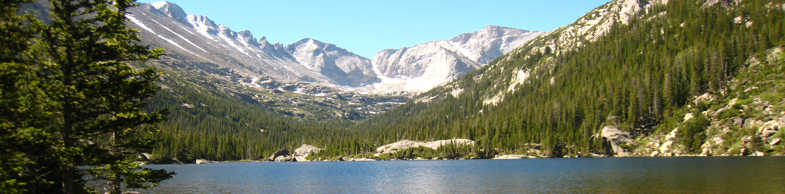
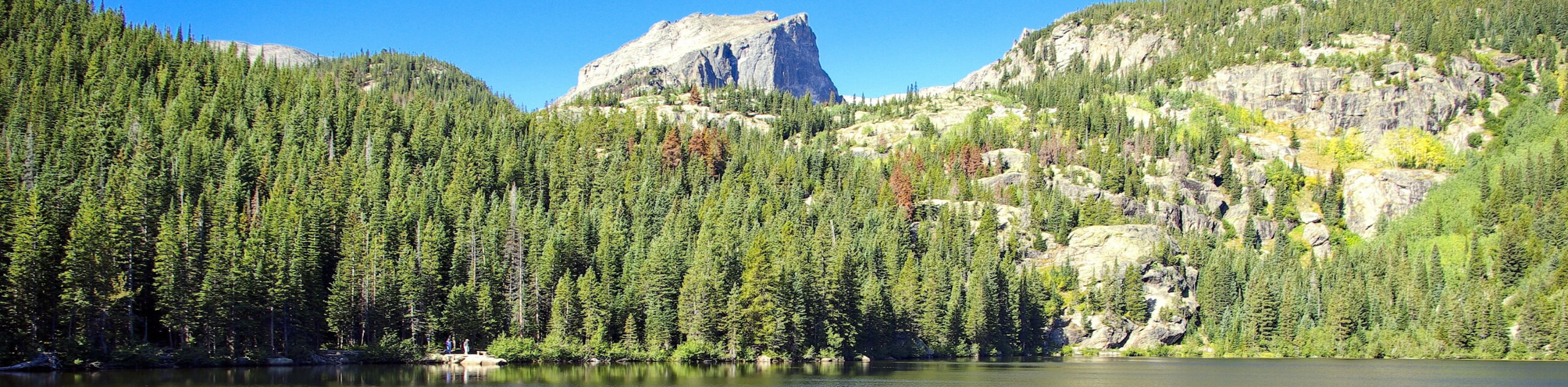
Leave the city in the rear-view mirror and head into the wilderness on the Storm Pass Trail. Located within the Rocky Mountain National Park, this adventure exhibits all the best typographies of the Colorado Front Range. Hike through dense forests, along vast meadows, over glacier streams and to stunning park overlooks. This excursion is a must add to your Colorado adventure list.
Getting there
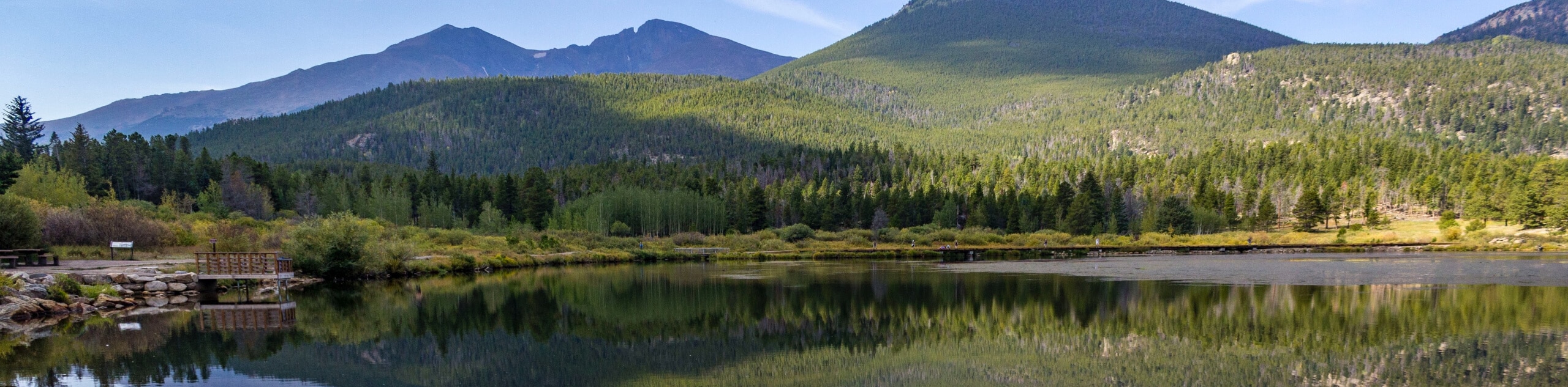
The Storm Pass Trail departs from Lily Lake off S St. Vrain Ave.

About
| Backcountry Campground | Designated Dispersed Campsites, view details here. |
| When to do | June-September |
| Pets allowed | No |
| Family friendly | No |
| Route Signage | Average |
| Crowd Levels | Moderate |
| Route Type | Out and back |
Storm Pass Trail
Elevation Graph
Weather
Storm Pass Trail Description
The Storm Pass Trail is a demanding, but highly rewarding hike through the Rocky Mountain National Park. If you are seeking a long, less demanding hike than a summit trail, then you have found your match. Ensure you are acclimated to the area’s high elevation prior to completing this hike and ensure to wear sturdy footwear. Though trekking poles are not necessary, they can be useful when navigating steep segments of the path. Located within the Rocky Mountain National Park (RMNP), hikers are required to purchase a park pass. What are you waiting for? Lace up those shoes and grab your water bottle because we are hiking the Storm Pass Trail.
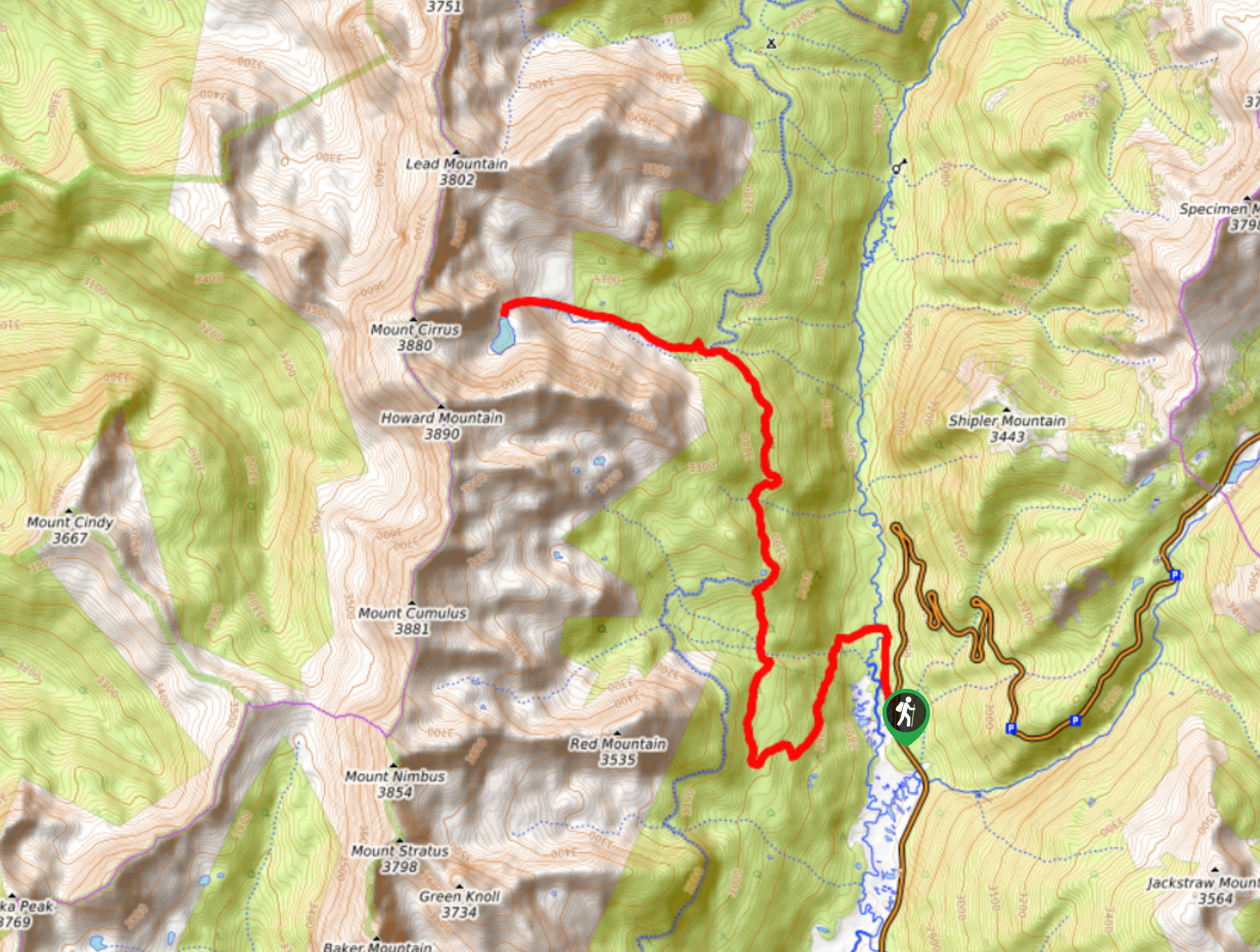
Begin your journey along the Storm Pass Trail from the Lily Lake Trailhead. From here, track the Storm Pass Trail southwest. Cross Aspen Brook and ascend the steep path to Estes Cone. Then the trail gradually descends until the turnaround point. Enjoy the mountainous vistas from atop the pass and notice Longs Peak in the southwest. Hike along the increasingly forested terrain, past several streams and dispersed campsites. As you near the trails end there will be plenty of intersecting paths, ignore these and maintain along the Storm Pass Trail. Soon, you will pass Sprague Lake and cross Glacier Creek before arriving at the trail’s end.
When you encounter Bear Lake Road you will know you have met the trail’s end. If you left a car on this side of the path or arranged for pickup, then your journey is over! If not, simply retrace your steps along the route all the way back to the parking lot and trailhead.
Similar hikes to the Storm Pass Trail hike
Lake of the Clouds Hike
The Lake of the Clouds Hike is a picturesque adventure on the western border of the Rocky Mountain National Park.…
The Spearhead Hike
The Spearhead Hike is a demanding but awesome hike in the Rocky Mountain National Park. Ascend the Glacial Gorge past…
Bear Lake to North Inlet Hike
The Bear Lake to North Inlet Hike is a demanding one-way excursion across the Rocky Mountain National Park. This challenging…
Comments