Mount Ida Trail
View Photos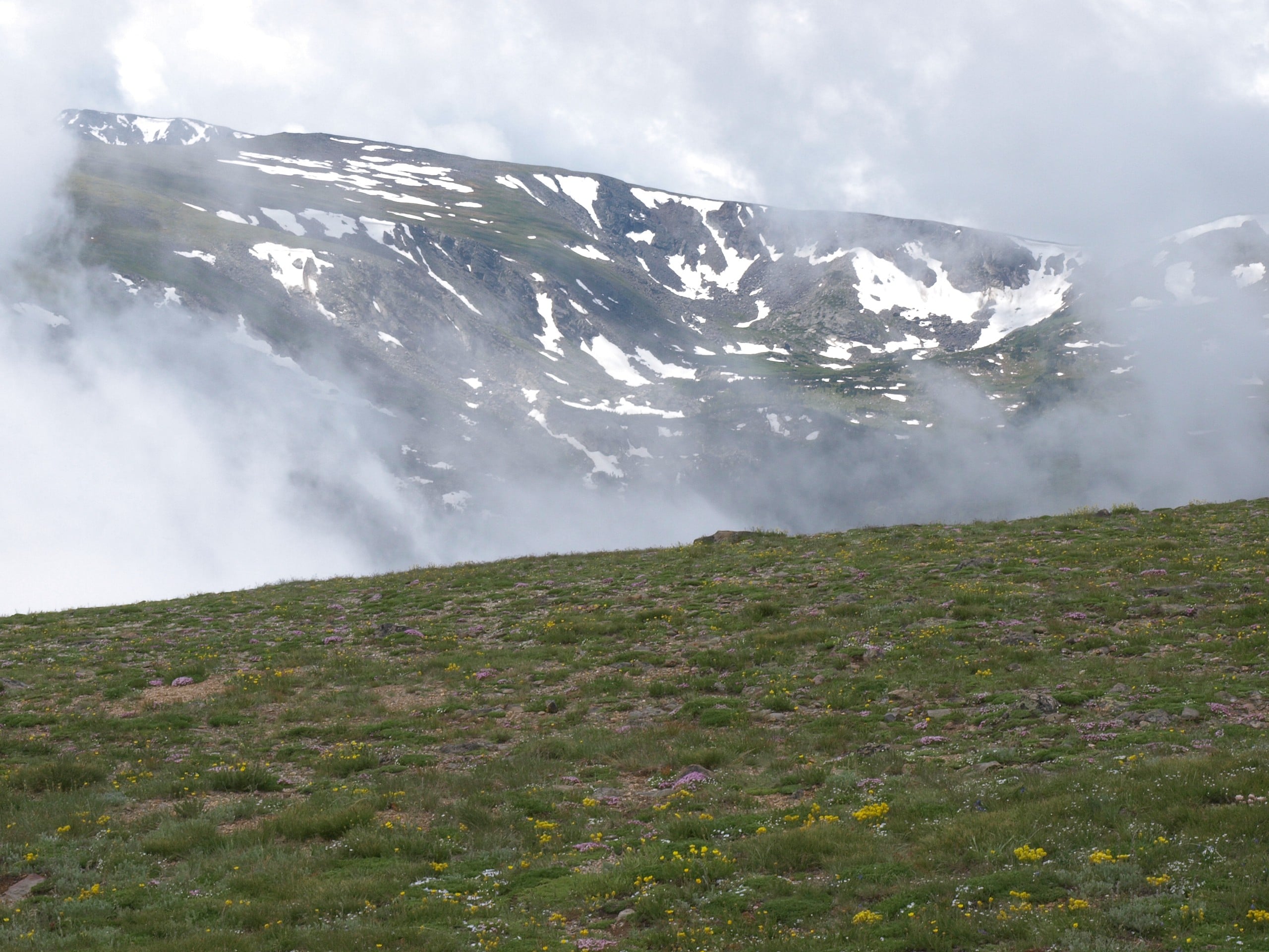
Mount Ida Trail
Difficulty Rating:
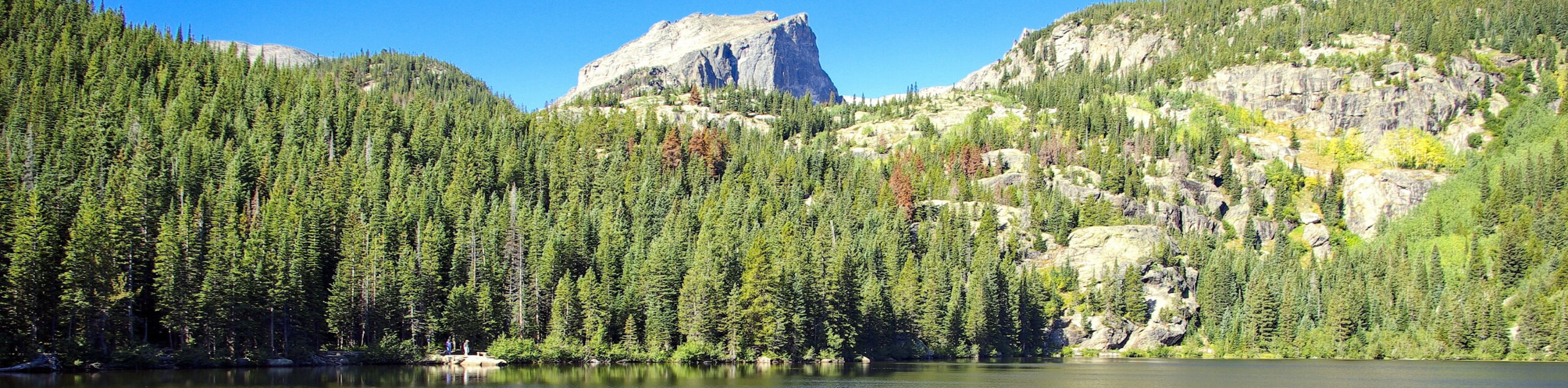
The Mount Ida Hike is a scenic adventure along the Continental Divide. This trail is unlike many in the Rocky Mountain National Park! Spending little time below the timberline, the route is almost entirely exposed, delivering sweeping mountain vistas the entirety of the hike. Though not the most prominent summit, this path demands stamina and an intrepid spirit.
Getting there
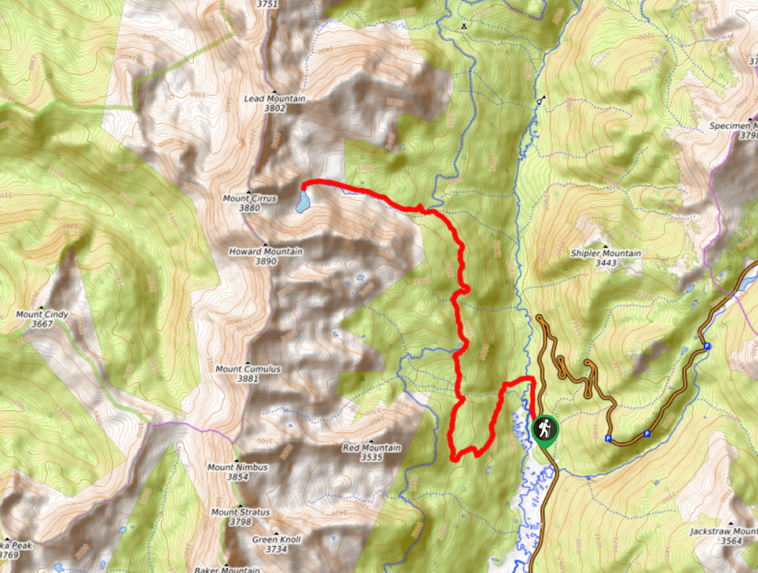
The Mount Ida Hike is accessed via the Milner Pass Trailhead off the Trail Ridge Road.

About
| Backcountry Campground | No |
| When to do | May-September |
| Pets allowed | No |
| Family friendly | Older Children only |
| Route Signage | Average |
| Crowd Levels | Extreme |
| Route Type | Out and back |
Mount Ida Trail
Elevation Graph
Weather
Mount Ida Hike Description
The Mount Ida Trail is an amazing expedition across the Continental Divide to the summit. However, these undeniably scenic adventures come with its risk. As we mentioned, this path is exposed to the elements, and exposed trails at high altitudes come with inherent risks. At such a high elevation, the weather can change on a dime; this trail is a much safer morning adventure. We recommend summiting before noon to avoid getting caught in an afternoon lightning storm along the ridge, which is so common to the RMNP.
Along with storms, the high altitude brings snowy and windy conditions… wear layers and if you are hiking in the autumn, bring microspikes to navigate the likely icy and snowy terrain at the summit. Additionally, make sure you are acclimated to the area’s high altitude before this hike to mitigate the chances of altitude sickness. Finally, note the RMNP requires visitors to purchase a pass to use the trails.
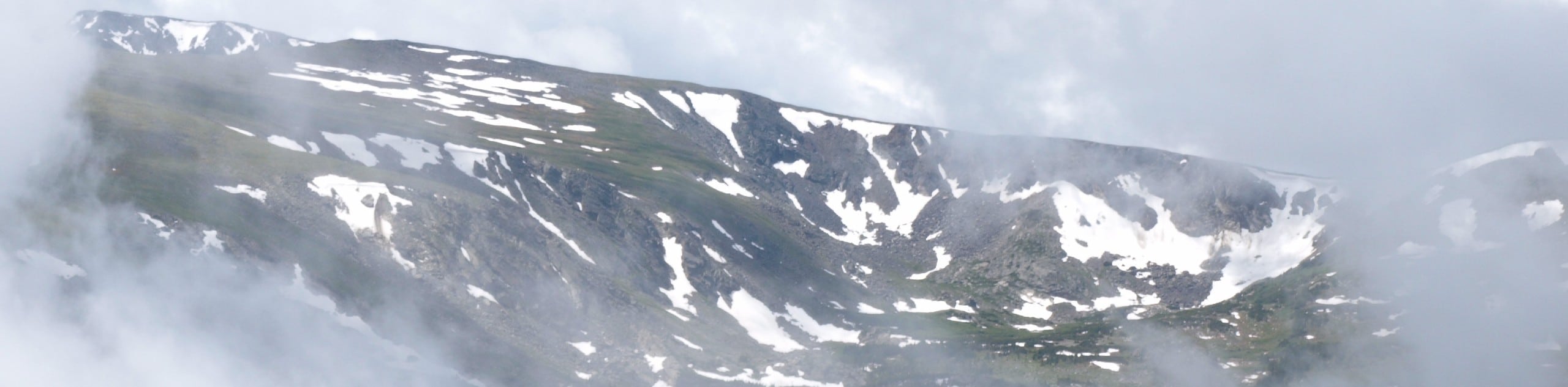
What more could you ask for than 360-degree panoramic vistas, right? As you hike along the exposed pass and up to the summit of Mount Ida, you will be granted sweeping views of the Mummy Range and the garden of alpine lakes below. We love this trail, not only for its scenery but for the challenge. There is nothing better than a workout with a view; at least, that is what we tell ourselves. So get your steps in, fill your lungs with the alpine air and push your limits as you navigate the diverse terrain of the Mount Ida Trail.
The Mount Ida Hike departs from the Milner Pass Trailhead. From the trailhead, track the Ute Trail along the shoreline of Poudre Lake. Stay at the first intersection, keep left on the Ute Trail and at the second junction, veer right, and you will be diverted onto the Mount Ida Trail. The initial segment of the path will lead you through towering lodgepole pines; enjoy the brief tree shade while you can. Shortly after your departure from the trailhead, you will summit the timberline.
Once you graduate the treeline, the rest of your journey will be exposed—as you traverse the narrow path along the Milner Pass. Enjoy the sweeping mountainous views as you ascend the alpine tundra. Keep an eye on the skies because even the weather forecast can mispredict an afternoon storm. Track south along the rocky ridge and notice Jackstraw Mountain in the west. As you travel through the alpine tundra, keep an eye out for elk, marmots, picas, and bighorn sheep!
The Mount Ida trail will alternate between steep terrain and level plateaus. Hike along the worn path, but if you get off track, find the rock cairns that mark the route. As you ascend the trail towards Mount Ida, you will be granted unforgettable views of the Never Summer Mountains. As you near Mount Ida, the terrain will become increasingly technical and rocky. Mind your footing as you ascend the summit.
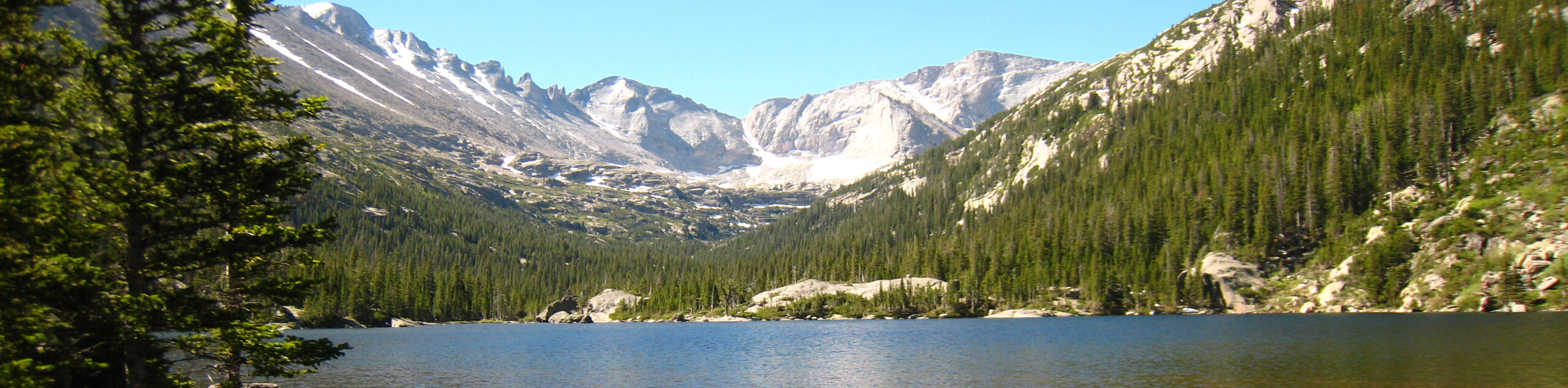
From the top of Mount Ida, you will be rewarded with unparalleled views of the encompassing, snow-dusted Front Range peaks that hem the lush subalpine forests below. Revel in the grandeur of the Rocky Mountain National Park and its summits before beginning your descent. When you are rested and ready, head back along the trail, retracing your steps all the way back to the trailhead.
Trail Highlights
Mount Ida
Mount Ida is an impressive summit that sits atop the Continental Divide in the Rocky Mountain National Park. Part of the Front Range, Mount Ida peaks at 12865ft and is accessed via Milner Pass. Located in the cirque basin below the summit are Azure and Inkwell Lakes. Many believe the mountain was named after Mount Ida in Crete, Greece, but that’s just speculation. Ranked 1017th in Colorado, the Mount Ida summit hike is deceiving. Though it is not the most prominent or elevated peak, the hike to summit the mountain is almost entirely exposed. The exposure as hikers track across the Pass is no joke, and many must turn around before they reach Mount Ida. Make sure you are properly prepared before attempting this summit hike.
Frequently Asked Questions
How tall is Mount Ida?
Mount Ida sits at an elevation of 12865ft.
Can you hike up to Mount Ida?
Yes, Mount Ida is an extremely popular hiking trail in the Rocky Mountain National Park.
Insider Hints
Wear many layers! The exposure and high altitude of the trail warrants sudden forecast changes.
If you are hiking in the autumn, even before the snow falls at the trailhead, bring microspikes, because there will almost always be snow-dusting at the summit.
There are limited water sources along the path so ensure to pack plenty of H20 to keep hydrated.
Trekking poles are not necessary, but they can be handy as you navigate the steep, rocky terrain near the summit.
Similar hikes to the Mount Ida Trail hike
Lake of the Clouds Hike
The Lake of the Clouds Hike is a picturesque adventure on the western border of the Rocky Mountain National Park.…
The Spearhead Hike
The Spearhead Hike is a demanding but awesome hike in the Rocky Mountain National Park. Ascend the Glacial Gorge past…
Bear Lake to North Inlet Hike
The Bear Lake to North Inlet Hike is a demanding one-way excursion across the Rocky Mountain National Park. This challenging…
Comments