

Grand Pass Trail
View PhotosGrand Pass Trail
Difficulty Rating:
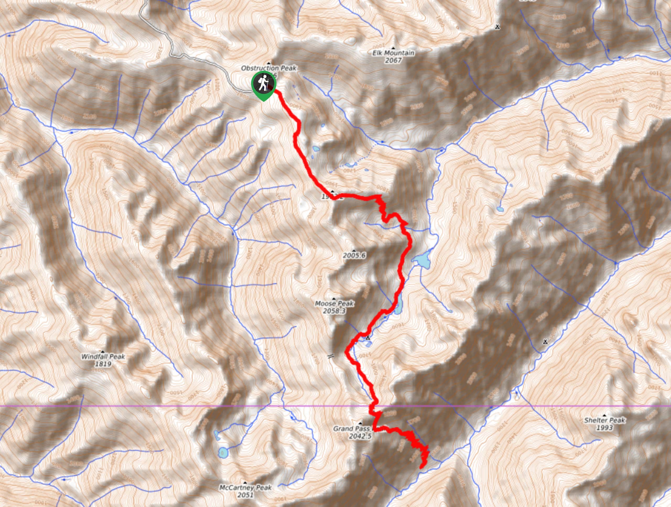
Grand Pass Trail is a beast of a day hike, with over 13.7mi to cover across varied, steep terrain. This is a spectacular, hard day trip or a gorgeous backpacking adventure. Know that many day hikers complete a portion of this trail, often turning back before the steep descent (and subsequent ascent) into the valley at the end of the trail. This still allows you to enjoy the lakes dotted alongside the route and the changing terrain and views that make this trail enjoyable.
Come prepared with lots of water, food, and good boots and poles.
Getting there
The trailhead for Grand Pass Trail is at the end of Obstruction Point Road.
About
| Backcountry Campground | Gladys Lake, Moose Lake |
| When to do | June-October |
| Pets allowed | No |
| Family friendly | No |
| Route Signage | Average |
| Crowd Levels | Low |
| Route Type | Out and back |
Grand Pass Trail
Elevation Graph
Weather
Grand Pass Trail Description
Grand Pass Trail is a jaw-dropping trek through Olympic National Park, passing deep blue lakes, mountains, and vibrant forest. It’s a demanding day trip, so most hikers either backpack it or shave off the trip into the valley at the end of the trail.
Begin from the trailhead at the end of Obstruction Point Road. Take the trail on the right here, quickly climbing on top of a ridge. The terrain and views slowly evolve as you trek to the first junction, where you’ll stay left.
Descend down to Grand Lake and Moose Lake, a popular spot for a mid-hike cooldown swim. Climb past little Gladys Lake and then ascend to one of the most difficult ridges of the hike. This section is boulder-clad and a bit tough to get through. On the other side of this ridge is a steep descent into the river valley. This is normally where day hikers call it quits, and if you want to continue, make sure you have lots of gas in the tank for the steep, rocky ascent back up from the valley floor.
Retrace your steps to your campsite or the trailhead.
Similar hikes to the Grand Pass Trail hike

Mount Angeles via Sunrise Ridge Trail
Mount Angeles via Sunrise Ridge Trail is a challenging hike that starts out more forgiving before ending with a demanding…

Heather Park and Mount Angeles via Lake Angeles Trail
Heather Park and Mount Angeles via Lake Angeles Trail is a 15.8mi

Pyramid Mountain Trail
Pyramid Mountain Trail is a hike in Olympic National Forest that is moderately trafficked and just over 6.2mi…


Comments