

Merry Widow Ridge
View PhotosMerry Widow Ridge
Difficulty Rating:
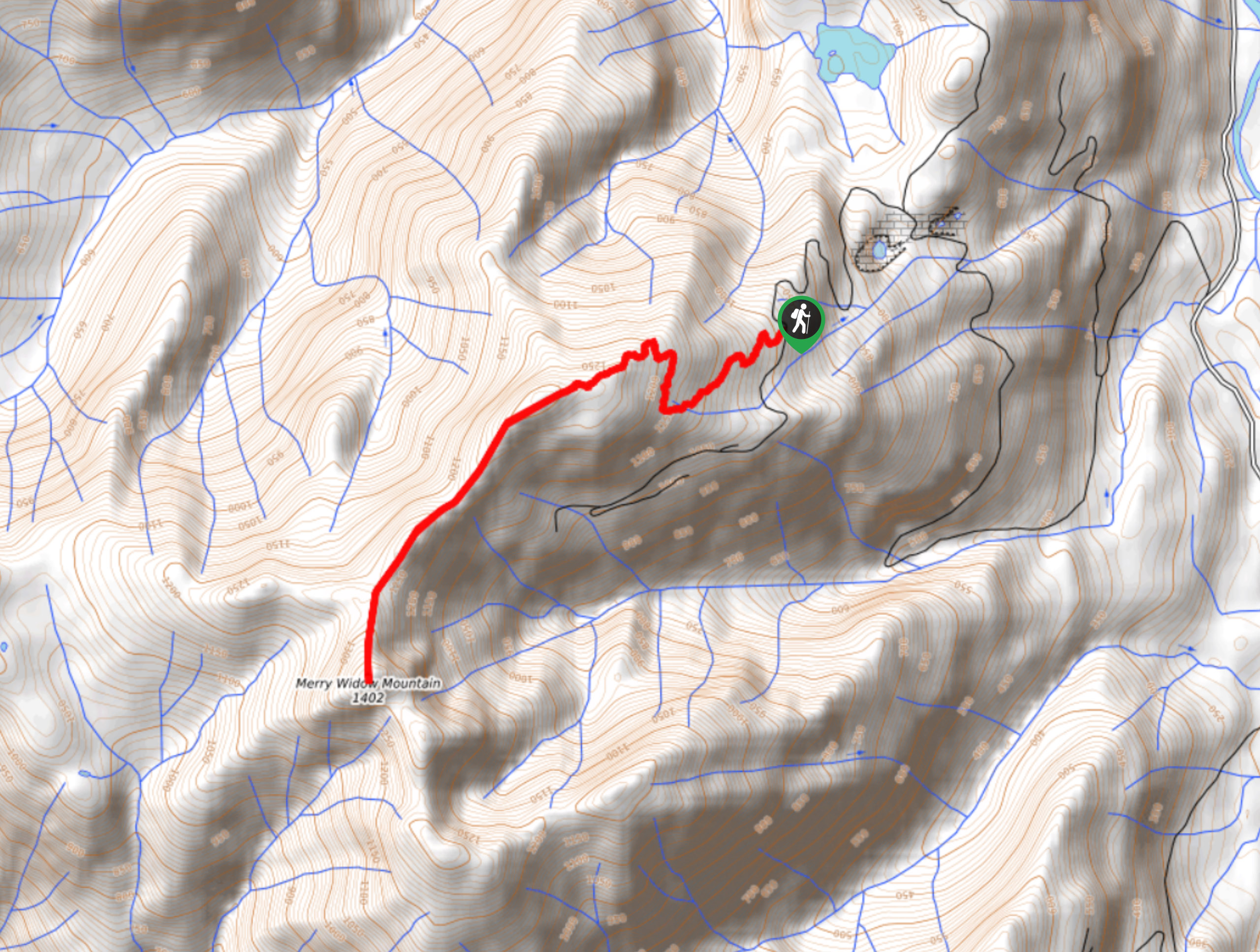
The Merry Widow Ridge Trail is a 4.3mi out-and-back hiking route on the northern end of Vancouver Island that allows you to explore the rugged mountain peaks that can be found in this part of the interior. Along the trail, hikers will climb uphill through the forest before transitioning to more exposed terrain along the rugged ridgeline for some amazing views of the surrounding peaks, including Merry Widow Mountain. The road into the trailhead is pretty rough, so make sure to use a vehicle capable of maneuvering the rugged terrain.
Getting there
To reach the Merry Widow Ridge trailhead from Port McNeill, drive southeast on Campbell Way for 1.6mi and turn right onto BC-19, following it for 2.3mi. Turn left onto Keogh Road and continue on it for 1969ft before turning straight onto Keogh Main. After 1.9mi, turn left onto Keogh Road and follow it for 2.7mi, where you will turn right to continue on the same road for another 15.1mi. Turn right onto Alice Lake Road and follow it for 0.7mi before turning left. From here, keep left for 4.3mi to arrive at the trailhead.
About
| When to do | May-September |
| Backcountry Campsites | No |
| Pets allowed | Yes |
| Family friendly | No |
| Route Signage | Average |
| Crowd Levels | Low |
| Route Type | Out and back |
Merry Widow Ridge
Elevation Graph
Weather
Merry Widow Ridge Trail Description
Although the drive into the trailhead is more than a bit bumpy, once you get out on the Merry Widow Ridge Trail you will be inundated with breathtaking scenery and forget all about the initial journey to get there. Setting out from the parking area, follow the trail to the west as it cuts through a beautiful stretch of forest and begins to climb uphill towards the top of the ridge. The terrain here will become more rocky, rugged, and exposed, so make sure to watch your footing as you bring yourself up the ridge. Once there, you can take in the amazing views of the surrounding peaks as you traverse the ridgeline toward Merry Widow Mountain to the southwest.
Once you have made your way to the end of the trail, turn back and carefully retrace your steps down the ridge while stealing a few last glances across the mesmerizing Vancouver Island landscape on your return journey to the trailhead.
Similar hikes to the Merry Widow Ridge hike

Tod Mountain via Altitude Trail
Tod Mountain via Altitude Trail is a 6.0mi lollipop hiking route at the Sun Peaks Mountain Resort that…

Dave Farrant Trail to Blinkhorn Point
The Dave Farrant Trail to Blinkhorn Point is a 47.8mi out-and-back hiking route that follows closely along the…

Tex Lyon Trail
The Tex Lyon Trail is a 7.9mi out-and-back hiking route near Port Hardy, BC that will allow hikers…


Comments