

Dave Farrant Trail to Blinkhorn Point
View PhotosDave Farrant Trail to Blinkhorn Point
Difficulty Rating:
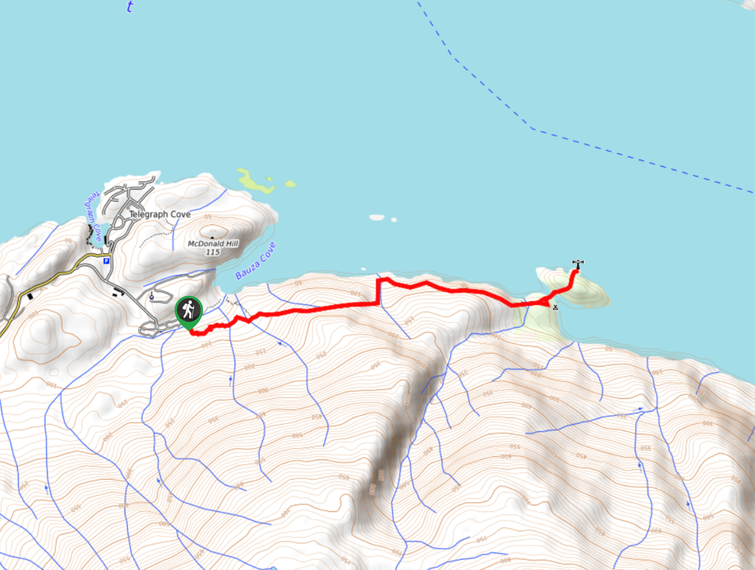
The Dave Farrant Trail to Blinkhorn Point is a 47.8mi out-and-back hiking route that follows closely along the coast of Vancouver Island to provide views looking out over the Johnstone Strait. Hikers along the trail will experience the best of both worlds, as they can hike through a serene West Coast temperate rainforest setting and the beautiful but rugged landscape of the coast. Make sure to check the tides before you set out on your hike, as the Blinkhorn Peninsula becomes an island when the water level is high enough.
Getting there
To reach the trailhead for the Dave Farrant Trail to Blinkhorn Point from Port McNeill, drive southeast on Campbell Way for 1.6mi and turn left onto BC-19, following it for 4.5mi. Make a left on Beaver Cove Road and continue along for 6.5mi, before turning left again onto Telegraph Cove Road. After 2.9mi, turn right onto Wastell Road and follow it for 689ft. Make a left and continue on for 1640ft to arrive at the campground where you will find the trailhead.
About
| When to do | Year-round |
| Backcountry Campsites | Telegraph Cove Campground |
| Pets allowed | Yes |
| Family friendly | No |
| Route Signage | Average |
| Crowd Levels | Low |
| Route Type | Out and back |
Dave Farrant Trail to Blinkhorn Point
Elevation Graph
Weather
Dave Farrant Trail to Blinkhorn Point Description
Hiking the Dave Farrant Trail to Blinkhorn Point is a great way to explore both the amazing rainforest and coastal landscapes that can be found on the northern part of Vancouver Island. Named after Dave Farrant, who cleared the lookout by chainsaw in the 1970s while dangling over the cliff, the route travels through the breathtaking forest atmosphere to arrive at the scenic Blinkhorn Point.
Setting out from the southeast corner of the Telegraph Cove Campground, follow the trail east as it heads into the dense forest and crosses over several small streams before arriving at the lookout. From here, hikers can enjoy a nice view to the north across the blue waters of the Johnstone Strait before continuing through the rugged rainforest to Blinkhorn Point. Once there, you can make your way across the peninsula for some more amazing views along the coast- just remember to check the tides in advance so you don’t get stranded! After taking in the breathtaking views, head back along the same route to return to the trailhead.
Similar hikes to the Dave Farrant Trail to Blinkhorn Point hike

Tod Mountain via Altitude Trail
Tod Mountain via Altitude Trail is a 6.0mi lollipop hiking route at the Sun Peaks Mountain Resort that…

Merry Widow Ridge
The Merry Widow Ridge Trail is a 4.3mi out-and-back hiking route on the northern end of Vancouver Island…

Tex Lyon Trail
The Tex Lyon Trail is a 7.9mi out-and-back hiking route near Port Hardy, BC that will allow hikers…


lcmh 3 years ago
This was one of the most rewarding hikes I have ever done. It was super easy and friendly for most ages and experience levels. At the end is a little lighthouse and a wonderful lookout to have a break and a bite at. When I did this trail I was lucky enough to see a pod of at least 20 orcas swim by right beside the rock! We even got the chance to have a quick talk with the marine biologists tracking this pod. It was absolutely incredable!