

Tom Moore Trail
View PhotosTom Moore Trail
Difficulty Rating:
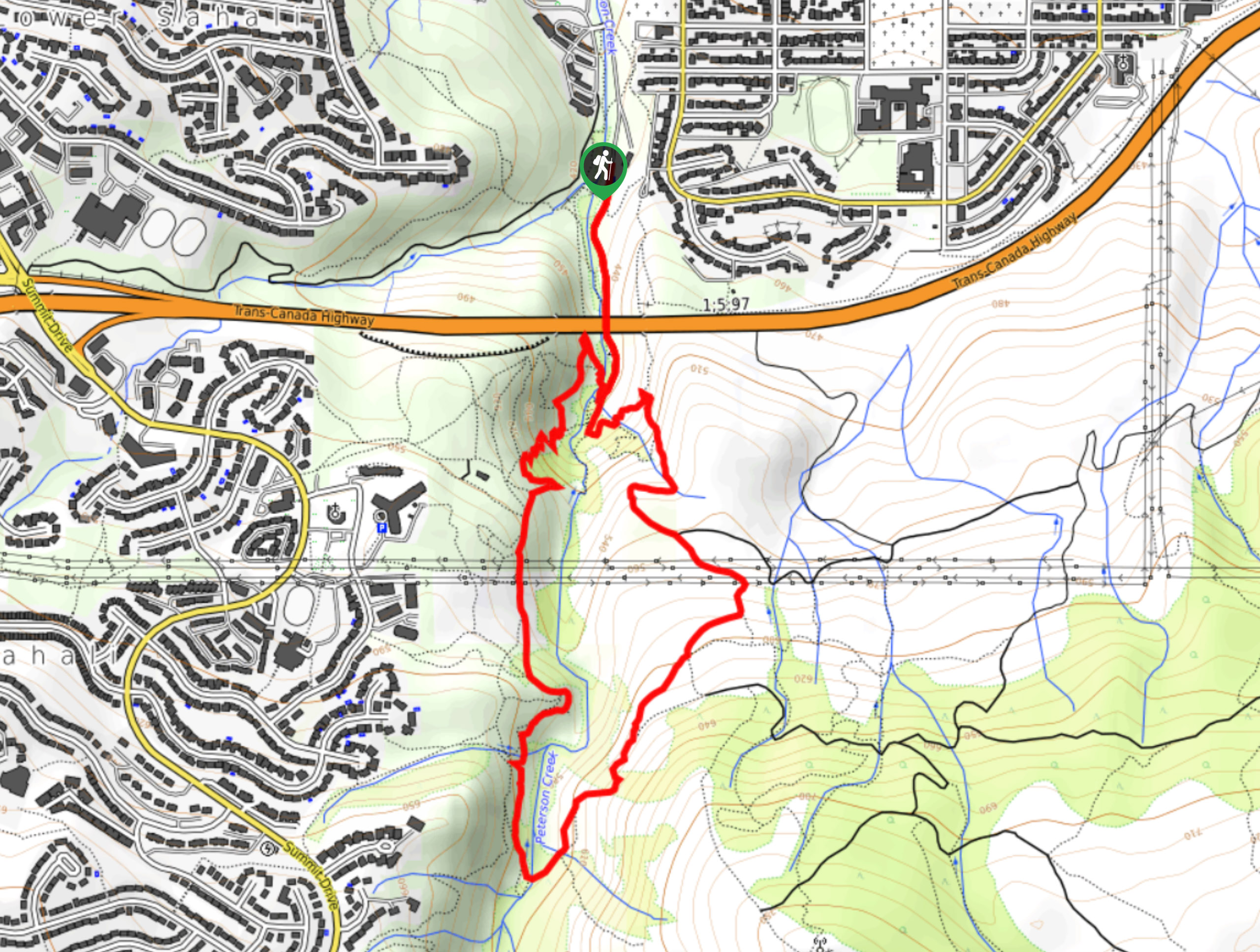
The Tom Moore Trail is a 3.0mi lollipop hiking route in Kamloops, BC, that will take you uphill through the Peterson Creek Nature Park for some spectacular views of the surrounding valley landscape. Along the route, you will work your way up the Tom Moore Trail before breaking off on the downhill portion of the hike utilizing the Billy Miner Trail. This trail is perfect for a family outing and is even dog-friendly, meaning you won’t need to leave your canine friend at home while you are out exploring the trails.
Getting there
To get to the parking area for the Tom Moore Trail from Kamloops, head west on Columbia Street for 558ft and turn left at 5th Avenue. After 1312ft, turn left, followed by an immediate left to get to Glenfair Drive. Turn right here and follow it for 1083ft to arrive at the parking area.
About
| When to do | March-October |
| Backcountry Campsites | No |
| Pets allowed | Yes |
| Family friendly | Older Children only |
| Route Signage | Average |
| Crowd Levels | Moderate |
| Route Type | Lollipop |
Tom Moore Trail
Elevation Graph
Weather
Tom Moore Trail Description
Although the Tom Moore Trail is fairly well marked, this route is actually a combination of trails that will allow you to explore various sections of the park. To stay on the correct route, hikers should bring a GPS or trail map in order to stay on the correct path, or remember to turn left onto the Billy Miner Trail for the return journey down the hillside.
Setting out from the parking area, make your way uphill along Peterson Creek and under the overpass to continue along the trail. When you reach the junction, head right to follow the Tom Moore Trail as it crosses over the creek and wins through the park. Reaching the top of the trail, take some time to soak up the views before turning left onto the Billy Miner Trail. From here, you will work your way downhill to the View of Kamloops vantage point, where you can enjoy some spectacular views of the city and surrounding area. Continue downhill through the nature park until you meet up with the original trail that will lead you back to the parking area.
Similar hikes to the Tom Moore Trail hike

Community Trail
The Community Trail is a 8.3mi point-to-point hiking route just north of Kamloops, BC, that will allow you…

Lac du Bois Tower Loop
The Lac du Bois Tower Loop is a 4.0mi hiking circuit northwest of Kamloops that will allow you…

Gibraltar Rock
The trek to Gibraltar Rock follows a 2.0mi out-and-back trail that sets out from the Paul Lake Beach…


Comments