

Red Tailed Hawk Loop
View PhotosRed Tailed Hawk Loop
Difficulty Rating:
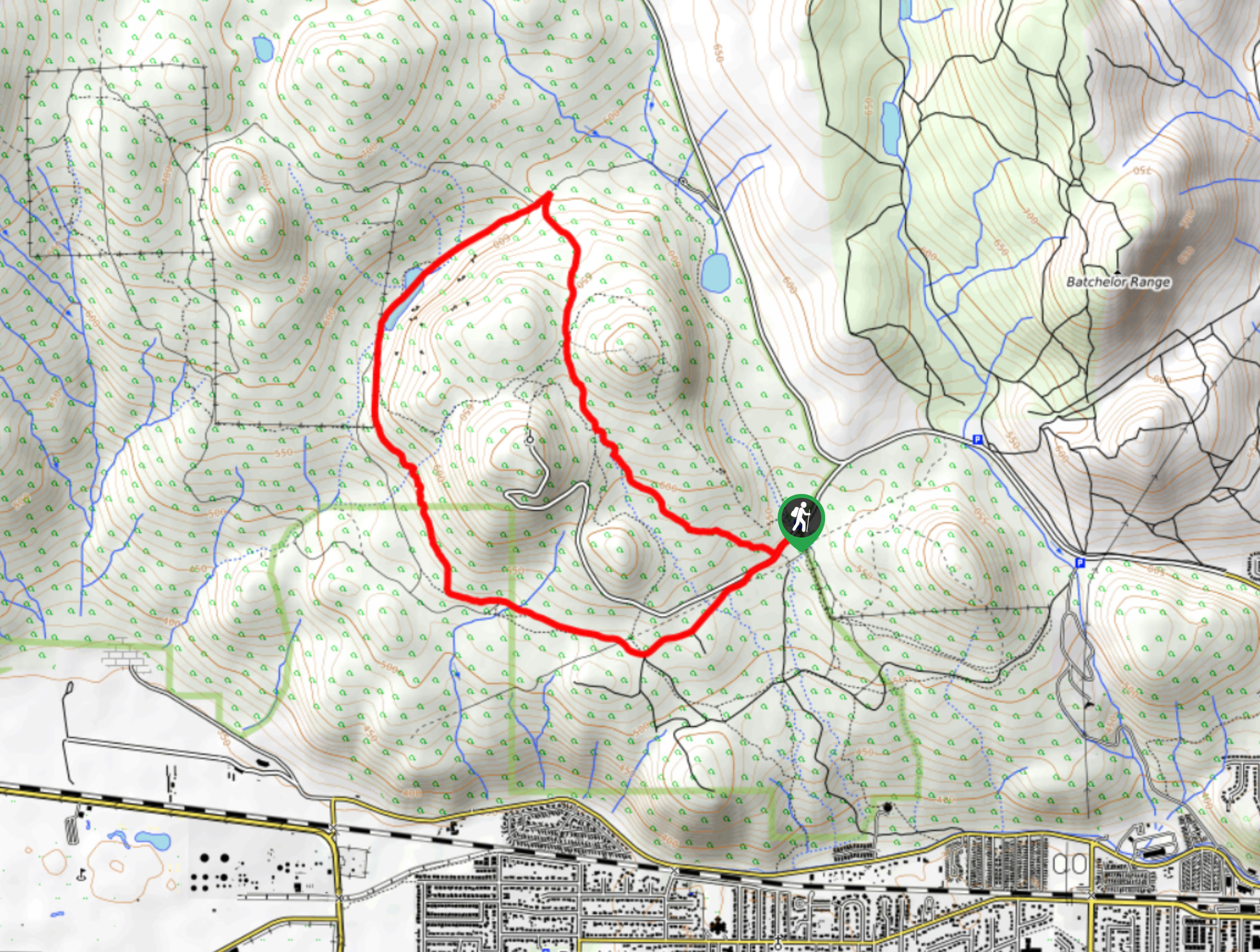
The Red Tailed Hawk Loop is a 3.8mi lollipop hiking route in Kamloops that winds through Kenna Cartwright Nature Park to provide some amazingly scenic views of the North Thompson Valley. While there are some stretches of light forest cover, the majority of the trail is exposed, so be prepared for a day in the sun. Additionally, this entire park is an off-leash area for dogs, making it an ideal hiking route that the entire family will love.
Getting there
To get to the trailhead for the Red Tailed Hawk Loop from Kamloops, make your way southwest along BC-1 for 2.0mi and take exit 366. After 984ft, stay to the right to merge onto Copperhead Drive. Continue on for 328ft and make a left turn on Hillside Drive. Follow this for 1312ft and turn right to enter the parking lot.
About
| When to do | Year-Round |
| Backcountry Campsites | No |
| Pets allowed | Yes |
| Family friendly | Older Children only |
| Route Signage | Average |
| Crowd Levels | Low |
| Route Type | Lollipop |
Red Tailed Hawk Loop
Elevation Graph
Weather
Red Tailed Hawk Trail Description
While the Red Tailed Hawk Loop is accessible year-round, the steeper portions of the trail can become blanketed with mud and ice in the winter and spring seasons. Plan your hike accordingly and bring any necessary gear if you want to complete the entire route. Setting out from the trailhead, make your way uphill to the fork and take the Ponderosa Trail to the left to begin your ascent of the western side of the ridge. This portion of the hike is steep in some areas and has some loose rock, so watch your footing as you climb your way uphill. Reaching the northwest corner of the loop, you will pass by an outhouse and the Spadefoot Pond before following the Lower Doug Daws Trail to the east.
Here, you will have an amazing view looking down into the valley below, with the coursing water of the Thompson River dissecting the valley floor. Work your way around the forests that make up the eastern edge of the park and take in the scenic views overlooking Kamloops before heading south to meet up with the Red Tailed Hawk Trail. Follow this to the south to descend the ridge and complete the return journey to the parking lot below.
Similar hikes to the Red Tailed Hawk Loop hike

Community Trail
The Community Trail is a 8.3mi point-to-point hiking route just north of Kamloops, BC, that will allow you…

Lac du Bois Tower Loop
The Lac du Bois Tower Loop is a 4.0mi hiking circuit northwest of Kamloops that will allow you…

Gibraltar Rock
The trek to Gibraltar Rock follows a 2.0mi out-and-back trail that sets out from the Paul Lake Beach…


Comments