
Hoodoo Mara Mountain Connector Trail
View Photos
Hoodoo Mara Mountain Connector Trail
Difficulty Rating:
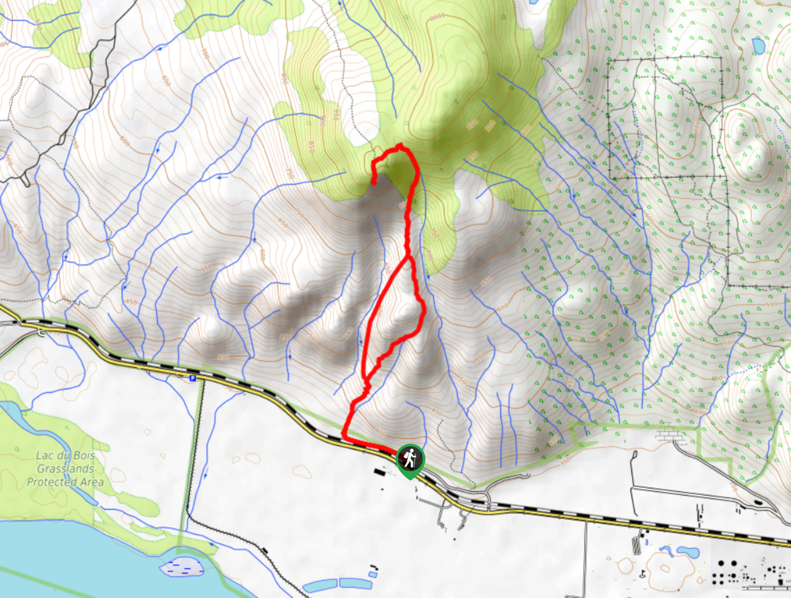
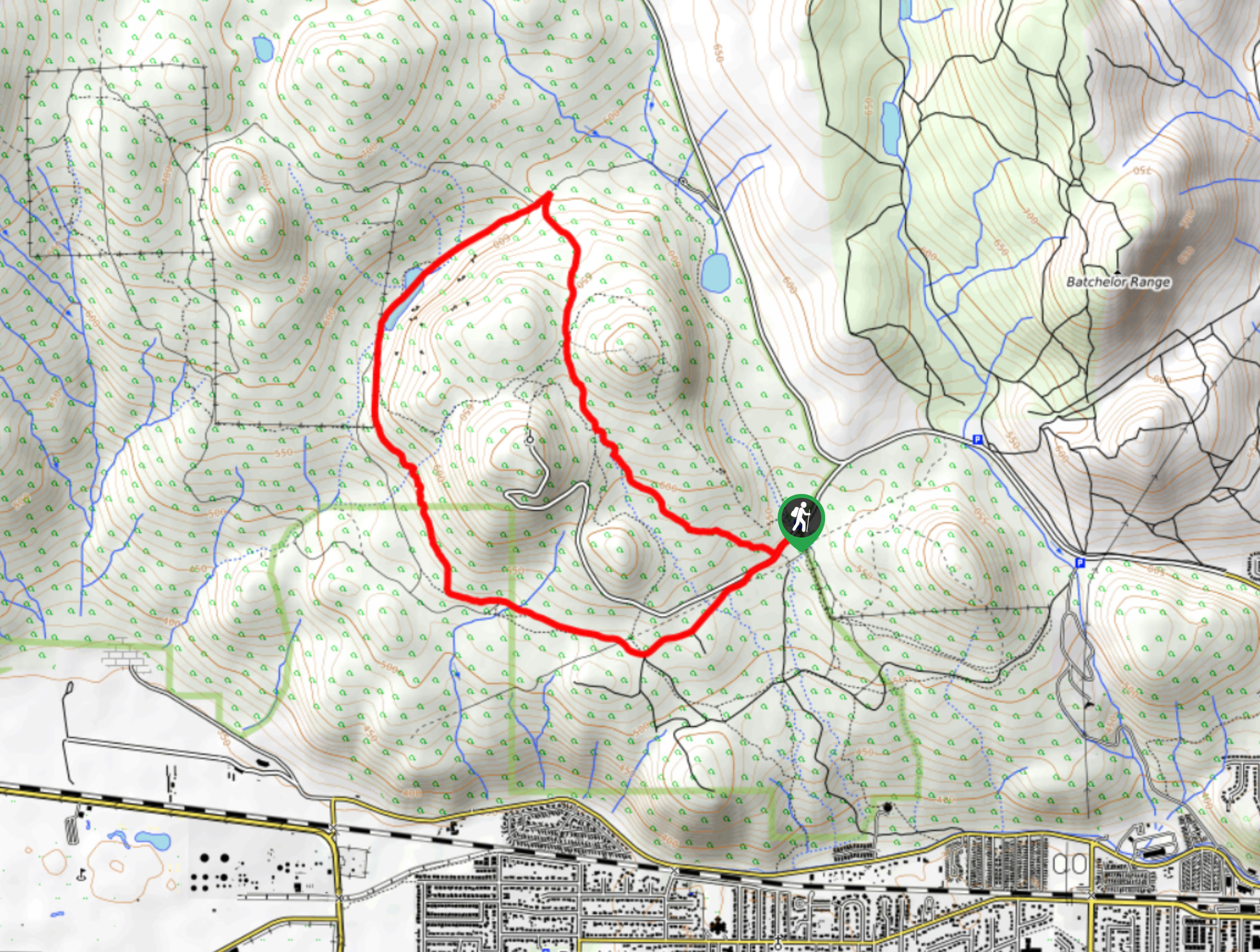
The Hoodoo Mara Mountain Connector is a challenging 4.7mi lollipop hiking route within Lac du Bois Grasslands Provincial Park that will take up a steep, rocky route to reach viewpoints at two different peaks on Mara Mountain. Along the trail, you will experience some amazing views of the nearby hoodoo rock formations before climbing further uphill for an amazing view stretching out across the valley. The upper portions of this hike are very steep and exposed, so make sure to wear proper hiking footwear and take your time on the way to the summits.
Getting there
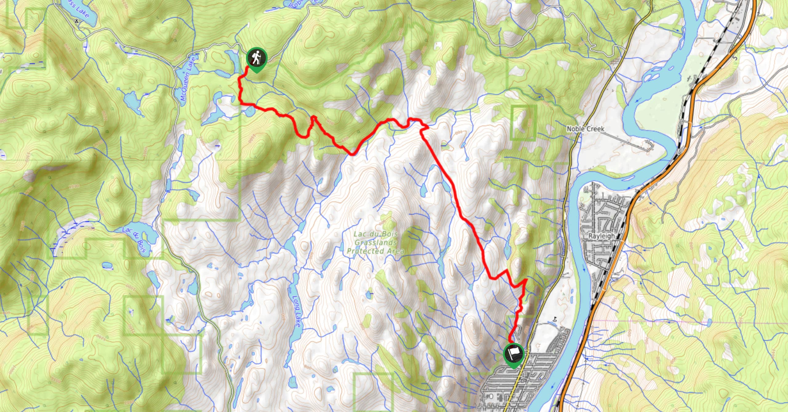
To get to the trailhead for the Hoodoo Mara Mountain Connector from Kamloops, drive to the southwest along Ord Road for 3.0mi and make a left to stay on the road for 591ft. Turn right on Tranquille Road, following it for 1.4mi. Turn right on Ord Road and you will find the parking area in 1312ft.

About
| When to do | April-October |
| Backcountry Campsites | No |
| Pets allowed | Yes |
| Family friendly | No |
| Route Signage | Average |
| Crowd Levels | Low |
| Route Type | Lollipop |
Hoodoo Mara Mountain Connector Trail
Elevation Graph
Weather
Hoodoo Mara Mountain Connector Trail Description
The Hoodoo Mara Mountain Connector is a challenging but breathtaking hike that will provide you with some of the best scenery that can be found in the area. The trail sets out from the parking area and heads west before turning to the north to begin the steep climb uphill. Along this lower portion of the hike, you will be able to spot some amazing hoodoos that have been carved into the rock as a result of weathering. Continue heading uphill along the rocky and technical terrain to reach the first summit with amazing views looking down on the Thompson River. The last portion of the hike up to the second summit is the most challenging, but also the most rewarding. Take in the breathtaking panoramic views of the valley before working your way back downhill along the alternate trail to the right to reach the parking area where you began.
Similar hikes to the Hoodoo Mara Mountain Connector Trail hike
Community Trail
The Community Trail is a 8.3mi point-to-point hiking route just north of Kamloops, BC, that will allow you…
Lac du Bois Tower Loop
The Lac du Bois Tower Loop is a 4.0mi hiking circuit northwest of Kamloops that will allow you…
Raft Peak Trail
The Raft Peak Trail is a 4.0mi out-and-back hiking route northeast of Clearwater, BC, that will take you…
Comments