Gibraltar Rock
View Photos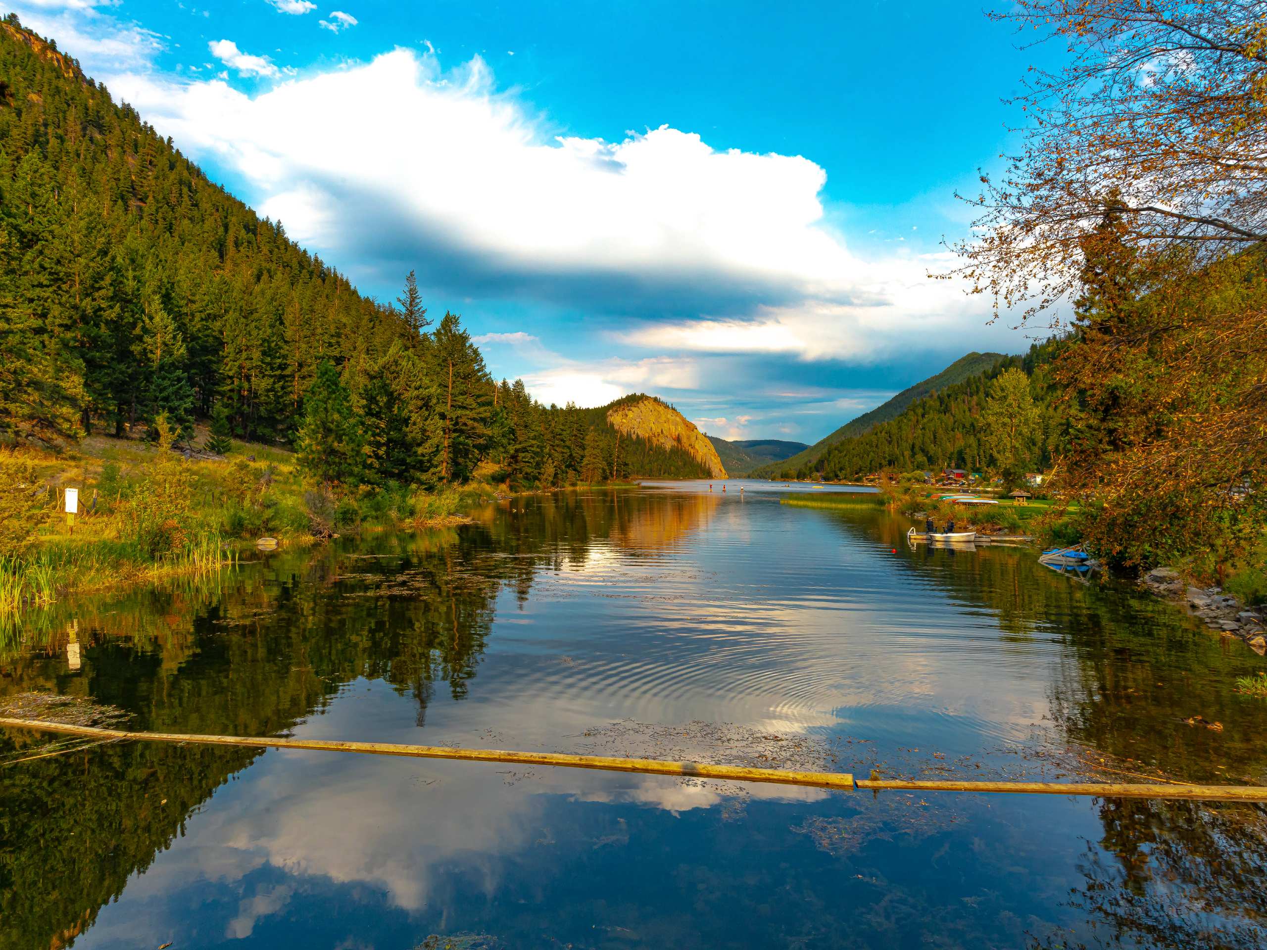
Gibraltar Rock
Difficulty Rating:
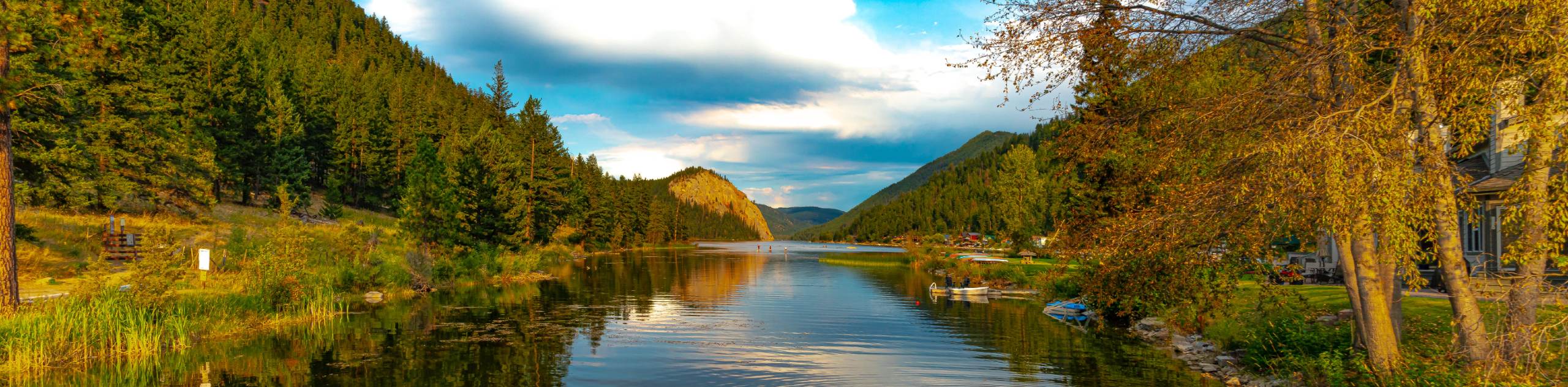
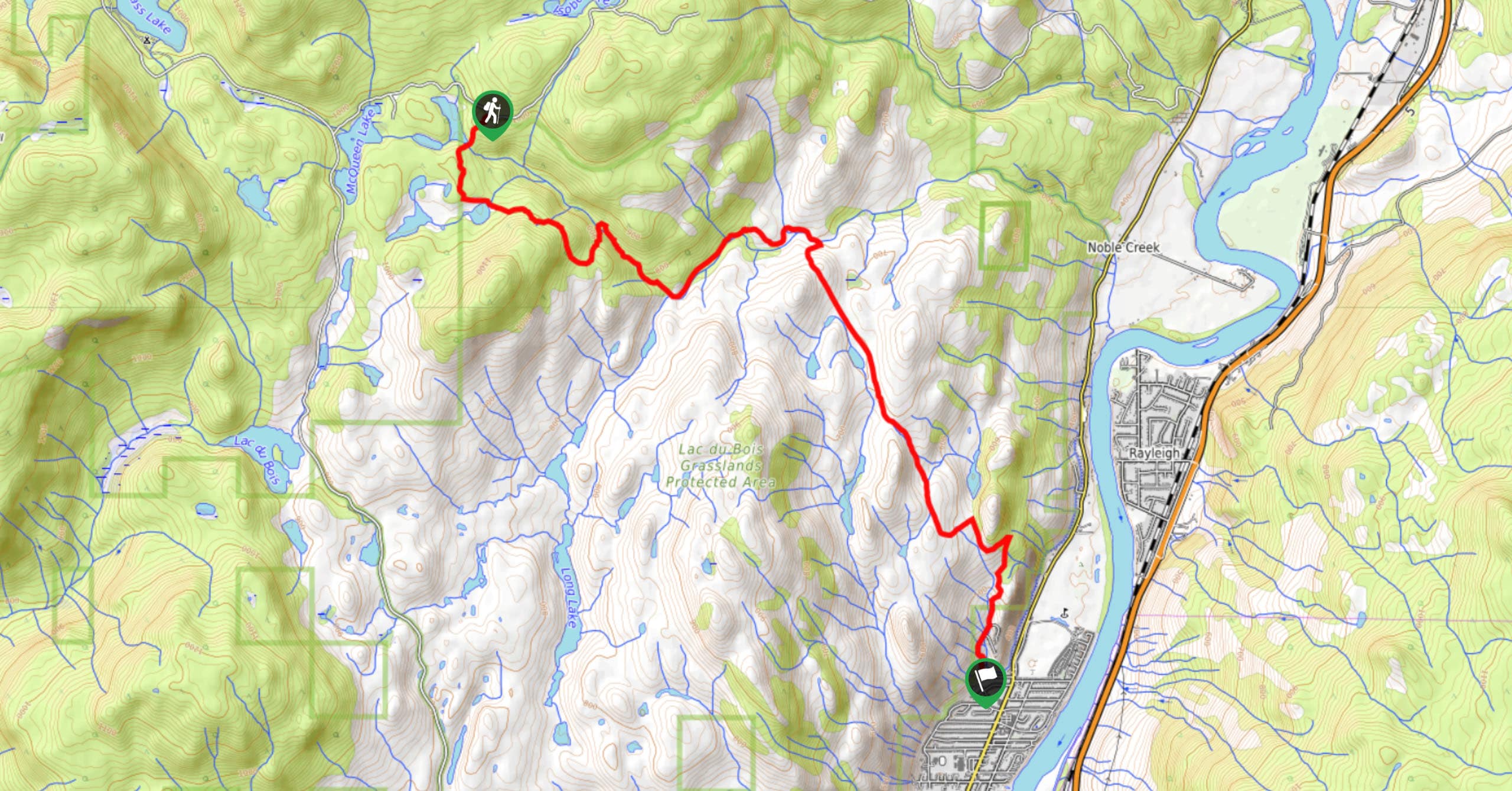
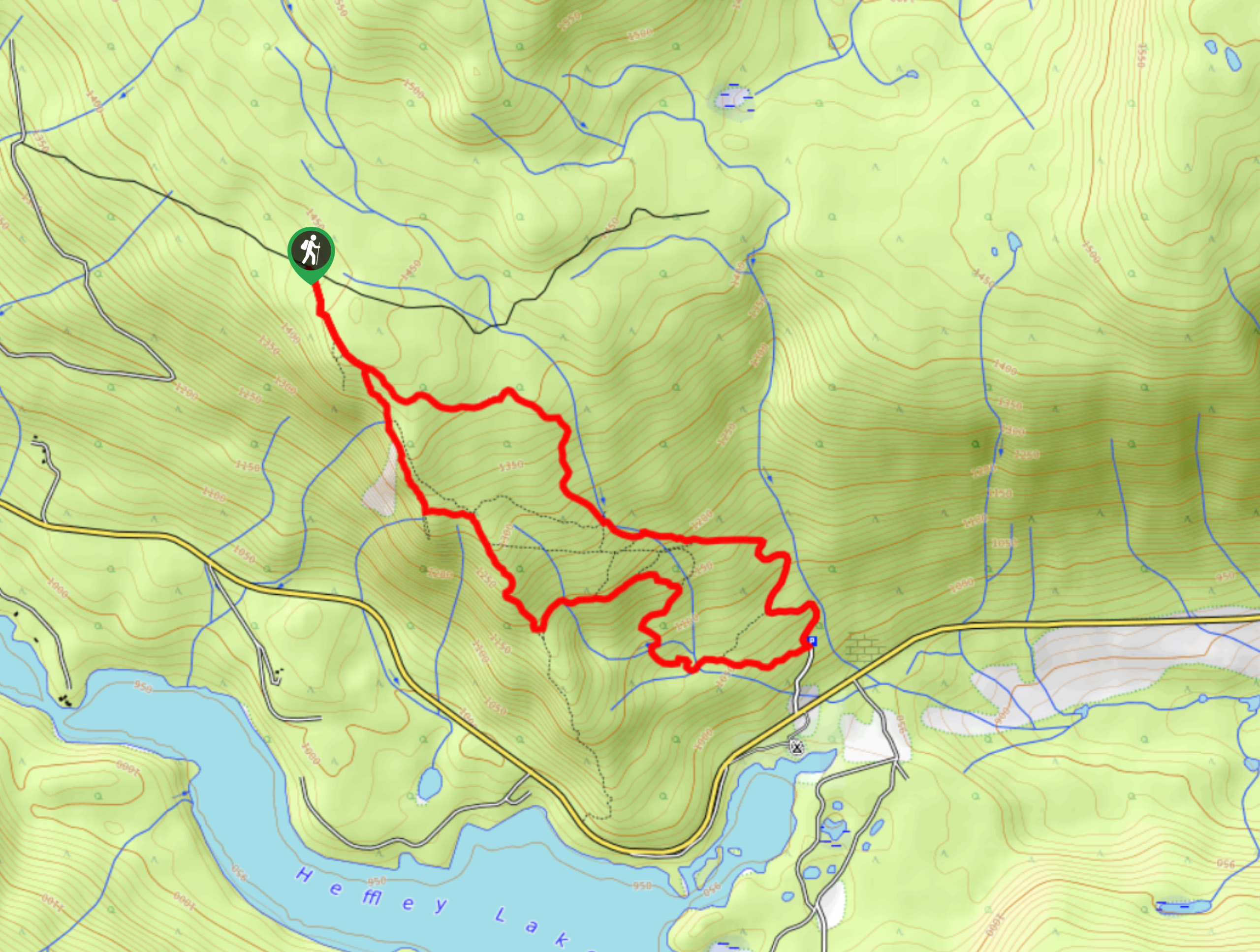
The trek to Gibraltar Rock follows a 2.0mi out-and-back trail that sets out from the Paul Lake Beach area and heads west to the lookout at the summit of Gibraltar Rock. Once there, you will be greeted with an amazing view overlooking the surrounding woodland valley and the calm waters of Paul Lake nestled within it. Remember to bring bear spray along for this hike, as the animals are frequently seen in the vicinity of the trail due to its proximity to the campsite.
Getting there
To access the Gibraltar Rock trailhead from Kamloops, make your way north along BC-5 for 3.0mi and turn right onto Paul Lake Road. After 7.4mi, continue onto Pinantan Pritchard Road and follow it for 3.8mi before turning right. Continue on for 0.7mi and you will arrive at the parking area.

About
| When to do | April-October |
| Backcountry Campsites | Paul Lake Campground |
| Pets allowed | Yes - On Leash |
| Family friendly | Yes |
| Route Signage | Average |
| Crowd Levels | Moderate |
| Route Type | Out and back |
Gibraltar Rock
Elevation Graph
Weather
Gibraltar Rock Trail Description
Hiking the Gibraltar Rock Trail is a great experience within Paul Lake Provincial Park that will allow you to experience the natural beauty of the woodland landscape of the area while getting a nice workout in from the climb up to the rocky lookout point. From Paul Lake Beach, the trail assets out to the west and enters into the shady cover of the forest on a route that runs parallel to the edge of the lake. As you hike through the tranquil forest, the route will begin to gradually climb uphill and meet up with another trail at a higher elevation. Keep left to continue onto the summit, where you will be met with some amazing views across the heavily forested valley. After taking in the sights of Paul Lake, make your way back along the same trail to return to the beach area where you began your trek.
Similar hikes to the Gibraltar Rock hike
Community Trail
The Community Trail is a 8.3mi point-to-point hiking route just north of Kamloops, BC, that will allow you…
Lac du Bois Tower Loop
The Lac du Bois Tower Loop is a 4.0mi hiking circuit northwest of Kamloops that will allow you…
Embleton Mountain Loop
The Embleton Mountain Loop is an 5.2mi lollipop hiking route northeast of Kamloops that climbs uphill through a…
Comments