Doc Findlay Loop
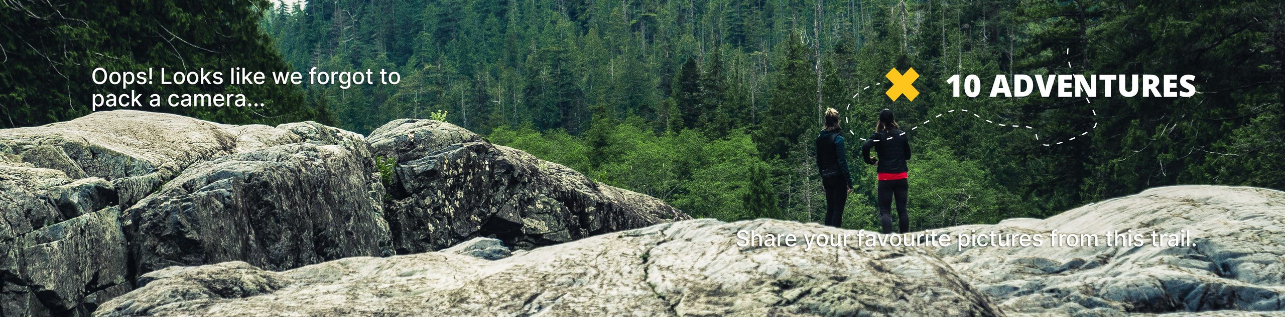
View Photos
Doc Findlay Loop
Difficulty Rating:
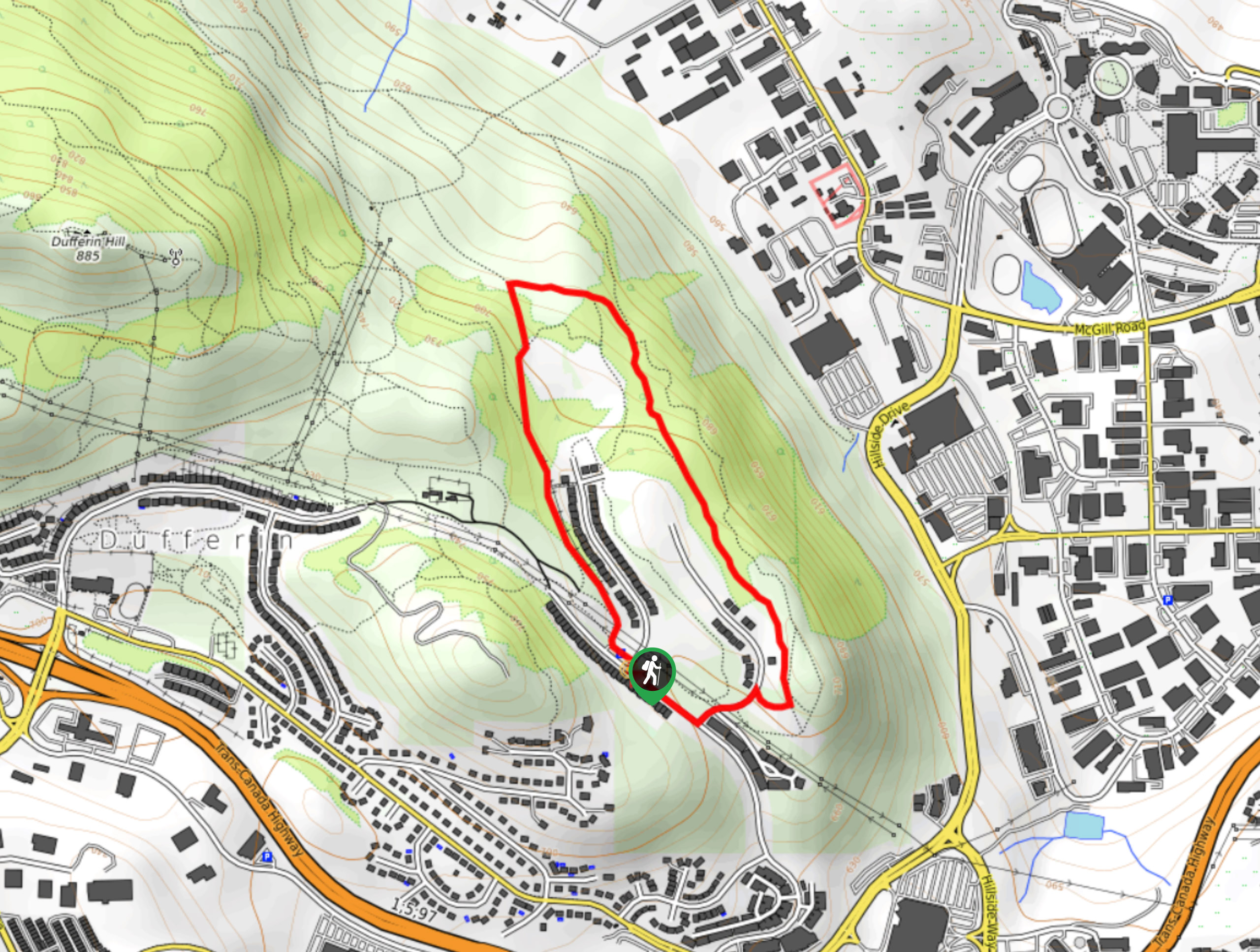
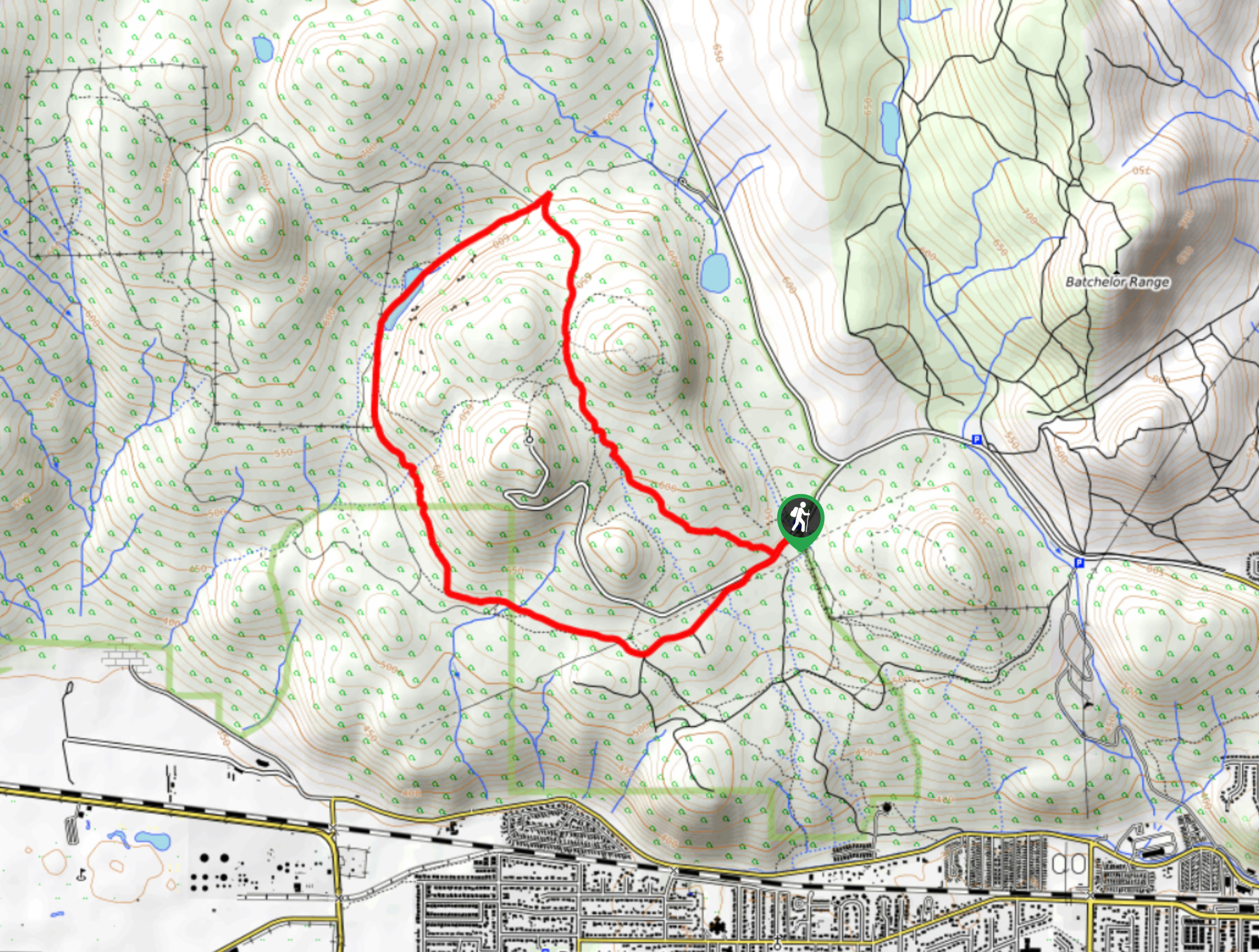
The Doc Findlay Loop is a 1.6mi hiking circuit in Kamloops that passes through the Kenna Cartwright Nature Park for some amazing views overlooking Kamloops and the North Thompson Valley. The trail is made up of very well-maintained and easy to navigate dirt paths that cross forested and exposed terrain, making them ideal for hikers of all skill levels. Although children will have no problem traversing the landscape, some areas of the trail are uneven and narrow, which might make mobility a challenge for families with strollers.
Getting there
To reach the parking area for the Doc Findlay Loop from Kamloops, head southwest on BC-1 for 0.8mi and take exit 367 to merge onto Pacific Way. Follow this for 1.1mi to arrive at the parking area on the right.

About
| When to do | April-November |
| Backcountry Campsites | No |
| Pets allowed | Yes - On Leash |
| Family friendly | Yes |
| Route Signage | Average |
| Crowd Levels | Moderate |
| Route Type | Circuit |
Doc Findlay Loop
Elevation Graph
Weather
Doc Findlay Trail Description
Although it is only a short hike, the Doc Findlay Loop is big on scenery, offering some of the best views of Kamloops that can be found in the area. The trail sets out from the parking area and initially heads to the north between two residential neighbourhoods, before entering a stretch of forest. From there, you will follow the trail to the east as it descends to a trail slightly lower on the hillside. Continue south along the trail and take in the intermittent views of the city and surrounding landscape before meeting up with the road on the southernmost point of the loop. From here, cross over the road and cut through the open section of grassland to return to the parking lot having completed the Doc Findlay Loop.
Similar hikes to the Doc Findlay Loop hike
Community Trail
The Community Trail is a 8.3mi point-to-point hiking route just north of Kamloops, BC, that will allow you…
Lac du Bois Tower Loop
The Lac du Bois Tower Loop is a 4.0mi hiking circuit northwest of Kamloops that will allow you…
Gibraltar Rock
The trek to Gibraltar Rock follows a 2.0mi out-and-back trail that sets out from the Paul Lake Beach…
Comments