Beacon Hill Trail
View PhotosBeacon Hill Trail
Difficulty Rating:
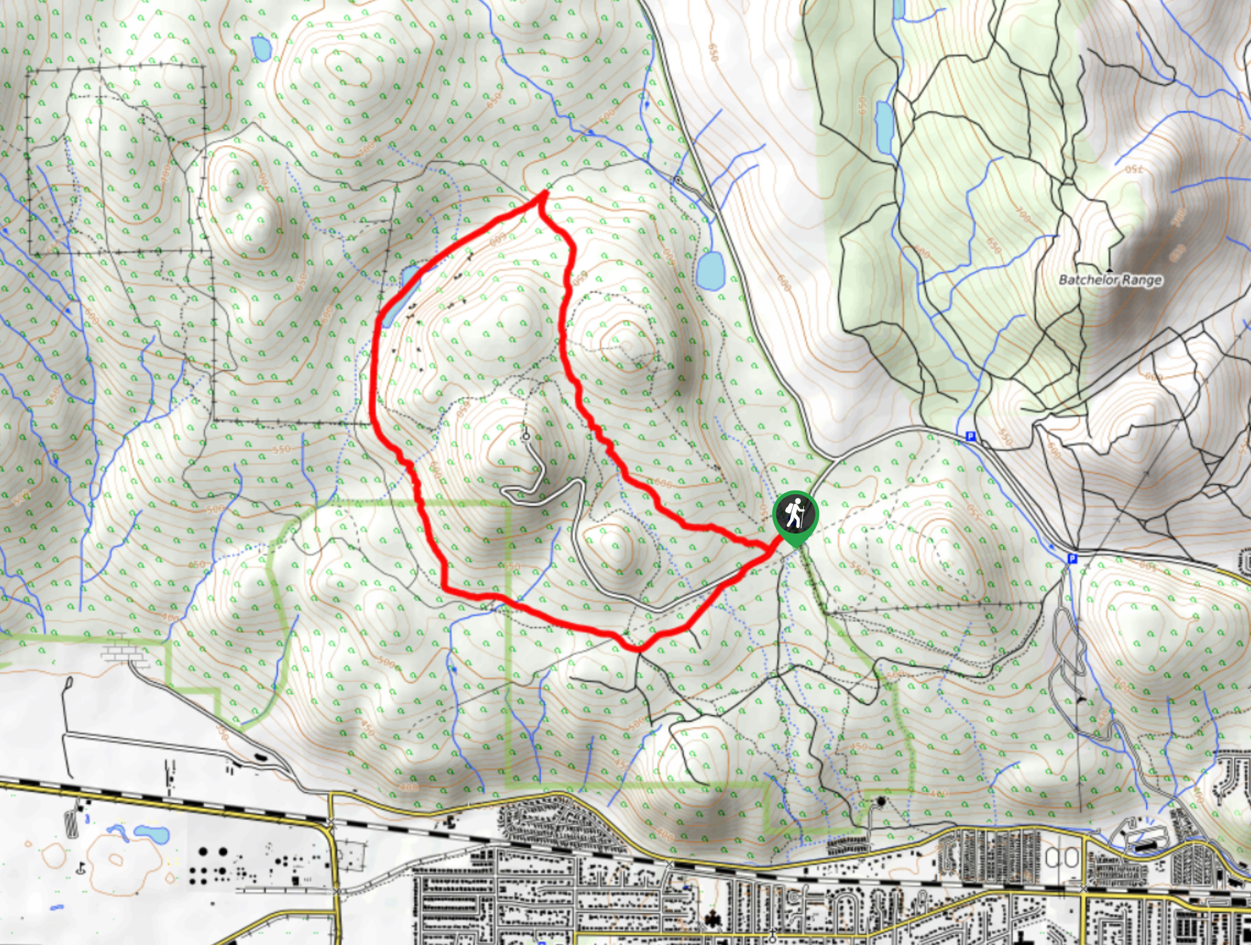
The Beacon Hill hike is a 39.8mi lollipop route just outside of Kamloops that traverses the picturesque terrain of Lac du Bois Grasslands Provincial Park and offers some amazing views that sweep across the North Thompson Valley. Hikers along this trail will experience vast blue skies and rolling green hills that are interrupted only by the small lakes and coursing rivers that dissect the landscape. With well maintained trails and easy to navigate terrain, this route is perfect for hikers of all skill levels.
Getting there
To arrive at the Beacon Hill trailhead from North Kamloops, drive north along 8th Street for 0.9mi and continue straight onto Batchelor Hills Drive. After 1.7mi, continue onto Lac du Bois Road, and follow it for 2297ft before turning left to arrive at the parking area.
About
| When to do | April-October |
| Backcountry Campsites | No |
| Pets allowed | Yes |
| Family friendly | Yes |
| Route Signage | Average |
| Crowd Levels | Moderate |
| Route Type | Lollipop |
Beacon Hill Trail
Elevation Graph
Weather
Beacon Hill Trail Description
Hiking the Beacon Hill Trail is a fantastic outdoor experience in Kamloops, BC, that will see you gain and lose small amounts of elevation through traversing the undulating hills that make this landscape so breathtaking. Although the trail is easy to navigate, there are a number of intersecting trails along the route that could lead you off course. Pay attention to the trail signs and bring a GPS to stay on the correct path.
Setting out from the parking area, the trail meanders to the southwest through a small grassland plain that sits between two larger hills. When you reach the fork in the trail, follow the path to the left, as the right trail will be for the return journey. Continue along the trail as it crosses over several small streams to another fork. Follow this to the left, as it will lead you to a scenic viewpoint overlooking Kamloops and the Thompson River, with a sweeping view across the valley. After taking in the sights, head back along the trail to the fork and follow it to the left to complete the remainder of the loop through the grassland terrain and arrive back at the trailhead where you began your hike.
Similar hikes to the Beacon Hill Trail hike

Community Trail
The Community Trail is a 8.3mi point-to-point hiking route just north of Kamloops, BC, that will allow you…

Lac du Bois Tower Loop
The Lac du Bois Tower Loop is a 4.0mi hiking circuit northwest of Kamloops that will allow you…

Gibraltar Rock
The trek to Gibraltar Rock follows a 2.0mi out-and-back trail that sets out from the Paul Lake Beach…


Comments