
Pratt and Fox Canyon Loop
View Photos
Pratt and Fox Canyon Loop
Difficulty Rating:
Seeking an easy-going family adventure near Ojai, CA? Well, you have come to the right place! The Pratt and Fox Canyon Loop is a wonderful adventure that offers a diversity of scenery, including mountain views, beautiful streams, seasonal wildflowers, and lush vegetation.
Getting there
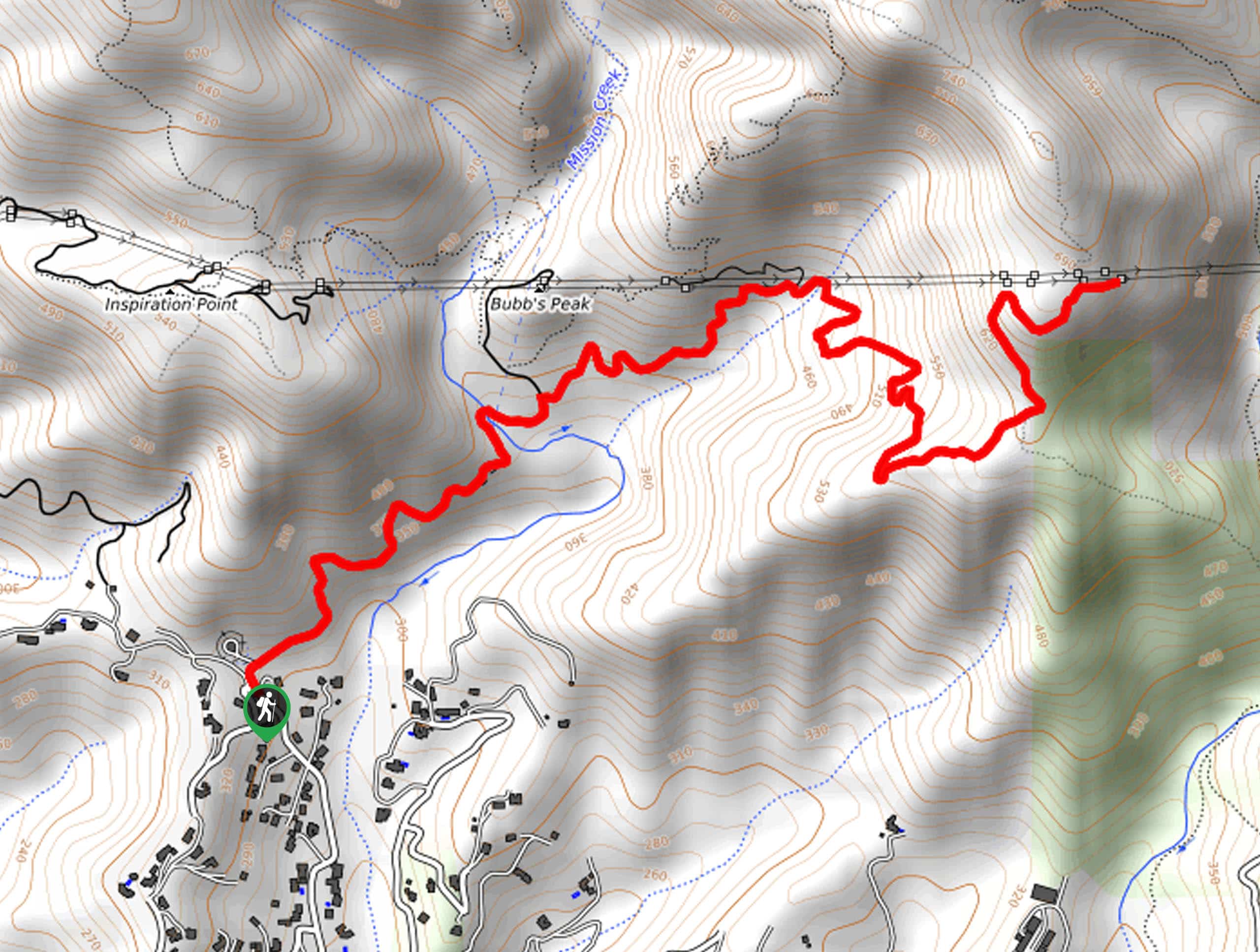
Access the Pratt and Fox Canyon Loop via the trailhead off N Signal Street.

About
| Backcountry Campground | No |
| When to do | Year-round |
| Pets allowed | Yes - On Leash |
| Family friendly | Yes |
| Route Signage | Average |
| Crowd Levels | Moderate |
| Route Type | Circuit |
Pratt and Fox Canyon Loop
Elevation Graph
Weather
Pratt and Fox Canyon Loop Description
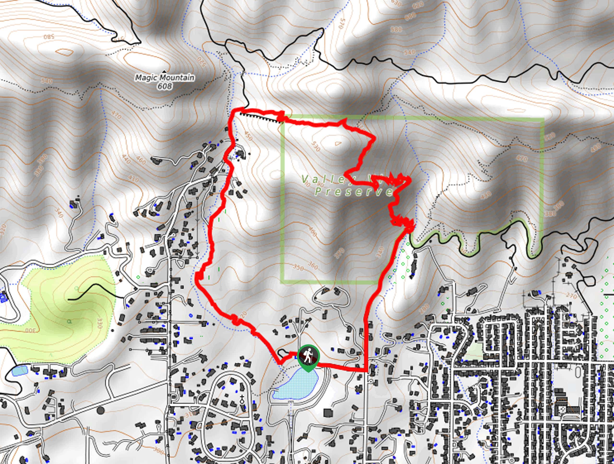
The Pratt and Fox Canyon Loop is an epic excursion that the whole family can enjoy! Wander through grassy meadows, communities of chaparral brush, wildflowers, tree stands, and over beautiful creeks. Get out into the fresh air and admire the picturesque environment. Note that much of this path is exposed, so be sure to wear SPF and a sunhat— don’t forget to bring water! The final segment of the trail travels along the road, so maintain on the sidewalk and shoulder of the road.
Setting out from the Pratt Trailhead, the Pratt and Fox Canyon Loop wanders east along the Pratt Trail, quickly diverting north along a meandering creek. This segment of the hike gradually climbs along the stream through a more residential area and over the creek, merging onto the Foothills Road. Travel along the Foothills Road, merging onto the Foothills Trail at the junction. Now wandering east through the foothills, you will eventually be redirected south onto the Fox Canyon Trail. This route will lead you down switchbacks and onto the rightmost Shelf Road Trail at the next intersection.
From here, follow the Shelf Road south, merging onto N Signal Road, and right, back to the trailhead.
Similar hikes to the Pratt and Fox Canyon Loop hike
Brazil Ranch Trail
The Brazil Ranch Trail is an amazing adventure in the Los Padres National Forest that is sure to impress. Walk…
Tequepis Trail
Challenge yourself along the Tequepis Trail. This demanding adventure in the Los Padres National Forest rewards hikers for their efforts…
Spyglass Ridge Road Hike
The Spyglass Ridge Road Hike would make a wonderful addition to an experienced hiker’s adventure itinerary. Demanding the navigation of…
Comments